Cookies help us deliver our services. By using our services, you agree to our use of cookies. Learn more.
  • Log In
  • Register
CEEOL Logo
Advanced Search
  • Home
  • SUBJECT AREAS
  • PUBLISHERS
  • JOURNALS
  • eBooks
  • GREY LITERATURE
  • CEEOL-DIGITS
  • INDIVIDUAL ACCOUNT
  • Help
  • Contact
  • for LIBRARIANS
  • for PUBLISHERS

Content Type

Subjects

Languages

Legend

  • Journal
  • Article
  • Book
  • Chapter
  • Open Access
  • Geography, Regional studies
  • Physical Geopgraphy

We kindly inform you that, as long as the subject affiliation of our 300.000+ articles is in progress, you might get unsufficient or no results on your third level or second level search. In this case, please broaden your search criteria.

Result 541-560 of 1301
  • Prev
  • 1
  • 2
  • 3
  • ...
  • 27
  • 28
  • 29
  • ...
  • 64
  • 65
  • 66
  • Next

ASTROPHYSICAL ANALYSIS OF EARTHQUAKE NEAR KRALJEVO (SERBIA) ON 03 NOVEMBER 2010

Author(s): Milan Radovanović,Milan Stevančević,Dragana Milijašević,Saumitra Mukherjee,Željko Bjeljac / Language(s): English Issue: 3/2011

Results of previous studies have pointed to a satistically significant relationship between the ionospheric, ie. atmospheric disturbances and earthquakes. Also, numerous previous studies concerning the relationship between the sun's activity and disturbances in the atmosphere have been taken into consideration. Based on these indicators, we tried to determine the possible existence of a causative-effective connection between processes on the sun and the earthquake that occurred on 03 November 2010 near Kraljevo (Serbia). Based on theoretical considerations, a new model is proposed that suggests the occurrence of trigger pulse. The results have shown that at statistically more significant number of samples it would be necessary to determine potential regularity in the changes of the parameters of the interplanetary magnetic field (IMF), that is solar wind components (SW) a few days before and after the occurrence of strong earthquakes.

More...
Mountain Border Area of Eastern Serbia in the Function of the Spring Zones of Surface Water

Mountain Border Area of Eastern Serbia in the Function of the Spring Zones of Surface Water

Author(s): Nina Ćurčić,Dejan Šabić,Bojana Mihajlović,Miroljub Milinčić / Language(s): English Issue: 1/2012

Border mountain area of eastern Serbia has a distinct potential and importance in the function of surface water sources, which are characterized by range of geographical and environmental characteristics and similarities determined by mountainous character of the territory. For the purposes of this paper, border area of Serbia towards Bulgaria is provisionally determined by iso-border of 25 km. On the defined area of eastern Serbia there are 11 individual territories allocated in the function of being surface water source. Key objects for the realization of the goals of rational and functional exploitation of surface water sources are accumulations. They are the link between the system of surface water sources and water supply system.

More...
Assessment Of Vulnerability To Climate Hazards In Municipality Of Lom, Bulgaria

Assessment Of Vulnerability To Climate Hazards In Municipality Of Lom, Bulgaria

Author(s): Alexander Gikov,Mariyana Nikolova / Language(s): English Issue: 3/2013

An important part of the natural hazard’s risk management is the vulnerability assessment. There are many publications proposing different systems of indicators and tools for vulnerability assessment, but very few of them are dealing with the problem on community level. The study for municipality of Lom is carried out on the base of a framework for vulnerability assessment which includes the following important elements: hazard probability, exposure, sensitivity and coping capacity. In this paper we use the spatial dimensions of the areas prone to a particular climate hazard as an indicator for the level of exposure to this hazard. We introduce a measure for the system sensitivity as a function of hazard and exposure classes assigned to these areas. On the base of a system of indicators and scores for the hazard, exposure, sensitivity and capacity, is estimated a Vulnerability Index for municipality of Lom. The results from this case study show that implementation of the proposed Vulnerability Assessment Method provide reliable information for the level of vulnerability to ten climate hazards. It may be of use for different risk management purposes.

More...
The Probability Of Flooding Wave Occurrence And The Vulnerability Of The Kosovo Territory Settlements

The Probability Of Flooding Wave Occurrence And The Vulnerability Of The Kosovo Territory Settlements

Author(s): Mila A. Pavlović,Dragica Živković,Aleksandar Valjarević / Language(s): English Issue: 3/2013

The work displays the presumed laws of flooding waves which would occur if the 1976 situation when the great floods in Kosovo happened reoccurred again. On a 1:300000 multilayer map of Kosovo and Metohia, there are areas which would have been flooded in case of a maximum flooding wave, and what is also shown is the areas which were covered in water as the average was measured, including the areas used as projects of minimal flooding wave value. There is a layer showing the points with regular flood defense, including the places where protection needs to establish. The map includes the ratio of 1:300000, whilst the areas are calculated with the help of processing their dynamic static’s, as well as using the formulae Gumbel Distribution and Weibull Formula. The data have been calculated with their maximum value, including the average and the minimum of flooding period embracing the time of 40 years.

More...
Using GIS for Landslides Graphical Representation. Case Study in Cornăţel (Hârtibaciului Plateau)

Using GIS for Landslides Graphical Representation. Case Study in Cornăţel (Hârtibaciului Plateau)

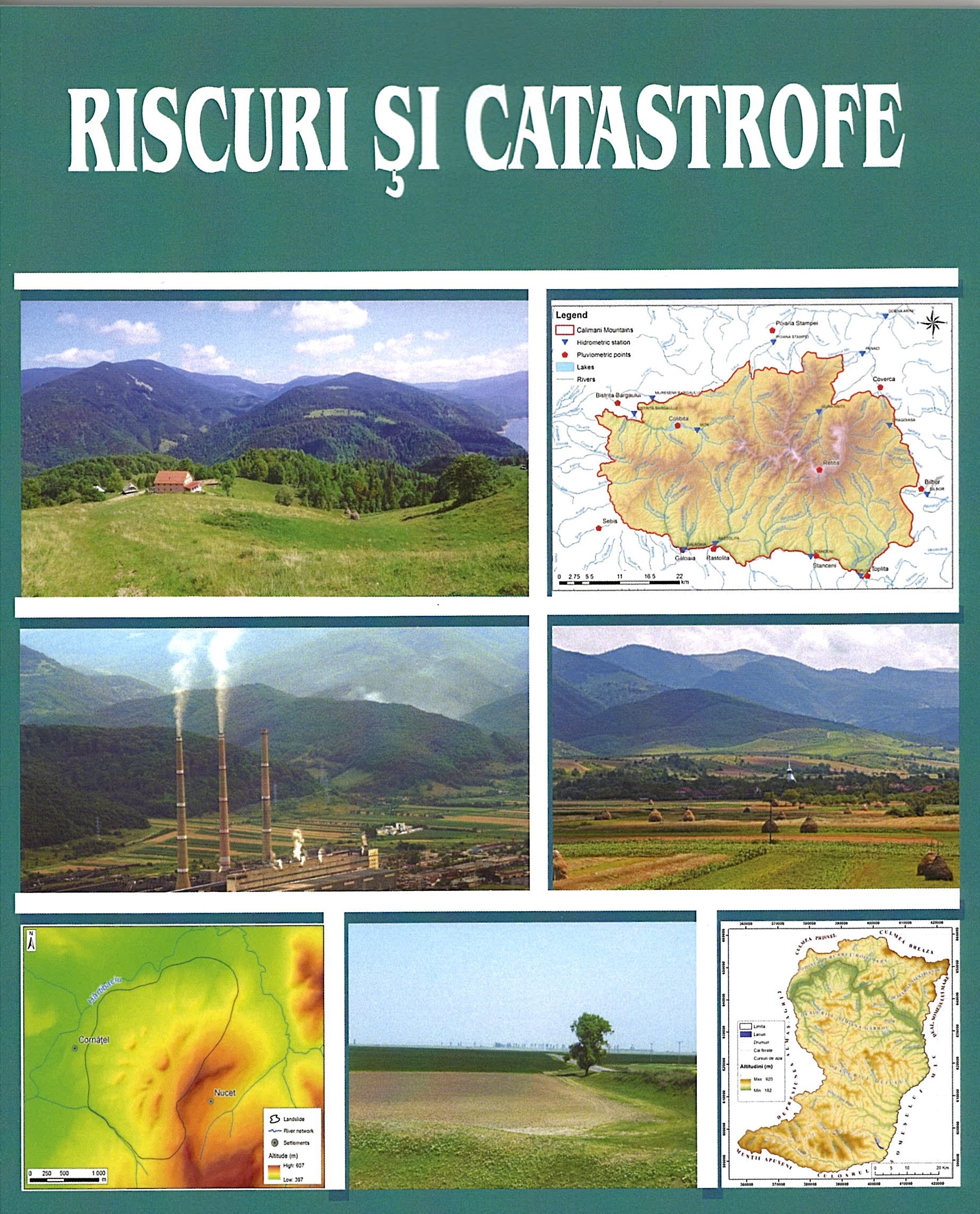
Author(s): Gheorghe Roșian,Csaba Horváth / Language(s): English Issue: 1/2020

This paper it’s part of the present concern regarding the graphical representation of landslides. A very particular category of landslides is the glimee type. Of the territories in which they are frequently encountered, the Transylvanian Depression must be noted. Despite that these landslides are considered stable, since they occurred thousands of years ago, they were affected in time by various geomorphological processes. These include the recent (shallow) landslides, runoff on the slope, etc. For a correct graphical representation of both the old landslide and the current processes, which by their manifestation contribute to the genesis of new relief microforms, a GIS methodology was used. By using it, one can obtain both a graphical representation of various generations of landforms and can also make calculations allowing them to find out exactly their surface. This aspect has obvious practical connotations. As case study we used the landslide of Cornăţel, located in the south-western part of Hârtibaciului Plateau, an old glimee type landslide.

More...
Characteristics of periods with high flow on the rivers from Căliman Mountains.

Characteristics of periods with high flow on the rivers from Căliman Mountains.

Author(s): Costin Hârlav,Victor Sorocovschi / Language(s): English Issue: 1/2020

The Căliman Mountains in the central part of the Eastern Carpathians represent the highest volcanic massif in Romania. The river network is organized on three hydrographic basins (Someş to the west, Mureş to the south and Siret to the east). The work was developed following the processing and interpretation of data from 14 hydrometric stations. The calculation period was 1981-2010. In the characterization of the periods with high flow, the high waters and the floods were analyzed as important phases in the daily regime of the water flow of the rivers. -spatial of some temporal, quantitative and form parameters.

More...

Investigation of the lateral channel migration: A case study of the South Morava River (Serbia)

Author(s): Marko Langović / Language(s): English,Serbian Issue: 1/2020

The morphological evolution of the fluvial relief in the lowland areas is determined by the dynamic of the lateral channel migration process. River meandering and lateral channel migration represent continuous, dynamic and complex processes, which intensity modifies alluvial plains. Accordingly, it is a current topic observed from the domain of various scientific disciplines and practices, including the geographical aspect of the study. Directly or indirectly, variations of natural and anthropogenic processes affect changes in the lateral migration intensity, which is later manifested through permanent consequences for the environment. The aim of this paper is to investigate the process of lateral channel migration, through the review and interpretation of theoretical and methodological concepts and results of contemporary scientific literature. In this paper, on specific sections of the South Morava River (Serbia), the values of maximum lateral migration over different time periods are determined. Three representative river sectors were singled out, spatial and temporal dynamic was determined, while the process of lateral channel migration was presented quantitatively and graphically. Based on the obtained data, a comparative analysis showed significant riverbank changes for the observed meanders, within the period 1924-2020. Special emphasis is on the analysis of the lateral channel migration in the last decade of the mentioned period. The obtained results can be further used in order to develop and implement plans of water and land management, environmental protection and socio-economic development strategies.

More...

Analysis of human thermal comfort in Central European City during summer of 2015: A case of Novi Sad (Serbia)

Author(s): Dragan Milošević,Stevan Savić,Daniela Arsenović,Zorana Lužanin,Jelena Dunjić / Language(s): English Issue: 1/2020

Urban meteorological network (UMN) was established in the Central European City of Novi Sad (Serbia) based on "local climate zones" (LCZs) system. Physiologically Equivalent Temperature (PET) index was used for the assessment of outdoor thermal comfort in the "built" and "land cover" LCZ classes of Novi Sad. The index was calculated in the RayMan software based on the meteorological, physiological as well as building and vegetation data. Temporal analysis was performed for extreme heat stress days (PETmax ≥ 41 °C), extreme heat stress hours (PETav ≥ 41 °C) and days with occurrence of "tropical nights" (Tmin > 20 °C) during exceptionally hot summer of 2015. Our results show that extreme heat stress hours are the least frequent in compact midrise LCZ 2, followed by dense trees LCZ A. On the contrary, countryside (low plants - LCZ D) showed to be the most uncomfortable area during daytime followed by compact low-rise areas (LCZ 3). Tropical nights are the most frequent in midrise LCZs 5 and 2 (40-46 nights) and decreasing towards open, sparsely built and natural LCZs (6-8 tropical nights in LCZs A and D). This is almost 800% decrease and it has implications for health and recreation of urban population and emphasizes the need for UMN development based on LCZ system.

More...

Analysis of land surface temperatures in the "Local Climate Zones" of Novi Sad (Serbia)

Author(s): Stevan Savić,Jan Geletič,Dragan Milošević,Michal Lehnert / Language(s): English Issue: 1/2020

In this study, the Local Climate Zones (LCZs) in Novi Sad, the second largest city in Serbia, are analysed as to surface temperature differences. The LCZs were delineated on the basis of the GIS-based method created by Geletič & Lehnert (2016). Land Surface Temperatures (LSTs) were derived from the satellites Terra, sensor ASTER, and LANDSAT-8. The thermal images were provided at a similar time (at about 9.30 AM) between 2002 and 2008 (ASTER) and between 2013 and 2017 (LANDSAT-8). Statistical analyses, including the analysis of variance (ANOVA) and Tukey-HSD test, were employed to reveal LST differences between the LCZs. The results indicate that in 84% of cases there were significant differences in LST between pairs of LCZs. Temperature differences between LCZs were the most pronounced in the summer season. In general, 8 (large low-rise), 10 (heavy industry), 2 (compact midrise) and 3 (compact low-rise) LCZs had the highest surface temperatures in Novi Sad. Contrary to this, LCZs A (dense trees), B (scattered trees) G (water bodies) were the coolest zones.

More...
Emission of carbon dioxide of selected retailers

Emission of carbon dioxide of selected retailers

Author(s): Radojko Lukić / Language(s): English Issue: 3-4/2017

Increased attention has been paid recently to the analysis of the effects of applying the concept of sustainable development in retail. In that context we have particularly considered greenhouse gases emission in retail. This is achieved through the use of modern ecological technology in business - through the whole value chain. The ultimate goal is to achieve the planned reductions of carbon dioxide in retail, which positively reflects the overall performance of retailers, environmental in particular. The costs of carbon dioxide emission reduction affect the performance of retailers. Continuous empirical research shows that almost all global retailers achieve a significant reduction in carbon dioxide emissions from year to year. Empirical research conducted in this paper on the example of global retailers in the United States, Europe and the European Union, the United Kingdom, Mexico, China, Croatia and Serbia shows significant and planned reduction of carbon dioxide emissions in retail, especially in countries with developed market economies. This empirical research is mainly based on the analysis of the original sustainable (environmental and ecological) reports officially disclosed by selected retailers, primarily from the countries of a developed market economies, which they started to publish with regular annual financial statements. They are now an integral part of the so-called integrated reporting on performance of global retailers. Due to the general importance, harmonized regulations on sustainable retail reporting are being increasingly applied as a data source for more efficient environmental management. In perspective, this will ease the comparative analysis of the carbon dioxide emission of global and other retailers.

More...
Are Heteroptera communities able to be bioindicators of urban environments?

Are Heteroptera communities able to be bioindicators of urban environments?

Author(s): O. M. Kunakh,I. O. Fedyay / Language(s): English Issue: 2/2020

The Heteroptera is a group of animals associated with the vegetation cover. The conducted analysis indicates that groups of heteropterans in the urban environment have a pattern of reaction to the environmental factors, determined using the phytoindication method. In the study, we considered the following hypotheses: 1) phytoindicational assessments of ecological factors may explain the patterns of variation of the groups of heteropterans; 2) among Heteroptera species, comparatively homogenous ecological groups could be distinguished which are characterized by similar character of response to the effect of certain environmental factors; 3)these groups could be used for bioindication of the conditions of environment in urban ecosystems. Stationary collection of heteropterans was performed during three years from May to October of 2017–2019 on six plots in Kharkiv. The article describes factors which affect the structure of groups of Heteroptera within the ecosystem of the large city and assess the bioindication possibilities. The data presented in the article, as well as the conclusions drawn, are to a large extent associated with stenotopic species, most of which could be used as bioindicators of the condition of one or another biocenosis. According to the results of a taxonomical survey in the territory of Kharkiv, 180 species of Heteroptera were found, belonging to 120 genera and 17 families. The highest species diversity was seen for the family Miridae, accounting for 50 species (27.0% of the total number of counted species). Fewer species were identified as the representatives of families Lygaeidae – 46 species (24.9%) and Pentatomidae – 23 (12.4%). Family Rhopalidae was represented by 11 species (5.9%). Nabidae and Tingidae – 10 species each (5.4%). Families Coreidae – 8 (4.3%), Cydnidae and Scutelleridae – 4 species each (2.2%), Anthocoridae – 3 (1.6%). The families Berytidae, Piesmatidae, Pyrrhocoridae and Reduviidae were represented by only 2 species each (1.1%). Families Acanthosomatidae, Alydidae and Aradidae were represented by 1 species each, in total accounting for 1.5%. The reasonably high level of species and ecological diversities of Heteroptera in the territory of the city allows them to be used in bioindication studies. We determined comparatively homogenous ecological groups of heteropterans which have a similar pattern of response to the impact of certain environmental factors. The study demonstrates that phytoindicatory assessments of the ecological factors can explain the patterns of variation in groups of heteropterans, We determined the factors which have effects on the structure of the group of heteropterans within the metropolitan ecosystem. The level of their effect on groups of heteropterans within the city is different. The most influential were light and humidity. Comparison of potential and realized projections of ecological space allows us, to a certain extent, to generate hypotheses about the orientations of transformation of the group heteropterans.

More...
Ecological and physiological peculiarities of bryophytes on a post-technogenic salinized territory

Ecological and physiological peculiarities of bryophytes on a post-technogenic salinized territory

Author(s): O.V. Lobachevska,N.Y. Kyyak,I.V. Rabyk / Language(s): English Issue: 4/2019

Taxonomic, biomorphological and ecological structures of bryophytes, their reproductive strategy and the main mechanisms of tolerance in the conditions of salinization were investigated. Bryophytes are the pioneers that have colonized the territory of a tailing storage that holds liquid waste from potassium-magnesium concentrate production of the Mining and Chemical Enterprise "Polymineral". Due to excess salts, the soil solution in the shore area of the tailing pond acquires high osmotic pressure. Three experimental plots which differed significantly in the level of the substrate salinity were laid at the distance of 3, 6 and 9 m from the reservoir for experimental studies. Water extracts of the substrates from the test sites showed the highest concentrations for sulfates – 10.4–64.6 mg Eq/100 g of soil and chlorides – 7.6–43.3 mg Eq/100 g of soil. It was established that the investigated areas of the tailing storage territory differed in the biochemical activity of the substrate, which was evaluated by its redox potential. On the areas of the uncovered substrate it was the lowest – 230 mV, which indicates anaerobiosis in conditions of very high salinization and moisture. Higher ROP values were determined at the sites of bryophyte cover distribution – 295–330 mV. The aim of the study was to determine the features of taxonomic, biomorphological and ecological structures of bryophytes, their reproductive strategy and to establish the main mechanisms of adaptation to the conditions of salinization on the tailing storage territory. 24 species and 3 varieties of bryophytes, belonging to 12 families and 16 genera were found on the shore of the tailing storage pond. The results of biomorphological and ecological analysis of bryophytes indicate the uneven conditions of the habitats and their considerable ecological plasticity. Among the bryophytes, mesophytes, xeromesophytes and meso-eutrophs, eutrophs with a life-form of low dense and loose turf dominated. In salinization conditions, dioicous acrocarpous mosses prevailed, the fertile turf of which, depending on the influence of abiotic factors, differed significantly in the number of sexual shoots, their ratio and productivity. Bulbils were found only on the tips of Bryum argenteum shoots. Along with Salicornia europaea L., a euhalophyte, the leading role in the initial stage of overgrowth of the tailing storage area most often belonged to Didymodon rigidulus, Bryum argenteum, Funaria hygrometrica and Barbula unguiculata. The process of formation of bryophyte cover occurred along a gradient of decrease in salt concentration at the experimental sites. Adaptation of bryophytes to substrate salinity is due to a change in metabolic processes, which is manifested in an increase of the total content of carbohydrates and an increase of the cation exchange capacity of moss cell walls, which is the primary barrier that reduces the toxic effect of ions under salt stress.

More...
АНАЛИЗА АГРАРНЕ ПОЛИТИКЕ У СРБИЈИ С КРАЈА 20. И ПОЧЕТКА 21. ВЕКА СА АСПЕКТА ФИНАНСИРАЊА

АНАЛИЗА АГРАРНЕ ПОЛИТИКЕ У СРБИЈИ С КРАЈА 20. И ПОЧЕТКА 21. ВЕКА СА АСПЕКТА ФИНАНСИРАЊА

Author(s): Gordana Radović / Language(s): Serbian Issue: 175/2020

The aim of this paper is to analyze the agricultural policy implemented in Serbia from the end of the 20th and the beginning of the 21st century from the aspect of agriculture finance. The domestic agricultural policy of the pre-transitional and the beginning of the transitional period, during the mid 1990s, was based on the concept of protectionism. Back then, the financing of agriculture was realized mainly through the primary emission of the National Bank i.e. through selective and subsidized credits. The agricultural policy was abruptly transformed from the concept of protectionism to liberalization. Although this concept was applied for only several years, it significantly aggravated the economic situation in agriculture, thus complicating the issue of financing even more. Along with the agrarian budget, the sources of financing agriculture during this period were the loans granted by commercial banks, which were unfavorable for the majority of agricultural entities. The methods used in this paper are analytical-empirical, historical, and comparative. The author concludes that the former concepts of agricultural policy in Serbia have not defined an acceptable and sustainable model of financing agriculture. The agrarian budget, as a quantitative and qualitative demonstration of the agricultural policy, has been the key source of financing agriculture during the entire transition period up to now. Despite the modifications in the qualitative structure of the agrarian budget, in accordance with the requirements of agricultural entities and the EU integration, in quantitative terms the agrarian budget failed to meet the growing demands of the agricultural entities for subsidies.

More...
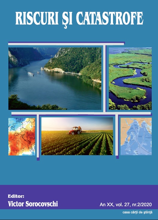
Danube. Hydrographycal, hydrologycal and qualitative characteristics water with references on the Pontic Sector

Danube. Hydrographycal, hydrologycal and qualitative characteristics water with references on the Pontic Sector

Author(s): Petre Gâștescu,ȚUCHIU ELENA / Language(s): English Issue: 2/2020

The Danube is the second largest water course in Europe (after the Volga) in terms of length (2860 km) and area (817,000 km2) The river springs from the central-western part of Europe (Schwarzwald), runs through the central part of the continent, crosses the Pannonian Depression to the confluence with the Drava, then pierces the Carpathian Mountains through the Iron Gate Gorge. Farther down it separates the southern part of the Romanian Plain from the Prebalkan Plateau, and the eastern part of Sea, encompasses the Delta area. In Romania the Danube is 1075 km long and drains 97% of the country’s territory. It flows through European regions affected by Oceanic, Baltic, Mediterranean and temperate-continental climatic influences that stamp their mark on the morpho-hydrographic and hydrologic characteristics of the river. The Danube discharge regime depends on its upper course tributaries which come from the Alps with high waters in June. In its middle and lower course it depends on the Drava and the Sava, with high waters in spring (April –May) and lower ones in autumn (September – October). The Danube’s multiannual mean discharge increases downstream as follows: 1,470 m²/s at Passau, after confluencing with the Inn River; 1,920 m²/s in Vienna; 2,350 m²/s in Budapest and 5,300 m²/s after its junction with the Drava, Tisa and Sava rivers. This water volume enters Romania at Baziaş with 5560 m²/s. Hence forward values continue to rise through the contribution of its lower course tributaries, reaching 6,495 m²/s (over the 1840-2016 period) when flowing into the Delta-Ceatal Chilia. Maximum discharge is recorded during the high spring waters, but occasionally in summer, too: 15,800 m³/sec at Baziaș in April 2006; 15,300 m²/s at Giurgiu, and 15,900 m²/s at Ceatal Chilia. Minimum discharge occur in autumn and occasionally in winter: 1,040 m²/s at Baziaș 1949; and 1,790 m²/s at Ceatal Chilia in 1947.The alluvial discharge (1840-2000) was 53 million tons/ year, respectively 1,681kg/s, of which 2.81 million tons /year represented coarse alluvia (sands). The extreme values during that interval were 4,470 kg/sec (141 million tons/year) in 1871 and only 229 kg/sec (7.2 million tons/year) in 1990. Throughout that period there was a tendency to decrease at an annual rate of 8.3 kg/year, naturally with fluctuations in terms of the liquid discharge. The mineralisation degree is still moderate despite the higher quantities of polluting wastes being spilled into the river in front of large cities – Vienna, Bratislava, Budapest and Belgrade (values coming close to 350 – 400 mg/l due mainly to chlorine and natrium). The Danube’s great self-purification capacity makes it recover in the lower course. The qualitative characteristics of the water was implemented in 1996 by Danube Transnational Monitoring Network - TNMN, the objectives and programs in view of ensuring the concentrations and loads of relevant pollutans and identifyng of the major sources of pollution. The spatial and temporal variation in the pontic sector of the physico-chemical quality indicators, reflect the general characteristics and the effect / impact of the main pressures identified at basin level for the period 1996-2015, in 6 monitoring sections (from Baziaș to Reni). The type of surface water body (river, lake, transient water, coastal water) is an aquatic unit that has an aquatic flora and fauna determined by the climatic, lithological and morphological conditons of the minor riverbed, hydrological and physical. significant anthropogenic unmodified chemicals.

More...
Pedological risks in Romania. Preliminary analysis.

Pedological risks in Romania. Preliminary analysis.

Author(s): Sanda Roșca,Ștefan Bilașco,Florin Gheorghe Fodorean,Iuliu Vescan,Dănuț Petrea,Ioan PACURAR,Raularian Rusu / Language(s): English Issue: 2/2020

The pedological resources of a territory lay at the basis of agricultural potential, because they have a direct influence on the favorability or restrictiveness of a territory for a certain use. Therefore, the study of the physical-chemical and morphological characteristics of soils becomes very important when one proposes economically viable agricultural crops. The restrictive climatic and morphological factors may have isolated or cumulative negative effects on the agricultural sector in a certain territory, but the pedological risks are most difficult to mitigate. The purpose of this study is to analyze the distribution of pedological risk classes across Romania, assessing the scientific literature in the field, and to highlight the regions comprising the largest areas affected by soil-related risks.

More...
Insights on the Indian Ocean Tectonics and Geophysics Supported by GMT

Insights on the Indian Ocean Tectonics and Geophysics Supported by GMT

Author(s): Polina Lemenkova / Language(s): English Issue: 2/2020

This paper presented analyzed and summarized data on geological and geophysical settings about the tectonics and geological structure of the seafloor of the Indian Ocean by thematic visualization of the topographic, geophysical and geological data. The seafloor topography of the Indian Ocean is very complex which includes underwater hills, isolated mountains, underwater canyons, abyssal and accumulative plains, trenches. Complex geological settings explain seismic activity, repetitive earthquakes, and tsunami. Understanding and prognosis of the disastrous and catastrophic geological events is strongly based on correct data analysis, modelling and visualization. An important feature of this paper is mapping multi-source high-resolution data by GMT. Data include raster grids in NetCDF and GRD formats: ETOPO1, geologic and marine free-air gravity data, EGM96, age, spreading rates, and spreading asymmetry of the ocean crust by NOAA, total sediment thickness. Data were visualized by GMT modules to compare and analyze geophysical and geological settings of the Indian Ocean. Visualization reveled correlations between high bathymetric variations of the oceanic seafloor, distribution of main geological seafloor fabric: Southwest, Southeast, Mid and Carlsberg ridges. Tectonic maps were plotted to perform comparative analysis of several variables: crust age, spreading half rates (mm/yr), asymmetries in crustal accretion on conjugate ridge flanks (%), variations in the geopotential and gravimetric models. Being the warmest of the world’s ocean, Indian Ocean has specific climatic conditions (repetitive monsoons, tsunamis, cyclones and storms), complex geologic seafloor structure with triple junction and unique geographic settings. Presented paper contribut ed to the regional studies of the Indian Ocean.

More...
Victor Sorocovschi - SOMEȘEAN PLATEAU. HYDROGEOGRAPHIC   STUDY

Victor Sorocovschi - SOMEȘEAN PLATEAU. HYDROGEOGRAPHIC STUDY

Author(s): Petre Gâștescu / Language(s): English Issue: 2/2020

More...
TÜRK KÜLTÜRÜ ve MİTOLOJİSİNDE SU İYESİ ÜZERİNE KISA BİR DEĞERLENDİRME

TÜRK KÜLTÜRÜ ve MİTOLOJİSİNDE SU İYESİ ÜZERİNE KISA BİR DEĞERLENDİRME

Author(s): Şeyda Büyükcan Sayilir / Language(s): Turkish Issue: 48/2020

Water, which is a part of the earth-water (yer-su), and the "water cult" shaped around it, were evaluated in the first place together with "earth" in the natural cults of the Turks. In the background of the perception of water as sacred, in cosmic and cosmogonic expressions, the fact that the cosmos starts with water and ends with water again plays a vital role. Therefore, water spirits are both the owner and the “lord” of the waters. Concordantly, the idea that everywhere was covered with water at the beginning of life brings to the fore the concept and motif of being the dominant power and being a part or representative of the celestial spirits. In the epics, water mostly appears in the form of the sky-khagan duality, the sanctity of water being a part of God, being a state and a helping power in keeping a homeland. In this context, the words, prayers, sayings, attitudes and behaviors related to the water cult in Anatolia are the reflected forms and manifestations of the earth-water beliefs that existed in the pre-Islamic ancient Turkish culture.

More...

Java and Sumatra segments of the Sunda Trench: Geomorphology and geophysical settings analysed and visualized by GMT

Author(s): Polina Lemenkova / Language(s): English Issue: 2/2020

The paper discusses the geomorphology of the Sunda Trench, an oceanic trench located in the eastern Indian Ocean along the Sumatra and Java Islands of the Indonesian archipelago. It analysis difference in depths and variation in slope steepness between the two segments of the trench: southern Java transect (108.8°E 10.10°S - 113.0°E 10.75°S) and northern Sumatra transect (97.5°E 1.1°S - 101.0°E 5.5°S). The maps and geomorphological modelling were plotted using Generic Mapping Tools (GMT). The data include high-resolution grids on topography, geology, geodesy and geophysics: GEBCO, EGM2008 EGM-2008, GlobSed. The results include modelled segments, slope gradients, and cross-section profiles. The geological processes take place in the Indian Ocean at different stages of its evolution and influence the nature of the submarine geomorphology and geomorphology of the trench that differs in two segments. Java segment has a bell-shaped data distribution in contrast to the Sumatra with bimodal pattern. Java segment has the most repetitive depths at -2,500 to -5,200 m. Sumatra transect has two peaks: 1) a classic bell-shaped peak (-4,500 m to -5,500 m); 2) shelf area (0 to -1,750 m). The data at middle depths (-1,750 to -4,500 m) have less than 300 samples. The most frequent bathymetry for the Sumatra segment corresponds to the -4,750 m to -5,000 m. Comparing to the Sumatra segment, the Java segment is deeper. For depths > -6,000 m, there are only 138 samples for Sumatra while 547 samples for Java. Furthermore, Java segment has a more symmetrical geometric shape while Sumatra segment is asymmetric, one-sided. The Sumatra segment has a steepness of 57.86° on its eastern side (facing Sumatra Island) and a contrasting 14.58° on the western part. The Java segment has a steepness of 64.34° on its northern side (facing Java Island) and 24.95° on the southern part (facing the Indian Ocean). The paper contributes to the studies of the submarine geomorphology in Indonesia.

More...

Assessment of the water quality in the Morača River basin (Montenegro) using water quality index

Author(s): Miroslav Doderović,Ivan Mijanović,Dragan Burić,Milan Milenković / Language(s): English Issue: 2/2020

In this paper, the water quality of the Morača River and its main tributaries (the Zeta and the Cijevna) were analyzed, using the Water Quality Index (WQI) methods. Data from 12 hydrological stations (HS) from 2010 to 2018 were used. The analysis included ten parameters of physic, chemical and microbiological water quality: oxygen saturation, BOD5, ammonium ion, pH value, total nitrogen oxides, orthophosphates, suspended solids, temperature, electrical conductivity and coliform bacteria. Calculations for all 12 HS were made using the Serbian Water Quality Index (SWQI). The results of the research showed that the general situation is not discouraging, because the SWQI values ranged from 73-97, which according to the categorization of water quality corresponds to the classes good, very good and excellent. The only exceptions were the two measuring stations in the lower course of the Morača River (City Collector and Grbaci). During the entire observed period, the water quality was the worst on the profile of the City Collector (SWQI between 39 and 71) on Morača River. Also, downstream on Morača River, on HS Grbavci for 2015, the average annual value of SWQI was 70, which according to the gradation corresponds to the class of poor quality. The biggest sources of pollution were municipal wastewaters, followed by agricultural activities and illegal garbage disposal both along the stream and in the river itself. It follows that the lower part of the Morača River was the most polluted in the observed basin. This is a serious problem, especially since it is a part of the Morača River that flows through the most populated and most agriculturally active parts of Montenegro (Podgorica, Zeta Plain, Lješkopolje). Therefore, it is necessary to take adequate measures as soon as possible, which primarily relate to the introduction of wastewater treatment technology and to educate population about the importance of river water conservation.

More...
Result 541-560 of 1301
  • Prev
  • 1
  • 2
  • 3
  • ...
  • 27
  • 28
  • 29
  • ...
  • 64
  • 65
  • 66
  • Next

About

CEEOL is a leading provider of academic eJournals, eBooks and Grey Literature documents in Humanities and Social Sciences from and about Central, East and Southeast Europe. In the rapidly changing digital sphere CEEOL is a reliable source of adjusting expertise trusted by scholars, researchers, publishers, and librarians. CEEOL offers various services to subscribing institutions and their patrons to make access to its content as easy as possible. CEEOL supports publishers to reach new audiences and disseminate the scientific achievements to a broad readership worldwide. Un-affiliated scholars have the possibility to access the repository by creating their personal user account.

Contact Us

Central and Eastern European Online Library GmbH
Basaltstrasse 9
60487 Frankfurt am Main
Germany
Amtsgericht Frankfurt am Main HRB 102056
VAT number: DE300273105
Phone: +49 (0)69-20026820
Email: info@ceeol.com

Connect with CEEOL

  • Join our Facebook page
  • Follow us on Twitter
CEEOL Logo Footer
2025 © CEEOL. ALL Rights Reserved. Privacy Policy | Terms & Conditions of use | Accessibility
ver2.0.428
Toggle Accessibility Mode

Login CEEOL

{{forgottenPasswordMessage.Message}}

Enter your Username (Email) below.

Institutional Login