Cookies help us deliver our services. By using our services, you agree to our use of cookies. Learn more.
  • Log In
  • Register
CEEOL Logo
Advanced Search
  • Home
  • SUBJECT AREAS
  • PUBLISHERS
  • JOURNALS
  • eBooks
  • GREY LITERATURE
  • CEEOL-DIGITS
  • INDIVIDUAL ACCOUNT
  • Help
  • Contact
  • for LIBRARIANS
  • for PUBLISHERS

Content Type

Subjects

Languages

Legend

  • Journal
  • Article
  • Book
  • Chapter
  • Open Access
  • Geography, Regional studies
  • Physical Geopgraphy

We kindly inform you that, as long as the subject affiliation of our 300.000+ articles is in progress, you might get unsufficient or no results on your third level or second level search. In this case, please broaden your search criteria.

Result 901-920 of 1301
  • Prev
  • 1
  • 2
  • 3
  • ...
  • 45
  • 46
  • 47
  • ...
  • 64
  • 65
  • 66
  • Next
Интердисциплинарни подходи в преподаването на географията на Китай

Интердисциплинарни подходи в преподаването на географията на Китай

Author(s): Yana Shishkova / Language(s): Bulgarian Issue: 1/2019

In the recent years, the demand for Chinese language training has increased significantly worldwide. Following the trend, Bulgaria for many years now develops intensive language studies in the secondary schools and Universities all around the country. A need for cultural classes emerged to provide the necessary resources for successful realization in China or with Chinese language in the labor market. This paper provides different approaches of teaching China‘s geography for students, linking it to ancient and modern China, and to the practical aspects of applying the new knowledge provided.

More...
Globalna mobilność w dobie globalnego ocieplenia…. Czy zmiany klimatu wpłyną na nasilenie migracji międzykontynentalnych?

Globalna mobilność w dobie globalnego ocieplenia…. Czy zmiany klimatu wpłyną na nasilenie migracji międzykontynentalnych?

Author(s): Małgorzata Krywult Albańska / Language(s): Polish Issue: 1/2018

A widely held view in the academic circles is that there is a growing impact of humans on climate. Empirical data and analyses prove unambiguously that anthropogenic climate change is real, whereas its consequences, such as flooding of coastal areas, fires, droughts and heat waves, threaten the livelihoods of mostly the populations of the countries of the Global South, while increasingly affecting also the countries of the Global North. The aim of the article is to demonstrate whether climate change may increase international migrations, and intercontinental ones in particular. The first part reports the main issues in the academic debate on the relationship between human migrations and the environment. The second part summarizes the research conducted so far on migrations as a response to environmental change. The article ends in an attempt to forecast future trends. Despite the fact that – as research so far confirms – most environmental migrations are temporary and shirt-distance, the answer to the title question is positive: climate change is so profound that it will lead to an intensification of also intercontinental migrations.

More...
Classification of Countries of Destination by Gross and Relative Values of International (Inbound) Tourism and its Factors

Classification of Countries of Destination by Gross and Relative Values of International (Inbound) Tourism and its Factors

Author(s): Oleksandr Korol,Volodymyr Krul / Language(s): English Issue: 3/2020

The present work is aimed at the analysis of gross and relative values of inbound tourism by countries of destination for the purpose of their classification. As a result of confronting total and specific (per 1 km of conventional radius of the country’s territory) numbers of international tourist arrivals with the median values for 100 countries of the world as of 2016, countries of destination were divided into four classes. Small countries of intensive inbound tourism are predominantly represented by tropical islands of the Caribbean Basin and Indian Ocean, as well as by the Mediterranean region. Over half of big countries of intensive inbound tourism are located in Europe and the Mediterranean destinations were the most often visited ones. Big countries of extensive inbound tourism show significant volume of inbound tourism in the first place due to their significant territories. Among these, there were Scandinavian destinations of Europe, Canada and Russia. The low intensity of their inbound tourism is explained by the unfavourable climate for human thermal-physiological sensations. Small countries of not-intensive inbound tourism had considerably less volume and intensity of tourism arrivals due to their small territories, unfavourable geographical conditions, but, what is most essential, also due to the poverty. In addition, cost indicator, that is receipts from inbound tourism per one arrival, was taken into account in the analysis. The factors that have influence over it were also disclosed.

More...
Engaging Cinema in Environmental Crisis : A Paradigm of Documentary Films of the Niger Delta

Engaging Cinema in Environmental Crisis : A Paradigm of Documentary Films of the Niger Delta

Author(s): Stephen Ogheneruro Okpadah / Language(s): English Issue: 11/2022

The oil-rich Niger Delta region of Nigeria remains one of the most environmentally devastated places in the world. This is caused by gas flaring, crude oil spillages, illegal oil bunkering and pipeline vandalism in the region. The call for eco-democracy and the disruption of eco-apathy has driven global academia into developing paradigms that would foster environmental transformation. Interestingly, while academic disciplines such as history, geography, anthropology and the global humanities continue to critically engage in practices and discourses that would facilitate achieving anticipatory climate adaptation, African academia, especially in Nigeria, has been slow to absorb the same critical spirit as the West. In fact, environmental film critics in Nigeria have not fully explored the environmental discourse that has gathered strength in other disciplines central to the greening of the humanities. Therefore, there remains a dearth of critical underpinning for environment and cinema, or what I term discourses of/on the green cinema, in African scholarship. Against this backdrop, I examine environmental crisis in the documentary film Delta Blues, The Nigerian Oil Thieves and The True Price of Crude Oil, and use content analysis method to investigate how these films have been used to create environmental awareness in the region. The analysis is anchored on Adrian Ivakhiv’s biocentric model of ecocriticism, which acknowledges the unity of man and all the creatures and the environment around him, and further recommends a shift from human-centrism to biocentrism.

More...
Археология на ландшафта: проучвания в долината на реките Хаджийска, Бяла и Ахелой

Археология на ландшафта: проучвания в долината на реките Хаджийска, Бяла и Ахелой

Author(s): Zhivko Uzunov / Language(s): English,Bulgarian Issue: 1/2022

In the autumn of 2020 and spring of 2021, archaeological and geological field surveys were conducted within the Nessebar and Pomorie municipalities, as part of the project “Archaeology of Landscape: Patterns of Reconstruction of the Ancient Environment.” The project aims to reconstruct the landscapes of the Southern slopes of The Emine Stara Planina Mountain during Antiquity, as well as investigate human impact on the environment and archaeological sites. During the surveys, 102 new archaeological sites were discovered (see Fig. 1). Two sites date back to the Late Chalcolithic period, four to the Late Bronze Age, and nine small settlements to the Early Iron Age. These settlements were located along the banks of the Aheloy River and Hadzhiiska River. The majority of the sites (51 settlements) date back to the second half of the 1st millennium BC. Eleven settlements were dated to the Archaic and Classical periods, and ten to the Hellenistic period. Thirty sites did not yield enough diagnostic artifacts, and thus were largely dated to the second half of the 1st millennium BC. The Early and Late Roman periods, as well as Late Antiquity, were represented by a total of 54 sites, with 13 sites from the Roman period and 41 from Late Antiquity. However, this remains a conditional division, as some of the sites from Late Antiquity could potentially date back to the 2nd and 3rd centuries. The Medieval period was represented by 46 sites, with three sites dating back to the earliest part of the period (8-10th century). These sites contain pottery from the First Bulgarian Kingdom, while eleven sites belong to the 10th-12th centuries, and eighteen sites to the 13th-14th centuries.

More...
Jak reagować na kryzys klimatyczny w dobie ekstraktywizmu? Perspektywa „akademii w działaniu”

Jak reagować na kryzys klimatyczny w dobie ekstraktywizmu? Perspektywa „akademii w działaniu”

Author(s): Maria WODZIŃSKA / Language(s): Polish Issue: 1/2023

Review of: Za pięć dwunasta koniec świata. Kryzys klimatyczno‑ekologiczny głosem wielu nauk, ed. Kasia Jasikowska, Michał Pałasz

More...
Climate-change education: more ideology than science?

Climate-change education: more ideology than science?

Author(s): Curtis L. Hancock / Language(s): English Issue: 30/2020

A few years ago, a commercial for Nissan motors, advertising its environmentally friendly, electric-powered car, named the Leaf, ran frequently on American television. It captured one’s interest and even had a certain charm. The commercial opened with arresting images of glaciers melting and arctic ice crashing into the sea. The camera zooms into a lone polar bear, looking forlorn, adrift on a small patch of ice. Next, we see the polar bear swimming miles to a distant shore. Coming to land, he finds himself in a populated metropolitan area, where he walks relatively unnoticed (go figure). Eventually, he appears on the driveway of a Nissan owner. He approaches the owner who is about to enter his car. The polar bear embraces him. The motorist reciprocates with a generous hug of his own. The message, not lost on even the casual viewer, was twofold: (1) global warming is a threat to our planet’s survival, and (2) already global warming is a threat to the survival of polar bears. The commercial was bound to be effective in the United States, since tens of thousands of American school children, as a matter of educational policy, were subjected to Al Gore’s sensational film, An Inconvenient Truth.

More...

LANDSCAPE DYNAMICS IN THE SOMEȘ CORRIDOR. CASE STUDY: GURUSLĂU DEPRESSION (ROMANIA)

Author(s): Andreea Costea,Viorel Gligor,Ioan-Aurel Irimus / Language(s): English Issue: 1/2022

Changes in land use patterns induced by different agricultural practices are reflected territorially through transformations at the level of elementary landscape units, with an impact on territorial identity and cohesion. The aim of this study is to highlight the dynamics of the territorial structures in the post-communist period (1990-2018), diachronically reflected in the transformations of the landscape of the Guruslău Depression, using the landscape metrics. The main direction of the scientific research was based on the analysis of land use changes and the identification of the spatial elements of structural-landscape distinction with impact on land degradation process. The evaluation of the landscape dynamics in the current context uses several effective metrics and tools, which increasingly require the identification of interdisciplinary methods of analysis, with a decisive impact on territorial development. Besides, the present approach is also motivated by the increasing environmental impact of climate change. The methodology used in the present paper is based both on the geoprocessing of vector data using GIS tools and correlated spatial analysis, and on the identification of landscape types using a new process of reclassifying land use categories, according to a set of landscape definition variables. The results of the research highlighted both the particularities of landscape transformations that occurred in the reference interval, as well as the favourable conditions for addressing biocultural diversity, by identifying traditional agricultural practices and the resilience of geographical landscapes given the adaptation to changing development strategies. Meanwhile, by detecting the landscape structures affected by change, in correlation with the impact induced on the biodiversity of the territory, the present study has a wide applicability in the most appropriate implementation of local development policies, as well as in identifying the forms of sustainable valorisation of the landscape in the study area.

More...
MITIGATING FLASH FLOODS WITH THE USE OF NEW TECHNOLOGIES: A ΜULTI-CRITERIA DECISION ANALYSIS TO MAP FLOOD SUSCEPTIBILITY FOR ZAKYNTHOS ISLAND, GREECE

MITIGATING FLASH FLOODS WITH THE USE OF NEW TECHNOLOGIES: A ΜULTI-CRITERIA DECISION ANALYSIS TO MAP FLOOD SUSCEPTIBILITY FOR ZAKYNTHOS ISLAND, GREECE

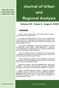
Author(s): Stavros Stavropoulos,George N. Zaimes,Evangelos Filippidis,Daniel Constantin Diaconu,Dimitrios Emmanouloudis / Language(s): English Issue: 2/2020

Floods can be extremely harmful for the welfare of societies regardless if they are natural or caused by humans. The Mediterranean region has experienced an increase in flash floods frequency and severity. The suddenness and episodic nature of these type of floods makes it more difficult to predict them compared to river floods. In this study, a map was developed in regard to the flood susceptibility of Zakynthos Island with the use a multi-criteria decision analysis. This analysis utilized six factors: a) flow accumulation, b) land use, c) slope, d) rainfall intensity, e) geology and f) elevation. Each factor had a different weight based on their importance in regard to flash floods. The analysis was run in GIS. To validate the developed susceptibility map, the locations of the recorded past floods on the island were utilized. The end product was a validated flood susceptibility map. This map can help the Civil Protection Authority of Zakynthos Island to mitigate communities’ susceptibility to flash floods.

More...
Exceptionally hot summer 2022 in south-west Romania. Risks and Catastrophes Journal,

Exceptionally hot summer 2022 in south-west Romania. Risks and Catastrophes Journal,

Author(s): Ion Marinica,Andreea Floriana Marinică / Language(s): English Issue: 2/2022

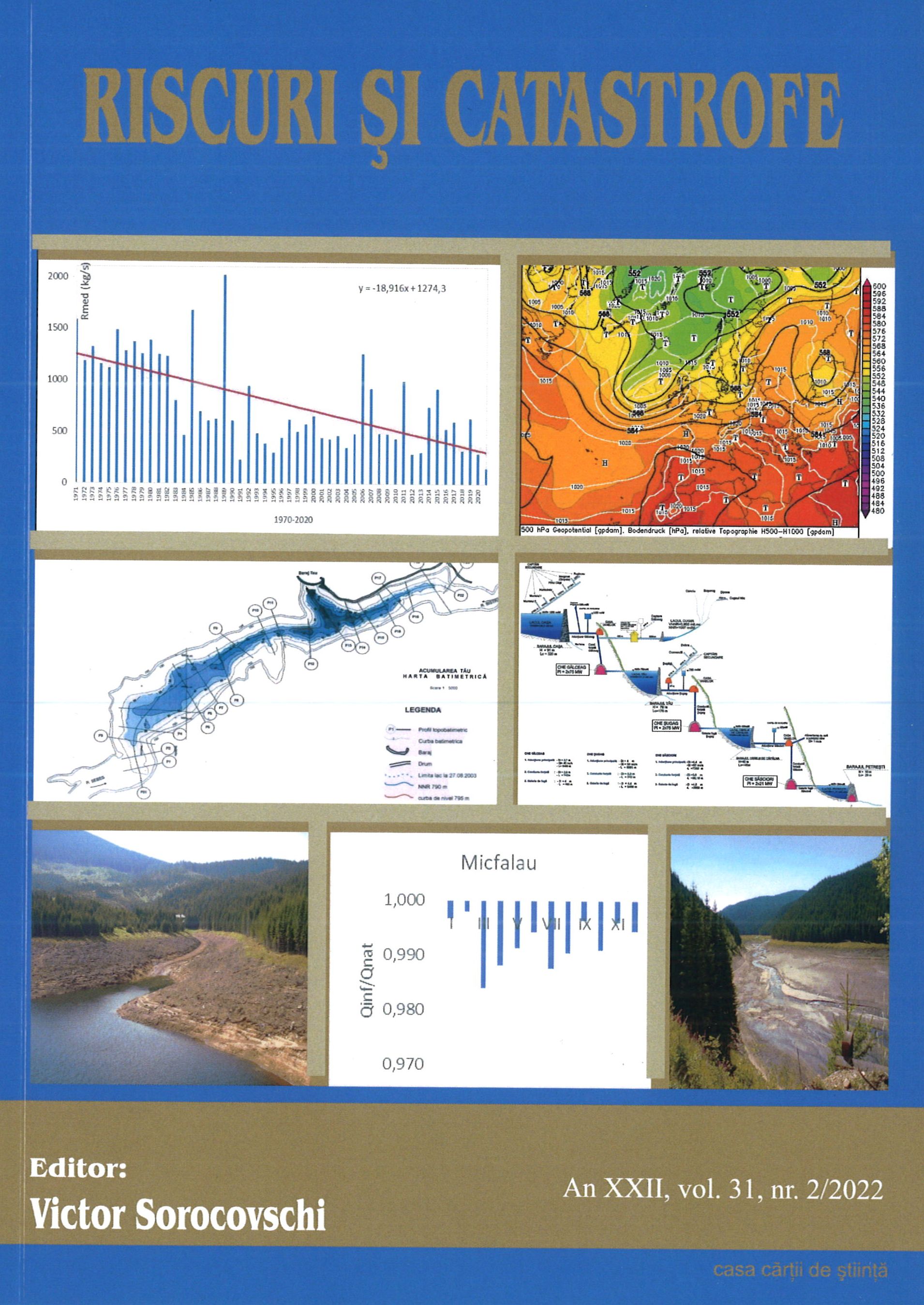
The summer of 2022, in southwest Romania, as in Romania and on the European continent, was particularly hot, marked by a progressive weather warming starting from the very last month of spring - May. According to the Hellmann criterion, June was warm (CL) with a monthly mean of 22.06°C and a deviation from normal of 2.65°C. July was warm (C) with a monthly average, for the entire Oltenia region, of 23.96°C and a deviation from normal of 2.45°C. August was warm (C) with a monthly mean of 23.59°C and a deviation from normal of 2.5°C. Summer was hot (C) with a seasonal mean of 23.2°C and a deviation from normal of 2.5°C. The heat waves had the temporal extension of 51.1% of the summer days, and after the 7.VIII a rainy period followed. The entire continent of Europe was affected by the drought and then by the rainy season. The paper analyses the climatic evolution of this summer, which was the third warmest in the history of the climate in Oltenia, and is useful to all those interested in the climate of south-western Romania.

More...
The role of the relief in the process of water drainage of the rivers in the Căliman Mountains.

The role of the relief in the process of water drainage of the rivers in the Căliman Mountains.

Author(s): Costin Hârlav / Language(s): English Issue: 1/2023

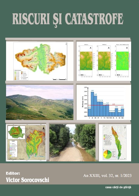
The analysis of the flow of river water from a certain surface is very important f r determining the multi-year flow regime. In the formation of the regime, an important role is played by the features of the relief of the hydrographic basin, which directly influence the direction of flow and the speed of the water, and indirectly, the climatic elements. The Căliman Mountains are less analysed from this point of view, the relief elements being included in only a few specialized works. In the study, the role of the morphometric elements (altitude, geodeclivity, density and depth of fragmentation, orientation of the slopes) and morphological elements of the relief in the flow process from the highest volcanic massif in Romania located in the central part of the Eastern Carpathians was analysed.

More...
Variability of Air Temperature During Winter Between 1961-2022 in Southwest Romania (Oltenia)

Variability of Air Temperature During Winter Between 1961-2022 in Southwest Romania (Oltenia)

Author(s): Ion Marinica,Andreea Floriana Marinică / Language(s): English Issue: 1/2023

The periods of heating and cooling of the weather on Earth followed each other with great irregularity and caused significant variations in air temperature but allowed the existence of life and especially of the human species. In the paper I have analysed the variation of the air temperature in Oltenia during the winters for the interval 1961-2022. A number of our other works have analysed climate variability in this part of Romania. After the warm interval 1945-1955 there followed a gradual cooling of the weather, and in the interval 1986-2022 (for 36 years), there was not a single very cold winter (FR) but only two cold winters (R) and two cool (RC). The interval 2000-2022 (23 years) was the warmest of the entire period of meteorological observations in Oltenia. Many annual, monthly and daily temperature climate records have been broken. At the same time, in the analysed interval, in the polar areas the rate of melting of the ice increased a lot and exceptional thermal maxima were recorded in the cold season. The warm periods during the winters were increasingly longer, more frequent and more intense. The work is useful to all those interested in climate variability in Oltenia.

More...
ULOGA I ZNAČAJ VODE U RAZVOJU SARAJEVA KROZ HISTORIJU

ULOGA I ZNAČAJ VODE U RAZVOJU SARAJEVA KROZ HISTORIJU

Author(s): Sedad Bešlija,Hana Younis,Dženita Sarač-Rujanac,Mehmed Hodžić / Language(s): Bosnian Issue: 10/2023

Water represented a 'very important segment in the design and functioning of Sarajevo over the course of its long past. Water, as a symbol of life, in -various forms and shapes, has been an indispensable factor in the creation and development of many urban areas in human history, which is very clearly visible in the Sarajevo example. Based on data from unpublished archival materials, published sources and relevant literature, this text attempts to present certain elements that undoubtedly led to the city's development. The work deals with different thematic areas that chronologically presented the exploitation of the water potential of Sarajevo and its immediate surroundings, as one of the key causes of the city's urban development and its economic and social transformation. In the classic Ottoman era, Sarajevo was, to the greatest extent thanks to the institution of the Waqf, an area with an extremely large number of different forms of construction on the water. Wells, fountains and shadirwans as well as a wide branched network of water supply systems, made it possible to use the bounty of water unhindered. Mills and bridges were in the function of economic activity, which directly affected the prosperity of the city. In addition to these positive examples, the paper also provides information on certain problems caused by the natural effect of water power. During the Ottoman and Austro-Hungarian periods, Sarajevo was faced with floods which, depending on the intensity and whether the Miljacka or one of its tributaries flooded, caused damages of different scopes. Therefore, special attention was paid to the efforts of the city authorities to prevent such scenarios. The paper deals with the construction and maintenance of Sarajevo's water supply network. Its beginnings in the Ottoman period are presented and analyzed, as well as the first, at that time, modern approaches in the construction o f a modern water supply system after the Austro-Hungarian occupation of Bosnia and Herzegovina. The Austro- Hungarian authorities, aware of the existing water potential of the source of the Mošćanica river not far from Sarajevo, tried to make maximum use of these facilities with the aim of supplying the city with sufficient quantities of drinking water.

More...
EFFECTIVE WASHING AGENT FOR THE REMOVAL OF LEAD AND COPPER FROM MULTI-METAL CONTAMINATED SOILS IN MINING AREAS

EFFECTIVE WASHING AGENT FOR THE REMOVAL OF LEAD AND COPPER FROM MULTI-METAL CONTAMINATED SOILS IN MINING AREAS

Author(s): GIANINA ELENA DAMIAN / Language(s): English Issue: 23/2023

Removal of heavy metals from soil by washing with different eco-friendly washing agents is one of the methods that has gained great interest in scientific research. As previous studies reported the potential of chitosan to be used as an eco-friendly washing agent for the removal of heavy metals from soils, in the present study, the removal of lead and copper from multi-metal contaminated soil collected from a mining area located in Zlatna (Alba County, Romania) by chitosan washing was investigated. Soil washing experiments were performed at laboratory scale by an ex-situ soil washing technique. A solid/liquid ratio (S/L ratio; g:mL) of 1:10, two concentrations of chitosan washing solution (2 and 5%) and different stirring times (120, 240, 360, 720, 1440 and 2400 min) were the studied parameters of the washing process. The results indicated that copper and lead removal efficiency increased with increasing the stirring time and the concentration of chitosan in the washing solution (in the case of Cu). In the investigated experimental conditions, about 55 % and 77% of copper and lead were removed from the soil after 2400 min of stirring with the chitosan washing solution.

More...
Atmospheric levels of PM10 in relation to meteorological elements. Case study: Moldova Region, Romania

Atmospheric levels of PM10 in relation to meteorological elements. Case study: Moldova Region, Romania

Author(s): Alina Nistor,Bogdan Nistor,Dumitru Mihăilă,Petruț-Ionel Bistricean / Language(s): English Issue: 1/2023

The major goal of our research was to find statistically relevant mathematical correlations between PM 10 levels in the atmosphere and the meteorological complex over the Moldova - Romania region. The period of analysis was from 2009 to 2020. We worked on daily data on PM10 levels and meteorological parameters from a network of 25 monitoring stations. The correlations between PM10 levels and air temperature, solar radiation, wind and precipitation were negative. The correlations between PM10 concentrations, atmospheric pressure and relative humidity were positive. However, over the medium term (12 years), the overall climatological correlations between PM10 concentrations and meteorological elements (assessed using Pearson coefficients) had values below ±0.5. This suggests that PM10 levels are not primarily influenced by meteorological elements but rather are closely associated with daily and annual patterns of socioeconomic activities. At time intervals of a few days up to 1-2 weeks, in certain favorable geographical situations, the correlative links between PM10 levels and meteorological elements can become strong and relevant (the Pearson index has in these temporal and spatial contexts values above or below 0.9 units).

More...
Study on atmospheric radioactivity in Suceava Metropolitan Area

Study on atmospheric radioactivity in Suceava Metropolitan Area

Author(s): Liliana Gina Lazurca (Andrei),Dumitru Mihăilă,Petruț-Ionel Bistricean,Vasilică-Dănuț Horodnic,Mihaela Țiculeanu,Alin Prisacariu,Alina Nistor,Vasile Budui,Bogdan Nistor,Sînziana-Cătălina Silișteanu / Language(s): English Issue: 1/2023

Ionising radiation from different environments (sun, celestial bodies, soil and geological substrate, etc.) influences the whole living world as a hidden factor. About 87% of the radiation dose received by humans is due to natural radiation. It is essential to assess radiation doses in order to control possible health effects from such natural sources. In this context we were interested in assessing the atmospheric radioactivity in Suceava Metropolitan Area by performing an experimental field monitoring with gamma dose monitoring, between 15 - 17 July 2021, and an analysis based on gamma dose rate measurements, global specific beta activity and radon/thoron emissions in the period (2009 - 2020) performed by the Environmental Radioactivity Monitoring Laboratory of Suceava Environmental Protection Agency. The obtained results for the external gamma dose, on hourly data show that the warning threshold of 0.250 μSvh-1 was exceeded, on cumulative annual data the external gamma dose rate was between 0.53 mSv in 2012 and 0.97 mSv in 2019, so it did not rise above the threshold of 1 mSv, the threshold from which health problems may occur. For atmospheric aerosols the warning threshold of 10 Bq m-3 was not exceeded in any case, and for atmospheric deposition (on the ground) the maximum in observations rose to 61.3 Bq m-3, less than 1/3 of the warning threshold value of 200 Bq m-3. The assessment of Radon and Thoron emissions showed a maximum of 28.4 Bq m-3, a quarter of the human health threshold of 100 Bq m-3.

More...
Riverscape changes in the Lower Siret Basin in the late Little Ice Age

Riverscape changes in the Lower Siret Basin in the late Little Ice Age

Author(s): Alexandru-Ionuț Cristea / Language(s): English Issue: 1/2023

Research focusing on the environmental history of the Lower Danube region is rather scarce compared to the progresses made for the upper and middle sections. Moreover, little is known about the effects of recent climatic fluctuations and increasing anthropogenic pressure on the highly sensitive river systems of the area. In this paper, the information available in various historical sources (charters, narratives and historic maps) was used to carry out cartographic reconstructions of the riverscape in the former borderland of the Romanian Provinces from the fifteenth century to modern times. The results indicate that significant hydrographical disturbances occurred throughout this period and the present day configuration of the drainage network is relatively recent. The diversion of the lower course of river Siret at the beginning of the seventeenth century led to several other hydrological and hydrographical alterations, such as channel planform changes, supplementary channel shifts of the tributaries or increased incision into the floodplain. The origin of the triggering factors is to be found in the interplay between natural conditions and human activities.

More...
Some current data and observations regarding the ski slopes in Suceava County, Romania

Some current data and observations regarding the ski slopes in Suceava County, Romania

Author(s): Dinu Iulian Oprea,Andrei-Emil Briciu / Language(s): English Issue: 1/2023

Current climate change poses numerous challenges for humanity. People's leisure activities are affected by climate warming, here including winter sports, in general, and skiing, in particular. In this study, we inventoried the ski slopes in Suceava county and selected the most important ones for an analysis of their length, facilities and potential. The 18 ski slopes on which we focus are located in 7 administrative-territorial units, of which 4 are resorts of national interest - Vatra Dornei, Câmpulung Moldovenesc, Gura Humorului and Suceviţa - and 2 are resorts of local interest - Mălini and Pojorâta. Most of the selected ski slopes are of medium difficulty level (72.2%), those with easy difficulty are 16.7%, while those with high difficulty represent 11.1%. Due to favorable climatic conditions and history, Vatra Dornei is the administrative unit with most ski slopes and most kilometers of ski slopes in Suceava county, followed by Câmpulung Moldovenesc. A long-term strategy should be established for building a sustainable ski slope in the mountain area and geographers are specialists who can cover important chapters in a pre-feasibility or feasibility study.

More...
Le transport collectif par voie d’eau à Abidjan, un moyen de lutte contre le réchauffement climatique

Le transport collectif par voie d’eau à Abidjan, un moyen de lutte contre le réchauffement climatique

Author(s): Seydou Ouattara,Adjoba Marthe Koffi-Didia / Language(s): French Issue: 2/2023

Despite the importance of the hydrographic system, cabotage remains less exploited in Côte d'Ivoire. Nevertheless, it is more visible in the coastal regions where the presence of the lagoon has caused a spatial break. But Abidjan remains the most exploited Ivorian locality in this area. The city has experienced rapid expansion which causes a sustained demand for travel because it is fragmented by a lagoon water body which lengthens distances between its compartments. So, less expensive, faster, more ecological, shorter lagoon transport compared to land transport should be a response to improving the transport of goods and people. This is why through this research; it is studied the policy of development of lagoon transport in Abidjan as a means for combating global warming. Literature research and field survey were used as a means of collecting the information necessary to conduct this study. Their exploitation provides several results related to lagoon transport used as a factor of reducing global warming. One of the elements identified is the modernization of the sector and the increase in stations on the lagoon banks which have an impact on road detours. The creation and multiplication of vehicle parking areas near lagoon stations is also a reason for reducing global warming. The introduction of multimodalism, which allows a segmentation of the journey between several means of transport, reduces greenhouse gases emitted. Finally, the massification of lagoon transport and mobility is accepted as a cause having an influence on global warming.

More...
Advanced Geomorphological Analysis of Erosion Dynamics at Făgetu Ierii: Integrating UAV Techniques and GIS for Enhanced Precision.

Advanced Geomorphological Analysis of Erosion Dynamics at Făgetu Ierii: Integrating UAV Techniques and GIS for Enhanced Precision.

Author(s): Gheorghe M. Rus,Gheorghe Roșian,Ștefan Bilașco,Rozalia Benedek,Csaba Horváth / Language(s): English Issue: 2/2023

This article delves into the realm of high-resolution geomorphological analysis, with a particular focus on soil erosion assessment. To achieve a more precise analysis of surface erosion, our study selected the former quartz sand exploitation site at Făgetu Ierii, in the Iara commune. This location serves as a focal point for studying various geomorphological processes, including landslides and gully formation, characterized by their significant intensity. Traditional methods for monitoring erosion dynamics involve substantial investments in both human effort and technical resources. This entails on-field tasks such as identification and detailed measurements, as well as office-based activities involving mapping and spatial analysis. Recognizing the challenges associated with these conventional approaches, our research explores more efficient methods that harness rapidly evolving modern technology. In this pursuit, the adoption of Unmanned Aerial Vehicle (UAV) techniques and methodologies appears as particularly promising. UAVs facilitate the creation of comprehensive databases capturing the three-dimensional (3D) structure of the terrain within the study area. The advantages are multifaceted: UAVs significantly reduce the time and costs associated with fieldwork while simultaneously enhancing the precision and accuracy of digital databases. These databases play a pivotal role in conducting spatial analysis within Geographic Information Systems (GIS), allowing for a more accurate identification of the impact and risk factors present in the territory. This study underscores the transformative potential of UAV technology in advancing geomorphological analysis, enhancing our understanding of erosion processes, and supporting sustainable land management practices in areas vulnerable to erosion due to both natural and human-induced factors.

More...
Result 901-920 of 1301
  • Prev
  • 1
  • 2
  • 3
  • ...
  • 45
  • 46
  • 47
  • ...
  • 64
  • 65
  • 66
  • Next

About

CEEOL is a leading provider of academic eJournals, eBooks and Grey Literature documents in Humanities and Social Sciences from and about Central, East and Southeast Europe. In the rapidly changing digital sphere CEEOL is a reliable source of adjusting expertise trusted by scholars, researchers, publishers, and librarians. CEEOL offers various services to subscribing institutions and their patrons to make access to its content as easy as possible. CEEOL supports publishers to reach new audiences and disseminate the scientific achievements to a broad readership worldwide. Un-affiliated scholars have the possibility to access the repository by creating their personal user account.

Contact Us

Central and Eastern European Online Library GmbH
Basaltstrasse 9
60487 Frankfurt am Main
Germany
Amtsgericht Frankfurt am Main HRB 102056
VAT number: DE300273105
Phone: +49 (0)69-20026820
Email: info@ceeol.com

Connect with CEEOL

  • Join our Facebook page
  • Follow us on Twitter
CEEOL Logo Footer
2025 © CEEOL. ALL Rights Reserved. Privacy Policy | Terms & Conditions of use | Accessibility
ver2.0.428
Toggle Accessibility Mode

Login CEEOL

{{forgottenPasswordMessage.Message}}

Enter your Username (Email) below.

Institutional Login