Cookies help us deliver our services. By using our services, you agree to our use of cookies. Learn more.
  • Log In
  • Register
CEEOL Logo
Advanced Search
  • Home
  • SUBJECT AREAS
  • PUBLISHERS
  • JOURNALS
  • eBooks
  • GREY LITERATURE
  • CEEOL-DIGITS
  • INDIVIDUAL ACCOUNT
  • Help
  • Contact
  • for LIBRARIANS
  • for PUBLISHERS

Content Type

Subjects

Languages

Legend

  • Journal
  • Article
  • Book
  • Chapter
  • Open Access
  • Geography, Regional studies
  • Physical Geopgraphy

We kindly inform you that, as long as the subject affiliation of our 300.000+ articles is in progress, you might get unsufficient or no results on your third level or second level search. In this case, please broaden your search criteria.

Result 881-900 of 1301
  • Prev
  • 1
  • 2
  • 3
  • ...
  • 44
  • 45
  • 46
  • ...
  • 64
  • 65
  • 66
  • Next
VELIKE VODE: POPLAVE RIJEKA DRAVE I SAVE U 19. STOLJEĆU

VELIKE VODE: POPLAVE RIJEKA DRAVE I SAVE U 19. STOLJEĆU

Author(s): Zlata Živaković- Kerže,Marija Benić Penava / Language(s): Croatian Issue: 17/2021

From time immemorial, the Drava and Sava rivers in the middle and lower courses had high water levels in spring and autumn and flooded twice a year. High waters flooded agricultural lands and forests, pastures, orchards, but also populated areas. In doing so, they destroyed crops, demolished embankments and houses, and often took human lives. Floods along the Drava watercourse near Osijek and the Sava near Brod na Savi (today’s Slavonski Brod) were systematically recorded in the chronicles of the Franciscans during the 19th century. Since high waters were a constant phenomenon with huge consequences, this led to the beginning of flood defense works, with the reconstruction (raising, folding and maintenance) of old embankments and the construction of new ones with the addition of hydromelioration facilities. However, the conditions for a sustainable high-water defense system were not created, so flood protection work continued during the following century.

More...
LEWIS DARTNELL, PODRIJETLO. KAKO JE POVIJEST ZEMLJE STVARALA POVIJEST ČOVJEKA - ANDRI SNAR MAGNASON O VREMENU I VODI: JE LI KASNO DA SPASIMO SVIJET? - HENRY DAVID THOREAU, WALDEN – ŽIVOT U ŠUMI

LEWIS DARTNELL, PODRIJETLO. KAKO JE POVIJEST ZEMLJE STVARALA POVIJEST ČOVJEKA - ANDRI SNAR MAGNASON O VREMENU I VODI: JE LI KASNO DA SPASIMO SVIJET? - HENRY DAVID THOREAU, WALDEN – ŽIVOT U ŠUMI

Author(s): Hrvoje Petrić / Language(s): Croatian Issue: 17/2021

Review of: Hrvoje PETRIĆ - LEWIS DARTNELL, PODRIJETLO. KAKO JE POVIJEST ZEMLJE STVARALA POVIJEST ČOVJEKA, PLANTEOPIJA, ZAGREB 2020., 351 STR. Hrvoje PETRIĆ - ANDRI SNAR MAGNASON O VREMENU I VODI: JE LI KASNO DA SPASIMO SVIJET?, PLANTEOPIJA, ZAGREB 2021., 288 STR. Hrvoje PETRIĆ - HENRY DAVID THOREAU, WALDEN – ŽIVOT U ŠUMI, PLANTEOPIJA, ZAGREB 2019., 316 STR.

More...
BRINGING “SMART” INTO CITIES TO FIGHT PANDEMICS – WITH THE REFERENCE TO THE COVID-19

BRINGING “SMART” INTO CITIES TO FIGHT PANDEMICS – WITH THE REFERENCE TO THE COVID-19

Author(s): Dajana Tešić,Dragana Blagojević,Aco Lukić / Language(s): English Issue: 1/2020

The outbreak of Coronavirus Disease 2019 (COVID-19) has affected the lives of 5,698,246 people globally. Originating in China, the virus progressed rapidly to other countries. The COVID-19 outbreak has mostly affected cities and seriously threatened citizens’ health, the economy, and the infrastructures of the urban territories. Several states were relatively quick to deploy smart technology solutions to respond to the emergence of COVID-19. Existing and new digital technologies are proposed to supplement the traditional measures within the response to the first pandemic of the decade. The term smart technologies imply the Internet of Things (IoT), Big Data, and Artificial Intelligence. The focus of this paper was to propose smart technologies as a part of the solution toward reducing the spread of pandemics in urbanized areas. One of the aims was to find positive examples of the smart city implementation during the pandemics and show its usefulness in facing it. The possibility of using real-time data, thus conducting real-time action is their main advantage and that is why more cities should use this smart concept to respond to the global crises.

More...
Contribuţia învăţătorilor băcăuani la dezvoltarea meteorologiei şi seismologiei româneşti (sfârşitul sec. XIX-începutul sec. XX)

Contribuţia învăţătorilor băcăuani la dezvoltarea meteorologiei şi seismologiei româneşti (sfârşitul sec. XIX-începutul sec. XX)

Author(s): Cornelia Cucu / Language(s): Romanian Issue: XLVII/2018

The construction of modern Romania has been achieved, not only through the efforts of politicians and culture people, who proposed and made the necessary reforms, but also by the teachers's contribution, especially rural teachers. Besides the class and extracurricular students activities of lifting the masses through education, teachers have also been involved in solving other problems, with impact on the community, such as the study of natural phenomena (climate and influence on vegetation, earthquakes), contributing to the foundation of Romanian scientific research in this field. This study presents the role of Bacau teachers in the development of Romanian meteorology and seismology at the end of the XIX-th century and the beginning of the XX-th century.

More...
Wpływ młynów wodnych na przekształcenia sieci hydrograficznej Wadowic i okolic

Wpływ młynów wodnych na przekształcenia sieci hydrograficznej Wadowic i okolic

Author(s): Karol Witkowski,Marcin Witkowski / Language(s): English,Polish Issue: 20/2017

The main goal of the research was to determine the impact of construction, functioning and liquidation of water mills on the hydrographic network of Wadowice and its surroundings. Another indirect purpose was to reconstruct the medieval river network from the period prior to the heyday of milling and indicate the remaining traces of the milling infrastructure. The research was conducted on the basis of analysis of historical sources and archival topographic maps.The origins of development of milling in Wadowice were dependent on the royal privileges. The first of them was issued in the 15th century. The mills in Wadowice were located on rivers Choczenka, Kleczanka and Dąbrówka, as well as on three artificial mill races, but never on river Skawa. The longest mill race began in Świnna Poręba, where it was supplied with water from Skawa. At the foot of Iłowiec, the mill race was supplied from Nawieśnica and Potok Zbywaczowski, whose course was modified. After merging with Dąbrówka, the mill race ran further parallel to Skawa and ultimately flowed to Choczenka. There were between 3 and 5 mills throughout the entire course of the artificial crosscut. Between 1 and 3 mills were situated at the watercourse which supplies the ponds in Wadowice and Tomice. The third mill race, which began in Kleczanka, powered 1 mill and flowed into Skawa after merging with Rokowski Potok. Due to the environmental conditions, the mills in Wadowice did not require construction of ponds.The mills in Wadowice were located on the basis of economic conditions. The natural conditions were not favourable for the functioning of hydraulic machines, which forced the construction and maintenance of artificial riverbeds.Water milling was subsequently liquidated due to the development of steam mills, and ultimately electric mills. In consequence of the decline of water mills, the maintenance works on mill races were abandoned. Some of the watercourses were backfilled, others were transformed into drainage ditches, whereas the mills in the town were included in the sewerage system. The shape of the former river network of Wadowice is now only reflected by few fragments of certain creeks.

More...
Geological appraisal of the Theban cliff overhanging the Hatshepsut temple at Deir el-Bahari

Geological appraisal of the Theban cliff overhanging the Hatshepsut temple at Deir el-Bahari

Author(s): Patryk Chudzik,Ahmed-Reda M. El Younsy,Wael F. Galal,Abdelhamid M. Salman / Language(s): English Issue: XXX/2021

Throughout its existence the Temple of Hatshepsut, as well as two other royal sanctuaries, the temples of Mentuhotep II and Thutmose III, located in the great bay of Deir el-Bahari, have been under constant threat of falling rocks from the overhanging Theban cliff. The PCMA UW archaeological expedition at Deir el-Bahari, which has progressed with the study and conservation of the Hatshepsut temple since the 1960s, has implemented a project designed to address the issue of the protection of the temple from damages that could be caused by environmental processes (rainwater and seismic activity) affecting the Theban cliff behind the monument. In a geological survey of the fractured limestone cliff, the evidence from 31 observation stations was appraised and samples of Esna Shale and Theban Limestone were examined in order to ascertain the degree of the cliff’s instability and fragility. The results were used to prepare a 2D model presenting the environmental processes threatening the ancient substance.

More...
Gebelein Archaeological Project in 2019: Northern necropolis and the temple complex

Gebelein Archaeological Project in 2019: Northern necropolis and the temple complex

Author(s): Wojciech Ejsmond,Olivier Pierre Rochecouste,Taichi Kuronuma,Piotr Witkowski / Language(s): English Issue: XXX/2021

Continued archaeological surveys at two sites in the Gebelein area, the Northern Necropolis and the temple complex, have contributed new data for a better understanding of the ancient remains. Geophysical anomalies detected in 2015 in the western part of the Northern necropolis should now be interpreted most probably as tombs with mud-brick walls. Mounds of earth in the central part of the necropolis yielded numerous artifacts dating from between the Naqada I and the early Old Kingdom periods; they are likely to have been dumped from a nearby settlement site, probably the ancient town of Sumenu. Work in the temple complex was aimed at protecting the structure made of inscribed mud-bricks dating from the Twenty-first Dynasty.

More...
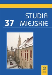
WROCLAW PARTICIPATORY BUDGET AS A TOOL TO STRENGTHEN NATURAL CAPITAL AND THE URBAN CLIMATE RESILIENCE IN THE YEARS 2016-2018

WROCLAW PARTICIPATORY BUDGET AS A TOOL TO STRENGTHEN NATURAL CAPITAL AND THE URBAN CLIMATE RESILIENCE IN THE YEARS 2016-2018

Author(s): Marta JAMONTT,Karol Kociszewski,Johannes (Joost) Platje / Language(s): English Issue: 37/2020

Participatory budgets are a popular form of residents’ co-deciding about public space and quality of life in their cities. Projects submitted to participatory budgets respond to needs such as recreation, health, communication and safety. This article evaluates the projects from 2016-2018 of the Wroclaw Participatory Budget in terms of aspects related to the wider issue of the natural capital and climate change. The results obtained indicate that despite increasing financial outlays on projects that can contribute to strengthening environmental and climatic aspects, the share of investments directly targeted at their implementation is relatively small. A total of 201 projects were analyzed, of which 12% directly and 18% indirectly referred to issues related to the natural capital and/or climate change.

More...
Tadeusz i Stefan Zwolińscy: przyczynek do biografii speleologicznej

Tadeusz i Stefan Zwolińscy: przyczynek do biografii speleologicznej

Author(s): Łukasz Lewkowicz / Language(s): Polish Issue: 1/2021

The research aim of the article was to present the broadly understood speleological activity of the brothers Tadeusz and Stefan Zwoliński. The text presents biographies of both described characters, then the individual stages of their speleological activity are analyzed in detail, and in the end the legacy of the Zwoliński brothers is characterized. The speleological activity of the Zwoliński brothers lasted several dozen years in total: it began during the Austro-Hungarian period, was continued with many successes in the interwar period and ended after the Second World War in the Polish People’s Republic. At the threshold of their activity, only 44 caves in the Polish Tatras were known. The activity of the Zwoliński brothers finally brought the knowledge of nearly 120 new cave facilities. Their various publications also provided a model for the development of cave documentation and influenced the tourist and scientific activities carried out there. The article is a contribution to further research on the history of Polish speleology.

More...
Bucureștiul teritorial

Bucureștiul teritorial

Author(s): Ștefan Simion,Emil Burbea-Milescu,Cristian Borcan / Language(s): English,Romanian Issue: 1/2018

Northeast of Bucharest there is a row of lakes and the largest forest patch remaining in the immediate vicinity of the capital city. Like an XXL urban form, 11 villages (from Tunari to Fundeni) are set onto this series of ponds which are well-known to fishermen. Forming an infrastructural landscape, these small lakes are separated by a series of crossings: for cars and for pedestrians, but also land strips that help regulate water levels and divide the breeding areas of the fish. The Territorial Bucharest project’ goal is to build a set of interventions along these narrow strips of land to speculate the physical situation of the place (the meeting point between natural and built environment) on which to propose various public and community programs and functions: Library, Pub, Pontoon for fishermen, Swimming pool, simple Pavilion pointing a walk in the territory, and so on.

More...
Armiero, Marco, (2021). Wasteocene. Stories from the Global Dump.

Armiero, Marco, (2021). Wasteocene. Stories from the Global Dump.

Author(s): Irena Borić / Language(s): English Issue: 2/2022

Review of: Armiero, Marco, (2021). Wasteocene. Stories from the Global Dump. Cambridge Elements. Elements in Environmental Humanities, Cambridge University Press.

More...
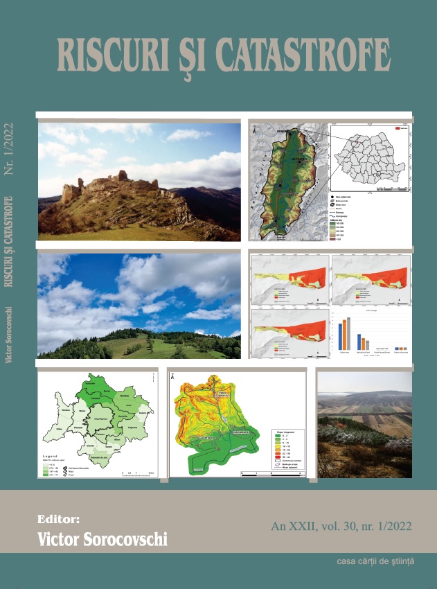
The influence of urban expansion on landslide evolution. A case study in Cluj-Napoca Municipality.

The influence of urban expansion on landslide evolution. A case study in Cluj-Napoca Municipality.

Author(s): Anna-Hajnalka Kerekes,Szilárd Poszet / Language(s): English Issue: 1/2022

In the case of Cluj-Napoca Municipality, the analysis of the landslides is a frequently discussed topic due to its complex geology and urban expansion tendency. In this study, we chose the Gruia Neighbourhood in order to map the landslide evolution and land-use/land-cover (LULC) changes which occured between 2003 and 2021. In order to use the post-classification Change Detection method, we applied the supervised classification technique on three satellite imageries (2003, 2009, 2021), which were validated by high Kappa coefficient values, as it follows: 0,892, 0,879 and 0,931. Comparing the three classified imageries, we could conclude that a transition between agricultural land to urban areas is visible, with a total decrease of the agricultural land by 40,69% and a total increase of the urban area by 24,47%. In the evaluation process of the influence of the LULC change on the landslide evolution, we could observe that the increase of the urban areas led to the increase of the surface of the landslides, moreover, the slided territories on urban areas have increased by 200%.

More...
Flood hazard and resilience in the watershed Nhat Le–Kien Giang in Vietnam

Flood hazard and resilience in the watershed Nhat Le–Kien Giang in Vietnam

Author(s): Huu Duy Nguyen,Thi Thuy Hien Trinh,Dinh Kha Dang / Language(s): English Issue: 1/2023

Flood is the most dangerous of natural disasters. It is responsible for considerable loss of life and economic damage, especially in Southeast Asian countries such as Vietnam. Improving community resilience can both reduce damage and alleviate the economic burden of communities in the aftermath of floods. Flood damage reduction strategies in Vietnam mainly focus on flood hazard and often neglect to take into account community resilience. The objective of this article is the development of a theoretical framework to assess the relationship between flood hazard and community resilience in the Nhat Le-Kien Giang River watershed. Flood hazard was calculated by integrate flood depth and flood velocity applying MIKE FLOOD modeling and the AHP , while data on the resilience of communities was collected via questionnaire. A total of 70 households in Hong Thuy commune were selected by the random sampling technique. The results showed that the high-hazard region is concentrated along the river like Tan Ninh, Gia Ninh, Hong Thuy, and Hoa Thuy communes. It also illustrated how access to resources, prevention strategies, and community perceptions are important factors to improve the resilience of communities. The results represent an important theoretical framework that can be used to support decision-makers in building appropriate damage-reduction strategies.

More...
The Regional Pecularities of Water Use in the Republic of Moldova

The Regional Pecularities of Water Use in the Republic of Moldova

Author(s): Petru Bacal,Daniela Burduja / Language(s): English Issue: 2/2018

The purpose of this research consists in the elucidation of regional and branch aspects of the water use in the Republic of Moldova. The main topics presented in this paper are: 1) the regional delimitations of the Republic of Moldova; 2) resources of surface water and groundwater: 3) regional aspects of water use; 4) dynamics of water use by abstracted sources and by the main usage categories; 5) branch profile of water use and its dynamics: 6) existing problems in the evaluation and monitoring of water use.

More...
Literary Sources Concerning the Evolution of the Climate in the Carpatho-Danubian-Pontic Area in the 1st Millennium

Literary Sources Concerning the Evolution of the Climate in the Carpatho-Danubian-Pontic Area in the 1st Millennium

Author(s): Cornel Bucurenciu / Language(s): English Issue: LXI/2022

Throughout history people have always believed that they live in unprecedented, extraordinary times. And as is evident from the written sources that have been preserved, these changes were an important enough topic at that time so as to be recorded by the scribes of the time. The aim of this paper is to analyse the ancient literary sources that discuss climate change and the perception that contemporary people had on it. The sources analysed, cover the period between the first and seventh century A.D. in the Carpathian Danubian Pontic space.

More...
ELBİSTAN HAVZASI’NIN GENEL MORFOTEKTONİK DİNAMİKLERİNİN JEOMORFOMETRİK İNDİSLERLE ANALİZİ

ELBİSTAN HAVZASI’NIN GENEL MORFOTEKTONİK DİNAMİKLERİNİN JEOMORFOMETRİK İNDİSLERLE ANALİZİ

Author(s): Fatma Esen,Saadettin Tonbul / Language(s): Turkish Issue: 24/2022

In this study, the structural features affecting the geomorphological development of the Elbistan Basin were questioned with geomorphometric indices. In the inquiry, the effect of geological structure and tectonics on the acquisition of geomorphological characteristics of 25 sub-basins belonging to the Elbistan Basin was tried to be explained with quantitative data. For this purpose, drainage basin asymmetry (Af), transverse topographical symmetry factor (T), basin relief (Bh), relief ratio (Rh), basin shape index (Bs), hypsometric curve (Hc) and hypsometric integral (Hi) such as geomorphometric indices were applied. During the application, a 10x10 meter resolution Digital Elevation Model (DEM), geology data, active fault data and ArcGIS 10.7 package program from Geographic Information System (GIS) software were used. Quantitative data obtained from the indices (Af, T, Bh, Rh, Bs, Smf, Hc, Hi) applied to the basin gave consistent results with each other. In other words, based on the classifications made according to the degree of tectonic impact in the sub-basins, it is generally seen that the same sub-basins are in the same group. However, the sub-basins located in close locations were mostly in the same classes. Another geomorphometric index used to calculate the relative tectonic activity of fault segments in the shaping of the Elbistan Basin is Smf. When the results obtained from the Smf values applied to 15 basins were evaluated, it was determined that tectonics played a highly active role in the development process of the mountain fronts. Active tectonic and lithology played an important role in the different form of the sub-basins in the Elbistan Basin.

More...
MOUNTAIN POPULATION AND HUMAN VALUES: DOES THE MOUNTAIN STILL REPRESENT THE EXPRESSION OF FREEDOM?

MOUNTAIN POPULATION AND HUMAN VALUES: DOES THE MOUNTAIN STILL REPRESENT THE EXPRESSION OF FREEDOM?

Author(s): Brîndușa Sterpu,Mihai Covaci / Language(s): English Issue: 1/2022

The paper approaches the topic of the mountain population in the context of human values. In the context of the year 2022 declared by the United Nations as the Year of Mountain Development, studying mountain issues is a necessary step. For the inhabitants of the mountain area, the expression of freedom was given numerous times by the mountain. People took shelter in this area and developed accordingly by exploiting the mountain potential. The research for this paper was carried out exploratively, by studying various sources on mountain science. The results conclude to the current mountain picture of many areas around the globe, which presents, from an infrastructural point of view, an image of some underdeveloped or developing areas. The work captures important valences of the mountain area and offers solutions for mountain development.

More...
Jak edukować w czasach kryzysu klimatycznego i środowiskowego?

Jak edukować w czasach kryzysu klimatycznego i środowiskowego?

Author(s): Piotr Skubała / Language(s): Polish Issue: 31/2022

Education has a key role in building and ensuring a safe world for mankind. Today it takes on a special importance because we have moved beyond the safe space of action for humanity. Scientists are issuing a red alert for Earth. In order to avoid the worst, we have a duty to take extraordinary emergency measures. A necessary step is a radical change in education. Its overriding goal must be to shape the attitude of a young person in the sense of unity with nature, capable of caring for other nonhuman beings. In this article, I present ten tips that should be an integral part of the educational process if we want to educate a generation of people who are aware, empathetic, and able to take effective action to resolve the climate and environmental crisis.

More...

Ecological impact of mining brownfields in Bucovina (Romania)

Author(s): Viorel Chiriță,Daniela Matei / Language(s): English Issue: 1/2022

The decline of mining activities in Romania has led to the appearance of large areas of mining waste, buildings and decommissioned equipment. Known by the name of mining wastelands, they challenge both the environment as well as the communities in which they are located. The problems created by the mining wastelands generate shock waves in the development of the rural territories hosting them and block their sustainable development. This paper highlights the stages of the evolution of different types of mining wastelands in Bukovina, with an emphasis on the environmental component, as well as on their possible integration using various forms of valorization. The data was gathered in 2017 as part of a research called “La dynamique des paysages culturels intégrant des aires avec des friches minières. Rétrospectives et perspectives géographique en Bucovine (Roumanie) et en Wallonie (Belgique)”, funded by “L`Agence Universitaire de la Francophonie”. We used the Rapid Impact Assessment Matrix (RIAM) methodology to assess the environmental impact of mining wastelands, which included 5 evaluation criteria and 15 components investigated (6 physical-geographical and ecological components, plus 9 socio-economic and cultural ones). The findings indicate that the ecological impact of abandoned mining areas is directly related to the area they occupy as well as the morphoclimatic system in which they are located. The socioeconomic component analysis highlighted the role of mine closure in increasing unemployment and lowering living standards, as well as a community takeover of some infrastructure elements through direct involvement of local government.

More...

Study on the perception of the oenological tourism potential of the Moldavian Region, Romania

Author(s): ADELINA-IULIANA NENIU / Language(s): English Issue: 1/2022

This study aims to evaluate the perception of the potential tourists on wine tourism in Moldavia region. The area under study represents Romania’s largest wine region, concentrating about 38% of the total area covered by vineyards and about 47% of the area under grafted bearing vineyards. Similarly, the counties comprised within the wine region of the Moldavian Hills supply 40% of the total quantity of grapes and 38% of the quantity of wine grapes produced in Romania. The importance of the region is underlined by the existence of 12 vineyards and 55 wine centres; thus, for the recognition of the quality and particularities of their wines, there are several Controlled Designation of Origin/CDO. The main objective of this paper is to evaluate the perception of a random sample, consisting of 140 people from different regions of Romania (and the Republic of Moldova), on the importance of the wine potential and the tourist capitalization of the oenological patrimony of the region. It was found that most respondents practised wine tourism both in the country and in other states, some of them even visiting Moldavia region. Most of the respondents fall into the category of young people, which led to different perceptions of wine tourism and to various expectations related to its practice in Moldavia region, especially when compared to other categories of tourists. The personal experience of practicing this type of tourism has led to answers based on the reality perceived by the respondents, both with the advantages of Moldavia and with the issues inherent in a developing region, especially those related to the promotion and capitalization of the wine tourism potential. Respondents also provided solutions to reduce problems in the region's development and suggested that institutions be involved in achieving them.

More...
Result 881-900 of 1301
  • Prev
  • 1
  • 2
  • 3
  • ...
  • 44
  • 45
  • 46
  • ...
  • 64
  • 65
  • 66
  • Next

About

CEEOL is a leading provider of academic eJournals, eBooks and Grey Literature documents in Humanities and Social Sciences from and about Central, East and Southeast Europe. In the rapidly changing digital sphere CEEOL is a reliable source of adjusting expertise trusted by scholars, researchers, publishers, and librarians. CEEOL offers various services to subscribing institutions and their patrons to make access to its content as easy as possible. CEEOL supports publishers to reach new audiences and disseminate the scientific achievements to a broad readership worldwide. Un-affiliated scholars have the possibility to access the repository by creating their personal user account.

Contact Us

Central and Eastern European Online Library GmbH
Basaltstrasse 9
60487 Frankfurt am Main
Germany
Amtsgericht Frankfurt am Main HRB 102056
VAT number: DE300273105
Phone: +49 (0)69-20026820
Email: info@ceeol.com

Connect with CEEOL

  • Join our Facebook page
  • Follow us on Twitter
CEEOL Logo Footer
2025 © CEEOL. ALL Rights Reserved. Privacy Policy | Terms & Conditions of use | Accessibility
ver2.0.428
Toggle Accessibility Mode

Login CEEOL

{{forgottenPasswordMessage.Message}}

Enter your Username (Email) below.

Institutional Login