Cookies help us deliver our services. By using our services, you agree to our use of cookies. Learn more.
  • Log In
  • Register
CEEOL Logo
Advanced Search
  • Home
  • SUBJECT AREAS
  • PUBLISHERS
  • JOURNALS
  • eBooks
  • GREY LITERATURE
  • CEEOL-DIGITS
  • INDIVIDUAL ACCOUNT
  • Help
  • Contact
  • for LIBRARIANS
  • for PUBLISHERS

Content Type

Subjects

Languages

Legend

  • Journal
  • Article
  • Book
  • Chapter
  • Open Access
  • Geography, Regional studies
  • Physical Geopgraphy

We kindly inform you that, as long as the subject affiliation of our 300.000+ articles is in progress, you might get unsufficient or no results on your third level or second level search. In this case, please broaden your search criteria.

Result 501-520 of 1302
  • Prev
  • 1
  • 2
  • 3
  • ...
  • 25
  • 26
  • 27
  • ...
  • 64
  • 65
  • 66
  • Next

Miškingumo kaita Aukštadvario regioninio parko teritorijoje 1893–2015 m.

Author(s): Marijus Pileckas,Zenonas Gulbinas,Viktorija Karmazaitė / Language(s): Lithuanian Issue: -/2017

Forest coverage is important geographical factor for every country, so it is very important to regulate, control and supervise it. The purpose of this paper – to analyze forest changes in Aukštadvaris Regional Park in the period from 1893 to 2015. In order to reach the goal, certain tasks were accomplished. Firstly, with the use of GIS and cartographic sources of different periods (1:21 000 – 1:25 000 scale topographic maps of the Republic of Lithuania forest cadastral digital data) to identify forest areas of Aukštadvaris Regional Park in 1893, 1934, 1949, 1984, 2000, 2015, changes were identified and their spatial distribution were examined. During the study maps were made to reflect the mentioned years, changes that had occurred during period between the years, all of this information were analyzed, evaluated and described. Second, causes and factors of forest changes in Aukštadvaris Regional Park area were examined. It showed that the main reason for this was government policies, wars, lack of natural-growth control. Finally, the results, information and trends were compared with the Lithuanian forest situation and trends. In this way, problems, regional park is facing, were highlighted – too many fastgrowing forest coverage, because in Lithuania forest coverage were both increasing and decreasing over the period of time, and right now it stands at 33,4 %, but in the regional park of Aukštadvaris, during analysed period has only been rising and right now stands at 54,8 %. If the situation will not change and appropriate measures will not be taken, forest coverage can reach 60 %.

More...
Развој геопортала за мониторинг клизишта

Развој геопортала за мониторинг клизишта

Author(s): Dušan Petrovački,Aleksandra Ristić,Ivan Alargić,Milan Vrtunski,Dubravka Sladić / Language(s): Serbian Issue: 4/2012

The paper presents the implementation of geoportal for landslide monitoring which includes two subsystems: a system for acquisition, storage and distribution of data on landslides and real time alert system. System for acquisition, storage and distribution of data on landslides include raster and vector spatial data on landslides affected areas, as well as metadata. Alert system in real time is associated with a sensor for detecting displacement, which performs constant measurements and signals in case of exceeding the reference value. The system was developed in accordance with the standards in the field of GIS: ISO 19100 series of standards and OpenGIS Consortium and is based on service-oriented architecture and principles of spatial data infrastructures. [Projekat Ministarstva nauke Republike Srbije, br. TR37017: Modeliranje stanja i strukture padinskih procesa primenom GNSS i tehnologija skeniranja laserom i georadarom]

More...
Неки аспекти антропогеног утицаја на интензитет ерозивних процеса у сливу Темштице

Неки аспекти антропогеног утицаја на интензитет ерозивних процеса у сливу Темштице

Author(s): Sanja Mustafić / Language(s): Serbian Issue: 1/2007

Comparative analyses of data in the observing period from 1970 until 2003 has shown that there has been decrease of the erosive processes on the territory of Temstica river basin. It has been established that character and the intensity of the erosion depends not only on physical factors but on demographic and socio-economical changes in the investigated space.

More...
Примена RHS метода у сливу Голијске Моравице

Примена RHS метода у сливу Голијске Моравице

Author(s): Ana Milanović,Marko Urošev,Dragana Milijašević / Language(s): Serbian Issue: 2/2006

River Habitat Survey (RHS) is terrain method developed in UK in 1994. for determination of physical character of rivers and river basin. This method is applied for the first time in Golijska Moravica river basin. Two indices which broadly describe the diversity of river habitat and landscape features (Habitat Quality Assessment (HQA)) and extent and severity of artificial modification to the channel (Habitat Modification Class (HMC)) has been developed for reporting purposes. These are based on simple scoring systems which have been agreed by technical experts.

More...
Методологија одређивања прагова за екстремне температуре ваздуха у источној Србији на примеру јануара и јула месеца у Неготину

Методологија одређивања прагова за екстремне температуре ваздуха у источној Србији на примеру јануара и јула месеца у Неготину

Author(s): Goran Anđelković / Language(s): Serbian Issue: 1/2006

The human life and the most of human activities are adapted to the normal climatic conditions everywhere in the world. Therefore any deviation in intensity, frequency or spatial distribution of climatic events is considered as extraordinary climatic phenomenon which could cause unpleasant consequences. These events are known as extreme phenomenon. In this paper are formulated extreme air temperature events and methodology for identification is considered on example of town Negotin in eastern part of Serbia.

More...

Утицај извора података на тачност дигиталног модела терена

Author(s): Branislav Bajat,Dragoljub Štrbac / Language(s): Serbian Issue: 1/2005

The overview of the contemporary data acquisition methods for Digital Terrain Models (DTM), as well as the accuracy of data provided by these methods, are given in this article. The procedure of the accuracy estimation for DTM, which is produced by digitising of topographic maps and test points, obtained by GPS technology and aerophotogrammetric terrain surveying, is presented.

More...

Две регионализације фертилитета

Author(s): Branislav S. Đurđev / Language(s): Serbian Issue: 1/2004

Paper evaluates and compares two fertility regionalizations and contributes fertility geography discussion. Paper points out that fertility transition in geographic sense is a movement from unique global model toward numerous local models and at the end toward unique global model again.

More...

Анализа квалитета дигиталног модела терена на локацији “Златибор”

Author(s): Branislav Bajat,Dragoljub Štrbac / Language(s): Serbian Issue: 1/2003

The concept of DTM technology, data acquisition and data base management for DTMs are presented in this article. The problem of quality analysis of DTMs has also been examined. The verification of the model of quality analysis for generated DTMs with GRID data structure has been performed on a test area Zlatibor, on a covered area of 2km×3km.

More...
Petrographic study of selected sculptural works of Jan Michałowicz from Urzędów

Petrographic study of selected sculptural works of Jan Michałowicz from Urzędów

Author(s): Małgorzata Ciosmak,Patrycja Rzęsa / Language(s): English Issue: 3/2018

Nowadays, in order to determine whether given rock properties make it useful for specifi c purposes, the material is examined using relevant test equipment. At the times of Jan Michałowicz, any knowledge in this respect was transmitted by the master to his apprentices, based on the master’s experience. The artist used domestic rock raw materials to sculpt monuments commemorating important persons who were his contemporaries. For the petrographic analysis, the authors selected the most distinguishable works of the artist, which he signed or which are most likely to have been sculpted by him. The authors analysed the materials used by the artist to carve specifi c elements of his works, as well as rock raw materials in terms of their historical and contemporary properties. Consequently, the petrographic study allowed to describe the rocks in greater detail, as well as their properties useful for sculpture purposes, and their durability. Artistic qualities helped determine the sources of stones used by Jan Michałowicz during his projects. These include the quarries near Pińczów (limestone), Kunów (sandstone), Bolechowice (marble), Żurawno (alabaster) and initially quarries in Hungary. The discussed works of Jan Michałowicz provide firm grounds for acknowledging the artist as the leading co-founder to Polish Renaissance art.

More...
Water (in) security – modern security paradigm

Water (in) security – modern security paradigm

Author(s): Vladimir Prebilič / Language(s): English Issue: 2/2019

Water. In the existence and activities of each individual it is water that (un) consciously essentially defines them. Therefore, water is called the source of life, but nowadays we know it under the new concept: blue gold. The reason for such a modern understanding of the role of water lies in the increasing limitations of access to sufficient quantities, which first results in water stress – the situation where needs remain unmet, but water scarcity does not yet interfere with the foundations of the activities of societies. Water stress is thus the first form of threat to water security, especially when deficiency destroys all basic social systems that cannot function without water. The question of the role of water between them is increasingly being raised, as the operation of one system in the area of water consumption or management can mean interfering with the water potential of another system. This confronts us with the effect of the definite quantities of water, although countries with ample water resources and quantity (still) often do not understand or perceive it. Of course, this does not mean that the debate is not necessary; it is, conversely, necessary, and it is only in this way that it is possible to prevent or at least control the situation in which many countries around the world have found themselves and there is a total lack of water resources in the most existential aspects. Under these conditions, water security has become the most essential element of national security of these countries and thus a potential weak link in ensuring security.

More...

Danube Delta Biosphere Reserve. Tourist Potential, Turning to Good Account, Impact

Author(s): Petre Gâștescu,Elena Toma / Language(s): English Issue: 2/2019

The Danube Delta Biosphere Reserve, with a surface of 5800 km2 within which 20 strictly protected areas are delimited, summing-up 506 km2, with corresponding buffer areas bringing the area to 2233 km2 and economic areas which widen the surface under scrutiny to 3061 km2 had a very good reason to become a biosphere reserve in the year 1990. The Danube Delta was declared a biosphere reserve due to its morpho-hydrographic bio-geographic and landscape uniqueness in Europe as regards bio-diversity, ecosystems and habitats characteristic to the Delta-specific humid environment The complex landscape (relief, water, vegetation, fauna, population and human settlements) within the Danube Delta Biosphere Reserve has attracted ever since the second half of the 20th century numerous tourists having come to enrich their knowledge and for recreation purposes. The originality of Romania’s tourist potential is a representative feature of the tourist product that Romania can supply, as promoted on the internal and external tourist market respectively, however not at the level of its true potential. The new statute of the Danube Delta, as a biosphere reserve, following the year 1990, meant a change of direction and reorganizing of the tourist activity, in the context of protecting biodiversity and the landscape and of a sustainable turning to good account of the renewable natural resources. The assets of the natural tourist potential are completed by the anthropic potential, there resulting an indivisible, unique complex, specific to the Danube Delta Biosphere Reserve. Overall, tourism is one of the major components of the social and economic life, having become nowadays an economic sector with tangible development resources. Due to the fact that the Danube Delta is a geographic environment under permanent formation, fragile and vulnerable, the impact of tourism in general can be felt at the level of the natural and anthropic habitats, with major consequences on the whole ecological balance. Since tourism is a main development vector, it is necessary to pay the utmost attention to the consequences of this activity on all the other sectors of activity. Tourism must represent not only a positive and dynamic development factor but also a practical solution to keeping the environment unaltered.

More...
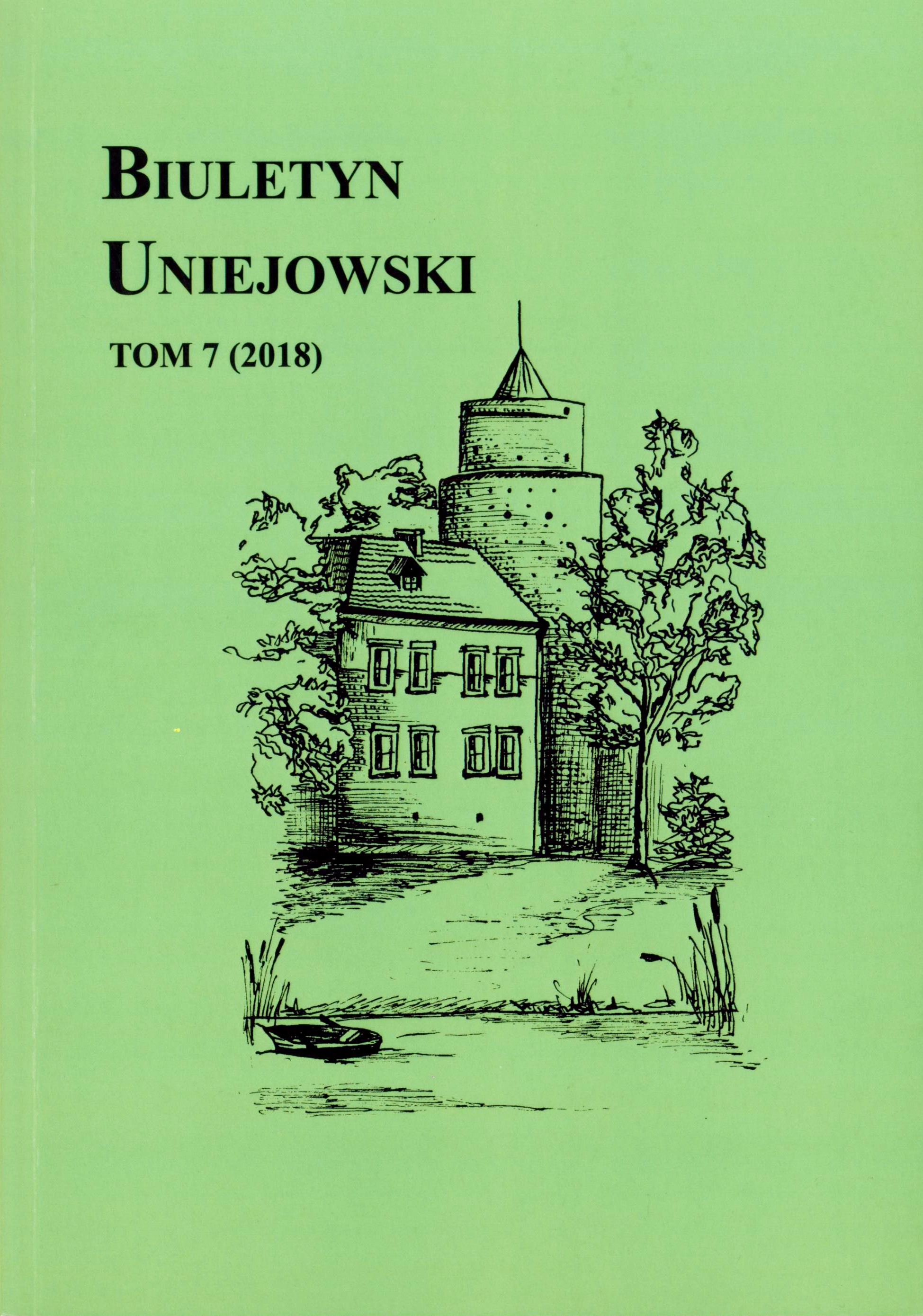
ANALIZA OPADÓW ATMOSFERYCZNYCH W UNIEJOWIE JAKO PRETEKST DO BADAŃ KLIMATU LOKALNEGO UZDROWISKA

ANALIZA OPADÓW ATMOSFERYCZNYCH W UNIEJOWIE JAKO PRETEKST DO BADAŃ KLIMATU LOKALNEGO UZDROWISKA

Author(s): Marcin Gorączko,Mateusz Cukras / Language(s): Polish Issue: 7/2018

The article presents statistical analysis of precipitation data for the period 1980–2015 collected at the Uniejów station belonging to the Institute of Meteorology and Water Management of the National Research Institute. The analysis identified rainfall characteristics in the long term and in annual, seasonal and monthly perspective. The conducted research has shown that precipitation is one of the most variable elements of local climate, not only in terms of quantity, but also periods of their occurrence and duration. Having up-to-date knowledge of seasonal and long-term cyclicality of precipitation, as well as the possibility of significant deviations from average values, seems to be particularly important for a city whose current economic development is mainly dependent on the inflow of tourists seeking recreation and open-air entertainment. Furthermore, only a proper identification of the specific characteristics of the local climate of Uniejów provides the necessary basis for its protection against the effects of anthropogenic impact on the environment in this region.

More...
TÜRKİYEDE DEPREM GERÇEĞİ ve YASAL DÜZENLEMELER

TÜRKİYEDE DEPREM GERÇEĞİ ve YASAL DÜZENLEMELER

Author(s): Uğur Aşik / Language(s): Turkish Issue: 44/2019

Earthquakes, which are at the beginning of the natural disasters that the world and our country should face the most, the loss of lives and property experienced in the earthquake necessitates the construction of very strong and high-impact legal regulations as well as the strong structures and engineering works. earthquakes in recent years, and the huge losses experienced in these earthquakes, Turkey is a country of earthquakes and making the necessary legislation for that matter, before the need to earthquakes, as well as demonstrates the minimization of the necessity of the losses will be experienced after the earthquake. On the other hand every moment of need related to the earthquake in Turkey, the world should also se developments, Turkey's earthquake to take seriously the fact that exactly, the legislative measures taken are seen as being functional enough.

More...

Assessment of torrential flood susceptibility: Case study - Ukrina River Basin (B&H)

Author(s): Novica Lovrić,Radislav Tošić,Slavoljub Dragićević,Ivan Novković / Language(s): English Issue: 2/2019

Torrential floods are the most frequent natural catastrophic events in the Republic of Srpska (B&H). The main objective of this study is susceptibility assessment to torrential floods in Ukrina River Basin using Index Based Method (IBM) and Flash Flood Potential Method (FFPI), which operates entirely in a GIS environment. The definition and identification of influencing factors for torrential floods was the first step in the process of developing the Torrential Flood Susceptibility Model (TFSM). According to the results of these models, 54.00% and 40.86% of the Ukrina Basin area is in the categories of strong and very strong susceptibility to torrential floods. The second task was to identify the torrential basins and create the Register and the Cadastre of Torrential Basins in the Ukrina River Basin. After detailed field survey and analyses, 154 torrential basins have been identified, occupying 551.37 km2 of the Ukrina Basin. According to the validation indicators of the Torrential Flood Susceptibility Model, 138 torrential basins are in the category of strong and very strong susceptibility according to Index Based Method, while 112 torrential basins are in the same category of susceptibility according to Flash Flood Potential Index Method, which are very good results of the validation. This paper presents the significant step towards better understanding of the phenomenon of torrential floods in the Republic of Srpska (B&H). The data presented in this paper are also significant to practical issues such as integral water management projects, spatial planning, sustainable land planning and protection of soil, forest ecosystems and environmental protection, sediment management, agriculture and other human activities.

More...
LE DANUBE VU PAR UN FRANÇAIS

LE DANUBE VU PAR UN FRANÇAIS

Author(s): Katarina V. Melić / Language(s): French Issue: 29/2019

The Danube, the oldest European traveller, is the only major river to flow from West to East and pass through ten countries. This river has been the source of inspiration for many artists: writers, painters, poets, travellers-writers. Our intention is to study how an artist-writer-traveller in the nineteenth century, Dieudonné Auguste Lancelot, travelling in the Balkans along the Danube, and impressed by this river and the fortress towns on its shores, notes and represents with words and images what has particularly attracted his attention. He presents a whole range of historical, geographical, ethnographic facts with the aim of popularizing other cultures. In Lancelot’s narrative, following the current of the Danube, we study particularly two aspects of the Danube: the cities-fortresses on its shores, and the possibilities of trade and tourism in relation with the opening of the Danube for free navigation and commerce.

More...
QASIM GÜLÜN TƏRTİB ETDİYİ “AZƏRBAYCAN SSR FİZİKİ COĞRAFİYASİ” (1968-ci il) DƏRSLİYİNİN TƏHLİLİ

QASIM GÜLÜN TƏRTİB ETDİYİ “AZƏRBAYCAN SSR FİZİKİ COĞRAFİYASİ” (1968-ci il) DƏRSLİYİNİN TƏHLİLİ

Author(s): Gülər Xankişizadə / Language(s): Azerbaijani Issue: 45/2020

The development of geography teaching is related to how geography is taught in schools. For years, learning what, how and why has been a problem faced by researchers in geography. In 1960-1982 Kasim Gul, a professor of physical geography of the Azerbaijani SSR, gave a textbook entitled "Economic Geography of the Azerbaijani SSR". This textbook has been a guide for the development of geography.

More...
ARDAHAN MERKEZ İLÇE’DE YERLEŞME ADLARI

ARDAHAN MERKEZ İLÇE’DE YERLEŞME ADLARI

Author(s): Emrah Polat,Zeki Koday / Language(s): Turkish Issue: 45/2020

The purpose of this study is to determine where the settlement islands in the area come from. Observation in place, questionnaire and interview methods were in the study. The central district of Ardahan is in the Erzurum-Kars of the Eartern Anatolia Region. Naming the palaces by having been affected from physical geography factors, shows that people and environment are affected from each other. From 1952 until the year 1978 to about 12.000 settling time in Turkey it was also changed name. Renamed villages are not appropriate to population. Specially older and middle aged is preferences to the old name of villages.

More...
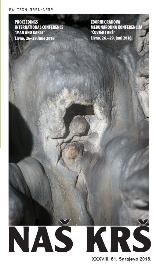
JAMA ZOVINE – ZANIMLJIV PALEONTOLOŠKI I SPELEOLOŠKI OBJEKT U ZALEĐU BIOKOVA

JAMA ZOVINE – ZANIMLJIV PALEONTOLOŠKI I SPELEOLOŠKI OBJEKT U ZALEĐU BIOKOVA

Author(s): Nediljko Ževrnja,Tonći Rađa,Tino Milat / Language(s): Croatian Issue: 51/2018

Zovine Pit is one of four researched caves in the area of the village Biokovsko Selo. It is situated around 850 m from from a part of village named Donje Bakote in S-SW direction. The research was carried out during 2017 as a part of survays in the wide area of hinterland of Biokovo mountain conducted during last several years by Speleological Society „Špiljar“ from Split. During the research, numerous underground fauna samples were with diverse and interesting endemic species. Also, bones of deer and bear were documented. During 2018, in cooperation with Natural History Museum and Zoological Garden from Split, and with the support by „More Mandić Ltd.“ from Sv. Filip i Jakov, all recorded bone remains were collected and transported to the Museum for preservation and further scientific research. The collected bones were part of torsos (pelvis bones, long bones, ribs, vertebrae and series of tiny bones), a bear scull and a deer scull with horns. The estimation of sample age by relative specific activity of 14C is in process.

More...
MLINOVI DUVANJSKOG I LIVANJSKOG POLJA

MLINOVI DUVANJSKOG I LIVANJSKOG POLJA

Author(s): Denis Radoš,Filip Krišto,Mirko Šarac / Language(s): Croatian Issue: 51/2018

Mlinovi na vodu, često nazvani i mlinice bili su važni gospodarski objekti na krškim poljima za vrijeme dok je u gospodarskom smislu dominirala poljoprivreda. Gradili su se na stalnim te periodičnim krškim rijekama koje u toplijem dijelu godine ostaju bez vode ili u kojima se razina vode značajno smanjuje. Industrijskim razvojem društva značaj mlinova se smanjuje, a potpuno se napuštaju dostupnošću električnih mlinova. Napuštanjem mlinova nestaje jedan važni dio graditeljske baštine krških polja. Cilj ovog rada je utvrditi koliko je mlinova postojalo na krškim rijekama Duvanjskog i Livanjskog polja te rekonstruirati toponime koji nisu očuvani, osim možda u usmenoj predaji.

More...
BLAŽENA JE VODA ŠTO RAĐA KAMENJE – POGLED NA POEZIJU STOJANA VUČIĆEVIĆA IZ KRŠKE PERSPEKTIVE

BLAŽENA JE VODA ŠTO RAĐA KAMENJE – POGLED NA POEZIJU STOJANA VUČIĆEVIĆA IZ KRŠKE PERSPEKTIVE

Author(s): Ivo Lučić / Language(s): Croatian Issue: 51/2018

How to entitle karstology interested in treating karst in one’s poetry? Poetic karstology? It sounds inappropriate, though it should be true. This is one of such attempts, on the occasion of thirtieth anniversary of the death of Stojan Vučićević, a poet of refined senses and exceptional poetic intuition, born in Popovo Polje. He comes into the world into a family that inherited the experience of the pastoral-agricultural culture shaped within this extraordinary karst phenomenon. The idea was to move karstology from conventional geoscience to an interdisciplinary and more holistically understood science. Basically, the poetic images and concepts of Stojan Vučićević are compared to the images and notions of karst created by karstology. This analysis, which is only one of the many possible ways, proved justified and offered various answers. The poetry of Stojan Vučićević is interwoven throughout and transversely with themes and figures of karst, in which karst specificities are an important means of poetic creation. This is most evident in the Siga (Flowstone) collection, which features particularly illustrative poems by “Siga”, “Ponornica” (Sinking river) and “Pećina” (Cave).

More...
Result 501-520 of 1302
  • Prev
  • 1
  • 2
  • 3
  • ...
  • 25
  • 26
  • 27
  • ...
  • 64
  • 65
  • 66
  • Next

About

CEEOL is a leading provider of academic eJournals, eBooks and Grey Literature documents in Humanities and Social Sciences from and about Central, East and Southeast Europe. In the rapidly changing digital sphere CEEOL is a reliable source of adjusting expertise trusted by scholars, researchers, publishers, and librarians. CEEOL offers various services to subscribing institutions and their patrons to make access to its content as easy as possible. CEEOL supports publishers to reach new audiences and disseminate the scientific achievements to a broad readership worldwide. Un-affiliated scholars have the possibility to access the repository by creating their personal user account.

Contact Us

Central and Eastern European Online Library GmbH
Basaltstrasse 9
60487 Frankfurt am Main
Germany
Amtsgericht Frankfurt am Main HRB 102056
VAT number: DE300273105
Phone: +49 (0)69-20026820
Email: info@ceeol.com

Connect with CEEOL

  • Join our Facebook page
  • Follow us on Twitter
CEEOL Logo Footer
2025 © CEEOL. ALL Rights Reserved. Privacy Policy | Terms & Conditions of use | Accessibility
ver2.0.428
Toggle Accessibility Mode

Login CEEOL

{{forgottenPasswordMessage.Message}}

Enter your Username (Email) below.

Institutional Login