Cookies help us deliver our services. By using our services, you agree to our use of cookies. Learn more.
  • Log In
  • Register
CEEOL Logo
Advanced Search
  • Home
  • SUBJECT AREAS
  • PUBLISHERS
  • JOURNALS
  • eBooks
  • GREY LITERATURE
  • CEEOL-DIGITS
  • INDIVIDUAL ACCOUNT
  • Help
  • Contact
  • for LIBRARIANS
  • for PUBLISHERS

Content Type

Subjects

Languages

Legend

  • Journal
  • Article
  • Book
  • Chapter
  • Open Access
  • Geography, Regional studies
  • Geomatics

We kindly inform you that, as long as the subject affiliation of our 300.000+ articles is in progress, you might get unsufficient or no results on your third level or second level search. In this case, please broaden your search criteria.

Result 341-360 of 583
  • Prev
  • 1
  • 2
  • 3
  • ...
  • 17
  • 18
  • 19
  • ...
  • 28
  • 29
  • 30
  • Next
The Valuation Process of Green Buildings in the Context of Urban Development

The Valuation Process of Green Buildings in the Context of Urban Development

Author(s): Daniela Răboj,Alexandra Nadia Cîrdei / Language(s): English Issue: 25/2018

Green buildings tend to become more and more present on the real estate market, being a less invasive solution for the environment, and at the same time providing people with a healthier environment to live or do their daily activities.Green buildings, due to lower bills, the pleasant ascent and intake to improve quality of life and increase productivity, have proved to be more attractive on the real estate market, both for sale and for rent. For this reason it is necessary to know their specific elements, which may have an influence on the market value, as well as the particularities of the valuation process of this type of building.

More...
Fotografia lotnicza jako narzędzie do identyfikacji kopalnych poligonów mrozowych – przegląd literatury

Fotografia lotnicza jako narzędzie do identyfikacji kopalnych poligonów mrozowych – przegląd literatury

Author(s): Maciej Dąbski,Patrycja Fabijańska / Language(s): Polish Issue: 3/2019

The article is a literature review concerning the use of aerial photography in identifying fossil frost polygons.In Poland, research on this topic has been conducted since the 1970s and concentrated in Wielkopolska(a young-glacial area), where sand wedges formed in the glacial till of Wisła Glaciation. In order to cover the issuein a broader sense, the authors also provide examples and methods that have been applied in other areas of outsidePoland. The presence of anthropogenic objects (modern and archaeological), sometimes makes it difficult to detectfrost polygons. Under favorable conditions for soil moisture and land use, aerial photography based on visible radiationfacilitates the mapping of fossil frost structures that indicate the occurrence of Pleistocene permafrost.

More...
Ocena tempa i kierunków zarastania jezior przy wykorzystaniu znormalizowanego różnicowego wskaźnika wegetacji NDVI na przykładzie jeziora Gardno

Ocena tempa i kierunków zarastania jezior przy wykorzystaniu znormalizowanego różnicowego wskaźnika wegetacji NDVI na przykładzie jeziora Gardno

Author(s): Roman Cieśliński,Kamil Mironik,Artur Młodzik / Language(s): Polish Issue: 3/2019

The development of aquatic vegetation in the littoral zone significantly change the nature of the immediate surroundings of the lake basin. However, the process of disappearance is affected not only by the lush succession of water vegetation, but also by the supply of bottom material, introduced by watercourses. The aim of the study isestimate the rate of overgrowth coastal reservoirs on example of Gardno lake, based on the normalized differential NDVI vegetation index. The assessment of the changes, taking place in the individual summer seasons within thelake basin, a thorough analysis based on satellite imagery performed for 2000-2014. The main aim, was to developan appropriate method to determine the extent of expansion of water vegetation on the example of a selected lake. Preliminary results, compiled with monthly average air temperatures and monthly mean precipitation totals, performed relationships between effective overgrowth and local meteorological conditions. The observed changes, inthe ever-growing littoral zone allow, us to suppose that the Gardno lake was going to disappear.

More...
Analiza promjene uporabe zemljišta na primjeru Panonskih brda u Sloveniji

Analiza promjene uporabe zemljišta na primjeru Panonskih brda u Sloveniji

Author(s): Rok Ciglič,Jennifer Deriaz,Matija Zorn,Mateja Ferk,Dénes Lóczy / Language(s): Croatian Issue: 15/2019

In several Central European countries, land use changes can be analysed on the basis of the Franciscan Cadastre. The main aim of the paper was to analyse land use dynamics with the Franciscan Cadastre and modern land use data. The study was carried out by calculating land use structure and landscape metrics for a part of Slovenske Gorice region in Slovenia. The analysis showed that the forest area expanded, and fields and vineyards areas diminished. In general, today’s landscape is made of less patches, but they are larger and of more irregular shapes.

More...
Prospecțiuni geofizice în județul Galați. Situl Negrilești și Muzeul Casa Cuza Vodă

Prospecțiuni geofizice în județul Galați. Situl Negrilești și Muzeul Casa Cuza Vodă

Author(s): Mihai Andrei,Alexandra Gerea,Alexandru-Ionuț Micu / Language(s): Romanian Issue: 1/2020

In recent years, geophysical methods have seen a surge in popularity, being applied in a large number of fields, inculding archaeology. Here, we present some representative results from a set of surveys carried out in the Galați county.The Negrilești-Curtea Școlii (Negrilești-School Yard) site was first investigated over 30 years and has since produced much archaeological material, spanning from the early Neolithic through to the modern age. Considering the large area that still remains unexplored, geophysical methods are excellently suited for this site. At the same time, the Cuza House Museum in Galați, currently undergoing renovations, offers a unique opportunity for indoor surveys inside this monument. An experiment on the edge of an excavated area was also carried out. We carried out several profiles using two geophysical methods (Ground Penetrating Radar and Electrical Resistivity Tomography) which were well suited for the area. The processing and interpretation of the data was then carried out, revealing several features of interest.The surveys were hampered by a number of equipment issues, yet the results are useful for future prospection and a better understanding of the investigated areas and can serve as a starting point for future work.

More...
SLOVAČKA JAMA NA SJEVERNOM VELEBITU

SLOVAČKA JAMA NA SJEVERNOM VELEBITU

Author(s): Darko Bakšić,Branko Jalžić,Damir Lacković / Language(s): Croatian Issue: 1/2000

While surveying the terrain on the 28th July 1995, Slovak cavers B. Šmida and M. Grifik found the entrance of a Slovak cave pot-hole. After nine days of speleo exploration, Slovaks reached the "bottom" at the depth of-514 m. They have also noted the side passage at the depth of-350 m. During summer 1996 Slovaks, together with their colleagues from the University Mountaineering Society "Velebit", continued the exploration of the Slovak cave in the horizontal passage at 350 m of depth. Three weeks later they reached depth of -1000 m. For the first time they observed in the cave an endemic troglobiontic leech named Croatobranchus mestrovi. In October 1996 a group of cavers from Zagreb, members of the societies "Velebit" and "Željezničar", in co-operation with the Croatian Natural History Museum, descended into the cave to the depth of 570 m with aim to collect a specimen of the leech for further scientific research. But, instead of a leech, they found the remnants of the unknown Coleopteran species of genus Radziella. In 1998 and 1999 Croatian-Slovak expeditions, under the leadership of Darko Bakšić and Branislav Šmida, took place with aim to continue survey of the cave. In 1998 Slovak cave was surveyed in two separated passages. Slovak cavers by the end of cavern Pompeji reached the depth of 1022 m, while the Croatian cavers reached in Kalkulovski passage (the continuation of the passage is named Velebni kanal) the depth of 1268 m. In 1999, after eight days of long surveying at the depth of 1254 m, Croatian cavers explored 670 new metres of horizontal passages and reached the depth of 1301 m. Slovak cavers discovered in upper parts passage named Zumpa at the depth of 866 m and Hermanova studnja at -530 m. This depth makes Slovak cave the 17th deepest in the world at the list of the deepest world caves. Important values are length that is 2414 m and included length of 5548 m.

More...
MORFOGRAFSKO-MORFOSTRUKTURNO PROUČAVANJE VELEBITA NA OSNOVI ORBITALNE SNIMKE U BOJI M 1:200.000 S POSEBNIM OSVRTOM NA TRAGOVE PALEOTEKUĆICA

MORFOGRAFSKO-MORFOSTRUKTURNO PROUČAVANJE VELEBITA NA OSNOVI ORBITALNE SNIMKE U BOJI M 1:200.000 S POSEBNIM OSVRTOM NA TRAGOVE PALEOTEKUĆICA

Author(s): Vilko Klein / Language(s): Croatian Issue: 1/1996

In this work the author deals with morphographic-morphostructural division of the mountain of Velebit by means of the coloured orbital photograph M 1:200.000. The most important seems to be bipartite rcsp. quadripartite transversal division of the mountain and the phenomenon of its cuneiform morphographic structure. A lot of ruts of the arch-bent elements of an old valley-net rcsp. of paleostream beds can be noted there. It all suggests that a great number of streams was running through the present-day high mountain residual plateau of Velebit some time in its geological past. It was the time when mountain was a part of its and that of Lika's lower laid and more extensive plateau. The separated arch characteristics of the relief reconfirm the presence of annular structures outlined spherically or ovaly. They so seem to be further particularity of the morphostructural pattern of Velebit. Likewise, the possibility of fractal analysis of the chaotically arranged relief elements of Velebit has been pointed out.

More...
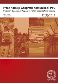
Jak mierzyć przyjazność przestrzeni dla ruchu pieszego?

Jak mierzyć przyjazność przestrzeni dla ruchu pieszego?

Author(s): Joanna Jaczewska / Language(s): Polish Issue: 4/2019

Walking as the elementary and most natural transport mode is often viewed as neglected. In the course of the 20th century it has lost its significance due to modernist visions and the dynamic development of motor vehicles. In the recent years we observe a change in the way walking is perceived and the resulting prioritizing of it as a transport system. As recent research studies make evident, pedestrians-oriented urban projects facilitate sustainable development of cities and prove to have a positive impact on the physical activity of the inhabitants and their overall health. That raises the question: how to evaluate the walkability of a specific space? Recently, a number of research studies have attempted to determine the degree of impact that particular factors exercise on human physical activity. The present article systematises recent concepts of walkability measurement on the basis of the relevant literature and, in particular, on the basis of two cross-sectional comparative papers that bring together the dispersed knowledge on the subject. The article considers the key measurement methods as well as their advantages and potential limitations. In the summary possible applications of research results and outlooks for research methods have been proposed. It is necessary to verify the methods used in the Polish local conditions. In order to secure more comparability of results the author claims a standardisation of indicators, as well as inclusion of internal factors that might influence the differentiation of walking behaviours. Finally, making use of big data is recommended.

More...
Gelionių ir Žaliojo ežerų morfometrija

Gelionių ir Žaliojo ežerų morfometrija

Author(s): Marijus Pileckas,Tauras Alekna,Vaidotas Valskys / Language(s): Lithuanian Issue: -/2021

Bathymetric surveys of Gelionys and Žaliasis Lakes (located in the Baltic Uplands, Aukštadvaris Regional Park, Lithuania) were carried out on April 21, 2020, from a boat with attached Lowrance HDI SKIMMER XDCR transducer (200 kHz), Simrad GO5 chartplotter and Lowrance Point-1 GPS/Glonass receiver. At the same time, the shorelines of the lakes were revised. Average distance between profiles was ~10 m and depth measurement accuracy up to 2–5 cm. Accuracy of water surface elevation measurement using GNSS receiver Topcon Hiper SR up to 1–2 cm. Later, detailed (0.5 × 0.5 m) digital lake bottom models (DEM) were developed, bathymetric plans of the lakes were created, the main morphometric features were calculated, the boundaries and area of the lake catchments were defined, and the physical-geographical characteristics of the lakes were described based on field observations and various data. Gelionys and Žaliasis are small lakes of glaciokarst origin. Gelionys Lake is oval-shaped while shape of Žaliasis Lake is closer to the circle. Despite small surface area the lakes are quite deep. According to survey data, the surface area of Gelionys Lake is 4.79 ha, water surface elevation 216.1 m a.s.l., maximum depth 19.8 m, mean depth 6.0 m, volume 288.3 thousands m3 , catchment area 71 ha. The surface area of Žaliasis Lake is 2.14 ha, water surface elevation 120.9 m a.s.l., maximum depth 15.84 m, mean depth 5.7 m, volume 122.2 thousands m3 , catchment area 60 ha. During the observation period (from May of 2018 to September of 2020), the annual amplitude of water level fluctuations in Gelionys Lake reached up to 0.47 m, and in Žaliasis Lake up to 0.33 m.

More...
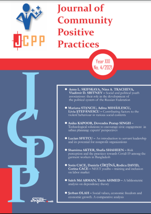
A bibliometric analysis on dependency theory

A bibliometric analysis on dependency theory

Author(s): Saleh Arman,Tazin Ahmed / Language(s): English Issue: 4/2021

Dependency theory, established after World War II, is a popular theory among economists to portray the relationship between the underdeveloped and the developed countries that conditions the ability of the underdeveloped countries to develop. Several concepts have been merged into this area from different corners, making it interdisciplinary. As a lucrative area of interest in research, the study would like to assess how the concept of dependency theory has been widely accepted among authors from different corners and schools of thoughts and how their research outputs make a significant notation in this area. The research conducted a bibliometric analysis on dependency theory. 1074 Scopus indexed documents in English were considered. The study covered the two pillars of bibliography analysis: performance analysis and science mapping. The study used several formulas to calculate parameters of performance analysis and availed Vosviewer software to make maps of science-mapping analysis. The study concluded that dependency theory is a significant theory in economics and has significant implications in different research publications. This bibliometric analysis surfaces the significance of this theory which would attract researchers in incorporating more interdisciplinary research.

More...
Projekt nauki wspólnotowej: społeczne monitorowanie skutków katastrofy ekologicznej Deepwater Horizon

Projekt nauki wspólnotowej: społeczne monitorowanie skutków katastrofy ekologicznej Deepwater Horizon

Author(s): Agnieszka Jelewska / Language(s): Polish Issue: 2/2021

The article discusses the strategies and research methods used within the community science paradigm developed by the Public Lab group. The workshops and practices of scientific cooperation with local communities are discussed on the example of the Public Lab’s founding project – monitoring the effects of an ecological disaster related to the oil spill from BP’s Deepwater Horizon oil platform into the Gulf of Mexico in 2010. The methods used to conduct the research were based on the local community’s involvement and led to the establishment of new models to disseminate data and scientific knowledge in which local participants play a crucial role and have access to essential measurement data. The article discusses the DIY method’s applications, the technique of experimental cartography and mapping performed using meteorological balloons and kites. The community research methods are juxtaposed with the contemporary contexts of the evolving blue turn in the humanities, social sciences, and media practices.

More...

Georeferenced gridded data handled by GMT: cartographic solutions for geophysical mapping

Author(s): Polina Lemenkova / Language(s): English Issue: 1/2021

The functionality of Generic Mapping Tools (GMT) to process and visualize geospatial information is crucial to the development of the advanced cartographic method. This paper presents modelling and spatial analysis of the marine geological data using GMT shell scripting. GMT demonstrated effective cartographic solutions for visualization of the georeferenced data. The particular feature of GMT consists in its scripting modular approach that enables to use machine learning to explore reliable georeferenced data. Here, the study applies a sequential shell scripting to devise GMT modules for depicting marine geological data on the Mariana Trench. The data cover bathymetry, geophysics, tectonics and geology. The first method makes use of the 'nearneighbor' GMT module for grid contour modelling using Nearest Neighbor algorithm. This form of modelling classifies the geospatial data based on a similarity. The second method presents surface modelling from the initial XYZ-ASCII dataset by a combination of the 'blockmean' and 'surface' modules. The third method includes the use of the modules 'grdimage', 'psbasemap' and 'grdcontour' for plotting. Compared to GIS methods in which data are processed in a menu, GMT presents the console-based approach which automates cartographic data processing. The results present seven new maps and explanations of scripts.A combination of visual approaches applied using a color fill and various textures to represent data, which is effective in allowing readers to assess geophysical setting. The study demonstrated the effectiveness of GMT in geodata visualization.

More...

A Practical Methodology for the Determination of Density and Depths Indicators in the Habitat Fragmentation Caused by Geoprocessing

Author(s): Tudor Borşan,Ionuț Maican / Language(s): English Issue: 29/2020

The present paper proposes a methodology consisting of a guide for the capitalisation of analytical principles that offer quantitative valences to the habitat by using the geoprocessing functions of GIS. The analysis is based on a complex of processes and operations performed in toolsets and leading to the determination of specific coefficients of the density and depth of habitat fragmentation.

More...

Monitoring of Agricultural Crops Based on Radar Images

Author(s): Mihai Valentin Herbei,Radu Bertici,Roxana Claudia Herbei / Language(s): English Issue: 29/2020

This article presents the importance of RADAR images in general and in particular a way to use Sentinel 1 Radar images in monitoring process of the crops. Sentinel images representing the European Space Agency (ESA) project were used in this research, and was designed to provide a vast amount of data and images for the Copernicus program in Europe. The Sentinel-1 system is equipped with two polar orbital satellites designed to provide spatial data for environmental monitoring. Sentinel 1 satellites take images both during the day and at night, being a Synthetic Aperture Radar - SAR. The captured images were pre-processed and processed using the SNAP program. The study area is part of the lands in the patrimony of BUASVM Timisoara, more precisely within the Experimental Didactic Station. and the monitoring period of agricultural crops was February - October 2020.

More...

Use the UAV Technology in Determination of Digital Land Model

Author(s): Ioan Ienciu,Georgeta Melania Sonica / Language(s): English Issue: 29/2020

The earth surface is the place where a geographical phenomenon is constantly occurring. Thus, the representation of the relief becomes a reference field for the use of GIS systems. Surface modeling does not involve the representation of well-defined models in space, but provides valuable information on its continuous dynamics. The present study aims to achieve the digital model of the terrain in order to represent it as accurately as possible. The collection and transfer of data through UAV technology leads to an efficient management of data on obtaining digital terrain models, this study being largely structured on the presentation of the application side of UAV technology by highlighting the results obtained.

More...

Solar Energetic Potential Analysis for the Building Owned by SC. SUNMED CLINICS S.R.L.

Author(s): Raul Sticlaru,Loredana-Mariana Crenganiş,Maximilian Diac / Language(s): English Issue: 29/2020

The problem of sustainable energy sources is one of the main discussion themes around the globe at this moment. The energy production of traditional methods have a big negative impact on the planet. This analysis will offer valuable information about electrical energy production potential, and even an estimation of the time required for the investment to pay for itself.

More...

Golden Valley – Neighborhood of Sibiu, Alba County

Author(s): Daniel Marcel Oprean Crasoveanu,Lucica Cuntan / Language(s): English Issue: 29/2020

Golden Valley is an young neighborhood, being the last district built during the communist period between 1982-1986. Although it is not big nor with a special architecture, this sector of the city attracts with some features that take it out of anonymity. Built at the edge of the Dumbrava forest, far from the noise of the center or the pollution from the industrial areas, this part of the city was and remains a marginal neighborhood, for collective constructions.From a morphological point of view, it was built on the bridge of the third terrace of Cibin, at an altitude of 455 - 460 m, in an area with a maximum suitability of relief for constructions, without risk of water erosion of the soil.Urban morphology is represented by a modern urbanism, with free, airy and green spaces between the blocks with a continuous and regular tissue, geometrical. The last district built by the communists and the smaller as size, stands still in the top districts in the country, according to a study made by Storia.ro. The agency D&D Research 2017, ranks it 1st in the country in terms of tranquility and services of transportation and also as 3rd in the country, 1st in the city, in terms of air quality. This part of the city is with the best access to recreational facilities such as green areas, sports and cultural facilities.

More...
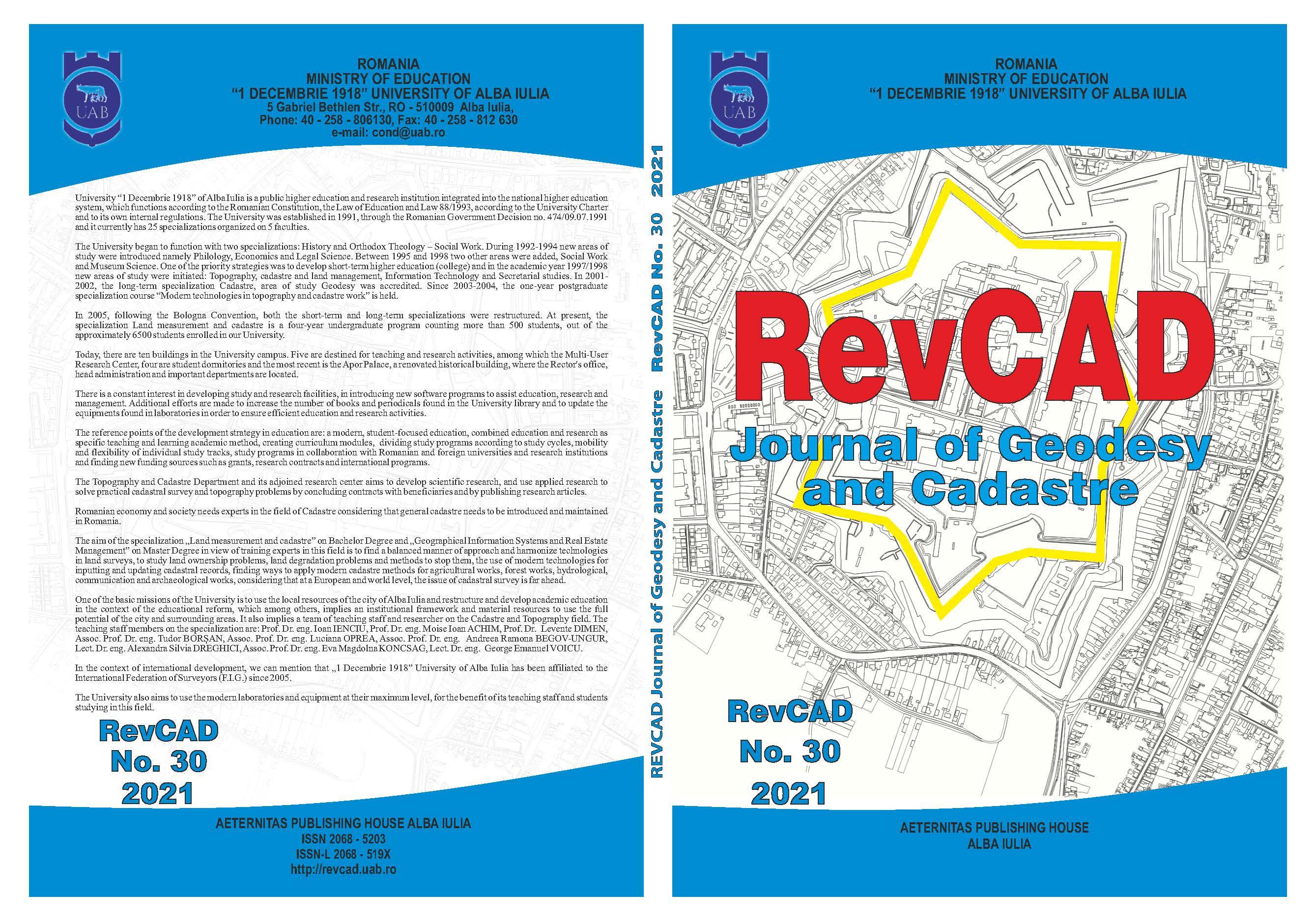
Topographic Study Regarding the Spatial Position Determination of the Interception of Some Mining Works by Vertical Drilling at Ciudanovita Mine

Topographic Study Regarding the Spatial Position Determination of the Interception of Some Mining Works by Vertical Drilling at Ciudanovita Mine

Author(s): Ioan Ienciu,Levente Dimén,Silvia Alexandra Dreghici,George Ghilea / Language(s): English Issue: 30/2021

This paper is based on theoretical and practical aspects in the field of Mining Topography works. Through this work we want to present the topographic documentation for the design phase of some works for the execution of two vertical boreholes, boreholes requested by the specialized designer. The paper will present the sequence of work steps that will necessarily consider the rules and technical instructions in force as well as the determinations required by the designer

More...
Aspects Regarding the Topo-Cadastral Operations Necessary for The Introduction of the Building Networks and the Modernization of the Street Framework in the Locality of Bălcaciu, Jidvei Commune, Alba County

Aspects Regarding the Topo-Cadastral Operations Necessary for The Introduction of the Building Networks and the Modernization of the Street Framework in the Locality of Bălcaciu, Jidvei Commune, Alba County

Author(s): Florina Voicu / Language(s): English Issue: 30/2021

According to INS data, in 2017, a total of 9,978,886 people in Romania had homes connected to sewer systems, representing 50.8% of the resident population. Regarding the treatment of wastewater, the population connected to the sewerage systems that included sewage treatment plants totalled 9,710,077 people, representing 49.4% of the resident population of the country.For the localities over 2000 inhabitants, to obtain financing, rural agglomerations were created artificially (commune and afferent villages). For these, systems have been designed and built, with sewer lengths that include the distances between communes and villages, often tens of kilometres. The number of communes in which the share of households connected to existing sewerage networks is below the 5% threshold, mainly due to connection costs and wastewater charges. Also, the resident population in these localities has decreased in the last ten years by more than 20%. As such, the costs of these projects will not allow the revenues generated by water companies to ensure the sustainability of the newly built infrastructure.

More...
Considerations for Using Smartphones in Modern Topography

Considerations for Using Smartphones in Modern Topography

Author(s): George Emanuel Voicu,Ioan Voina / Language(s): English Issue: 30/2021

With the advent of humanity in the digital age, the technology industry has seen an amazing development that now brings the user a wide range of useful applications, some of which can be used successfully in the field of modern topography.In this article, we set out to present some considerations on topographic applications developed in the field of smartphones.

More...
Result 341-360 of 583
  • Prev
  • 1
  • 2
  • 3
  • ...
  • 17
  • 18
  • 19
  • ...
  • 28
  • 29
  • 30
  • Next

About

CEEOL is a leading provider of academic eJournals, eBooks and Grey Literature documents in Humanities and Social Sciences from and about Central, East and Southeast Europe. In the rapidly changing digital sphere CEEOL is a reliable source of adjusting expertise trusted by scholars, researchers, publishers, and librarians. CEEOL offers various services to subscribing institutions and their patrons to make access to its content as easy as possible. CEEOL supports publishers to reach new audiences and disseminate the scientific achievements to a broad readership worldwide. Un-affiliated scholars have the possibility to access the repository by creating their personal user account.

Contact Us

Central and Eastern European Online Library GmbH
Basaltstrasse 9
60487 Frankfurt am Main
Germany
Amtsgericht Frankfurt am Main HRB 102056
VAT number: DE300273105
Phone: +49 (0)69-20026820
Email: info@ceeol.com

Connect with CEEOL

  • Join our Facebook page
  • Follow us on Twitter
CEEOL Logo Footer
2025 © CEEOL. ALL Rights Reserved. Privacy Policy | Terms & Conditions of use | Accessibility
ver2.0.428
Toggle Accessibility Mode

Login CEEOL

{{forgottenPasswordMessage.Message}}

Enter your Username (Email) below.

Institutional Login