Cookies help us deliver our services. By using our services, you agree to our use of cookies. Learn more.
  • Log In
  • Register
CEEOL Logo
Advanced Search
  • Home
  • SUBJECT AREAS
  • PUBLISHERS
  • JOURNALS
  • eBooks
  • GREY LITERATURE
  • CEEOL-DIGITS
  • INDIVIDUAL ACCOUNT
  • Help
  • Contact
  • for LIBRARIANS
  • for PUBLISHERS

Content Type

Subjects

Languages

Legend

  • Journal
  • Article
  • Book
  • Chapter
  • Open Access
  • Geography, Regional studies
  • Geomatics

We kindly inform you that, as long as the subject affiliation of our 300.000+ articles is in progress, you might get unsufficient or no results on your third level or second level search. In this case, please broaden your search criteria.

Result 41-60 of 455
  • Prev
  • 1
  • 2
  • 3
  • 4
  • ...
  • 21
  • 22
  • 23
  • Next
Au-Ag TELLURIDE DEPOSITS IN THE METALIFERI MTS.:
EFFECTS OF LOCAL GEOLOGY OR OF A “HYDROTHERMAL ICHOR”

Au-Ag TELLURIDE DEPOSITS IN THE METALIFERI MTS.: EFFECTS OF LOCAL GEOLOGY OR OF A “HYDROTHERMAL ICHOR”

Author(s): Gheorghe Udubasa,Sorin Silviu Udubaşa / Language(s): English Issue: 19/2019

The Metaliferi Mountains are located in the southern area of the ApuseniMountains. In these mountains there are the most important gold and silver deposits inRomania and Europe. An unusual feature of the gold-silver mineralization is the presenceof gold and silver tellures, discovered for the first time in the deposits in the “goldenquadrangle” Brad - Săcărmb - Roşia Montană - Baia de Arieş. In this study there are someclarificationsregarding the genesis of these mineralizations and the effects of local tectonicsand geology on the formation of gold and silver deposits.

More...
Audit Analytics, Administrative Accounting, Internal Auditing: Cadastre Corporate Governance

Audit Analytics, Administrative Accounting, Internal Auditing: Cadastre Corporate Governance

Audit Analytics, Administrative Accounting, Internal Auditing: Cadastre Corporate Governance

Author(s): Vasiliki Basdekidou,Athanasios Styliadis / Language(s): English Issue: 24/2018

In the Greek cadastre the usage of audit analytics is below any expectations according the European and International standards, although internationally internal auditing is increasingly accepted. In order to address this problem, the innovative concept “Cadastre Audit Analytics, CAA” is introduced in this article. Then, the concept is projected in three contexts and became a framework rich in collaborative financial engineering functionalities. Finally, the article discusses the application conceptual model (audit analytics, administrative accounting, and internal auditing) as an intermediate step towards a well-defined and documented accounting, auditing, and corporate governance system, in accordance with the international accounting standards.

More...
Badanie związków korelacyjnych parametrów zagęszczenia
nasypu budowlanego w warunkach in situ

Badanie związków korelacyjnych parametrów zagęszczenia nasypu budowlanego w warunkach in situ

Author(s): Maciej Kumor,Łukasz Kumor,Joanna Farmas / Language(s): Polish Issue: 3/2013

Geotechnical assessment of the implementation correctness of a road embankment wide range of issues, among which important selection and control of the quality of the earthworks are extremely significant. The article presents results of in situ tests determining correlations between the depending parameters defined by a static plate – VSS test – E1 and E2, and obtained from the study LFG Dynamic Load Plate. Studies indicate that the determination of the correlation between the parameters characterizing the particle size distribution (Cc, Cu, D10, D20, D30, D60), and the compaction parameters obtained by examining the compaction of sand embankment (Evd, E1, E2, I0) is physically complex and hence extremely difficult.

More...
BASIC RULES IN GEOGRAPHICAL PHOTOGRAPHY

BASIC RULES IN GEOGRAPHICAL PHOTOGRAPHY

Author(s): Bogdan Olariu,IULIAN SĂNDULACHE,CĂTĂLINA SĂNDULACHE / Language(s): English Issue: 18/2018

Photography plays a key role in geographical studies but also in teachinggeography. For the geographical photography there are some important aspects regardingthe photographic technique: setting the correct size of the image, white balance, ISOsensitivity, image format, time exposure, aperture, knowing the functioning of theincorporated light bulb, focalization, the optic and digital zoom, measuring the luminosityin the scene that is about to be photographed. In this study, there will be presented the mostimportant types of photography that are used in geography, while in the last part of the study,the most important rules that must be respected when framing and shooting are described.In the end it is presented a glossary which includes 29 terms of speciality that are used in thispaper.Photography plays a key role in geographical studies but also in teaching geography. For the geographical photography there are some important aspects regarding the photographic technique: setting the correct size of the image, white balance, ISO sensitivity, image format, time exposure, aperture, knowing the functioning of the incorporated light bulb, focalization, the optic and digital zoom, measuring the luminosity in the scene that is about to be photographed. In this study, there will be presented the most important types of photography that are used in geography, while in the last part of the study, the most important rules that must be respected when framing and shooting are described. In the end it is presented a glossary which includes 29 terms of speciality that are used in this paper.

More...
Biogeografické regiony České republiky
0.00 €

Biogeografické regiony České republiky

Author(s): Jan Divíšek,Zdeněk Laštůvka,Vít Grulich,Martin Culek / Language(s): Czech

This book aims with biogeographically important flora and fauna species, the same as typical phytocoenological unites in biogeographical regions (bioregions) of the Czech Republic. Higher biogeographical unites – subprovinces are characterised too. Characteristics of both bioregions and subprovinces includes description of bedrocks, morphology, climate, soils, typization of ecotopes and present landuse. The text is accompanied by characteristics of typical nature reserves. Within the territory of the Czech Republic, two biogeographical provinces, four biogeographical subprovinces and 91 biogeographical regions have been distinguished. Important part of publication is a map of biogeographical unites of the Czech Republic in the scale of 1:500 000.

More...
Bjelovarski ring u kontekstu europske gradogradnje

Bjelovarski ring u kontekstu europske gradogradnje

Author(s): Damir Krajnik / Language(s): English,Croatian Issue: 9/2015

Though the bastions of the city of Bjelovar were of symbolic character, and thus primarily presented more an indication of an urban entity borderline and less a real defence system, the manner in which they were transformed essentially defined the urban structure morphology. Levelling and transformation of the forts was realised within a fairly brief period at the turn of the 18th to the 19th century, whereby – following the best European examples – a representative urban stretch with a round street circling the former town centre, concentrated public town spaces and buildings of public use was formed. By analysing features of town planning according to the model defined in the author’s doctoral dissertation, it was established that Bjelovar belonged to the group of towns of integral type 1-B, characterised by a prevailingly mixed structure combined with buildings of (mostly) public use in the insulae, with a round street as a part of the traffic system in the area of the former forts, thanks to which the town-planning interpretation of space in the place they presently take in the urban matrix was enabled. The comparison with examples of Croatian and European cities (Varaždin, Vienna, Riga, Wroclaw and Würzburg), which belong to the same integral type according to town-planning features of space on the locations of bastion fortresses, has clearly indicated to the significance of the location rightfully referred to as the Bjelovar ring, and to the common town-planning principles of shaping cities in Croatia and Europe in the 19th century. It may therefore serve as an element in defining planning postulates of future town-planning interventions in the subject area.

More...
Blockchain Entrepreneurship: Building Sustainable Cadastral Practices

Blockchain Entrepreneurship: Building Sustainable Cadastral Practices

Blockchain Entrepreneurship: Building Sustainable Cadastral Practices

Author(s): Vasiliki Basdekidou / Language(s): English Issue: 24/2018

Today the state-of-the-art research in entrepreneurship involves the application of both the innovative Distributed Ledger Technology (DLT) and the Blockchain data structure to classical economy and (cadastral) management disciplines (i.e. corporate finance, peer-to-peer management, digital marketing, digital cadastral management, etc.). Despite the well known recognition of the importance and the role of the peer-to-peer (P2P) computing in the development of entrepreneurial financial and cadastral management strategies, as well as distributed firms and decentralized companies, there have been just few attempts to apply DLT/Blockchain methodology to financial practices in general; and absolutely no attempts at all to apply this methodology to cadastral related applications in particular. So, a number of hot-red issues have arisen in this field. The purpose of this article is to indicate opportunities for useful applications in the developing field of DLT entrepreneurship research. Hence, this article introduces, describes, evaluates, and documents new sustainable Blockchain functionalities and corporate finance practices for (green) entrepreneurship and sustainable cadastral practices.

More...
Brief History of the Height Reference Systems Used along the Romanian Sector of the Danube River

Brief History of the Height Reference Systems Used along the Romanian Sector of the Danube River

Brief History of the Height Reference Systems Used along the Romanian Sector of the Danube River

Author(s): Elena-Andreea Savu / Language(s): English Issue: 28/2020

Both geodetic engineers and specialists in the fields such as Hydrology, Hydrotechnics or Geography have faced countless times the problem of using multiple height reference systems on the territory of our country. Over the years, several "zero" points or fundamental points have been used in Romania: "zero" Black Sea Sulina, "zero" Adriatic Sea or "zero" Baltic Sea (most often used). Regarding the Romanian sector of the Danube River, all bathymetric navigation maps use Sulina as a fundamental “zero” point. Unfortunately, the (absolute) heights of the gauges “zero” installed along the Danube River differ from each other depending on the reference surface from which these heights are measured. For this reason, the water level determinations cannot be performed in the same height reference system. In practice, the transformations between different vertical datums used along the river are still a real challenge. This paper supports those who want to understand the history of using the main height reference systems on the Romanian sector of the Danube River and, moreover, represents a review of the relationships between them. Although they were determined long ago, some of them have been transposed into the GIS format to facilitate the height transformations.

More...
Budowa i wiek wyższej terasy Kamionki na odcinku Suchedniów–Rejów

Budowa i wiek wyższej terasy Kamionki na odcinku Suchedniów–Rejów

Author(s): Tomasz Kalicki,Paweł Przepióra,Łukasz Podrzycki / Language(s): Polish Issue: 106/2017

The structure, texture and age of the sediments of the higher (5–12 m) terrace of the Kamionka river between Suchedniów and Rejów are presented. These horizontal and cross-bedded sandy-gravel channel alluvia were accumulated by a braided river during the end of the Wartanian stadial (TL datings: 127–119 ka). Their grain size and structure differ in the wide and narrow sections of the valley, which was caused by changes of flow energy and differentiation of sedimentological fluvial subenvironments. Alluvia were covered by very coarse colluvia in the gap section. Dunes formed on top of the terrace in the Vistulian (climatic factor) and the last centuries (anthropogenic factor).

More...
Business Analyst Online and ArcGIS Online

Business Analyst Online and ArcGIS Online

Business Analyst Online and ArcGIS Online

Author(s): Ana Cornelia Badea,Gheorghe Badea / Language(s): English Issue: 21/2016

In this paper we want to emphasize the use of an ESRI application, called Business Analyst Online. The application and the data are hosted and maintained by ESRI. The study has been developped in order to show the main facilities and integration with ArcGIS Online. It had been taken into account eight criteria, based which it was concluded the most appropriate county to work in cadastral domain.

More...
Cadastral GIS

Cadastral GIS

Cadastral GIS

Author(s): Huba Marton / Language(s): English Issue: 21/2016

What are the benefits of implementing a Geographic Information System in the Cadastral workflow in Romania? Almost all local authorized surveyors and firms are somehow involved in Cadastre, doing their jobs with different levels of technology. What we introduce here is a Cadastral software and technology that offers benefits for all the factors activating in the Land Registration process, by organizing cadastral information starting from an Administrative Territorial level to parcel level (and not vice versa) using a GIS approach, that makes it easier to organize data and spot out missing information and material errors in documents and map data.

More...
CADASTRAL WORKS CARRIED OUT IN ORDER TO REGISTER IN THE
INTEGRATED LAND BOOK SYSTEM SOME STREETS LOCATED IN
THE VILLAGE OF ŞUGAG TO CERTIFY THE OWNERSHIP RIGHT

CADASTRAL WORKS CARRIED OUT IN ORDER TO REGISTER IN THE INTEGRATED LAND BOOK SYSTEM SOME STREETS LOCATED IN THE VILLAGE OF ŞUGAG TO CERTIFY THE OWNERSHIP RIGHT

Author(s): Eva Koncsag,MARIA ROMANA DOMBI / Language(s): English Issue: 18/2018

The present paper aims at the inclusion in the integrated land book systemof some streets located in the village of Şugag, in order to issue a Government Decision forthe attestation of the right of ownership.: The present paper aims at the inclusion in the integrated land book system of some streets located in the village of Şugag, in order to issue a Government Decision for the attestation of the right of ownership

More...
Cartography Targets for Shaping Sustainable Regions

Cartography Targets for Shaping Sustainable Regions

Cartography Targets for Shaping Sustainable Regions

Author(s): Maricel Palamariu,Ildiko Tulbure,Alexandra Dreghici / Language(s): English Issue: 24/2018

Regional sustainability was recognized as one key issue connecting urban to national sustainability. The developments have however emphasized that beside wanted effects of technological progress, undesired negative effects can appear. Some scenarios for the future regional development estimate that by 2050 regions will gain more self-administra-tion and development competence in the context of the own countries. In this regard technical and economic fields should be taken into account in connection to the social one, where special attention has to be paid to the field of cartography. This is becoming more relevant regarding assuring regional sustainability because of the need of land property clarifications. Without maps, people would hardly be space oriented and the knowledge about spatial relations and objects locations in space is a first condition for assuring a successful economic development. In the last time the scientific level in cartography has been strongly developed, so that maps can be currently automatically derived from geo-data acquisition methods and presented in a range of forms, from maps on mobile phones to augmented reality presenta-tions. In this paper some cartography targets will be debated for getting sustainable regions.

More...
Centrální Českomoravská vrchovina na prahu vrcholného středověku. Archeologie, geochemie a rozbory sedimentárních výplní niv.
20.66 €

Centrální Českomoravská vrchovina na prahu vrcholného středověku. Archeologie, geochemie a rozbory sedimentárních výplní niv.

Author(s): Petr Hrubý,Petr Hejhal,Karel Malý,Petr Kočár,Libor Petr / Language(s): Czech

The book presents the synthesis of the environmental and archaeological approaches which can answer a principally historical questions related to the uprise of the high mediaeval settlement structure but also of the beginnings of the gold and silver exploitation in the project base area. The book offers structured data to the mediaeval development in the region which is still lacking direct archaelogical evidence in many areas. A low and sometimes difficult detectability of early deforestation, settlement and a whole spectre of the mining activities is compensated by archaeoenvironmental, geochemical and archaeometallurgical analytics of the alluvial sediments in this territory.

More...
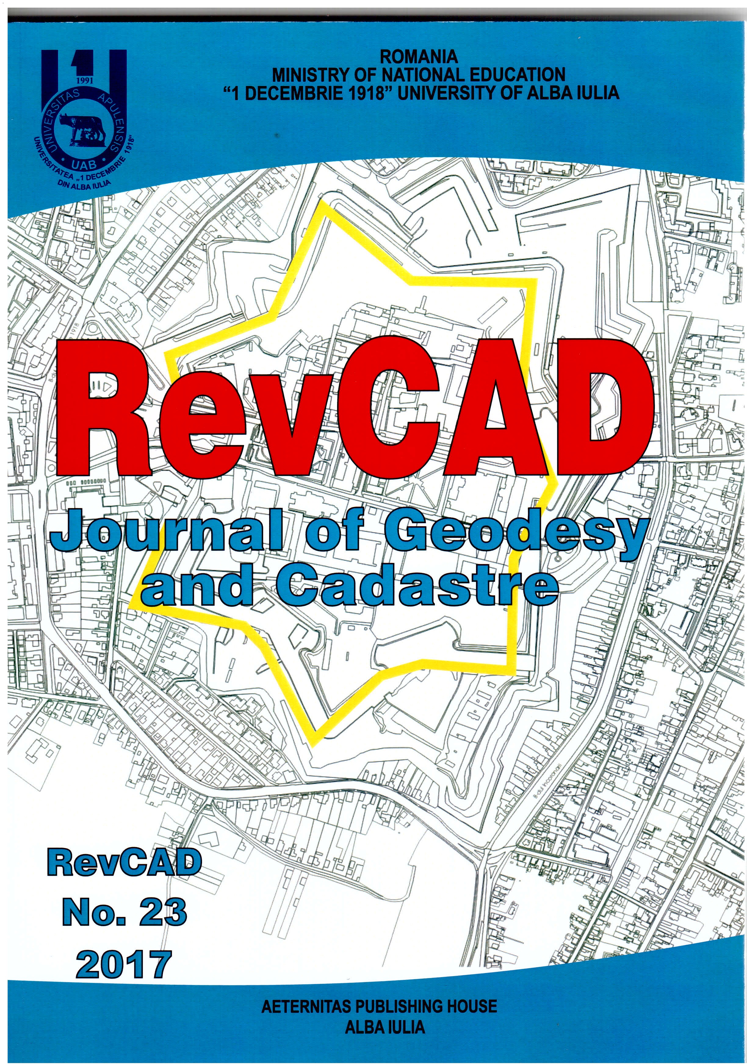
Combined Multi-beam Echo Sounder and Acoustic Doppler Profiler Mapping of the Danube-Epurasu Branch in Order to Determine the Influence of Newly Constructed Hydrotehnical Structures

Combined Multi-beam Echo Sounder and Acoustic Doppler Profiler Mapping of the Danube-Epurasu Branch in Order to Determine the Influence of Newly Constructed Hydrotehnical Structures

Combined Multi-beam Echo Sounder and Acoustic Doppler Profiler Mapping of the Danube-Epurasu Branch in Order to Determine the Influence of Newly Constructed Hydrotehnical Structures

Author(s): Ștefan Zamfir,Gyorgy Deak,Marius Raischi,Alina Nicolae,Lucian Georgescu,Natalia Raischi,Alexandru Cristea,Gabriel Badea,Marius Olteanu,Lucian Lumînăroiu,Eduard Pană,Constantin Cîrstinoiu,Bogdan Urițescu,Tiberius Dănălache / Language(s): English Issue: 23/2017

This article details field research conducted at the Epurasu branch of the Danube River that sought to investigate the influence of newly constructed hydrotehnical structures. The study area was surveyed with two vessels, aiming to investigate the morphology and flow field characterizing this secondary branch and to provide data in order to observe the state of the riverbed and bedforms, velocity, and possible morphologic changes. The first vessel was equipped with a multibeam echosounder and on the second one an acoustic doppler current profiler (ADCP) was used. The results of the research revealed changes in the riverbed morphology and highly detailed imagery of the riverbed and of the hydrotehnical works.

More...
Combining Topographic Measurements and Photogrammetric Works in Order to Achieve Digital 3D Model of the Apor Palace

Combining Topographic Measurements and Photogrammetric Works in Order to Achieve Digital 3D Model of the Apor Palace

Author(s): Alexandra Dreghici,Levente Dimén,Ioan Ienciu,Diana Monica Vancea / Language(s): English Issue: 31/2021

In recent years, there has been a strong emphasis on developing tools to streamline the realization of three-dimensional virtual models of cities. Therefore, the algorithms used to create 3D models are based on the combination of classical or GPS measurements with images taken using digital terrestrial or aerial camera systems. The visualization of the three-dimensional virtual models of the buildings is most often made on the basis of online platforms, created for this purpose. Such a well-built platform will quickly load the 3D model of the building and will allow its exploitation to the maximum level. The obtained result is very important in fields such as architecture and urbanism, offering the possibility to make simulations and visualizations on the project, to draw up projects for the reconstruction or restoration of monuments and buildings.

More...
Comparative Analysis of Specific Deformations Geodetic Reference Systems in Romania

Comparative Analysis of Specific Deformations Geodetic Reference Systems in Romania

Comparative Analysis of Specific Deformations Geodetic Reference Systems in Romania

Author(s): Floarea-Maria Brebu,Alina Corina Bălă / Language(s): English Issue: 25/2018

Based on the theories of Ptolemy emerge so far and Romania various systems cartographic projections: Stereographic 1930, Stereographic 1970 or Universal Transverse Mercator, which are used today. Each of these cartographic projection systems presents both advantages and disadvantages. Analyzing the deformations in the main cartographic projections in our country, using a generic program of transformation of geospatial coordinates from one CRS to another, we can obtain visually appropriate interpretations and make statistics, with the possibility of the percentage, the advantages of using one or the other.Based on the above-mentioned criterion, the scientific paper aims to present the implications from the point of view of the linear deformations, which each of these projections generates, as well as a comparative analysis between them, more suggestively, the advantages of cartographic representation in each case.

More...
Comparative Study on the Institution of Cadastre in International Context

Comparative Study on the Institution of Cadastre in International Context

Comparative Study on the Institution of Cadastre in International Context

Author(s): Luciana Oprea,Maria Barb / Language(s): English Issue: 26/2019

Land ownership has always been the basis of all civilizations. The state has always sought to know and to be informed about the extent and distribution of public and private property. For this reason, it was felt that there was a need to describe and register in the records the property limits to have a clear record of them, to control or limit them and to set the tax on the property. Thus, through the cadastre, a system of general and compulsory registration of the entire land fund is realized irrespective of the ownership of the property and the category of its use. Thus, the cadastre does not study the land itself but establishes the ways in which all technical information concerning the land fund is collected, processed and represented on the maps and plans together with the inclusion in the Land Registry of the related legal acts and deeds. In this context, this paper seeks to carry out a comparative study on the cadastre institution in an international context as well as to identify the elements that can serve to create a most viable cadastral system.

More...
Concept of Spatial Coordinate Systems, Their Defining and Implementation as a Precondition in Geospatial Applications

Concept of Spatial Coordinate Systems, Their Defining and Implementation as a Precondition in Geospatial Applications

Author(s): Aleksandar Sekulić,Zoran D. Nedeljković / Language(s): English Issue: 4/2015

There are many users of spatial information, and quite large interest about the nature and genesis of such information. Different users found spatial information in the form of maps, plans or alphanumerical tables. Recently, there are more often in the form of spatial databases, and in the form of geographic information systems. What is behind these spatial data? On what foundation are they designed? In this article we look at the basic aspects of space, dimensionality and global coordinate systems in applications of global geospatial research. Here is explained the definition of the coordinate system as an abstract entity and, consequently, its implementation or establishment in the form of a geodetic reference frame, as real geodetic reference network. The applicative aspect of coordinate systems in this article is emphasized through recommendations and considerations during usage of their different implementations.

More...
Configuring of Agricultural Parcels in Vineyards With a View to Setting up a Depending on the Conditions of the Relief of the Area

Configuring of Agricultural Parcels in Vineyards With a View to Setting up a Depending on the Conditions of the Relief of the Area

Configuring of Agricultural Parcels in Vineyards With a View to Setting up a Depending on the Conditions of the Relief of the Area

Author(s): Cristian Huțanu,Radu Oprea,Dan Pădure / Language(s): English Issue: 22/2017

The correct evaluation of the ecological factors in achieving a qualitative cadastre of a vineyard, which are to be set up in an area with temperate climate, is the basic condition for the economic success of the plantation, regarding the quantity and quality of the wines of the assortment of varieties chosen for planting. Taking into account the requirements of the European noble varieties grown, it can be concluded that a geographic area has vineyard potential, if it allows getting productions from year to year, primarily qualitative, to varieties from at least one direction of wine production (grape for consumption or for wine).

More...
Result 41-60 of 455
  • Prev
  • 1
  • 2
  • 3
  • 4
  • ...
  • 21
  • 22
  • 23
  • Next

About

CEEOL is a leading provider of academic e-journals and e-books in the Humanities and Social Sciences from and about Central and Eastern Europe. In the rapidly changing digital sphere CEEOL is a reliable source of adjusting expertise trusted by scholars, publishers and librarians. Currently, over 1000 publishers entrust CEEOL with their high-quality journals and e-books. CEEOL provides scholars, researchers and students with access to a wide range of academic content in a constantly growing, dynamic repository. Currently, CEEOL covers more than 2000 journals and 690.000 articles, over 4500 ebooks and 6000 grey literature document. CEEOL offers various services to subscribing institutions and their patrons to make access to its content as easy as possible. Furthermore, CEEOL allows publishers to reach new audiences and promote the scientific achievements of the Eastern European scientific community to a broader readership. Un-affiliated scholars have the possibility to access the repository by creating their personal user account

Contact Us

Central and Eastern European Online Library GmbH
Basaltstrasse 9
60487 Frankfurt am Main
Germany
Amtsgericht Frankfurt am Main HRB 53679
VAT number: DE300273105
Phone: +49 (0)69-20026820
Fax: +49 (0)69-20026819
Email: info@ceeol.com

Connect with CEEOL

  • Join our Facebook page
  • Follow us on Twitter
CEEOL Logo Footer
2023 © CEEOL. ALL Rights Reserved. Privacy Policy | Terms & Conditions of use
ICB - InterConsult Bulgaria ver.2.0.0312

Login CEEOL

{{forgottenPasswordMessage.Message}}

Enter your Username (Email) below.