Cookies help us deliver our services. By using our services, you agree to our use of cookies. Learn more.
  • Log In
  • Register
CEEOL Logo
Advanced Search
  • Home
  • SUBJECT AREAS
  • PUBLISHERS
  • JOURNALS
  • eBooks
  • GREY LITERATURE
  • CEEOL-DIGITS
  • INDIVIDUAL ACCOUNT
  • Help
  • Contact
  • for LIBRARIANS
  • for PUBLISHERS

Content Type

Subjects

Languages

Legend

  • Journal
  • Article
  • Book
  • Chapter
  • Open Access
  • Geography, Regional studies
  • Physical Geopgraphy

We kindly inform you that, as long as the subject affiliation of our 300.000+ articles is in progress, you might get unsufficient or no results on your third level or second level search. In this case, please broaden your search criteria.

Result 1021-1040 of 1301
  • Prev
  • 1
  • 2
  • 3
  • ...
  • 51
  • 52
  • 53
  • ...
  • 64
  • 65
  • 66
  • Next
Metodologia oceny ryzyka powodziowego gmin województwa łódzkiego

Metodologia oceny ryzyka powodziowego gmin województwa łódzkiego

Author(s): Marta Borowska-Stefańska / Language(s): Polish Issue: 147/2016

The aim of the article is to analyze methods of flood risk assessment used in Poland and to compare the results obtained on the basis of these analyses. The analysis involves 21 communes ( Polish: gmina ), which in the document created by the Department of Security and Crisis Management of the Łódź Municipal Government were referred to as those in which the damage connected with flooding is the biggest. In accordance with the Flood Directive ( 2007 ), flood risk is a “ combination of the probability of a flood event and potential adverse consequences for human health, the natural environment, and cultural and economic activity ” ( Flood Directive of 2007, Art. 2 Item 2 ). The article uses the methodology implemented in the Flood Control Operating Plan for the Łódź province ( 2013 ), Plans of Flood Risk Management ( 2015 ), and their results were compared with the author’s interpretation. Research has shown that the biggest discrepancies concerning flood risk levels concern five communes: Uniejów, Działoszyn, Warta, Gidle and Sulejów. This is linked with a different attitude towards flood risk. Regrettably, there still exists no reliable method of risk assessment, which would greatly facilitate the pursuance of an adequate anti-flood policy.

More...
ZAGADNIENIA MORFOGENEZY I PRZEMIAN ROZPLANOWANIA WSI NA TLE ROZWOJU OSADNICTWA W ZACHODNIEJ CZĘŚCI GMINY SZADEK

ZAGADNIENIA MORFOGENEZY I PRZEMIAN ROZPLANOWANIA WSI NA TLE ROZWOJU OSADNICTWA W ZACHODNIEJ CZĘŚCI GMINY SZADEK

Author(s): Tomasz Figlus / Language(s): Polish Issue: 16/2016

The paper presents results of geographical and historical research on morphogenesis and changes in spatial structures of villages in the western part of Szadek municipality. 32 villages west of the river Pichna have been examined. The research was based on historical cartographic sources, including topographic maps and archival plans of these settlements. A comparative analysis of these materials, from a dynamic perspective, made possible the reconstruction of the initial spatial structures and their subsequent transformations. The origins and processes of evolution of rural structures are discussed in the context of development of settlement in this area, based on source documents from the Middle Ages up to the 20th century.

More...
GEOMAGNETIC SURVEY OF CUCUTENI-SETTLEMENTS IN MOLDOVA – RESULTS OF THE FAU – CAMPAIGN 2015

GEOMAGNETIC SURVEY OF CUCUTENI-SETTLEMENTS IN MOLDOVA – RESULTS OF THE FAU – CAMPAIGN 2015

Author(s): Carsten Mischka,Doris Mischka,Alexander Rubel / Language(s): English Issue: 1/2016

In spring 2015, the Cucuteni sites of Scânteia (Iași County), Izvoare, Răucești (both Neamţ County), Ţigǎnești, Stănișești and Fulgeriș (all Bacău County) where surveyed by gradiometer. At Scânteia, more than 50 burned houses, ordered in parallel lines, as well as a threefold ditch system were encountered. The magnetograms from Fulgeriș, Izvoare and Răucești revealed also the typical, massive ditch systems, which were used on most Cucuteni sites for the settlement's delimitation. To a certain extend, at Fulgeriș the spatial order of a settlement, aligned along a central pathway is visible, while the other sites where not similarly informative. As a multi–layer settlement Izvoare exhibits a condensed picture of overlying structures, while Răucești, Ţigǎnești and Stănișești show different stages of destruction by erosion, caused by modern land–use. These range from disarticulated, but still present features up to the presumably complete annihilation of any archaeological substance. The results show the extraordinary potential of the Cucuteni sites for future, extensive landscape–archaeology, but they also indicate the probably short time during which these unique sources of archaeological information will remain intact for analysis under the circumstances of today’s more and more mechanized agriculture.

More...
UTJECAJ RIJEKE DRAVE NA NASELJA U ĐURĐEVEČKOJ PODRAVINI - PRIMJER SELA BROD U 18. I 19. STOLJEĆU

UTJECAJ RIJEKE DRAVE NA NASELJA U ĐURĐEVEČKOJ PODRAVINI - PRIMJER SELA BROD U 18. I 19. STOLJEĆU

Author(s): Nikola Cik / Language(s): Croatian Issue: 13/2017

The river Drava and its tributaries were in the past a very important geographic element in the Đurđevec area of Podravina because the floods restricted access to the banks of Drava and prevented settling in its vicinity. However, the great river had an attractive power for the people of Podravina, which is seen in the example of a ramified path networkt that led from all settlements in Đurđevec area of Podravina to the river Drava. The end points of such paths were river mills and crossings. This path network has affected environmental changes between the river Drava and the settlements located on the borders of the Đurđevečki peski (Đurđevec sands). A relatively wide zone of the forest-swamp area, partly meliorated and deforested during the 18th and 19th centuries, used to strech along the right bank of the river Drava. The process of deforestation and swamp draining, i.e. regulation of the tributaries of the Drava, was parallel to the process of occurence of konaki as temporary residences for humans and livestock. They originated in response to agrarian overcrowding in this part of Podravina in the second half of the 18th century. Konaki became independent villages in the 19th and 20th centuries, and because of the vicinity of the Drava, a specific coexistence with the river was developed there. The paper is focused on the village Brod, which was situated on the very bank of the river Drava during the 18th and first half of the 19th century and whose inhabitants have developed a specific coexistence with water through generations. We learn about life in Brod from various cartographic and written historical sources, especially from Parish register books with data for demographic research.

More...
ZAČETNO OBDOBJE SLOVENSKIH ZGODOVINOPISNIH RAZISKOVANJ PODROČJA REKE DRAVE V SLOVENIJI

ZAČETNO OBDOBJE SLOVENSKIH ZGODOVINOPISNIH RAZISKOVANJ PODROČJA REKE DRAVE V SLOVENIJI

Author(s): Andrej Hozjan / Language(s): Slovenian Issue: 13/2017

Among slovenian historiographical researches of Drava river territory in the Republic of Slovenia the most important research corpus belonges to the history of the Drava Valley., i. e. the territory between towns Dravograd and Maribor. Slovenian researching of that territory had started after the WW I, as an answer to some german spoken articles before WW I on that thema. Josip Mravljak, born and lived in town Vuzenica in Drava Valley (died in 1953), was the first slovenian author of more historiographical articles mostly about the towns, the peasantry uprisings and nobles, about the life, determinated by the river, and others. Starting of brighter interest about the Drava river past in Slovenian was the research opus of Jože Koropec. His works and monographies, writed and published in the 60.‘s and 70.‘s of 20th Century, finally established that part of slovenian Drava as an legitime thema of historiographical survey and research.

More...
Характеристики на температурния режим в град София за периода 1996–2015 г.
4.50 €
Preview

Характеристики на температурния режим в град София за периода 1996–2015 г.

Author(s): Vladimir Vlaskov / Language(s): Bulgarian Issue: 16/2018

The changes in climatic conditions of our planet impose a regional-local approach in the study of this problem. It is because in certain regions and countries significant parts of the population are concentrated on relatively limited territory – the big cities.Sofia is one of Europe’s metropolises. Almost 20% of the population of Bulgaria inhabit and work in this city. The characteristics of the climatic temperature regime of Sofia are important for the quality of life in the capital of Bulgaria.The changes in climatic conditions of our planet impose a regional-local approach in the study of this problem. It is because in certain regions and countries significant parts of the population are concentrated on rela¬tively limited territory – the big cities. Sofia is one of Europe’s metropolises. Almost 20% of the population of Bulgaria inhabit and work in this city. The characteristics of the cli¬matic temperature regime of Sofia are important for the quality of life in the capital of Bulgaria.

More...
„Тъз история да се изкове на каменна плоча“ – за фолклорната биография на мястото и дописването ѝ
4.90 €
Preview

„Тъз история да се изкове на каменна плоча“ – за фолклорната биография на мястото и дописването ѝ

Author(s): Vladimir Demirev / Language(s): Bulgarian Issue: 17/2019

A variant of interpretation of the folklore biography of the place Zhelyovi kamani near the village of Orizari in the region of Tvarditsa is submitted with a view to the opinion about the folklore biography of the place as a main topos with centre-organizing functions in the settlement space and an active participant in the construction of the settlement biography. The affair in question is the attitude to this biography, motivated through myths, legends, traditional ritualism in the local knowledge. It is expressed in the active appreciation towards the inherited knowledge and its own interpretation of its aspects even “faking” of the contents through the view of a local resident.

More...
Integrarea serviciilor ecosistemice în planificarea spaţială prin soluţii bazate pe natură

Integrarea serviciilor ecosistemice în planificarea spaţială prin soluţii bazate pe natură

Author(s): Mădălina Sbarcea,Filip Raicu,Alexandru-Ionuţ Petrişor / Language(s): Romanian Issue: 1/2019

Global changes, driven by land use changes, human population growth and consumption or pollution, manifest themselves through extensive urbanization and amplified extreme climate phenomena, that are threatening environmental systems and human well-being. Consequences of these changes results in habitats and ecosystems fragmentation and quality degradation, that lead to lower capacity of delivering ecosystem services as well as to negative impacts for human health. At the global and European level, nature-based solutions (NBS) have gained traction as an alternative to traditional measures to tackle these environmental and socioeconomic challenges. In this context, the EU oriented its Research and Innovation agenda towards NBS, aiming at green economic growth and new jobs creation, sustainable urbanization, regenerating degraded areas and improving citizen quality of life. Nature-based-solutions projects usually tackle complex problems and provide a series of benefits, most of which can be assessed from an ecosystem services perspective. The planning and implementation process usually involve multiple stakeholders, from governments to NGOs or lay citizens. Besides further need for monitoring, especially of quantitative effects, the complexity of interactions between humans and their environment require a systems approach to adequately represent feedbacks between variables like public health, wellbeing or environmental quality and ecosystem services. Given these complex relationships and context-dependency, the development of frameworks that support spatial planning professionals and decision makers and that involve regional stakeholders in a participatory process would maximize the benefits obtained by NBS implementation.

More...
Zonele metropolitane, cheia dezvoltării spaţiale durabile echilibrate a României

Zonele metropolitane, cheia dezvoltării spaţiale durabile echilibrate a României

Author(s): Antonio Valentin Tache,Cătălin N., Sârbu,Alexandru-Ionuţ Petrişor / Language(s): English Issue: 1/2020

Spatial policies are meant to ensure a balanced and sustainable development at different territorial levels. Although numerous studies were carried out, consensus was not achieved on the importance of different levels of policies (local, regional, national, European) on the development process, and whether regulated interventions can stimulate development better than the intrinsic mechanisms of territorial processes. This study aims to assess the development of Romania at the level of metropolitan areas, using GIS in conjunction with the statistical and mathematical modeling of territorial dynamics. The results strengthen the importance of the local level in monitoring the efficiency of spatial development policies.

More...
The Ranking and Rating of Climate Change in Romania: Trends and Individual-Level Determinants

The Ranking and Rating of Climate Change in Romania: Trends and Individual-Level Determinants

Author(s): Laura Nistor / Language(s): English Issue: 2/2022

The analysis investigates the ranking and rating questions of climate concern with a view to reveal Romanian respondents’ attitude towards the seriousness of climate change in the period of 2009–2019 based on the Special Eurobarometer research. The results show that climate change is seen in Romania as a severe but a less important problem. The multivariate analyses show that educational status represents the individual level variable that clearly determines climate concern whether it is a ranking or a rating type of measurement. It has also been demonstrated that climate-change-related concern is interlinked with other attitudes towards climate change. This points to the fact that although climate concern has a less stable socio-demographic root, it forms a coherent environment belief.

More...
Machine Learning Model to Predict Urban Sprawl Using Official Land-use Data

Machine Learning Model to Predict Urban Sprawl Using Official Land-use Data

Author(s): Mohamed Noby,Mohamed E. Elattar,Omar Hamdy / Language(s): English Issue: 3/2023

The rate of global urbanization is constantly increasing. As a result of the massive population growth, there is an increasing demand for further urban development, especially in developing regions such as Aswan city. This paper aims to examine the usage official land-use data in predicting future urban growth until 2046, moreover, to define urban driving forces in case study area. This was done using Similarity weighted model, a machine learning based model to simulate future urban growth. The results show that official land-use data produce a slightly better results’ accuracy than remote sensing sources within small to medium scales. The results although reveal that for study region, urban area is expected to expand to cover an area of almost 4460 Feddan by year 2046. The outcome of this research assesses decision makers to accurately predict future urban sprawl areas using available official land-use data.

More...
Промени в наименованията на физикогеографски обекти в България след 1878 – 2014 г. – факти и проблеми

Промени в наименованията на физикогеографски обекти в България след 1878 – 2014 г. – факти и проблеми

Author(s): Aleksandra Kiselkova / Language(s): English,Bulgarian Issue: 1/2020

The dictionary Geographical Renaming in Bulgaria 1878-2014, published by the Bulgarian Encyclopaedia Scientific Information Centre of the Bulgarian Academy of Sciences, TRUD Publishing House, 2015, is a first attempt to collect all renamed places in Bulgaria in one volume. The dictionary contains 415 6 toponyms along with comparisons, explanations and comments. The geographical naming conventions, renaming and name restoration in Bulgaria remain problematic. The selection oftoponyms, the renaming criteria that the commissions of the municipal councils use, as well as the composition of said commissions, all warrant criticism. In addition, the process of communicating the new toponyms to the administrations and the general public, of adopting the toponyms and controlling their usage is less than perfect. Furthermore, this article raises the issue of the lack of a consistent policy on the part of authorities, namely, the Geodesy, Cartography and Cadastre Agency of the Ministry ofRegional Development and Public Works.

More...
International environmental and climate policy and the directions of transport development at the national and regional level

International environmental and climate policy and the directions of transport development at the national and regional level

Author(s): Maria Zych-Lewandowska,Jakub Majewski / Language(s): English Issue: 2/2021

The aim of this paper was to analyse the transport-related content of European environmental and climate policy documents and to identify those elements that will be key in shaping transport development in individual countries and regions in the coming decade. In the first part, the authors present an overview of the most important documents defining environmental protection and climate change goals in the European Union. In the second part, the most important guidelines, which should affect the actions undertaken in the field of shaping and developing transport, were indicated. A short analysis of the processes occurring on the transport market in Poland and their convergence with the recommendations included in the documents was also included. The summary presents conclusions concerning the necessity of complementing national documents with the latest EU recommendations.

More...
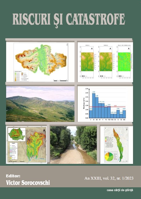
Assessing the Someşan Plateau water supply.

Assessing the Someşan Plateau water supply.

Author(s): Victor Sorocovschi / Language(s): English Issue: 1/2023

The sustainable development of the Someşean Plateau, a water-deficient region, requires solving the problem of ensuring the water supply for the population and agriculture. In this sense, in the present study, were analyzed a series of aspects related to: water supply sources (auththous and allochthous) of the localities; the amount of water distributed to consumers from the main subunits of the Someşean Plateau. Special attention was given to the evaluation of water needs (in four variants) at the level of localities, counties, hydrographic basins and geographical subdivisions. Finally, the optimization of water supply solutions for the localities in the studied region was analyzed.

More...
The correlations between land use and landslides in the Territorial Administrative Unit of Mintiu Gherlii

The correlations between land use and landslides in the Territorial Administrative Unit of Mintiu Gherlii

Author(s): Gheorghe Roșian,Csaba Horváth,Muntean Liviu,MĂCICĂȘAN Vlad,Rozalia Benedek / Language(s): English Issue: 1/2023

Landslides are among the most important geomorphological processes in the Transylvanian Basin, particularly affecting agricultural land and decreasing its value for producing specific agricultural products. The Someșan Plateau and the Transylvanian Plain are the morpho-structural units most affected by landslides, accounting for 3% to 10% or more of the territorial and administrative divisions in the Transylvanian Basin, including Mintiu Gherlii. In this context, where geology and landforms are relatively consistent, land use is the primary factor that can produce changes. Our analysis indicates that arable land and pastures have the largest areas affected by landslides, and this suggests that the agro-techniques used so far may not have been the most suitable. Therefore, preventive and control measures should be implemented to reduce the surface areas affected by landslides and minimize their impact on the local economy.

More...
INTRODUCING GIS TO LEARNING AND STIMULATING INTERACTIVITY AMONG STUDENTS

INTRODUCING GIS TO LEARNING AND STIMULATING INTERACTIVITY AMONG STUDENTS

Author(s): CRINA-AURELIA ELEFTERIU / Language(s): English Issue: 23/2023

Railway Technical College "Unirea" in Paşcani embarked on the ambitious two-year Erasmus KA220 project, "GIS FOR GIST OF EUROPE," commencing in December 2022. This endeavor is significant for both the institution and the local community. The project focuses on using Geographic Information Systems (GIS) to study the impact of climate change on the European environment. Interactive GIS maps allow users to explore the regions most affected by climate change, assess its effects on biodiversity and natural resources, and develop strategies to mitigate these environmental challenges. Within the Erasmus+ initiative, "GIS for Gist of Europe," GIS plays a central role, aiding urban planning, territorial development, and sustainable resource management. It also contributes to efficient communication networks and waste management systems. Project activities include online and in-person meetings, as well as Learning, Teaching, and Training (LTT) sessions. Key objectives involve creating two eLearning platforms, one with STEM educational resources featuring GIS maps and another for GIS training. The project fosters the advantages of GIS in data accessibility, correlation, and localized database creation. This project employing GIS will address climate change’s impact on Europe, enhancing education and advancing climate-resilient strategies. The digitization of Geography remains pivotal in modern education and research, deepening our understanding of our ever-changing world.

More...
Study of Air and Surface Temperatures in the City of Rouen (France) in Order to Evaluate the Characteristics of the Urban Heat Islands

Study of Air and Surface Temperatures in the City of Rouen (France) in Order to Evaluate the Characteristics of the Urban Heat Islands

Author(s): Zeineddine Nouaceur,Ovidiu Murărescu,George Murătoreanu / Language(s): English Issue: 1/2023

Due to its concave topography, the climate in the Rouen region is affected by the impact of urbanization. The urbanized area occupies the bottom of the Seine Valley and extends onto slopes and plateaus. These topographic conditions contribute to the formation of well-differentiated local climates. To better understand the urban heat island, an expeditionary measurement campaign was carried out from 25 June to 11 August 2020. This campaign is based on the knowledge of the spatial distribution of temperatures in the city. These measurements were carried out according to different profiles and a specific programme. During this period, the region was affected by three heatwaves.. In this study, we present the results regarding the air temperatures obtained on 25 June 2020. The study also relies on the analysis of “Landsat 8” channel 11 satellite images, with a spatial resolution of 30 m to define surface temperatures. The results obtained during the measurement campaign show the importance of the differences between vegetated and built spaces. They also highlight hotspots (at traffic intersections and on main transport corridors – boulevards). The results obtained from the processing of satellite images show significant temperature differences between the industrial area and the rest of the city. There is an important thermal contrast between green spaces and asphalt squares in the city centre. There is a thermal lag between the “west” plateau, Cailly Valley, and the rest of the city.

More...
Съвременни дидикатически постановки за учебното съдържание по география на Китай в обучението по география и икономика в VI клас в българското училище

Съвременни дидикатически постановки за учебното съдържание по география на Китай в обучението по география и икономика в VI клас в българското училище

Author(s): Tamara Draganova,Stela Dermendzhieva / Language(s): Bulgarian Issue: 1/2024

The paper investigates the didactic approaches to the textbook material regarding the geography of China in the junior secondary education stage of the basic education level. It researches, and presents the modern didactic ideas, content models and ways of studying China as a country, a typical representative for studying a normative document in the 6th grade of the Bulgarian school.

More...
Which index is better for assessing the success of reclamation: Naturalness or hemeroby?

Which index is better for assessing the success of reclamation: Naturalness or hemeroby?

Author(s): N. Podpriatova,O. M. Kunakh,O. Zhukov / Language(s): English Issue: 1/2024

The destruction of soil and vegetation caused by mining, if not prevented through careful planning, is usually extreme, as the original ecosystems have been grossly disturbed or buried in the mining process. A radical reconstruction is therefore necessary. In nature, this happens through the well-known processes of primary succession, without human intervention. In the interests of the economy and the preservation of our natural resources, reclamation should try to involve the same processes. When planning reclamation, it is crucial to clearly define goals, objectives and success criteria to allow for systematic reclamation. The need for methods to assess the effectiveness in achieving environmental and social goals is increasing, especially if agricultural land is to be restored. Over time, reclamation goals may need to be modified depending on the direction of the reclamation succession. The reclamation of mined areas requires the application of monitoring tools to understand the achievement of potential success. This problem can be solved by studying the biodiversity of plant communities and soil factors of mining areas as habitats in industrialized post-mining landscapes. Thus, the reclamation of territories disturbed by industrial activities is planned with the need to correct the trajectory of the restoration process, so it requires indicators that can be used to monitor the success of the planned process. The article tests the following hypotheses: 1) the dynamics of the reclamation process can be monitored using the indices of naturalness and hemeroby; 2) at the initial stages of reclamation, the hemeroby index has an advantage due to its greater sensitivity in this range of anthropogenic transformation levels. The plant community formed as a result of spontaneous growth of the reclamation sites was represented by 70 species of vascular plants. The projective vegetation cover was 22.0± 0.30%. In one test plot, 8.4± 0.1 plant species were found. The analysis of the synoptic phytosociological table revealed that the vegetation cover of the reclamation site was represented by nine associations from the vegetation classes Artemisietea vulgaris and Stellarietea mediae. The hemeroby of the communities averaged 85.0±0.22. The lowest level of hemeroby was found within the Cirsio-Lactucetum serriolae association.The average level of hemeroby was found for the associations Medicagini lupulinae-Agropyretum repentis, Ambrosio artemisiifoliae-Cirsietum setosi and Carduo acanthoidis-Onopordetum acanthi. The highest level of hemeroby was found for the associations Agropyretum repentis and Convolvulo arvensis-Agropyretum repentis. The highest level of hemeroby was observed in those plant communities formed on lithozems on the red-brown clays, and the lowest formed on the pedozems. A negative correlation was found between hemeroby and naturalness for all lithozems. No statistically significant correlation was found for pedozems. For the classification of associations, environmental factors such as salt content in the soil solution, nitrogen content, ombroclimate, light regime, and naturalness are of greatest importance. The traditional application of the hemeroby scale is to assess the level of anthropogenic transformation of an ecosystem, i.e. to quantify how far the ecosystem has deviated from its natural state. In our study, we use the hemeroby index to observe how the plant community returns to its natural state, which can be considered as a marker of the effectiveness of the reclamation process. This approach allows us to contrast the indicators of naturalness and hemeroby, which are formally symmetrical: the higher the hemeroby, the lower the naturalness should be. In a wide range of levels of anthropogenic pressure, this pattern is certainly true. The peculiarity of the naturalness index is that it is more sensitive in the range of anthropogenic transformation that occurs at the initial stages of deviation of the natural community from the natural state at low levels of anthropogenic impact. In turn, the hemeroby index is more sensitive to changes in the community under conditions of a high level of anthropogenic transformation.

More...
Report on a Case Study Process Evaluation of a HeartMath Intervention and Faith Following a Traumatic Experience

Report on a Case Study Process Evaluation of a HeartMath Intervention and Faith Following a Traumatic Experience

Author(s): David John Edwards,Yolanda Dreyer,Ben J.M. Steyn / Language(s): English Issue: 1/2024

An initial study [1] was undertaken on a HeartMath intervention, focusing on coherence, resilience and faith following a traumatic experience. Quantitively, there were significant post-intervention positive improvements in physiological coherence, and improvements in resilience and faith, and, qualitatively, positive integrated thematic changes in experiences of sense of coherence, resilience and faith. Correlations revealed various Sense of Coherence Scale items correlated with Brief Resilience Scale and Santa Clara Strength of Religious Faith Questionnaire items, and there were inter-related and overlapping experiences of sense of coherence, resilience and faith integrated themes and sub-themes. The first study’s recommendations included that a case study process evaluation of a HeartMath intervention and faith following a traumatic experience be undertaken. The aim was to identify causal, correlation and relationship mechanisms of change. For this case study, the sample consisted of five participants purposefully selected from the original cohort. Information from a qualitative questionnaire on before, during and after intervention experience of sense of coherence, resilience, faith and HeartMath, as well as the HeartMath intervention, were collected. Emerging causal, correlation and relationship mechanisms of change in the form of integrated themes and sub-themes are discussed.

More...
Result 1021-1040 of 1301
  • Prev
  • 1
  • 2
  • 3
  • ...
  • 51
  • 52
  • 53
  • ...
  • 64
  • 65
  • 66
  • Next

About

CEEOL is a leading provider of academic eJournals, eBooks and Grey Literature documents in Humanities and Social Sciences from and about Central, East and Southeast Europe. In the rapidly changing digital sphere CEEOL is a reliable source of adjusting expertise trusted by scholars, researchers, publishers, and librarians. CEEOL offers various services to subscribing institutions and their patrons to make access to its content as easy as possible. CEEOL supports publishers to reach new audiences and disseminate the scientific achievements to a broad readership worldwide. Un-affiliated scholars have the possibility to access the repository by creating their personal user account.

Contact Us

Central and Eastern European Online Library GmbH
Basaltstrasse 9
60487 Frankfurt am Main
Germany
Amtsgericht Frankfurt am Main HRB 102056
VAT number: DE300273105
Phone: +49 (0)69-20026820
Email: info@ceeol.com

Connect with CEEOL

  • Join our Facebook page
  • Follow us on Twitter
CEEOL Logo Footer
2025 © CEEOL. ALL Rights Reserved. Privacy Policy | Terms & Conditions of use | Accessibility
ver2.0.428
Toggle Accessibility Mode

Login CEEOL

{{forgottenPasswordMessage.Message}}

Enter your Username (Email) below.

Institutional Login