Cookies help us deliver our services. By using our services, you agree to our use of cookies. Learn more.
  • Log In
  • Register
CEEOL Logo
Advanced Search
  • Home
  • SUBJECT AREAS
  • PUBLISHERS
  • JOURNALS
  • eBooks
  • GREY LITERATURE
  • CEEOL-DIGITS
  • INDIVIDUAL ACCOUNT
  • Help
  • Contact
  • for LIBRARIANS
  • for PUBLISHERS

Content Type

Subjects

Languages

Legend

  • Journal
  • Article
  • Book
  • Chapter
  • Open Access
  • Geography, Regional studies
  • Physical Geopgraphy

We kindly inform you that, as long as the subject affiliation of our 300.000+ articles is in progress, you might get unsufficient or no results on your third level or second level search. In this case, please broaden your search criteria.

Result 801-820 of 1301
  • Prev
  • 1
  • 2
  • 3
  • ...
  • 40
  • 41
  • 42
  • ...
  • 64
  • 65
  • 66
  • Next
Analiza minerałów ciężkich jako metoda określania źródła osadów wodnolodowcowych w obszarze między Piotrkowem Trybunalskim, Radomskiem a Przedborzem

Analiza minerałów ciężkich jako metoda określania źródła osadów wodnolodowcowych w obszarze między Piotrkowem Trybunalskim, Radomskiem a Przedborzem

Author(s): Andrzej Barczuk,Lucyna Wachecka-Kotkowska / Language(s): Polish Issue: 103/2015

The paper presents results of the heavy minerals analysis separated of 39 fluvioglacial sediments samples collected at 19 sites in the Piotrków Trybunalski, Radomsko and Przedbórz area. A significant variability of transparent minerals (ca 14–82,5%) and opaque (ca 17,5–86%) have been shown in the set. Comparying to loess around Przedbórz area as to erosion resistance, transparent minerals were divided into five groups. Additionally, carbonates and phosphates as a local substratum index has been added to the classification of a group of 6. Spectra in all groups proved an advantage of Scandinavian detritic material, which was found some link between the resistance and the distance minerals and sediment transport dynamics and their age. Coming up to 40% of biotites and chlorites in glaciofluvial sediments interpreted as synsedimentary aeolian admixtures. Przedstawiono wyniki analizy minerałów frakcji ciężkiej wyseparowane z 39 próbek osadów wodnolodowcowych pobranych w 19 stanowiskach między Piotrkowem Trybunalskim, Radomskiem a Przedborzem. Analiza wykazała duże zróżnicowanie udziału minerałów nieprzezroczystych (14–82,5%) i przezroczystych (17,5–86%). W nawiązaniu do badań lessowych w okolicach Przedborza, minerały przezroczyste podzielono na 5 grup, przyjmując jako główne kryterium odporność na czynniki wietrzeniowe. Do klasyfikacji dodano grupę 6 – węglany i fosforany ze skał podłoża. Wszystkie próbki wskazały na przewagę źródła skandynawskiego materiału detrytycznego, przy czym stwierdzono pewne powiązanie między odpornością minerałów a odległością i dynamiką transportu osadów oraz ich wiekiem. Obecność tylko w nielicznych próbkach minerałów z utworów lokalnego podłoża dowodzi niewielkiej roli egzaracji w obszarze pogranicza Niżu i Wyżyn. Dochodzący nawet do 40% udział łyszczyków w osadach wodnolodowcowych zinterpretowano jako synsedymentacyjne domieszki eoliczne.

More...
Особености в климатичния режим на България през 2014 г.
4.50 €
Preview

Особености в климатичния режим на България през 2014 г.

Author(s): Vladimir Vlaskov / Language(s): Bulgarian Issue: 14/2016

The year 20143, like the year 2007, according to our research shows a new transition of changes in the nature of the climate in Bulgaria. They are determined by the specific distribution of rainfall not only in the calendar year, but in different seasons, months, and the separate rainy days. Changes are observed in the temperature balance, sunshine duration, cloudiness and relative humidity. Precipitation and temperature regime are trend to typical for subtropical conditions and are directly related to changes in regional atmospheric circulation and zonal aspect.

More...
Termiczne pory roku w Szymbarku (1968 – 2013)

Termiczne pory roku w Szymbarku (1968 – 2013)

Author(s): Witold Bochenek / Language(s): Polish Issue: 147/2016

The article contains an analysis of the duration and the dates of the start of thermal seasons of the year, distinguished on the basis of the average daily air temperature at the Institute of Geography and Spatial Organization Research Station at Szymbark over a period of 46 years ( 1968–2013 ). To determine the initial dates of thermal seasons a method proposed by Makowiec (1983 ) was used. According to this method, the year was divided into eight thermal seasons, with temperature threshold values : 0, 5, 10 and 15 °C. The classification by Makowiec is based on the growth or fall of cumulative ranks of air temperature diminished by the temperature threshold value for a particular season. The determination of the initial dates enabled the calculation of the length of the seasons. The long-term analysis involved also the tendencies of length and changes of the initial date of a given season. The location of the meteorological station enables to expand the area of the interpretation of results into the borderland of the Beskid Niski Mts and the Carpathian Foothills. A high variability of the dates of the start and the duration of seasons was observed. The trends of duration and starting dates are multidirectional. The longest season is summer ( 89 days ), which starts increasingly earlier and lasts increasingly longer. An increase in duration also refers to pre-spring and autumn. Increasingly shorter winters and springs were also observed within the multi-year period.

More...
ZAGADNIENIA MORFOGENEZY I PRZEMIAN ROZPLANOWANIA WSI NA TLE ROZWOJU OSADNICTWA WE WSCHODNIEJ CZĘŚCI GMINY SZADEK

ZAGADNIENIA MORFOGENEZY I PRZEMIAN ROZPLANOWANIA WSI NA TLE ROZWOJU OSADNICTWA WE WSCHODNIEJ CZĘŚCI GMINY SZADEK

Author(s): Tomasz Figlus / Language(s): Polish Issue: 16/2016

The article presents results of research in the field of historical geography of settlement, devoted to the morphogenesis and changes in the layout of villages in the eastern part of Szadek municipality. This part comprises 38 settlements located east of the river Pichna, with the exception of villages directly adjoining the river bed. The research included the study of historical cartographic sources, including topographic maps and archival plans of the villages. The use of retrospective and progressive methods made it possible to reconstruct the original layouts and their later transformations. The origins and changes in the spatial structures are presented against the background of the development of settlement in this area. In this context, analysis was carried out of selected sources as well as statistical and descriptive documents, spanning the period from the Middle Ages up to the 20th century. The comparative research covered the oldest records, changes in village sizes, the process of location under German law, and the rise and decline of the manorial system.

More...
KARSTNI FENOMENI I HIDROLOŠKE SPECIFIČNOSTI GLAMOČKOG POLJA

KARSTNI FENOMENI I HIDROLOŠKE SPECIFIČNOSTI GLAMOČKOG POLJA

Author(s): Dušan Radoja / Language(s): Bosnian,Croatian,Serbian Issue: 49/2016

This article introduces the ecological value of the natural heritage Glamočko polje. Because of the specific hydrology, geomorphology and geology karst fields appear interesante hydrologicaland geomorphological phenomena that are related to themselves karst relief. Through the work included significant relief forms (caves, pits, sinkholes) that are strictly related to water management problems, but also problems of water supply for the general population. In the“Geographical proximity” shows the natural beauty and phenomena of karst relief Glamočko polje.

More...
ZAŠTITA PRIRODE I KRAŠKOG OKOLIŠA NA PODRUČJU LIVANJSKOG POLJA KAO PREDMET PROSTORNE ANALIZE I STRATEŠKOG PLANIRANJA

ZAŠTITA PRIRODE I KRAŠKOG OKOLIŠA NA PODRUČJU LIVANJSKOG POLJA KAO PREDMET PROSTORNE ANALIZE I STRATEŠKOG PLANIRANJA

Author(s): Svjetlana Kodžo,Darko Kodžo,Aleksandra Kutić / Language(s): Serbian Issue: 48/2015

By using an analytical methodology, the paper interprets the concept of the Livno Field region nature and karst environment protection, within the framework of strategic planning. The concept of the Livno Field nature protection is based on existing data identification and on scientific and expert theses used as information and documentation foundation in the process of the spatial planning. In order to express the significance of the Livno Field from the viewpoint of its usage and advancement allocation, visualization and analysis of spatial data have been applied.The significance of the karst regions puts us under obligation of an accountable behaviour and rational planning. In order to facilitate decision-making on the ways of using the Livno Field region, i.e. define the plan of its economic and ecological development, the karst field has been described as a specific topic within the strategic spatial planning.

More...
Lietuvos kapinių statistika: kapinių skaičius, plotas ir geografinis tipologizavimas

Lietuvos kapinių statistika: kapinių skaičius, plotas ir geografinis tipologizavimas

Author(s): Darius Liutikas / Language(s): Lithuanian Issue: 63/2017

The article analyses the quantity and area of Lithuanian cemeteries and geographic locations of cemeteries. Information from Lithuanian municipalities about the cemeteries in their territories is summarized for the first time. All burial places in Lithuania are grouped into five groups. The characteristics of these groups are discussed. Cemeteries are analysed as the landscape objects having distinct elements and various differences.

More...
Romantyczne górnictwo. Między mistyką, nauką a przemysłem

Romantyczne górnictwo. Między mistyką, nauką a przemysłem

Author(s): Michał Kuziak / Language(s): Polish Issue: 1/2015

The article is devoted to the representations of civilisational issues especially associated with the mining and geology noticeable in Polish Romantic literature. The article shows the specificity of the problem – which is far from the reality of a modernizing (not without struggle) country – composed of ignoring the matters of civilisation and introducing mystical visions and the history of martyrdom connected with the mining.

More...

THE CURRENT CHEMICAL COMPOSITION OF INLAND WATER BODIES OF THE VOLGA-AKHTUBA FLOODPLAIN (RUSSIA)

Author(s): Alina Mezhevova,Yuliya Berestneva,Alexander Belyaev / Language(s): English Issue: 2/2024

The problem of clean water is one of the most important environmental problems in the world. It is impossible to prevent the occurrence of adverse environmental situations without careful monitoring of the aquatic ecosystems state. The assessment of the current chemical composition of the Volga-Akhtuba floodplain shallow channels (Peschanyj, Dudak, and Dudachenok) in the water-bottom sediments system was carried out. Studied shallow channels dried out during the summer-autumn low-water period for the last few decades. Studies were carried out after the clearance and ecological rehabilitation of the shallow channels. It was found that almost all the studied indicators in water samples correspond to the established quality standards. There is uneven distribution of heavy metals in the studied shallow channels. It can be caused by the influence of hydrodynamic conditions, changes in water and sediment flow, as well as local factors, including the catchment heterogeneous geology. The analysis of the metals content in bottom sediments with permissible ones made it possible to detect excess for Hg (0.18–0.75 mg/kg), Cd (1–2.12 mg/kg), Mn (370.8–493.3 mg/kg), Ni (2.6–67.9 mg/kg), Pb(14.3–22 mg/kg), Zn (75.2–147 mg/kg). The content of As (1–1.4 mg/kg) and Cu (8.54–28.7 mg/kg) in bottom sediments does not exceed the permissible concentrations. The obtained results will form the basis for a general comprehensive assessment of the clearance and ecological rehabilitation of the Volga-Akhtuba floodplain watercourses. It is necessary to continue monitoring the watercourses state and strengthen efforts to preserve the resilient ecosystem of the Volga-Akhtuba floodplain.

More...
Very warm and tropical nights in voivodeship cities in Poland in the period 1971–2020

Very warm and tropical nights in voivodeship cities in Poland in the period 1971–2020

Author(s): Agnieszka Mąkosza,JADWIGA NIDZGORSKA-LENCEWICZ,Czesław Koźmiński,Bożena Michalska / Language(s): English Issue: 117/2024

Using minimum air temperature data for the period April–September 1971–2020 obtained from 16 meteorological(synoptic) stations of IMGW-PIB located within the administrative boundaries of voivodeship cities in Poland, the temporaland spatial distribution of very warm (from >18°C to ≤20°C) and tropical (>20°C) nights was determined. The paper presentsthe results for thirty-year-long reference periods (1971–2000, 1981–2010, 1991–2020). A positive trend of mean minimum airtemperature in all stations in each month of the period April–September was demonstrated, and was particularly pronouncedin 1991–2020. Since 2010, there has been a considerable increase in the number of very warm and tropical nights, most evidentin Gdańsk and Gorzów Wielkopolski. It was found that very warm and tropical nights occur most frequently as isolated cases,rarely in a series of two or three nights, and particularly rarely in a series of six and more episodes. The longest seriesof thermally characteristic nights was found in Warszawa in 2018 between 25 July and 5 August. Based on the earliestand latest dates, it was found that, in the analysed years, very warm and tropical nights occur earlier but also disappear later.

More...
Opady atmosferyczne na stacji Łódź-Lublinek podczas adwekcji arktycznych mas powietrza

Opady atmosferyczne na stacji Łódź-Lublinek podczas adwekcji arktycznych mas powietrza

Author(s): Piotr Piotrowski / Language(s): Polish Issue: 117/2024

To analyse the precipitation conditions at the Łódź-Lublinek station during Arctic air-mass advection (AAMA),a modified Geb method for determining Arctic air masses was used. This study examined how AAMA affects precipitationat Łódź-Lublinek station. The precipitation during AAMA is favoured by cyclonic circulation from a north-western direction.The Arctic air-mass advection from this direction is most often associated with a low-pressure system located north-east fromthe borders of Poland. The highest number of precipitation incidents during AAMA, in comparison to all cases, was observedfrom November to December and March to April, while the lowest was from May to August. The 6-hour precipitation duringAAMA was lower in all months compared to precipitation that occurred under other air-masses types. This is due to the lowwater content in the relatively colder Arctic air masses in all seasons of the year. The low temperature of Arctic air masses alsoaffects low precipitable water over central Europe. Among all precipitation cases related to AAMA, the lowest deviationsin the precipitable water in the atmosphere and temperature were found in winter.

More...
Charakterystyka warunków meteorologicznych i chwiejności atmosfery w wybranych dniach z burzą w Łodzi w latach 2019–2023

Charakterystyka warunków meteorologicznych i chwiejności atmosfery w wybranych dniach z burzą w Łodzi w latach 2019–2023

Author(s): NATALIA ROSIŃSKA,Mariusz Siedlecki / Language(s): Polish Issue: 117/2024

The main goal of this work is to characterise the values of atmospheric instability indicators on storm days in Łódź.The assessment of atmospheric instability indices and the probability of thunderstorms were based on instability indices:the CAPE (Convective Available Potential Energy), KI, TTI (Total Totals Index) and SWEAT (Severe Weather Treat Index)indices. These indicators were determined on the basis of radio soundings carried out at two aerological stations in Legionowoand Wrocław, located 120 km and 185 km from Łódź, respectively. The research was based on 90 storm events in 2019–2023.The results showed that the analysed indicators reached high values indicating high instability and high probabilityof storms. The median value for the summer months of the KI index reached the level of 30–32 and the TTI index was 45–48.These values clearly indicate strong atmospheric instability and a high probability of storms. However, the characteristicsof the CAPE index showed that storms occurred with a very large variation in the value of this index. The determined medianvalues (for measurements performed during daylight hours) were in the range of 100–500 J·kg˗1.

More...
Zastosowanie pomiarów satelitarnych (Sentinel 3) w charakterystyce powierzchniowej miejskiej wyspy ciepła w Łodzi

Zastosowanie pomiarów satelitarnych (Sentinel 3) w charakterystyce powierzchniowej miejskiej wyspy ciepła w Łodzi

Author(s): Mariusz Siedlecki,Jan Górowski / Language(s): Polish Issue: 117/2024

The study presents the results of the assessment of the surface urban heat island in Łódź based on satellite detectionusing the Sentinel 3 satellite. To achieve the objectives of the work, 30 selected satellite images of surface temperature from2021–2022 were used. The study of the average urban heat island, its maximum value and spatial distribution was carried outseparately for the summer (April–September) and winter (January–March) periods. The results showed that the median SUHIvalue was 2.6°C in the summer and 1.9°C in the winter months.

More...

Atlantyk Północny a klimat Europy. Mechanizmy wpływu. Część 2

Author(s): Andrzej A. Marsz,Anna Styszyńska / Language(s): Polish Issue: 4/2024

The work discusses the mechanisms operating within the climate system leading to variability and changes in the atmospheric climate over Europe. The second part presents the impact of SLP changes over the Barents Sea modifying the effect of NA THC on the course of circulation processes in the Atlantic-Eurasian circulation sector. SLP changes over the Barents Sea, which are the result of the time-delayed action of NA THC, significantly influence the variability of climatic elements over Poland and Europe. The combined synchronous effect of NA THC changes and SLP changes over the Barents Sea as determined by the North Atlantic Climate Index (WKNA) explains 76% of the variance in annual mean temperature over Europe over the period 1951–2020. The additional inclusion of radiative forcing (ΔF), which is generally considered to be the main factor forcing temperature increases, increases the explanation of temperature changes to only 80%. This allows us to put forward the thesis that the impact of changes in CO2 concentration on the increase in air temperature over Europe plays a negligible role in relation to the action of natural factors. The main role in shaping climate change over the last 70 years has been played by changes in the intensity of meridional ocean heat transport in the N Atlantic.

More...

Petrographic and geochemical characteristics of Cretaceous formations of Nkara region and surrounding area (Kwilu province, DRC)

Author(s): Djonive Munene ASIDI,Thomas Kanika MAYENA,Hervé Kasongo MAKINISHI,Bob Mayemba KISAKA,Emmanuel Kalemba NGUNGI,Grace Tshimanga KAMBA,Benny Buetham MBIDIKA,Blaise Kalunga MUKUWA,Raphael Matamba JIBIKILA,Rossy Masuama NSIALA / Language(s): English Issue: 1/2024

Geological investigations in the Nkara region of Kwilu Province, DR Congo, have identified seven lithofacies: pudding, argillite, quartz arenite, feldspathic arenite, greywackes, micaceous arenite, and soft finegrained quartz arenite. This study presents the petrographic and geochemical compositions and paleo-environmental conditions for the first time. Chemical analyses show slight variations in SiO2, Al2O3, and Fe2O3, linked to mineral composition. The quartz grains indicate extensive transport under strong hydrodynamic conditions, and iron oxides suggest deposition in an oxidizing environment, highlighting the need for further geological research in the area.

More...

Producing Digital Photogrammetric Products From Data Acquired Using Kinematic Gnss Methods

Author(s): Andrei-Iulian Stoica,Andrei Șerban Ilie,Emil-Alexandru Alexandrescu / Language(s): English Issue: 37/2024

To determine the volume of material in a quarry and generate photogrammetric products, the DJI Phantom 4 RTK drone was used to capture 146 images, and a UniStrong G970 II GNSS receiver was used to determine the control points. For generating the orthophotoplan, the digital terrain model, and for volume determination, Pix4Dmapper software was used. During processing, interruptions were observed in the point cloud due to the shadow of the conveyor belt above the material and the camera's field of view (FOV), which caused insufficient data collection, leading to underexposed and obstructed areas. Due to these gaps, the volume determination is incorrect, as the software calculates the volume through the break in the point cloud, from the material to the height of the conveyor belt, resulting in a volume of 3211.84 m³ ± 20.12 m³. To compensate for this error, an additional volume of 93.45 ± 0.62 m³ was determined, representing the excess volume. Thus, the final volume, considering the difference between the two volumes, is 3118.39 m³ ± 19.5 m³. After introducing the control points (GCPs - Ground Control Points), their optimization was carried out by repositioning them correctly. The correct position is represented by the marks on the ground made with red spray paint. The actual mark is made at the intersection of the two red lines in the point cloud. Seven control points were used, placed near and on the material, whose position was determined with the UniStrong G970 II GNSS receiver. Comparing georeferencing with and without control points, precision decreases when using GCPs, but the position and quality of the products are correct, and the photogrammetric products can be used in other fields as well. For a detailed visualization of the area where the flight was carried out, contour lines can be generated using additional settings during processing. For the material volume and the surrounding area, contour lines with an interval of 0.5 m were generated, providing a detailed visualization. This can be used to track the behavior of a material volume over time or, in general cases, to monitor areas prone to landslides.

More...
INVERTEBRETES FROM BIHOR COUNTY (ROMANIA) IN 2022

INVERTEBRETES FROM BIHOR COUNTY (ROMANIA) IN 2022

Author(s): Aurelian Ilie,Mariana Marinescu / Language(s): English Issue: 5/2022

In this paper there were presented data about the invertebrates from the Bihor county, during 2022. There were recorded 342 species belonging to 3 classes and 12 orders. There were obtained ecological data of these species, unknown in the scientific literature. Many species in various stages of development have been observed to be active during the cold season, due to the relatively high temperatures recorded during this period, as a consequence of global warming. The recorded data contribute to the deepening of knowledge about the ecology and spread of these species at the national level, some species being probably mentioned for the first time in the fauna of Bihor county. Most of the species observed are relatively common nationally. In terms of geographical spread, most species are European, others have a wider distribution, being cosmopolitan.

More...
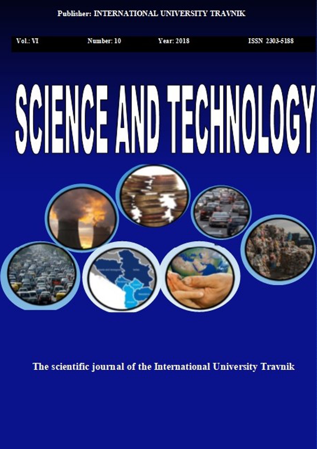
ANALYSIS OF FUNCTIONING PUBLIC TRANSPORTATION SYSTEM IN SUBURBAN AREAS

ANALYSIS OF FUNCTIONING PUBLIC TRANSPORTATION SYSTEM IN SUBURBAN AREAS

Author(s): Milan Stanković,Pavle Gladović,Vladimir Popović,Nada Stojanović / Language(s): English Issue: 10/2018

The existence of passengers in the public transport system puts extremely high demands on the organizers of this process, because any disturbance in the carriage of passengers reflects the satisfaction of the quality of transport services. The quality of public transport depends on the policy planning of the city development and mobility that is now developing. The main objective of the work is reflected in the presentation of the importance of a system of public transport and good connections lines for people who live in the peripheral areas of the city. Better access to the locations of jobs, the city center and other facilities is a priority towards sustainable development of the village. As a special part of this work will be presented research of counting of passengers in vehicles on suburban routes 33and 39 in Nis. Based on that graphical representations are made passenger flow by driving directions for each departure, taking into account the working day, saturday and sunday. They will also be given a description of the route of line with the basic data for the two lines. The results were analyzed, graphically presented and carried out on the basis of their conclusion.

More...
INDIKATORI EKO-EFIKASNOSTI U FUNKCIJI MJERENJA ODRŽIVOG RAZVOJA GRADOVA

INDIKATORI EKO-EFIKASNOSTI U FUNKCIJI MJERENJA ODRŽIVOG RAZVOJA GRADOVA

Author(s): Rade Biočanin,Tanja Milešević,Mirsada Begić / Language(s): Bosnian Issue: 5/2015

Often remains unknown how to apply and measure sustainable development into reality. 0ne way to measure the sustainable development of cities, is achieved by measuring the eco-efficiency. Ecoefficiency, two-dimensional indicator of sustainable development, is one of the ways in which sustainable development can be implemented at all levels. Assess the current eco-efficiency of the city means to answer the question: how effectively we use inputs (resources) in relation to the desired output (value to society) and what are the side effects (environmental impacts)? The paper describes three possible approaches to measuring the eco-efficiency of the city, and it means; sets of individual indicators for each of the three ecoefficiency (use of resources, pollution and social values), a set of indicators of eco-efficiency and ecoefficiency index. Application of the concept of eco-efficiency in urban areas means creating greater value for citizens, while reducing the use of resources and reduce waste and pollution

More...
USLOVI ZA RAZVOJ INTEGRISANE LOGISTIKE U MORSKOJ LUCI BAR

USLOVI ZA RAZVOJ INTEGRISANE LOGISTIKE U MORSKOJ LUCI BAR

Author(s): Mimo Drašković,Sanja Bauk,Željko Ivanović / Language(s): Montenegrine Issue: 4/2015

The paper considers the idea of attracting major international strategic partners (investors, shippers, logistics providers, bankers and other economic entities) in the Port of Bar. They would by their expertise, technologies and investments, contribute to the development of this port logistics and modernization of its infrastructure through increasing the depth of its basin and allowing the biggest ships to sail into it, along with the creation of inter-modal logistics and distribution centers in the narrower and wider hinterland. This should enable transport of huge amounts of Chinese and Korean goods through the Port of Bar to closer and wider region of Europe, with the possibility of developing cooperation and partnership with Adriatic ports. The starting basis are: a) the basic hypothesis that above mentioned would attract strong strategic partners and enable the inclusion of the Port of Bar in integrated logistics supply chain, and b) auxiliary hypotheses that this would consequently attract a significant part of import of Chinese and Korean goods into Europe, and increase competitive capabilities and advantages of the Port of Bar, throughout the economies of volume, increasing logistics service quality, reducing total logistics costs, and achieving greater level of the port’s added value and logistics services.

More...
Result 801-820 of 1301
  • Prev
  • 1
  • 2
  • 3
  • ...
  • 40
  • 41
  • 42
  • ...
  • 64
  • 65
  • 66
  • Next

About

CEEOL is a leading provider of academic eJournals, eBooks and Grey Literature documents in Humanities and Social Sciences from and about Central, East and Southeast Europe. In the rapidly changing digital sphere CEEOL is a reliable source of adjusting expertise trusted by scholars, researchers, publishers, and librarians. CEEOL offers various services to subscribing institutions and their patrons to make access to its content as easy as possible. CEEOL supports publishers to reach new audiences and disseminate the scientific achievements to a broad readership worldwide. Un-affiliated scholars have the possibility to access the repository by creating their personal user account.

Contact Us

Central and Eastern European Online Library GmbH
Basaltstrasse 9
60487 Frankfurt am Main
Germany
Amtsgericht Frankfurt am Main HRB 102056
VAT number: DE300273105
Phone: +49 (0)69-20026820
Email: info@ceeol.com

Connect with CEEOL

  • Join our Facebook page
  • Follow us on Twitter
CEEOL Logo Footer
2025 © CEEOL. ALL Rights Reserved. Privacy Policy | Terms & Conditions of use | Accessibility
ver2.0.428
Toggle Accessibility Mode

Login CEEOL

{{forgottenPasswordMessage.Message}}

Enter your Username (Email) below.

Institutional Login