Cookies help us deliver our services. By using our services, you agree to our use of cookies. Learn more.
  • Log In
  • Register
CEEOL Logo
Advanced Search
  • Home
  • SUBJECT AREAS
  • PUBLISHERS
  • JOURNALS
  • eBooks
  • GREY LITERATURE
  • CEEOL-DIGITS
  • INDIVIDUAL ACCOUNT
  • Help
  • Contact
  • for LIBRARIANS
  • for PUBLISHERS

Content Type

Subjects

Languages

Legend

  • Journal
  • Article
  • Book
  • Chapter
  • Open Access
  • Geography, Regional studies
  • Geomatics

We kindly inform you that, as long as the subject affiliation of our 300.000+ articles is in progress, you might get unsufficient or no results on your third level or second level search. In this case, please broaden your search criteria.

Result 501-520 of 583
  • Prev
  • 1
  • 2
  • 3
  • ...
  • 25
  • 26
  • 27
  • 28
  • 29
  • 30
  • Next
Wykorzystanie numerycznych modeli terenu w badaniach zmian środowiska geograficznego miasta Mysłowice

Wykorzystanie numerycznych modeli terenu w badaniach zmian środowiska geograficznego miasta Mysłowice

Author(s): Małgorzata Manowska,Maciej Szuba / Language(s): English Issue: 4/2015

The aim of the study is to demonstrate the usefulness of methods of analysis in GIS software, in broad studies of changes in the geographical environment of the city Myslowice. Geographical environment are created of natural and anthropogenic elements, concluded on maps for centuries. Assumed research method showed a very high possibility of using GIS software to analyze the changes, which took place in the town of Myslowice in the years 1883–1993. For this purpose, two digital elevation model (DEM) were generated by vectorization of izohips and altitude point. The first model was based on the old German Messtischblatt topographic maps at scale of 1:25 000 from the years 1883–1942. The second model was generated from Polish topographic maps at a scale of 1:10 000 from the year 1993. All these maps have been calibrated (registered) to a common coordinate system Poland 1992. Generating uneven-aged DEM also gave the opportunity to track changes in morphology on selected lines of cross-sections. Myslowice is a city of the Upper Silesian Coal Basin, in which the exploitation activity is dating back more than two hundred years. However, due to the limited number of maps the study only shows the effects of 110 years of exploitation. The usefulness of the method was confirmed in determining the precise areas of the city, which were hardest hit by the effects of mining activities. This fact was also verified in the field. As a result of the surface exploitation in several large quarries traces of underground mining operations are erased, but with a careful analysis they can be distinguished from each other. With GIS software and precise calibration of old maps is it possible to trace the changes in the components of the geographical environment, such as rivers, water reservoirs, roads, building development, afforestation. In addition, it enables the precise location of some elements of the environment that no longer exist such as old excavation of raw materials, sand, clay and limestone or traces of the former ironworks.

More...
Wykorzystanie programów QuantumGIS i SAGA GIS do budowy cyfrowego modelu wysokościowego zlewni Grajcarka

Wykorzystanie programów QuantumGIS i SAGA GIS do budowy cyfrowego modelu wysokościowego zlewni Grajcarka

Author(s): Grzegorz Wałek / Language(s): Polish Issue: 2/2013

In this paper use of 1:10 000 scale topographic maps and open-source GIS software to build Digital Elevation Model (DEM) with 5-meters resolution was analysed. DEM was built from contour lines vectorised in Quantum GIS using five different interpolation methods available in SAGA GIS: Ordinary Kriging, Ordinary Kriging with Block Kriging, Thin Plate Spline (Local), Thin Plate Spline (TIN), Multilevel B-Spline Interpolation. Special attention was given to the accuracy of DEM's built with those methods. DEM's were analyzed by crossvalidation of their surface with elevation points vectorised from topographic maps, which were not used in DEM interpolations. Correctness of generated drainage network was also investigated. Although construction of DEM in presented way is very time-consuming, it is often the only way to build high-resolution DEM of small catchments or other spatial units, which could be used in large-scale hydrological or geomorphological modeling.

More...
Ocena przydatności automatycznego wyznaczania linii szkieletowych terenu do analiz geomorfometrycznych

Ocena przydatności automatycznego wyznaczania linii szkieletowych terenu do analiz geomorfometrycznych

Author(s): Marcin Jaskulski,Aleksander Szmidt / Language(s): Polish Issue: 2/2013

The aim of following article is to present and evaluate possibility of automatic extraction of terrain skeleton lines using computational methods from Digital Elevation Model (DEM). Authors describe examples of morphological analysis in geomorphology, difficulty and time-consuming of executing of this kind of research using traditional, manual methods. Topography map of quaternary ground of Lodz Region has been analyzed. Firstly terrain skeleton lines were traced using traditional ways. After that lines were generated and analyzed by using ArcGIS software with ArcHydro and SpatialAnalyst extensions. Both of received maps were compared and evaluated.

More...
Integrated reporting vs. sustainability reporting for corporate responsibility in South Africa

Integrated reporting vs. sustainability reporting for corporate responsibility in South Africa

Author(s): Alexandra Clayton,Jayne M. Rogerson,Isaac Rampedi / Language(s): English Issue: 29/2015

Large corporates have come under increasing pressure to conduct their business in a more transparent and responsible manner. In order for business to fulfil its obligations under the ethic of accountability stakeholders must be given relevant, timely, and understandable information about their activities through corporate reports. The conventional company reports on annual financial performance, sustainability and governance disclosures often fail to make the connection between the organisation's strategy, its financial results and performance on environmental, social and governance issues. Recognising the inherent shortcomings of existing reporting models, there is a growing trend to move towards integrated reporting. South Africa has been one of the most innovative countries in terms of integrated corporate reporting. Since 2010 companies primarily listed on the country's major stock exchange have been required to produce an integrated report as opposed to the former sustainability report. The aim in this study is to review the development of integrated reporting by large corporates in South Africa and assess the impact of the required transition from sustainability reporting to integrated reporting on non-financial disclosure of eight South African corporates using content analysis of annual reports.

More...
Assessing accuracy of forest cover information on historical maps

Assessing accuracy of forest cover information on historical maps

Author(s): Urs Gimmi,Christian Ginzler,Matthias Müller,Achilleas Psomas / Language(s): English Issue: 146/2016

Assessing the uncertainty of historical map information is a prerequisite for using this source type for land cover reconstructions. We assessed the accuracy of forest cover information from 1930 / 1940 Swiss topographic maps (Siegfried maps) by comparing them with forest cover gained from orthophotos and terrestrial photos from the same period. Orthophotos were considered to contain the true forest cover information and consequently inconsistencies between historical maps and orthophotos were considered as true errors (over or underestimation of the forest cover on the map ). Terrestrial photos reflect the surveyors perspective in the field and we therefore used this source type to develop hypotheses on potential reasons for inaccuracy of map information. Generalized linear models were used to test the hypotheses. The results confirmed our expectation that disagreement between maps is more likely to occur near forest edges, at higher altitudes and in less accessible and visible areas. Contrary to our expectations terrain slope did not play a significant role to explain surprisingly high rates of inaccuracy occurred in forest core areas.

More...
Institutional Aspects for Improvement of the Current System for Real Property Appraisal for 
Tax Purposes in Moldova

Institutional Aspects for Improvement of the Current System for Real Property Appraisal for Tax Purposes in Moldova

Author(s): Olga Buzu / Language(s): English Issue: 22/2017

A new market value-based system for real property appraisal for tax purposes has been in the process of implementation in Moldova since 2004. The relevance and importance of such appraisal has been increasing with time, requesting improvements to the current mass valuation methodology and review of the roles played by diverse authorities and in particular by local governments, tax and cadastral authorities in property appraisal for tax purposes. The article presents a comparative analysis of diverse options for funding and handling mass real property valuation efforts. Suggestions have been developed to perform property revaluation intended to update databases and to expand the current tax base.

More...
Flood Vulnerability Usage for Flood Risk Assessment in the Republic of  Moldova

Flood Vulnerability Usage for Flood Risk Assessment in the Republic of Moldova

Author(s): Vasile Grama,Agostino Avanzi,Lucia Căpățînă,Enrico Frank,Vitalie Dilan / Language(s): English Issue: 21/2016

Vulnerability is the extent of harm, which can be expected under certain conditions of exposure, susceptibility and resilience. The most recent flood events in 2008 and 2010, occurred on the territory, demonstrated that the country is vulnerable to inundation. The concept of vulnerability covers three dimensions: social, economic, and environmental. In this paper the focus will be given on the economic dimension of the flood vulnerability. In the framework of the Management and Technical Assistance Support to Moldova Flood Protection Project a damage model was applied at a national scale using three land-use classes. Evaluation of economic damages has been performed using depth-damage curves for each land-use type. These depth-damage functions have been built taking into account data and functions found in literature and the particular characteristics of assets in Moldova.

More...

A GIS for the Pedological Soil Mapping of Popricani Area in Iasi County

Author(s): George Calin Baltariu,Constantin Bofu / Language(s): English Issue: 33/2022

The main purpose of the article aims in creating a GIS application for the pedological soil mapping of Popricani area in Iasi County with an eye to a further efficient utilisation of it by the end user, using web technologies, VBA and AutoLisp. Also the application includes an inventory of all the pedological data of the region. Other undertaken and proposed objectives are represented by creating an attribute database, relationing that database with graphic entities, making analysis, queries, thematic maps and creating a complex system that eases the end user experience and productivity.

More...

Maps Reflecting Population Displacement Caused by War

Author(s): Doina Vasilca / Language(s): English Issue: 33/2022

Using a series of maps rendered via ArcGIS Pro, the present article aims to make a comparison of the number of Ukrainian refugees fleeing the war between Russia and Ukraine during 2022 and the number of Arab refugees who left their countries between the years 2011 and 2021, following the so-called “Arab Spring” conflicts. The techniques used for creating the maps included dot and bivariate dot density mapping, as well as a bivariate color and chart symbol mapping. For an improved highlighting of the represented phenomenon, it was proposed to have it symbolized by dots of similarly colored shades, from the lightest to the darkest, depending on the number of refugees hosted by each country. The resulting maps are intended for the general public to provide an overview of the population displacement caused by war.

More...

UAV Technology Used for Monitoring a Mining Site

Author(s): Carmen Daniela Ioana Borza,Andreea Ramona Begov-Ungur,Silvia Alexandra Dreghici / Language(s): English Issue: 33/2022

Surveying technology currently offers us a multitude of benefits and can be used in many fields of activity to create a more efficient way of working for people. This project aims to describe the process of 3D reconstruction of a mining site with UAV technology. The first step means performing the actual flight in the targeted perimeter with a drone (or UAV – unmanned aerial vehicle) equipped with a camera to capture images of a site from different vantage points. Out of these images, a photogrammetry software can recreate geo-referenced 3D maps of the mining site. The processing of the cloud of points collected with the help of the drone is an important step of this project. Mining operators can also easily extract the precise volume of stockpiles or areas to be excavated. By providing thousands of data points for one stockpile, drone surveys are far more accurate than surveying with total stations.

More...
Visual Viewshed Simulation: Applying a 3D environment in archaeological research at Faysaliyya (southern Jordan)

Visual Viewshed Simulation: Applying a 3D environment in archaeological research at Faysaliyya (southern Jordan)

Author(s): Jacek Karmowski / Language(s): English Issue: XXXI/2022

The shift from presenting and analyzing threedimensional data in 2D to displaying and analyzing them in a 3D environment is becoming increasingly prevalent in archaeological practice. This approach opens new possibilities, such as a 3D virtual reality, that archaeologists can take advantage of. This paper presents an application of the Visual Viewshed Simulation, a 3D virtual reality tool for (re)constructing the visibility of objects in the field, taking into account factors such as atmospheric and lighting conditions. This approach can provide a new way to research people–place relations and may be particularly useful in landscape archaeology.

More...

LANDSCAPE DYNAMICS IN THE SOMEȘ CORRIDOR. CASE STUDY: GURUSLĂU DEPRESSION (ROMANIA)

Author(s): Andreea Costea,Viorel Gligor,Ioan-Aurel Irimus / Language(s): English Issue: 1/2022

Changes in land use patterns induced by different agricultural practices are reflected territorially through transformations at the level of elementary landscape units, with an impact on territorial identity and cohesion. The aim of this study is to highlight the dynamics of the territorial structures in the post-communist period (1990-2018), diachronically reflected in the transformations of the landscape of the Guruslău Depression, using the landscape metrics. The main direction of the scientific research was based on the analysis of land use changes and the identification of the spatial elements of structural-landscape distinction with impact on land degradation process. The evaluation of the landscape dynamics in the current context uses several effective metrics and tools, which increasingly require the identification of interdisciplinary methods of analysis, with a decisive impact on territorial development. Besides, the present approach is also motivated by the increasing environmental impact of climate change. The methodology used in the present paper is based both on the geoprocessing of vector data using GIS tools and correlated spatial analysis, and on the identification of landscape types using a new process of reclassifying land use categories, according to a set of landscape definition variables. The results of the research highlighted both the particularities of landscape transformations that occurred in the reference interval, as well as the favourable conditions for addressing biocultural diversity, by identifying traditional agricultural practices and the resilience of geographical landscapes given the adaptation to changing development strategies. Meanwhile, by detecting the landscape structures affected by change, in correlation with the impact induced on the biodiversity of the territory, the present study has a wide applicability in the most appropriate implementation of local development policies, as well as in identifying the forms of sustainable valorisation of the landscape in the study area.

More...
Advanced Geomorphological Analysis of Erosion Dynamics at Făgetu Ierii: Integrating UAV Techniques and GIS for Enhanced Precision.

Advanced Geomorphological Analysis of Erosion Dynamics at Făgetu Ierii: Integrating UAV Techniques and GIS for Enhanced Precision.

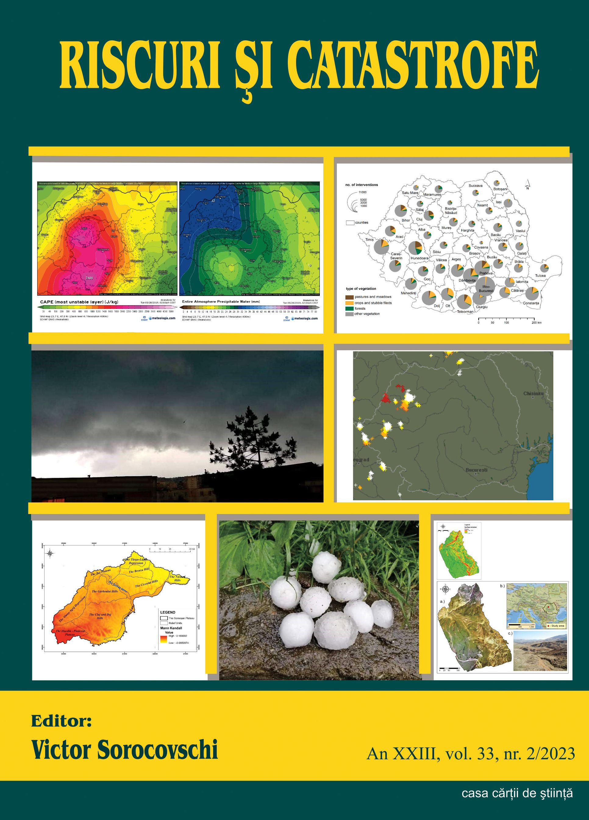
Author(s): Gheorghe M. Rus,Gheorghe Roșian,Ștefan Bilașco,Rozalia Benedek,Csaba Horváth / Language(s): English Issue: 2/2023

This article delves into the realm of high-resolution geomorphological analysis, with a particular focus on soil erosion assessment. To achieve a more precise analysis of surface erosion, our study selected the former quartz sand exploitation site at Făgetu Ierii, in the Iara commune. This location serves as a focal point for studying various geomorphological processes, including landslides and gully formation, characterized by their significant intensity. Traditional methods for monitoring erosion dynamics involve substantial investments in both human effort and technical resources. This entails on-field tasks such as identification and detailed measurements, as well as office-based activities involving mapping and spatial analysis. Recognizing the challenges associated with these conventional approaches, our research explores more efficient methods that harness rapidly evolving modern technology. In this pursuit, the adoption of Unmanned Aerial Vehicle (UAV) techniques and methodologies appears as particularly promising. UAVs facilitate the creation of comprehensive databases capturing the three-dimensional (3D) structure of the terrain within the study area. The advantages are multifaceted: UAVs significantly reduce the time and costs associated with fieldwork while simultaneously enhancing the precision and accuracy of digital databases. These databases play a pivotal role in conducting spatial analysis within Geographic Information Systems (GIS), allowing for a more accurate identification of the impact and risk factors present in the territory. This study underscores the transformative potential of UAV technology in advancing geomorphological analysis, enhancing our understanding of erosion processes, and supporting sustainable land management practices in areas vulnerable to erosion due to both natural and human-induced factors.

More...

Application of Geodesic Determination Methods Using 3D Terrestrial Scanning in Monitoring Saline Areas Subject to Landslides

Author(s): Nicolae Ion Babuca,Alin Croitoru,Aurel Călina,Jenica Călina,Marius Miluț / Language(s): English Issue: 36/2024

3D modeling allows the creation of three-dimensional models of the shape,surface or objects with the help of the computer and dedicated software, as a result 3Dmodeling makes product design much more efficient. Using 3D modeling, specialists fromdifferent fields of activity can walk through a virtual project model before it is built. Accurate3D modeling of various projects helps estimate project costs. The use of 3D modeling forconstruction and architectural design allows the architect to make constant changes as the3D model is developed and apply changes to suit the requirements, resulting in not only abetter finished design, but also a more efficient use of materials used.

More...

Accuracy Evaluation of Products Based on UAV Data Processed Using Different Approaches

Author(s): Iuliana Cuibac,Iuliana Maria Pârvu,Adrian Grigore Pârvu / Language(s): English Issue: 36/2024

The Unmanned Aerial Vehicle (UAV) is an aircraft designed to operate without a human on board. The main advantages of UAVs in photogrammetry are the possibility to acquire very high resolution imagery, but the most important limitation is represented by the area covered in time unit. The SfM algorithm, coupled with the advancements in UAV photogrammetric processes, have significantly enhanced the efficiency, accuracy, and accessibility of aerial mapping using UAVs. This paper gives an overview of the proper workflow with data acquired with photogrammetric sensor (Aeria X) mounted on an eBee SenseFly UAV and a comparison between the products (dense image matching point cloud, digital surface model, and orthophoto) obtained using the most known software: Pix4D Mapper (developed by the company Pix4D) and Metashape (developed by the company Agisoft LLC). In the study case, GCPs are used in the bundle adjustment, in order to generate better quality products. The quality is evaluated by computing metrics, like root mean square errors, but also in a relative manner by measuring distances between different products with Iterative Closest Point method.

More...

Usage of GIS in Integrating Spatial Data for Dumbrăvița Territorial Administrative Unit, Maramureș County, Romania

Author(s): Iulius Eduard Keller,Ovidiu Ștefan / Language(s): English Issue: 36/2024

Due to the necessity to integrate, administer, and interpret, with the utmost efficiency, a large volume of data, as well as due to the rapid development of information technologies, Geographic Informational Systems (GIS) prove their necessity and utility for several domains that deal with spatial information. The paper at hand presents a case study which aims to integrate all needed cadastral and topograhic data for Dumbrăvița Territorial Administrative Unit, Maramureș county, Romania. The goal is to present the utility and efficiency of GIS in such cases, in order to make the correct decisions.

More...

Monitoring Deforestation in the Administrative Territory of Curățele Commune Using Sentinel Satellite Data and GIS Processing and Interpretation Algorithms

Author(s): Cătălin Sabou,Ioana Pop,Florica Matei,Jutka Deak,Simion Bruma,Tudor Sălăgean / Language(s): English Issue: 36/2024

Considering the ongoing deforestation around the Apuseni Mountains, particularly in the Curățele commune of Bihor county, a comparative study between the years 2017-2022 was deemed necessary. Using GIS processing and interpretation algorithms, a multi-temporal analysis of satellite data sets enabled the visualization of deforestation on a large scale, aiding in monitoring its negative effects. To understand the area's topography, a digital elevation model was analyzed and correlated with the remote sensing data to assess the impact of deforestation on land characteristics, such as water drainage patterns, increased erosion risk, and loss of local flora and fauna. Moreover, by identifying yearly changes in the forest landscape, proactive measures can be taken to prevent further environmental damage or degradation.

More...

Considerations on Advanced GNSS Data Processing Techniques

Author(s): Ileana Spiroiu,Vlad Sorta,Mihaela-Simina Puia,Livioara Brașovanu,Iulian Banciu / Language(s): English Issue: 36/2024

The development of GNSS permanent stations networks at national or regional level has led to the need to integrate them into European and international networks. This involves calculating the coordinates of GNSS antennas in ETRF and ITRF systems with high precision, and this can only be achieved by performing observation compensation calculations with scientific GNSS data processing software. In this context, the certification of the coordinates of the antennas of the stations in the National GNSS Network by the European specialized forum, at EUREF – EPN, represents the last step to be taken, in order to fully integrate the Romanian Position Determination System – ROMPOS into the European network.

More...

The Importance of Topographic Works in the Elaboration of a General Urban Plan

Author(s): Ioan Ienciu / Language(s): English Issue: 36/2024

Along with the development of cities and communes, the problem of corroborating the expansion and exploitation of land was introduced, simultaneously with that of land development. Thus, through technical regulations, a unitary assurance of the framework for the development of the General Urban Plan at the level of urban and rural localities was established, both for intra-village areas and for extra-village lands.The possession of General Urban Plans approved under the law is mandatory for all urban and rural localities in the country and is absolutely necessary in case of investments of interest or public utility major such as: modernization of road infrastructure, expansion of the urban area and water infrastructure, sewerage and natural gas, etc.

More...

Mathematical Model for Processing Two-Dimensional Geodetic Networks Using Classical and Satellite Technologies

Author(s): Lucia Melania Ionescu,Andrei Șerban Ilie,Marin Plopeanu / Language(s): English Issue: 37/2024

GNSS technology has increasingly gained traction in the field of geodesy due to its numerous advantages. This paper proposes a case study where this technology was used to perform measurements on a geodetic network at the Râușor Dam between certain points where there were obstacles to performing measurements using the classical method (due to the positioning of the points, existing vegetation, or even the dam itself).To achieve the best possible ratio between the true value of the measured quantity and the obtained value, the data acquired from the network was processed to adjust for the inevitable errors that occur during the measurement process. Using the initial coordinates, the distances and orientations between the measured points were calculated. To formulate the correction equations and establish weights, coefficients for directions and distances were calculated, along with the variation in orientation and distance as a function of variations in planar coordinates and the free term, which are necessary elements. For the normalization of the linear equation system and solving the normal system, the matrix of the normal system N and its inverse Q were calculated, followed by calculating the vector of unknown parameters. With these elements, the necessary corrections for the measurements were calculated, resulting in the most probable coordinates of the new points.The novelty of this mathematical model lies in the combination of classical and satellite measurements by introducing a transformation parameter regarding rotation into the adjustment process. To verify if the adjusted elements meet the conditions of the functional model, a control of the results is performed after the adjustment. To conclude the observation processing, calculations for evaluating precision indicators are carried out, followed by the graphical representation of the error ellipse, which indicates the confidence domain in the 2D position of a point. Finally, the results obtained after processing the network are presented, including the most probable coordinates of the new points, the precision estimates of the unknown parameters, and the elements of the obtained ellipses.The case study demonstrated how GNSS technology offers advantages in this field (such as the lack of necessity for visibility between points), but also disadvantages, such as the lower precision of GNSS measurements compared to those made using classical methods. GNSS measurements are redundant, providing, in some cases, the ability to detect errors in the adjustment of classical measurements.

More...
Result 501-520 of 583
  • Prev
  • 1
  • 2
  • 3
  • ...
  • 25
  • 26
  • 27
  • 28
  • 29
  • 30
  • Next

About

CEEOL is a leading provider of academic eJournals, eBooks and Grey Literature documents in Humanities and Social Sciences from and about Central, East and Southeast Europe. In the rapidly changing digital sphere CEEOL is a reliable source of adjusting expertise trusted by scholars, researchers, publishers, and librarians. CEEOL offers various services to subscribing institutions and their patrons to make access to its content as easy as possible. CEEOL supports publishers to reach new audiences and disseminate the scientific achievements to a broad readership worldwide. Un-affiliated scholars have the possibility to access the repository by creating their personal user account.

Contact Us

Central and Eastern European Online Library GmbH
Basaltstrasse 9
60487 Frankfurt am Main
Germany
Amtsgericht Frankfurt am Main HRB 102056
VAT number: DE300273105
Phone: +49 (0)69-20026820
Email: info@ceeol.com

Connect with CEEOL

  • Join our Facebook page
  • Follow us on Twitter
CEEOL Logo Footer
2025 © CEEOL. ALL Rights Reserved. Privacy Policy | Terms & Conditions of use | Accessibility
ver2.0.428
Toggle Accessibility Mode

Login CEEOL

{{forgottenPasswordMessage.Message}}

Enter your Username (Email) below.

Institutional Login