Author(s): Vladimir Agrigoroaei / Language(s): English
Issue: 6/2022
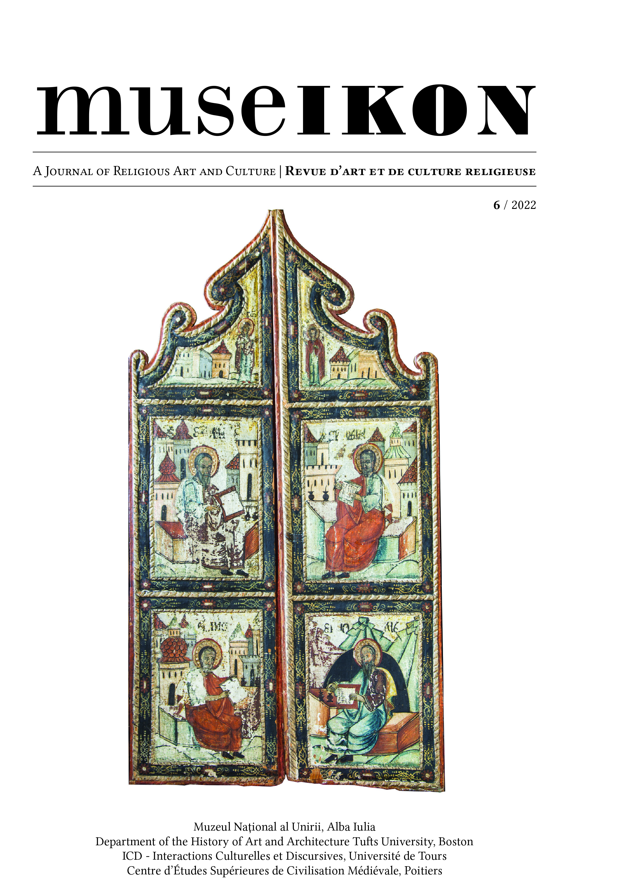
Après avoir reconfirmé la datation de Camille Enlart (vers 1421 ou 1421-1424) et identifié le comman-ditaire (l’évêque de Limassol Barthélemy Gui) dans une inscription fragmentaire, la présente étude explore: d’une part, les modèles des inscriptions en langue vernaculaire française de Pyrga (Chypre); d’autre part, la lo-gique du programme iconographique et le contexte culturel que sous-tend cette dernière. Dans la première par-tie, l’analyse des inscriptions de la chapelle prouve que le concepteur du décor peint a suivi un modèle manuscrit, sans doute un psautier avec un grand cycle d’enluminures. L’étude évoque trois termes de comparaison célè-bres: le Psautier de la reine Ingeburge (Chantilly, Bibliothèque du Musée Condé, 9 – tournant du xiiie siècle), le psautier de l’évêque Henri de Blois (Londres, British Library, Cotton Nero C iv – vers 1160) et le livre d’images de Marie de Rethel (Paris, Bibliothèque nationale de France, n. acq. fr. 16251 – vers 1285). Dans la source manuscrite reconstituée, les inscriptions en ancien français étaient probablement transcrites en tant que tituli, d’après une typologie tripartite: noms de fêtes religieuses, groupes nominaux ayant une fonction analogue et légendes sous forme d’énoncés introduits par l’adverbe coument. La langue des inscriptions de Pyrga, un français d’Outremer, présente les traits particuliers des scriptae chypriotes de la fin du Moyen Âge. De plus, on constate que la déco-ration de la chapelle inscrit le monument de Pyrga dans la catégorie des chapelles royales de l’Europe occidentale (xive et xve siècles). Le transfert du codex à la paroi concerne non seulement les images, mais également les textes qui accompagnent ces dernières. L’auteur s’intéresse ensuite à la disposition symétrique de la décoration dans les deux travées de la chapelle, ainsi qu’à la manière dont cette disposition accentue l’Uniatisme catholique-orthodoxe. La logique dos-à-dos de la décoration émule celle des icônes à double face – termes de comparaison directs pour la chapelle – notamment leur choix d’apparier deux scènes : la Crucifixion / la Mère de Dieu. Le con-cepteur du décor peint souhaitait évoquer l’osmose de deux églises: une église latine, orientée vers l’Est; la sug-gestion d’une église byzantine, orientée vers l’Ouest. Cela explique le choix particulier de la décoration des voûtes (christologique pour la travée Est et mariale pour la travée Ouest), la double représentation de l’An-nonciation (pour marquer l’orientation des deux églises) et le choix d’une composition de type pala d’altare pour la paroi Est, tandis que la paroi Ouest imite la décoration des templons byzantins. L’osmose des deux églises est indiquée de manière encore plus claire par le choix de représenter les martyriums des saints Étienne (signifiant l’Orient) et Laurent (signifiant l’Occident) au-dessus des entrées latérales. Ce serait une allusion à l’osmose des corps de ces saints dans la Coniunctio corporum sanctorum Stephani et Laurentii (bhl 4784b). Après une réévaluation du texte fragmentaire (aujourd’hui perdu) de l’inscription dédicatoire, il est évident que la dédicace proprement dite concernait l’Assomption de la Vierge. Qui plus est, l’osmose Est-Ouest était de nou-veau indiquée par la représentation dans un même cadre de la Dormition de la Mère de Dieu (sujet à connotation byzantine) et du Couronnement de la Vierge (thème occidental par excellence). Les textes littéraires des xive et xve siècles confirment la fixation chypriote de l’appariement de la Mère de Dieu avec la Passion du Christ, de même que plusieurs autres choix de la décoration de Pyrga. La signification de la décoration devait être multiple, en rapport avec la triple utilité du bâtiment: chapelle funéraire (pour Barthélemy Gui), chapelle royale (pour le couple Janus de Lusignan-Charlotte de Bourbon) et point d’entrée au monastère de Stavrovouni, qui hébergeait des reliques de la Sainte Croix.
More...