Cookies help us deliver our services. By using our services, you agree to our use of cookies. Learn more.
  • Log In
  • Register
CEEOL Logo
Advanced Search
  • Home
  • SUBJECT AREAS
  • PUBLISHERS
  • JOURNALS
  • eBooks
  • GREY LITERATURE
  • CEEOL-DIGITS
  • INDIVIDUAL ACCOUNT
  • Help
  • Contact
  • for LIBRARIANS
  • for PUBLISHERS

Content Type

Subjects

Languages

Legend

  • Journal
  • Article
  • Book
  • Chapter
  • Open Access
  • Geography, Regional studies
  • Physical Geopgraphy

We kindly inform you that, as long as the subject affiliation of our 300.000+ articles is in progress, you might get unsufficient or no results on your third level or second level search. In this case, please broaden your search criteria.

Result 941-960 of 1301
  • Prev
  • 1
  • 2
  • 3
  • ...
  • 47
  • 48
  • 49
  • ...
  • 64
  • 65
  • 66
  • Next
From village to city through maps: historical cartographic materials as an information source on 20th century environmental changes due to urbanisation in Poland

From village to city through maps: historical cartographic materials as an information source on 20th century environmental changes due to urbanisation in Poland

Author(s): Kamil Nieścioruk / Language(s): English Issue: 31/2016

The article presents the use of historical Polish post-war topographic maps and their usefulness in the detection and assessment of environmental changes caused by 20th century urbanisation. The case study area is the Polish city of Lublin. Two main research questions are defined and answered. The first is what kinds of maps can be used to trace environmental changes as well as to find the present-day remains of past environments and what is the reliability of these maps? Several series of topographic maps are used here together with aerial photography. The second research question is what changes can be found by comparing spatial sources and what features can be found today with the help of early maps. The main features investigated in this section are linear (road networks) and areal (orchards) supplemented with point features of various kinds (trees, wells, shrines). The quality of cartographic information is assessed and remnants of the past environment are discovered.

More...
Zróżnicowanie dopływu promieniowania słonecznego do południowej części Wyżyny Krakowsko-Częstochowskiej w latach 2008 – 2014

Zróżnicowanie dopływu promieniowania słonecznego do południowej części Wyżyny Krakowsko-Częstochowskiej w latach 2008 – 2014

Author(s): Zbigniew Caputa / Language(s): Polish Issue: 147/2016

The object of this study was the actual inflow of short-wave solar radiation ( K↓ ) to the plateau and the bottom of a canyon in the southern part of the Kraków-Częstochowa Upland. Its diurnal and annual variability was expressed in hourly, daily, monthly, seasonal and annual K↓ totals from the years 2008 – 2014. The K↓ flux was measured using CM3 ( 305 – 2800 nm ) sensors. Great diversity of the terrain, varied landforms, expositions and slopes, big denivelations, and also the diversity of land cover and land use makes this small area very diversified as far as radiation conditions are concerned. On the basis of the actinometrical study the differences in radiation were assessed on two different landforms: plateau and the bottom of a canyon. The mean daily value of the total K↓ in the analysed period amounted to 10.8 MJ • m–2 on the plateau and 9.1 MJ • m–2 at the bottom of the canyon. The mean annual total K↓, in he studied multi-year period amounted to 3955 MJ • m–2 and 3312 MJ • m–2 , respectively.

More...
PROSPECTĂRILE GEOMAGNETICE DE LA SCÂNTEIA

PROSPECTĂRILE GEOMAGNETICE DE LA SCÂNTEIA

Author(s): Cornelia-Magda Lazarovici,Carsten Mischka / Language(s): English,Romanian Issue: 1/2016

Over the time several magnetic prospectings have been performed for the investigation of the site: 1993-1994, M. Ghiţă, G. Manea; 2001-2004, Fl. Scurtu; 2007, 2015, C. Mischka; 2008, D. Micle, L. Măruia. Some of the magnetic anomalies have been verified through excavations (Surfaces I-VII/1995-2005). According to the last magnetic prospecting the site includes a very complex defensive system; two ditches surround an area of 6ha (external ditch) and respectively 4ha (internal ditch). Moreover, in the southern part another ditch has a parallel route with the two mentioned ditches. On the S and W part this ditch seems to have had a 5-8m width, while the others 3-5m. This outermost ditch does not have a clear outline on the N part. In the middle of the external ditch there is an entrance (6-7m) bordered by two parallel edges, 15m long, permitting the access. If to these ditches we add the defensive wall(crossed by our excavations in 2005), and the possible palisade (Fig. 10), as well as the entrance, we can consider the settlement as a real fortress. In the inner ditch (enclosing 4ha) 55 dwellings with massive fired clay structures have been identified; we should also consider some unburned dwelling with rectangular foundation ditches which have not given enough signals to be integrated into magnetograms.

More...
THE TERRITORY ON THE RIGHT BANK OF THE DRAVA BETWEEN MARIBOR AND PTUJ IN MISCELLANEOUS SOURCES FROM THE 17TH AND 18TH CENTURY

THE TERRITORY ON THE RIGHT BANK OF THE DRAVA BETWEEN MARIBOR AND PTUJ IN MISCELLANEOUS SOURCES FROM THE 17TH AND 18TH CENTURY

Author(s): Matjaž Grahornik / Language(s): English Issue: 13/2017

The paper presents the area between two towns, Maribor and Ptuj, located on the right bank of the river Drava during the (late) 17th century until the end of the 18th century. Data obtained from the oldest preserved parish registers of the Dravsko polje area (i.e. parishes Hoče, Slivnica, Hajdina and Spodnja Polskava) and Maribor town parish give the paper an added value. All registers are from the 17th century. The paper addresses (the beginnings of) rafting on the Drava river and also the (interrelated?) number of illegitimate children in the area. This part of the Drava stream used to represent the boundary between the dominions Vurberk (Wurmberg; on the left bank) and Ravno polje (Ebensfeld; on the right bank). Drava’s stream was a lot wilder in the past. After it reached the village of Zlatoličje (Goldorf), its stream gradually slowed down and began to accumulate gravel and sand. However, the river frequently flooded the area up to Zlatoličje, which caused the constant change of its stream, formation of lethargies and new small islands of land. Arrangements between the dominions, concluded in a certain period, soon became invalid due to the constant changes of the riverbed. Cultivation of the soil near the river required special agreements on both sides. The lack of proper arrangements among the owners of the land soon led to the increasing disputes. These are particularly reflected in the murder of the Vurberk landowner count Georg Günther Herberstein. The peasants of dominion Ravno polje killed him on 31 May 1677. The murder happened after count Georg and his subjects wanted to remove the dyke of Loka creek because it supposedly limited his rights for fishing and hunting.

More...
»OSTAVLJAJTE SVE, A SPAŠAVAJTE GOLI ŽIVOT« - (OSVRT NA PLAVLJENJA DRAVE OD 18. STOLJEĆA DO 20. STOLJEĆA)

»OSTAVLJAJTE SVE, A SPAŠAVAJTE GOLI ŽIVOT« - (OSVRT NA PLAVLJENJA DRAVE OD 18. STOLJEĆA DO 20. STOLJEĆA)

Author(s): Zlata Živaković- Kerže / Language(s): Croatian Issue: 13/2017

Based on the archive material, published chronicles and literature, the author follows the flooding of the Drava in Slavonia and Baranja from 18th to 20th century. High levels of water and a chaotic condition was particularly emphasized by the chronicler’s remark dating to early 19th century: »Leave it all and save the very life«. The paper describes the consequences of the floods on the economy and the water traffic of the area, and reflects on embankment works, in most cases unsuccessful defense attempts in building embankments, dikes and causeways.

More...
GRAD U DRAVI - POPLAVA DRAVE U OSIJEKU 1965. GODINE

GRAD U DRAVI - POPLAVA DRAVE U OSIJEKU 1965. GODINE

Author(s): Hrvoje Pavić / Language(s): Croatian Issue: 13/2017

From its beginning, 1965 was an exceptionally rainy year, which caused the rise in water lever of the rivers Danube and Drava. Osijek is a city that is located on the Drava river, 22km away from the mouth of the Danube. This is why the life of the city, which is also known as The City on the Drava, is inherently connected with the river. During the 20th century, the Drava flooded Osijek for four times – in 1926, 1954, 1965 and 1972. This research is concerned with the flood which happened in 1965. During the given period (May and June, 1965) Osijek daily news, The Voice of Slavonia ‘Glas Slavonije’, provides daily reports on the following: water level of the Drava river in Osijek, situation at the river bank and flood defense plans. The research is based on reconstruction of flood defense and residents’ fate based on the Voice of Slavonia’s texts as well as on the archive resources found in the Office for Urbanization of the Osijek District. The emphases is placed on the threatened Osijek settlements and their residents. The effects of the flood are migrations from the threatened areas into newly built settlements and the construction of a modern riverbank fort, which enabled Osijek to become more actively involved in the life of the river.

More...
POPLAVA, ZEMLJOTRES, SMOG: PRILOZI EKOHISTORIJI BOSNE I HERCEGOVINE U 20. STOLJEĆU,

POPLAVA, ZEMLJOTRES, SMOG: PRILOZI EKOHISTORIJI BOSNE I HERCEGOVINE U 20. STOLJEĆU,

Author(s): Dina Pašić,Ema Pašić / Language(s): Croatian Issue: 13/2017

Review of: "Poplava, zemljotres, smog: prilozi ekohistoriji bosne i hercegovine u 20. Stoljeću"; Collective work, Book III; Udruženje za modernu historiju/udruga za modernu povijest (umhis), sarajevo, ed. Amir duranović, sarajevo, 2017, 194. by: Ema Pašić and Dina Pašić

More...
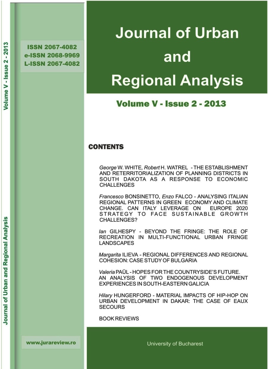
MATERIAL IMPACTS OF HIP-HOP ON URBAN DEVELOPMENT IN DAKAR: THE CASE OF EAUX SECOURS

MATERIAL IMPACTS OF HIP-HOP ON URBAN DEVELOPMENT IN DAKAR: THE CASE OF EAUX SECOURS

Author(s): Hilary Hungerford / Language(s): English Issue: 2/2013

The creative city has emerged as a driving force in urban studies in both academic and urban planning realms. Increasingly, scholars are interrogating these ideas of the creative city and the creative class as to their political implications and applications to cities around the world. This paper focuses on the role of the artist in urban development through the case study of one hip-hop group from the Pikine neighborhood of Dakar. Pikine, a poor neighborhood on the outskirts of the city, is one of many neighborhoods prone to seasonal flooding. Where city government programs of flood alleviation failed to produce positive results, the hip-hop artists have succeeded to organize and work against flooding. The artists imagined a better urban future from the point of view of disadvantaged neighborhoods, and organized the community to make real, material impacts on the city.

More...
Obnovljivi izvori energije u Bjelovarsko-bilogorskoj županiji

Obnovljivi izvori energije u Bjelovarsko-bilogorskoj županiji

Author(s): Nikola Čupin / Language(s): Croatian Issue: 6/2012

Current trends regarding power supply are moving towards a change of policy in order to achieve the following aims: (1) energy saving by increasing energy efficiency; (2) increased using of renewable energy sources; and (3) reducing the emission of greenhouse gasses (environment protection). The Croatian energy strategy supports this policy. The production of electric energy from renewable sources is stimulated, and the same is expected in relation to the production of thermal energy from renewable sources. The paper describes the types and characteristics of the following renewable sources: wind, water, solar energy, biomass and biogas, as well as geothermal sources. The Bjelovar-Bilogora County is rich in biomass and geothermal sources. The Bjelovar Forest Administration covers seven counties and an area of 133,000 ha. The geothermal source Velika Ciglena is located in the County; a geothermal energy plant (with the power of approximately 4 MW is planned to be built there. Possibilities for the economic development of the county based on renewable sources, in particular biomass and geothermal sources, are favourable; plans should be made at the county level and private initiative, which is still very young, should be stimulated. E.g. the wood-processing industry in Čazma provides thermal energy from biomass to the school and the gym, and an extension of heating pipe to the city centre is planned.

More...
Przebieg temperatury zim na obszarze Polski w latach 1720–2015

Przebieg temperatury zim na obszarze Polski w latach 1720–2015

Author(s): Anna Styszyńska,Andrzej A. Marsz / Language(s): Polish Issue: 155/2018

The work discusses the air temperature course of winter periods (December–March) in Poland in the years 1720–2015. The analysis is carried out for area mean values calculated from 5 stations: Szczecin, Wrocław, Warsaw, Wilno and Lwów. The time series of the mean area winter temperature (hereinafter PLZ) consists of combined observational (140 years) and reconstructed (156 years) data. The PLZ reconstruction is based on independent variables, i.e. the values of the maximum area of the Baltic Sea covered with ice in a given ice season and the monthly temperatures in January and March from the Central England Temperature (CET) data set.

More...
Chemical composition of utility water in the arid climate zone on the examples of Kébili and Medenine regions (southern Tunisia)

Chemical composition of utility water in the arid climate zone on the examples of Kébili and Medenine regions (southern Tunisia)

Author(s): Karolina Sobczak-Szelc,Beata Latos,Anna Szczucińska,Rafał Kozłowski,Krzysztof Skocki / Language(s): English Issue: 155/2018

Areas located within the hot, arid zone are characterized by extremely low availability of fresh water. In the Tunisian regions of Kébili and Medenine, deep-water sources and connate groundwater constitute its main sources. Surface waters, as well as shallow groundwaters found in those areas, are affected by a high level of salinity, which significantly reduces their use for either drinking or agriculture. Due to intensifying droughts the rainwater accumulation system, neither fulfils the needs of residents nor the developing agriculture. Waters in the oases of El Faour (Kébili) and Beni Kchedeche (Medenine) were analyzed in 2017 to find out their chemical composition, as well as their suitability for irrigation. The chemical composition of the investigated waters is dominated by the Na+, Ca2+, Cl– and SO4 3– ions.

More...
ПРИЛОЖЕНИЕ ЗА ОБРАБОТВАНЕ НА ХИДРОМЕТРИЧНИ ДАННИ

ПРИЛОЖЕНИЕ ЗА ОБРАБОТВАНЕ НА ХИДРОМЕТРИЧНИ ДАННИ

Author(s): Blagovest Pizhev,Emil Hadzhikolev / Language(s): Bulgarian Issue: 1/2018

The paper presents the work on building the HydroAnalyzer software application for storage and analysis of hydrometric data. It describes the software architecture model tailored to the specific ways of collecting and storing hydrometric data. The paper examines the application components and the main sequences of their use. The implemented functionalities include processing and comparison of hydrometric data, graphical and tabular data presentation, analysis and notifications of incorrect data. Future development of HydroAnalyzer is directed towards simultaneous analysis of multiple heterogeneous data sources and predicting

More...
Originile conectivităţii infrastructurii verzi în planificarea urbană

Originile conectivităţii infrastructurii verzi în planificarea urbană

Author(s): Oana Catalina Popescu,Alexandru-Ionuţ Petrişor / Language(s): Romanian Issue: 1/2020

Urban ecology sees today the city nature as a green infrastructure providing ecosystem services to the urban dwellers, contributing to their welfare and a sustainable urban development. However, the concepts included in this view are not as new as it seems. Ecosystem services are just a reiteration of the ecological economy view of nature as a natural capital providing goods and services to the human society. Similarly, although increasing attention has been paid lately to the green infrastructure and its role in addressing challenges faced by the modern society, including the mitigation of climate change effects, it is less known that the concept, that started being used relatively recently, in the ‘90s, has emerged at the end of the 21st century in the works of the prominent landscape architects and urban planners Frederick Law Olmsted and Ebenezer Howard. They argued in their projects, revolutionary for that time, for the need to combat urban sprawl through a strategic planning of vegetated systems and corridors, known today as “green infrastructure”. The designed components of the systems of urban parks and green spaces are similar to those of the “green infrastructure”, consisting of nodes (core areas/hubs) and connections. The relationship between nature and human well-being (known today as “ecosystem services”) and sustainability was also anticipated by their woks. Most importantly, these early researches demonstrated that the green infrastructure is not optional, but must be strategically devised, holistically planned, and properly managed. This work aims to revisit the old works from a modern perspective.

More...
О ВРЕМЕНИ ФИКСАЦИИ ГИДРОНИМА «СЫРДАРЬЯ» В ИСТОРИЧЕСКИХ ИСТОЧНИКАХ

О ВРЕМЕНИ ФИКСАЦИИ ГИДРОНИМА «СЫРДАРЬЯ» В ИСТОРИЧЕСКИХ ИСТОЧНИКАХ

Author(s): Nurlan A. Atygayev,Omirbek Hanayi / Language(s): Russian Issue: 01 (36)/2020

In the presented article, the issue of the time of fixation of the well-known hydronym «Syr Darya» in written historical sources is considered. The Syr Darya River is one of the main (in length and water content) rivers of Central Asia. It flows through the territory of several post-Soviet countries — Tajikistan, Uzbekistan and Kyrgyzstan, but the bulk of the river is located on the territory of Kazakhstan. The Syr Darya River is one of the most frequently mentioned hydronyms in the Muslim historical and geographical literature of the late Middle Ages and the New Age. In these written works, the river is referred to under various names: Seykhun, Khojend River, Shakhrukh River, Shash River and Akhsiket River. In modern historical and geographical literature, the opinion that the name “Syr Darya” appeared only in the 19th century is firmly established. In this article, the authors criticize this established opinion. The materials for this study are information and data from written sources — medieval historical and geographical works, archival documents, and geographical maps. The work also widely uses the findings of scientific research of scientists of the preceding period. The authors conclude that the name “Syr Darya” is found in historical, mainly in Turkic-language, writings from at least the second half of the 16th century. Since the end of the 17th century, this name is recorded in Russian archival sources, and from the beginning of the 18th century in Western European maps and writings.

More...
20. godina rada društva

20. godina rada društva

Author(s): Hamdo Tabaković / Language(s): Bosnian,Croatian,Serbian Issue: 3/1977

Speleološko društvo Bosne i Hercegovina osnovano je 5. aprila 1956. godine u Sarajevu. Prateće društvo bila je Speleološka sekcija pri Geografskom društvu BiH, koja je formirana 12. oktobra 1954. godine i djelovala je sve do osnivanja Speleološkog društva.

More...
O biospeleološkim istraživanjima dr. Karla Absolona u našoj zemlji

O biospeleološkim istraživanjima dr. Karla Absolona u našoj zemlji

Author(s): Sonja Mikšić / Language(s): Bosnian,Croatian,Serbian Issue: 4/1978

Proučavanje živog svijeta pećina Balkanskog poluostrva započelo je u stvari pronalaskom prvog slijepog insekta. Petnaestog septembra 1813. godine vodič u Postojinskoj pećini - Luka Čeč zapazio je jednog tvrdokrilca, koji je bio stanovnik podzemlja i predao ga grofu Franzu Hochenwartu, a ovaj ga je poklonio poznatom stručnjaku - bečkom entomologu Ferdinandu Schmidtu. Insekat je uskoro (1832. g.) ušao u nauku kao nova vrsta pod latinskim imenom Leptodirus hochenwarti Schmidt, dok mu je domaće ime (na slovenačkom) ostalo do danas - "drobnovratnik".

More...
Sedmi međunarodni speleološki kongres od 5-26. IX. 1977. G. u Sheffieldu - Engleska

Sedmi međunarodni speleološki kongres od 5-26. IX. 1977. G. u Sheffieldu - Engleska

Author(s): Viktor Ržehak / Language(s): Bosnian,Croatian,Serbian Issue: 4/1978

Kako je poznato šesti međunarodni speleološki kongres održan je 1973. godine u Olomoucu - Čehoslovačka i prema jednom od zaključaka idući sedmi kongres trebao se je održati u Engleskoj. Speleolozi Velike Britanije primili su ovu obavezu svesrdno i sa mnogo oduševljenja, što se vidjelo iz tri prethodna cirkulara (obavijesti), koje su bili razaslali svi zainteresovanim u svijetu.

More...
Treći međunarodni simpozij o praćenju tokova podzemnih voda

Treći međunarodni simpozij o praćenju tokova podzemnih voda

Author(s): Zdravko Šimunić / Language(s): Bosnian,Croatian,Serbian Issue: 4/1978

Treći međunarodni simpozij o praćenju tokova podzemnih voda (3. SUWT) održan je na Bledu u vremenu od 27. do 29. IX. 1976. godine kao nastavak ranijih simpozija koji su održani u Graz-u (Austrija) i Freiburg-u (BRD). Na Simpoziju je bilo 133 učesnika i to 58 iz stranih zemalja, te 75 iz SFRJ, od kojih 5 iz SR BIH.

More...
Program akcija Speleološkog Društva "Bosansko-hercegovački krš" u 1978. g.

Program akcija Speleološkog Društva "Bosansko-hercegovački krš" u 1978. g.

Author(s): Author Not Specified / Language(s): Bosnian,Croatian,Serbian Issue: 4/1978

More...
Bibliografija

Bibliografija

Author(s): Author Not Specified / Language(s): Bosnian,Croatian,Serbian Issue: 4/1978

Bibliography and review of: Međuakademijski odbor za zaštitu prirode pri Jogosl. Akad. Znanosti i Umjetnosti: Smipozij: Ekološko valoriziranje primorskog krša, Split, 1976, Zbornik; Božičević S.: Čovjek u podzemlju, Izdanje Školska knjiga, 68 str., Zagreb, 1977. D. Aranđelović: Geofizika na karstu (Geophysics in the karst); Izdanje: Institut za geološka, hidrogeološka, geofizička i geotehnička ispitivanja, knj. br. 17, Beograd 1976.

More...
Result 941-960 of 1301
  • Prev
  • 1
  • 2
  • 3
  • ...
  • 47
  • 48
  • 49
  • ...
  • 64
  • 65
  • 66
  • Next

About

CEEOL is a leading provider of academic eJournals, eBooks and Grey Literature documents in Humanities and Social Sciences from and about Central, East and Southeast Europe. In the rapidly changing digital sphere CEEOL is a reliable source of adjusting expertise trusted by scholars, researchers, publishers, and librarians. CEEOL offers various services to subscribing institutions and their patrons to make access to its content as easy as possible. CEEOL supports publishers to reach new audiences and disseminate the scientific achievements to a broad readership worldwide. Un-affiliated scholars have the possibility to access the repository by creating their personal user account.

Contact Us

Central and Eastern European Online Library GmbH
Basaltstrasse 9
60487 Frankfurt am Main
Germany
Amtsgericht Frankfurt am Main HRB 102056
VAT number: DE300273105
Phone: +49 (0)69-20026820
Email: info@ceeol.com

Connect with CEEOL

  • Join our Facebook page
  • Follow us on Twitter
CEEOL Logo Footer
2025 © CEEOL. ALL Rights Reserved. Privacy Policy | Terms & Conditions of use | Accessibility
ver2.0.428
Toggle Accessibility Mode

Login CEEOL

{{forgottenPasswordMessage.Message}}

Enter your Username (Email) below.

Institutional Login