Cookies help us deliver our services. By using our services, you agree to our use of cookies. Learn more.
  • Log In
  • Register
CEEOL Logo
Advanced Search
  • Home
  • SUBJECT AREAS
  • PUBLISHERS
  • JOURNALS
  • eBooks
  • GREY LITERATURE
  • CEEOL-DIGITS
  • INDIVIDUAL ACCOUNT
  • Help
  • Contact
  • for LIBRARIANS
  • for PUBLISHERS

Content Type

Subjects

Languages

Legend

  • Journal
  • Article
  • Book
  • Chapter
  • Open Access
  • Geography, Regional studies
  • Maps / Cartography

We kindly inform you that, as long as the subject affiliation of our 300.000+ articles is in progress, you might get unsufficient or no results on your third level or second level search. In this case, please broaden your search criteria.

Result 381-400 of 1162
  • Prev
  • 1
  • 2
  • 3
  • ...
  • 19
  • 20
  • 21
  • ...
  • 57
  • 58
  • 59
  • Next
Wielka Mapa Księstwa Pomorskiego Eilharda Lubinusa – nowe fakty

Wielka Mapa Księstwa Pomorskiego Eilharda Lubinusa – nowe fakty

Author(s): Bogna Górniak / Language(s): Polish Issue: 02/2016

The paper discusses a copy of The Great Map of The Duchy of Pomerania which in 2012 was handed over for restoration at The Department of Paper and Leather Conservation, Nicolaus Copernicus University, Toruń. The study of the technique and technology in which the map was created and observations made in the course of restoration, allow ascertaining that the copy is an exceptional artist’s proof print of the artwork, dating from 1618. The hypothesis has been confirmed by the analysis of the paper base of the map, its graphic layer and the print quality.

More...
Identification of the spatial causes of urban sprawl with the use of land information systems and GIS tools

Identification of the spatial causes of urban sprawl with the use of land information systems and GIS tools

Author(s): Ada Wolny-Kucińska,Agnieszka Dawidowicz,Ryszard Źróbek / Language(s): English Issue: 35/2017

Urbanization is one of the processes that determine the development of a country or a region, but it has both advantages and side effects. Some of its aspects may lead to unsustainable growth and dispersion of built-up area. The main causes of this process are increases in costs of transportation, infrastructure and nature conservation. There is a threat of uncontrolled spread of development as a result of urbanization processes, particularly in suburban municipalities. It has been requested by many researches that authorities put more interest in avoiding dispersed suburbanization, but they still are looking for better solutions, tools and procedures to solve this problem. The aim of this article is to demonstrate the important role of spatial information from land information systems in identifying and predicting the causes of the development of dispersed built-up areas. Thanks to GIS instruments local authorities are more likely to preserve spatial order and avoid the side effects of "sprawling".

More...
Analysis of the relationships between the spatial arrangement of palaeovalleys and contemporary valleys of Central Poland in the light of GIS methods

Analysis of the relationships between the spatial arrangement of palaeovalleys and contemporary valleys of Central Poland in the light of GIS methods

Author(s): Aleksander Szmidt / Language(s): English Issue: 15/2016

W artykule przedstawiono przykład zastosowania wybranych metod GIS w celu wykazania związków pomiędzy przebiegiem dolin kopalnych oraz współczesnych na obszarze Polski Środkowej. Analizowany obszar w warunkach lądowych kształtowany był już w paleogenie i neogenie, natomiast największy wpływ na obecną rzeźbę powierzchni odcisnęły procesy morfogenetyczne w czwartorzędzie. W opracowaniach paleogeograficznych dla analizowanego obszaru często wskazuje się na możliwe zależności pomiędzy wykształceniem rzeźby współczesnej a jej podłożem, w szczególności zaś sieci dolinnej. W celu weryfikacji tej hipotezy, na podstawie archiwalnych materiałów kartograficznych oraz Cyfrowego Modelu Wysokościowego rzeźby współczesnej, zaproponowano schemat przeprowadzenia analizy z wykorzystaniem zestawu ogólnodostępnych narzędzi GIS. Z wyników przeprowadzonej analizy można stwierdzić, że główne doli- ny rzeczne Polski Środkowej w dużej części nawiązują swoim przebiegiem do kopalnej sieci dolinnej, gdzie związki te najlepiej są widoczne w przypadku dolin największych.

More...
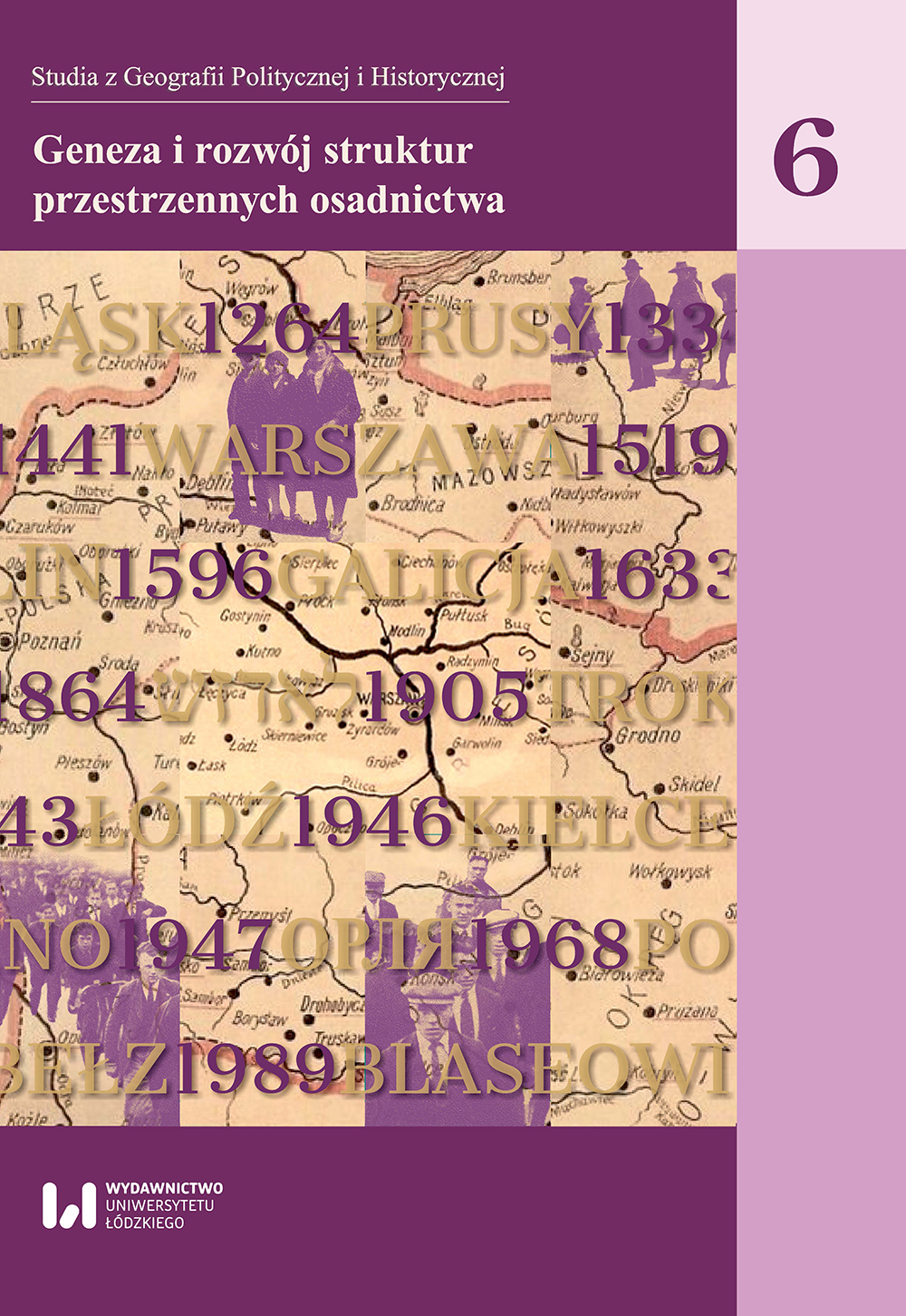
Rozwój morfologiczno-przestrzenny Rovaniemi

Rozwój morfologiczno-przestrzenny Rovaniemi

Author(s): Marta Chmielewska / Language(s): Polish Issue: 06/2017

The paper applies to the city of Rovaniemi and the morphological and spatial structure of its urban space. As a result of a comparative analysis of chronologically compiled town plans conducted by the Conzenian school of urban morphology, correlated with the written sources about the history of the city and field research, six stages of morphologic-spatial development of Rovaniemi were specified. A number of factors which exerted an influence on the development of the urban space of the town in the course of time have also been identified.Artykuł dotyczy historii kształtowania się współczesnej struktury morfologiczno-przestrzennej miasta Rovaniemi (Laponia, Finlandia). W wyniku przeprowadzonej analizy porównawczej chronologicznie zestawionych planów miasta metodą M.R.G. Conzena, uzupełnionej o kwerendę literatury dotyczącej historii miasta i badania terenowe, w dziejach Rovaniemi wydzielono sześć etapów rozwoju morfologiczno-przestrzennego. Wyodrębniono także szereg czynników, które wywierały wpływ na przestrzeń miasta w poszczególnych okresach jego rozwoju.

More...
Rozwój przestrzenny i przemiany morfologiczne osiedli Wrocławia wyrosłych wokół dawnych wsi kmiecych

Rozwój przestrzenny i przemiany morfologiczne osiedli Wrocławia wyrosłych wokół dawnych wsi kmiecych

Author(s): Barbara Miszewska,Robert Szmytkie / Language(s): Polish Issue: 06/2017

Between the years 1928 and 1973, three towns (Brochów, Leśnica, Psie Pole) and over 50 villages were incorporated into the borders of Wrocław city. It resulted in the growth of the administrative area of the city from 49.2 to 292.8 km2. Amongst the settlements incorporated into the city borders, it is possible to recognize the vegetable, peasant and farm villages. In most cases, former villages became genetic cores, around which current districts of the city were developed. Due to the diversified dynamics and the complex character of morphological transformations, the peasant villages deserve particular attention. An analysis of the spatial development and the main tendencies of morphological transformations of settlements developed around the peasant villages is the main purpose of this article. The majority of peasant villages are located in the western and southern parts of the city. Villages taken into account in the analysis differ in the progress of development processes, morphological diversification of settlements developed around former villages and in the transformations of the habitat of the village (from fully preserved forms to the forms with partly or entirely changed farm buildings). In the case of peasant villages, the morphological transformations have a different scale, from the phase of the minimal transformations (e.g. Jerzmanowo), to the phase where the initial form of the village is becoming blurred and the inter-urban “conglomerate” is developing (Ołtaszyn – Wojszyce).W latach 1928–1973 w granice Wrocławia wcielono trzy miasta (Brochów, Leśnicę i Psie Pole) oraz ponad 50 wsi, w wyniku czego powierzchnia miasta wzrosła z 49,2 do 292,8 km2. Wśród przyłączonych do miasta miejscowości można wyróżnić wsie: warzywnicze, kmiece i folwarczne. W większości przypadków stały się one jądrami genetycznymi, wokół których wyrosły obecne osiedla miasta. Na szczególną uwagę, z uwagi na zróżnicowane tempo i złożony charakter przemian morfologicznych, zasługują zwłaszcza wsie kmiece. Celem artykułu jest analiza rozwoju przestrzennego i głównych tendencji przemian morfologicznych osiedli powstałych w sąsiedztwie wsi kmiecych. Większość z nich położona jest w zachodniej i południowej części miasta. Ich wybór podyktowany był zaawansowaniem procesów rozwoju i zróżnicowania morfologicznego osiedli powstałych wokół dawnych wsi i stopniem przekształcenia pierwotnego siedliska wsi (od zachowanej po częściowo zachowaną i całkowicie wymienioną zabudowę zagrodową), od fazy minimalnych zmian pierwotnego układu (Jerzmanowo) po fazę zacierania formy inicjalnej i powstawania swoistej wewnątrzmiejskiego „zlepieńca” (Ołtaszyn – Wojszyce).

More...
DESCRIPTIO SILVAE – PRIKAZI ŠUMA U HRVATSKOM PRIMORSKOM PROSTORU TIJEKOM 16. STOLJEĆA

DESCRIPTIO SILVAE – PRIKAZI ŠUMA U HRVATSKOM PRIMORSKOM PROSTORU TIJEKOM 16. STOLJEĆA

Author(s): Josip Faričić / Language(s): Serbian Issue: 14/2018

The paper describes and interprets selected 16th-century cartographic depictions of forests in the Croatian coastland area. Through researching the cartographic sources of the spatial data, certain regularities and specific features were confirmed in the depiction of forests as components of the landscape, important parts of the ecosystem, and a valuable economic resource. In the 16th century, forests were usually shown only on chorographic maps of small spatial units, and were not shown at all on maritime charts. Chorographic maps varied widely in terms of their geographic contents, quality of depiction and cartography, right up to the early 19th century, when topographic and cadastral surveys of the entire Croatian coastal area were carried out systematically using a unified methodology. Based on these first modern maps, it was possible to produce smaller-scale chorographic maps and various thematic maps using standardised cartographic procedures. Since forest communities in the 16th century were not depicted in a standardised way, and were not previously subjected to systematic surveys or even field observations in many cases, it is impossible to reconstruct the spatial development of the forest cover and quantify human influence on it, particularly forest degradation caused by felling for various economic purposes (increasing arable land, fuel, house-building, ship-building, fishing, lime production, etc.). Nonetheless, the depictions of forests on 16th-century maps allow a partial insight into the significance of the forests in the spatial organisation of individual Croatian coastal regions, and should not be ignored in historical-geographical and ecohistorical research into the area.

More...
Specific Issues Applying the Law 165/2013

Specific Issues Applying the Law 165/2013

Author(s): Caius DIDULESCU,Gheorghe Badea,Ana Cornelia Badea,Adrian Savu / Language(s): English Issue: 23/2017

During the last years, in Romania there were complex situations involving restoration of property rights by the authorized bodies. A big step was made in 2013, when the applicable law was changed by Law no.165/2013. Between 2013 and 2017 the legislative framework was changed twelve times, according with different emergency ordinances, government decisions and laws, in order to complete the restitution process – in kind or by compensation –of the real estate’s abusively taken during the communist regime. In this paper we want to highlight the incident methodology and some specific issues encountered during the restitution process in a specific case study.

More...
Analysis of Land Cover Changes Using Sentinel-1 Data. Case Study- Galati County, Romania

Analysis of Land Cover Changes Using Sentinel-1 Data. Case Study- Galati County, Romania

Author(s): Nicoleta Violeta Iurist,Florian Stătescu,Cazarina Georgiana Bartic,Valeria Ersilia Oniga / Language(s): English Issue: 23/2017

The study of land cover changes is very important to have proper planning and utilization of natural resources and their management. The aim of this paper is to classify the study area, for two different time periods and to analyses the change detection using free-of-charge Sentinel-1 data. For this case study, dual-polarization (VV+VH) Interferometric Wide swath mode (IW) data collected on August 16th 2017 and October 11st 2017, over South-Est of Romania, were used. Pre-processing and processing were conducted using ESA Sentinel-1 toolbox (S1TBX) in the Sentinel Application Platform provided by ESA. Data have been calibrated, terrain corrected, and classified using supervised classification. The training and test data have been collected from Sentinel- 2 images.

More...
Drought and Irrigations of Romanian Agricultural Areas

Drought and Irrigations of Romanian Agricultural Areas

Author(s): Lucian Laslo,Nicu Ciobotaru,Theodor Lupei,Monica Matei,Ana Maria Velcea,Mădălina Boboc,Gabriel Badea,Deak Gyorgy / Language(s): English Issue: 23/2017

This article presents the DROUGHTSAT project and its preliminary results related to the soil moisture accounting based on self-calibrated Palmer drought severity index and water use for irrigation in the main agricultural areas. The used data and methods consist in monthly temperature and precipitation amounts, from ECAD database covering 27 meteorological stations and statistical data regarding the water use for irrigation. The results present the relationship between drought and water use.

More...
Monitoring Special Urban Installations with the GIS Model

Monitoring Special Urban Installations with the GIS Model

Author(s): Iustina Lateș,Mihail Luca,Ștefania Chirica / Language(s): English Issue: 23/2017

GIS models are currently used in many areas of activity where they combine field data, maps, plans and applications to provide useful information in the shortest possible time. A new field of applications for GIS models is the in-service monitoring of the water networks. GIS models are made in different programs, ArcMap, Autocad and are structured on custom layouts. Work layers require attachment of data banks for characteristic parameters of the water supply system. Management is more effective in a monitoring program using GIS applications, based on the speed of work and the complexity of the attached data. Thematic maps, work reports and mathematical models for design and exposition in a relatively short time can be developed through GIS models. The monitoring is done both for the entire water supply system and separately for each construction and water-supply system in part.

More...
The Influence of the Environment on Real Estate Appraisal

The Influence of the Environment on Real Estate Appraisal

Author(s): Voichița Roib,Ilinca Roib / Language(s): English Issue: 23/2017

The existence of adverse environmental conditions may reduce the value of a real estate property, so the appraisers must identify the factors and conditions that influence this value. One of the environmental factors that may influence the real estate value is climate. The paper presents the analysis of thermal comfort in a hot summer day, in the central area of Cluj-Napoca City. The results show an overview of the climate in this urban area in the mentioned period and can be used to analyse the best use of the property. In order to appraise a real estate property, the appraisers must take into account how the thermal comfort can influence the value of the real estate property.

More...
Implementation of Systematic Cadastre in an Administrative Territory

Implementation of Systematic Cadastre in an Administrative Territory

Author(s): George Emanuel Voicu,Florina Voicu / Language(s): English Issue: 23/2017

By its nature, the Earth has always been considered as a means of production without which life would not have existed, being limited as a surface, stable and irreplaceable, people transforming it into a good whose value has been established to the point. As a real estate, both the land and the constructions on it, have been subject to tax and tax records. At the same time, these records made it possible to establish the property right at the same time as creating the premise for its transmission in different situations.The success of land reform, the consolidation of democratic structures and the organization of society cannot be achieved without clear evidence of land ownership and ownership. Achieving evidence of real estate within an administrative territory now involves the execution of some complex works that allow highlighting the three aspects of a building: technical, economic and legal, so that can be created a complex record of the entire land fund in Romania.

More...
Combined Multi-beam Echo Sounder and Acoustic Doppler Profiler Mapping of the Danube-Epurasu Branch in Order to Determine the Influence of Newly Constructed Hydrotehnical Structures

Combined Multi-beam Echo Sounder and Acoustic Doppler Profiler Mapping of the Danube-Epurasu Branch in Order to Determine the Influence of Newly Constructed Hydrotehnical Structures

Author(s): Ștefan Zamfir,Gyorgy Deak,Marius Raischi,Alina Nicolae,Lucian Georgescu,Natalia Raischi,Alexandru Cristea,Gabriel Badea,Marius Olteanu,Lucian Lumînăroiu,Eduard Pană,Constantin Cîrstinoiu,Bogdan Urițescu,Tiberius Dănălache / Language(s): English Issue: 23/2017

This article details field research conducted at the Epurasu branch of the Danube River that sought to investigate the influence of newly constructed hydrotehnical structures. The study area was surveyed with two vessels, aiming to investigate the morphology and flow field characterizing this secondary branch and to provide data in order to observe the state of the riverbed and bedforms, velocity, and possible morphologic changes. The first vessel was equipped with a multibeam echosounder and on the second one an acoustic doppler current profiler (ADCP) was used. The results of the research revealed changes in the riverbed morphology and highly detailed imagery of the riverbed and of the hydrotehnical works.

More...
Areas Affected by Wildfires in Thasos Island using GIS

Areas Affected by Wildfires in Thasos Island using GIS

Author(s): Ana Cornelia Badea,Gheorghe Badea / Language(s): English Issue: 22/2017

In this paper we want to highlight the areas affected by wildfires in Thasos using Esri technology. The study is based on images from before and after the event. GIS possibilities offer us the appropriate environment to develop the study. The workflow was created in ArcGIS Pro10.3, using Chain Function.

More...
Surveying Students’ Opinion using GIS Web App

Surveying Students’ Opinion using GIS Web App

Author(s): Gheorghe Badea,Ana Cornelia Badea / Language(s): English Issue: 22/2017

In the paper is emphasized a GIS Web App that had been used having an educational and managerial purpose, for retrieving the students’ proposals for Faculty of Geodesy, Bucharest. These applications proved to be very useful in collecting and analyzing students’ opinion about the educational process and staff. It had been used a GeoForm to submit the students’ score for the faculty and a Summary Viewer app to see the others entries.

More...
Mobile Mapping Systems for Airports – Case Study Timişoara “Traian Vuia” International Airport

Mobile Mapping Systems for Airports – Case Study Timişoara “Traian Vuia” International Airport

Author(s): Emil Cristian Gabor,Cristian Iosub / Language(s): English Issue: 22/2017

The article focuses on the benefits of employing mobile LiDAR technology for airports surveys to deliver faster, safer and better geographical data. Airports administrations are bound to provide geographic data related to infrastructure and obstacles in nearby areas according to international regulations. Acquisition of these data using conventional surveying methods is slow but with low cost. Using airborne LiDAR technology is fast but very expensive. An appropriate compromise is the use of terrestrial mobile mapping LiDAR system. Surveys for Timisoara airport are presented together with the results of the study. In the end, a SWOT analysis is shown for the technology used in the study. Three results are introduced: “Certification Specifications (CS) for Aerodromes (EU) No 139/2014”, “International Civil Aviation Organization (ICAO) Annex 14 Obstacle Limitation Surfaces”, and “ICAO Annex 15 Terrain and Obstacle Data Collection Surfaces”.

More...
Distribution Maps for Protected Area Rosci 0299 - Dunărea La Gârla Mare Maglavit

Distribution Maps for Protected Area Rosci 0299 - Dunărea La Gârla Mare Maglavit

Author(s): Irinel Constantin Greșiță,Ionuț Maican / Language(s): English Issue: 22/2017

Protected areas, defined as areas in which the primary purpose is the conservation and protection of nature and cultural values are important to all segments of society. They have great potential to become models of the harmonious development of human society because these areas are promoted, more than elsewhere, sustainable management of natural and cultural resources. One of such protected area is - ROSCI0299- DUNĂREA LA GÂRLA MARE MAGLAVIT in Dolj County, and it consists of six blocks. Site of Community Importance, ROSCI0299 Danube at Gârla Mare - Maglavit is characterized by the presence of several classes of habitats, specify both the wetlands and the land, territories sure walk some important species of conservation interest, among mammiferous , amphibians, fish etc. The site totals an area of 9422 ha, which, in terms of bio-geographic region is integrated into the mainland. Actions due to natural phenomena (unpredictable or predictable) and / or factor socio-economic constantly evolving technical and economic can generate, over time, changes in the natural environment and components defining site ROSCI0299 Danube at Gârla Mare - Maglavit, with implications area times its scientific relevance. Mapping the distribution of the species for this site is a very important part of the management plan of the protected area.

More...
Configuring of Agricultural Parcels in Vineyards With a View to Setting up a Depending on the Conditions of the Relief of the Area

Configuring of Agricultural Parcels in Vineyards With a View to Setting up a Depending on the Conditions of the Relief of the Area

Author(s): Cristian Huțanu,Radu Oprea,Dan Pădure / Language(s): English Issue: 22/2017

The correct evaluation of the ecological factors in achieving a qualitative cadastre of a vineyard, which are to be set up in an area with temperate climate, is the basic condition for the economic success of the plantation, regarding the quantity and quality of the wines of the assortment of varieties chosen for planting. Taking into account the requirements of the European noble varieties grown, it can be concluded that a geographic area has vineyard potential, if it allows getting productions from year to year, primarily qualitative, to varieties from at least one direction of wine production (grape for consumption or for wine).

More...
Using GIS Techniques for Identification of the Surfaces with Flash-Flood Risk Potential Within the Area Upstream of Poiana Uzului Reservoir

Using GIS Techniques for Identification of the Surfaces with Flash-Flood Risk Potential Within the Area Upstream of Poiana Uzului Reservoir

Author(s): Ioana Delia Miftode / Language(s): English Issue: 22/2017

Knowing the value of the flash flood potential index (FFPI) is significant, because there are included in the GIS environment various physical and geographical and anthropic factors playing an essential role in the flash flood occurrence: lithology, slopes, profile curvature, soil texture and the land use. In the mountainous region situated upstream of the Poiana Uzului reservoir, an area with a potential very high risk of flash flood sums up a total surface of 49.36 km2; the area with a potential high risk of flash floods sums up a total surface of 99.31 km2. The highest percentage of the total studied area is exposed to an average risk of flash floods. The Uz hydrographic basin is situated in an area with a potential high risk of flash floods. The map thus obtained displays the spatialization divided into five risk classes (very high, high, average, low, and very low). The surfaces the most exposed to flood generation are concave surfaces, surfaces that include high slopes, hard rocks, a low degree of forestation, clay soils. The areas identified as being critical, concerning the potential of flash flood generation, presented an elevated risk for other related phenomena – in this case, the floods.

More...
GaussCAD – a WebGIS Application for Collecting Cadastral Data

GaussCAD – a WebGIS Application for Collecting Cadastral Data

Author(s): Mihai Mircea Moise / Language(s): English Issue: 22/2017

Starting with the National Programme of Cadastre and Land Registry 2015-2023, there is an ever-growing need to streamline the workflow of systematic cadastre works. GaussCAD application was born as a solution in the Geographic Information Systems domain, being an online tool that allows computerized integration for the procedures used in systematic cadastre: data collection for land plots, owners and possessors, importing and infilling GPS points, digitizing land plots and buildings, collecting relevant documents and saving field collected data on a server. The software runs both on tablet and desktop, having the possibility of being used as a real-time solution. The application shortens the time allocated for field data processing, having the potential to become an important innovation for the future development of cadastre in Romania.

More...
Result 381-400 of 1162
  • Prev
  • 1
  • 2
  • 3
  • ...
  • 19
  • 20
  • 21
  • ...
  • 57
  • 58
  • 59
  • Next

About

CEEOL is a leading provider of academic eJournals, eBooks and Grey Literature documents in Humanities and Social Sciences from and about Central, East and Southeast Europe. In the rapidly changing digital sphere CEEOL is a reliable source of adjusting expertise trusted by scholars, researchers, publishers, and librarians. CEEOL offers various services to subscribing institutions and their patrons to make access to its content as easy as possible. CEEOL supports publishers to reach new audiences and disseminate the scientific achievements to a broad readership worldwide. Un-affiliated scholars have the possibility to access the repository by creating their personal user account.

Contact Us

Central and Eastern European Online Library GmbH
Basaltstrasse 9
60487 Frankfurt am Main
Germany
Amtsgericht Frankfurt am Main HRB 102056
VAT number: DE300273105
Phone: +49 (0)69-20026820
Email: info@ceeol.com

Connect with CEEOL

  • Join our Facebook page
  • Follow us on Twitter
CEEOL Logo Footer
2025 © CEEOL. ALL Rights Reserved. Privacy Policy | Terms & Conditions of use | Accessibility
ver2.0.428
Toggle Accessibility Mode

Login CEEOL

{{forgottenPasswordMessage.Message}}

Enter your Username (Email) below.

Institutional Login