Cookies help us deliver our services. By using our services, you agree to our use of cookies. Learn more.
  • Log In
  • Register
CEEOL Logo
Advanced Search
  • Home
  • SUBJECT AREAS
  • PUBLISHERS
  • JOURNALS
  • eBooks
  • GREY LITERATURE
  • CEEOL-DIGITS
  • INDIVIDUAL ACCOUNT
  • Help
  • Contact
  • for LIBRARIANS
  • for PUBLISHERS

Content Type

Subjects

Languages

Legend

  • Journal
  • Article
  • Book
  • Chapter
  • Open Access
  • Geography, Regional studies
  • Maps / Cartography

We kindly inform you that, as long as the subject affiliation of our 300.000+ articles is in progress, you might get unsufficient or no results on your third level or second level search. In this case, please broaden your search criteria.

Result 401-420 of 1162
  • Prev
  • 1
  • 2
  • 3
  • ...
  • 20
  • 21
  • 22
  • ...
  • 57
  • 58
  • 59
  • Next
Rozszerzenie możliwości analiz rozkładu przestrzennego kontaktów z wykorzystaniem GIS

Rozszerzenie możliwości analiz rozkładu przestrzennego kontaktów z wykorzystaniem GIS

Author(s): Jadwiga Brzuchowska / Language(s): Polish Issue: 2/2013

This paper aims to develop new visualization methods of spatial distribution analyses of transportation needs using GIS tools. It improves trip-directional plans method that is based on movement intensity analysis and mutual spatial impact of transportation agencies. This method uses vectors, raster data and attributes in order to improve spatial distribution analyses of transportation needs and make thematic maps more legible. Use of different data types also enhance processing and visualization capabilities as it allow to take into account all spatial relationships between data.

More...
Историјско - географска анализа карте Корнелијуса де Јодеа "Croatia versus turcam" из 1593. године

Историјско - географска анализа карте Корнелијуса де Јодеа "Croatia versus turcam" из 1593. године

Author(s): Mirko Grčić / Language(s): English,Serbian Issue: 1/2017

This is the historical and geographical analysis of the old military and geopolitical map made by a Dutch cartographer from the Renaissance period of Cornelis de Jode in 1593, under the heading "Croatia & circumiacentiu[m] Region[m] versus Turcam nova delineatio". The map shows the part of the Military Frontier (Vojna krajina) in Croatia and Bosnia, as the site of war conflicts between the Habsburg and Ottoman Empires in the late 16th century. It is a beautiful combination of cartographic drawings and illustrations from the Renaissance, as well as an example of a practical combination of a geopolitical map and a military-political illustration. It represents an imagined projection of the relationship of forces, interests and conflicts in the area of former Croatia. The map contains two "layers" of information - cartographic and pictographic. In the research paper, the decoding of geographical names from the aspect of today's situation on the ground is performed. Barring the vignette of military fortifications, the map contains illustrations of a military-political character which meaning and context is also analyzed in the paper from the aspect of the historical circumstances of the map. In that context, the map is considered as a way of communication and representation of the Other, in this case the Ottoman. The specific context of the map is the hierarchy of power in the continuum of geographical space of different ranks - from the former empires, presented in the image of their mighty rulers, to belligerent vassal countries. It sublimates not only the military-political significance of the geographical space that it represents, but also the perception of the author, as well as the functions, expressive means and symbolism of geopolitical cartography in the Renaissance period.

More...
Значај визуелизације у картографској комуникацији

Значај визуелизације у картографској комуникацији

Author(s): Aleksandar Đorđević,Dragica Živković,Vesna Ikonović / Language(s): English,Serbian Issue: 4/2011

Visualization is a field of computer graphics which explores the analytical and communication possibilities of visual presentation. Visualization explores the possibilities of using images, similar to three-dimensional world, as models so that analysis and communication can be improved. Visualization depends on new computer techniques of data analysis and presentation, as well as on the accuracy, exactness and form of said data. Visualization is a scientific tool, but its application demands art, imagination and intuition. Visualization demands the use of the latest and the best computer technology.

More...
Aleksandrów i okoliczne wsie w świetle nieznanych źródeł z przełomu XVIII i XIX w.

Aleksandrów i okoliczne wsie w świetle nieznanych źródeł z przełomu XVIII i XIX w.

Author(s): Krzysztof Paweł Woźniak / Language(s): Polish Issue: 06/2017

The article contributes to recognition of the settlement processes in the Western part of then Zgierz County at the turn of 18th and 19th centuries. It discusses and presents issues based on formerly unknown sources concerning the establishment of Olęder settlements in Ruda Bugaj and Brużyca Mała. The study, based on sources which were never accounted before, resulted in clearing the doubts concerning the exact date of establishment of the industrial settlement in Aleksandrów.Artykuł stanowi przyczynek do poznania procesu osadniczego przebiegającego na przełomie XVIII i XIX w. w zachodniej części ówczesnego powiatu zgierskiego. Omówiono nieznane dotychczas w polskiej literaturze przedmiotu źródła dokumentujące założenie osad olęderskich w Rudzie, Bugaju i Brużyczce Małej. Na podstawie nieuwzględnianego dotąd przekazu źródłowego rozstrzygnięto wątpliwości narosłe wokół daty założenia osady przemysłowej Aleksandrów.

More...
СРЕДИЗЕМНОМОРСКОЕ ПОБЕРЕЖЬЕ АФРИКИ В «ГЕОГРАФИИ» ПТОЛЕМЕЯ И В «СТАДИАСМЕ ВЕЛИКОГО МОРЯ»

СРЕДИЗЕМНОМОРСКОЕ ПОБЕРЕЖЬЕ АФРИКИ В «ГЕОГРАФИИ» ПТОЛЕМЕЯ И В «СТАДИАСМЕ ВЕЛИКОГО МОРЯ»

Author(s): Dmitry A. Shcheglov / Language(s): Russian Issue: 2/2018

The paper argues that the depiction of the Mediterranean coast of Africa in Ptolemy’s Geography was based on a source similar to the Stadiasmus of the Great Sea. Ptolemy’s and the Stadiasmus’ toponymy and distances between major points are mostly in good agreement. Ptolemy’s place names overlap with those of the Stadiasmus by 80%, and the total length of the coastline from Alexandria to Utica on Ptolemy’s map deviates from the Stadiasmus data by only 1% or 1.5% (in different recensions). A number of serious disagreements between Ptolemy’s map and the Stadiasmus regarding the length of particular coastal stretches can be explained by assuming that Ptolemy had to tailor the distance data derived from periploi to his other sources, especially, to the longitudes of the key reference points, such as Cape Phyces, Cyrena, Berenica, Aesporis (Eperos), Thena, and Carthage. A notable stretching and the subsequent contraction of the coast between Alexandria and Cyrenaica, as are exhibited by Ptolemy’s map relative to the Stadiasmus’ data, can be explained by assuming that several points on this coast were tied to the position of Crete, which was moved to the west being pushed by the westward shift of Rhodes. A sharp contraction of the two coastal stretches of the Great Sirte, oriented along the north-south direction, can be explained by Ptolemy’s erroneously underestimated value for the circumference of the Earth.

More...
Атласи: сложени модели геопростора

Атласи: сложени модели геопростора

Author(s): Vesna Ikonović / Language(s): Serbian Issue: 2/2005

Atlas is modeled contexture contents of treated thematic of space on optimal map union. Atlases are higher form of cartography. Atlases content composition of maps which are different by projection, scale, format, methods, contents, usage and so. Atlases can be classified by multi criteria. Modem classification of atlases by technology of making would be on: 1. classical or traditional (printed on paper and 2. electronic (made on electronic media - computer or computer station). Electronic atlases divided in three large groups: view-only electronic atlases, 2. interactive electronic atlases and 3. analytical electronic atlases.

More...

Утицај извора података на тачност дигиталног модела терена

Author(s): Branislav Bajat,Dragoljub Štrbac / Language(s): Serbian Issue: 1/2005

The overview of the contemporary data acquisition methods for Digital Terrain Models (DTM), as well as the accuracy of data provided by these methods, are given in this article. The procedure of the accuracy estimation for DTM, which is produced by digitising of topographic maps and test points, obtained by GPS technology and aerophotogrammetric terrain surveying, is presented.

More...
Строение пространства в «Географии» Птолемея: методологические сложности геореференцирования античных топонимов

Строение пространства в «Географии» Птолемея: методологические сложности геореференцирования античных топонимов

Author(s): Dmitry A. Shcheglov / Language(s): Russian Issue: 1/2019

In this paper I would like to draw attention to several features inherent to Ptolemy’s Geography that limit the effectiveness of different mathematical approaches to georeferencing (i.e. locating within the modern coordinate system) its unidentified places. Out of the 6,300 coordinate points listed in Ptolemy’s Geography, approximately 50% still don’t have recognized identifications on the modern map. This makes the Geography a real bonanza for researchers developing different methods to translate Ptolemy’s coordinates into the modern ones. Most of these methods can be effective only insofar as Ptolemy’s Geography is regarded as an example of what David Woodward called “equipollent-coordinate space” where “every place in the system is of equal geometric significance.” This kind of space is supposed to be as continuous and homogeneous as the space of the modern maps is. My central thesis is that Ptolemy’s space was closer to what Woodward has called “route-enhancing space,” in which “the routes are endowed with the importance of direct observation,” hiding behind the mask of the “equipollent” one. This hidden nature of Ptolemy’s space manifests itself in two interrelated aspects: it was discrete and hierarchically organized. On the one hand, there are reasons to suppose that most points on Ptolemy’s map were originally located not in relation to their nearest neighbors, but rather in relation to a few distant reference points. On the other hand, Ptolemy tended to distribute all places more evenly throughout the entire space they occupy and to round their coordinates as much as possible. These features of Ptolemy’s method result in that, even if he tried to follow his sources most closely, each separate point on his map could have been displaced relative to its original neighborhood. The displacements are often so significant and unpredictable that they cannot be adequately described by a single continuous function. Mathematical methods remain, of course, an important tool for studying Ptolemy’s Geography and, in particular, for georeferencing its unidentified places. However, like any instrument, these methods have limited effectiveness. The specific features of Ptolemy’s method pointed out in the present paper can contribute to our understanding of how these methods can be improved and enhanced.

More...
CARTOGRAPHIES OF MEMORY: 14TH ISTANBUL BIENNIAL: SALTWATER: A THEORY OF THOUGHT FORMS (2015) AND ABY WARBURG’S MNEMOSYNE ATLAS (1924-1929)

CARTOGRAPHIES OF MEMORY: 14TH ISTANBUL BIENNIAL: SALTWATER: A THEORY OF THOUGHT FORMS (2015) AND ABY WARBURG’S MNEMOSYNE ATLAS (1924-1929)

Author(s): Mehmet Berkay SÜLEK / Language(s): English Issue: 04/2018

The question of memory has been a prominent subject of study in contemporary art scene during the last few decades. One can argue that it is important to look at moments when this increased interest was expressed at full. Therefore, I would like to analyze two projects which were produced hundred years apart from each other with different intentions. These are Aby Warburg’s Mnemosyne Atlas and Carolyn Christov-Bakargiev’s 14th Istanbul Biennale: Saltwater Theory of Thought Forms (2015). Although those projects were constructed in different manners, they share similarities at the structural end. One can argue that both of those projects were constructed around the questions of memory and invisible memory in particular. Furthermore, they raise these questions around the notion of memory in a specific way. In this thesis, I would like to argue that it is the willingness to create a map and how it interacts with the photographic and cinematic ways of communications.

More...
Comparative Study on the Institution of Cadastre in International Context

Comparative Study on the Institution of Cadastre in International Context

Author(s): Luciana Oprea,Maria Barb / Language(s): English Issue: 26/2019

Land ownership has always been the basis of all civilizations. The state has always sought to know and to be informed about the extent and distribution of public and private property. For this reason, it was felt that there was a need to describe and register in the records the property limits to have a clear record of them, to control or limit them and to set the tax on the property. Thus, through the cadastre, a system of general and compulsory registration of the entire land fund is realized irrespective of the ownership of the property and the category of its use. Thus, the cadastre does not study the land itself but establishes the ways in which all technical information concerning the land fund is collected, processed and represented on the maps and plans together with the inclusion in the Land Registry of the related legal acts and deeds. In this context, this paper seeks to carry out a comparative study on the cadastre institution in an international context as well as to identify the elements that can serve to create a most viable cadastral system.

More...
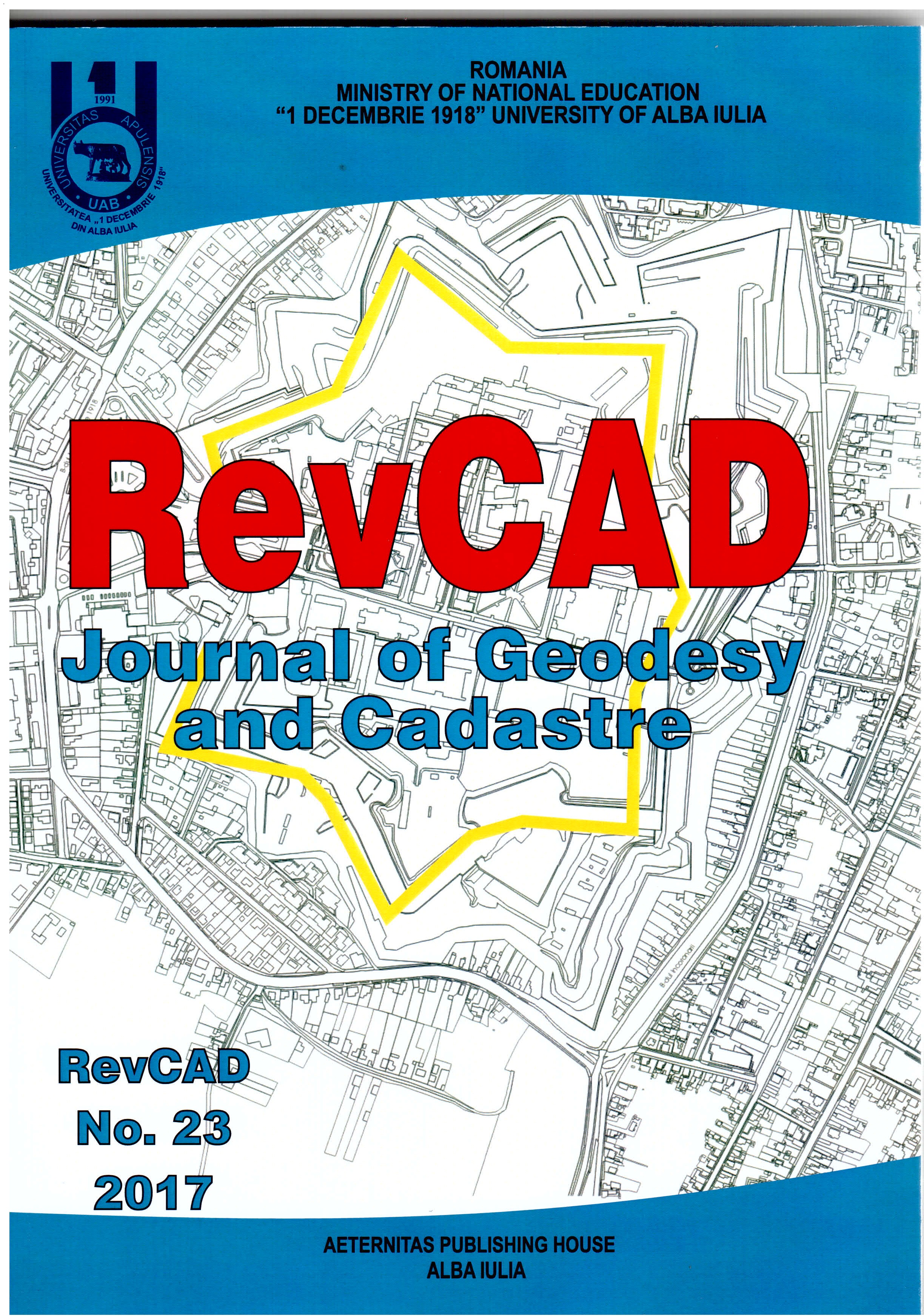
Implementation of Agriculture Cadastre in an Administrative Territory

Implementation of Agriculture Cadastre in an Administrative Territory

Author(s): Luciana Oprea,Mădălina Bârsan / Language(s): English Issue: 23/2017

The importance of the general cadastre is that it provides the real-world data of a real-estate needed in all branches of the national economy. At the same time, the cadastre is a very important tool for market economy because it provides documents that give security to transactions that take place on the real estate market. The attributions of the agricultural cadastre are the basis for obtaining information on the quantity and quality of the land, serving as a purpose to solve financial problems such as investments, modernization, taxation and the other like this. The realization of the agricultural cadastre at national level is made by determining the parcel areas, taking into account the land use categories, the holders, the owners, the forms of exploitation and the administrative territories, this thing being possible by drawing up the agricultural cadastral plan and the writable cadastral documentation based on technical norms and instructions.

More...
Floods Damage Estimation Using Sentinel-1 Satellite Images. Case Study-Galati County, Romania

Floods Damage Estimation Using Sentinel-1 Satellite Images. Case Study-Galati County, Romania

Author(s): Nicoleta Violeta Iurist,Valeria Ersilia Oniga,Florian Stătescu,Casiana Marcu / Language(s): English Issue: 22/2017

Romania has a long and well documented history of flooding, resulting in numerous material as well as human loses. In order to monitor and estimate flood damages in near-real time, numerous techniques can be used, from a simply digitizing on maps, to using detailed surveys or remote sensing techniques. However, when using the last mentioned technique, the results are conditioned by the time of data acquisition (day or night) as well as by weather conditions. Although, these impediments can be surpassed by using RADAR satellite imagery.The aim of this study is to delineate the land surface of Galati County that was affected by floods in October 2016. For this case study, Sentinel-1C-Band SAR data provided by ESA (European Space Agency) were used. The data sets were taken before and after the flood took place, all within 6 days and were processed using Sentinel Toolbox.

More...
Digital Surface Models derivation from Airborne Laser Scanning Data

Digital Surface Models derivation from Airborne Laser Scanning Data

Author(s): Ana Maria Loghin,Ion Giurma,Valeria Ersilia Oniga / Language(s): English Issue: 22/2017

Within a time frame of only two decades, LiDAR technology has become a very important surveying method, that provides reliable geo-spatial information, being used in many scientific domains of activity, like: production of digital surface and terrain models, forest management and monitoring, corridor mapping, cultural heritage.In contrast to the Digital Terrain Model, describing the elevation of the ground surface, the Digital Surface Model represents the surface which can be seen from an acquisition platform. Over time, there were developed many algorithms for Digital Surface Models derivation from airborne laser scanning (ALS) data. Some of them are based on DSMmax, containing the highest points within a defined raster cell, that has some disadvantages: in case of low point densities, it can contain void pixels and, in case of inclined smooth surfaces, it can show an artificial roughness. In order to obtain an improved DSM, the disadvantages of the DSMmax, are reduced by using an interpolated grid, DSMmpl, containing heights based on moving planes interpolation.For the present case study, the Digital Surface Model of “Neubacher Au” area, located in Lower Austria was derived, based on a combination of two products, previously determined: the DSMmax and the interpolated grid DSMmpl. This algorithm is implemented in the scientific software package OPALS (Orientation and Processing of Airborne Laser Scanning data). For this test site, ALS data with a point density of 57 echoes per m2 are available. Compared to the traditional DSM of the study area, the derived combined DSM offers a better visualisation of the territory, being better used in forestry applications.

More...
Romanian Cadastre Involvement in Climate Change Policy

Romanian Cadastre Involvement in Climate Change Policy

Author(s): Raluca Manea,Mariana Călin,Anca Maria Moscovici,Vlad Păunescu,Ana Virsta,Tudor Sălăgean / Language(s): English Issue: 22/2017

This paper aims to present the usefulness of cadastral data integration in analyzing the effects of climate change. Based on the experience of developed countries in the EU and on the necessity of stopping, if possible, the effects of climate change, is necessary also in our country to take urgent action of public and authorities awareness campaigns in this direction. We will try to demonstrate that cadastral data can provide support policies to mitigate the effects of climate change, especially in urban areas.

More...
Digital Terrain Model In Mining Topography Aplications

Digital Terrain Model In Mining Topography Aplications

Author(s): Costin Sebastian Manu,Ioan Boroica,Dumitru Filip Tivig,Mihai Cătălin Costea / Language(s): English Issue: 22/2017

The digital terrain model is a real relief representation in three-dimensional space, taking into account the planimetric coordinates N, E and the H elevation. The studied terrain topography is approximated through a mathematical surface achieved by interpolating the measured elevation in the terrain and with the help of the contour. This article approaches the creation of the digital model of the the terrain in several ways and solving specifical mining topographycal problems based on this.

More...
Research of Surface Waters Quality in Hilly Areas with Model “WaQ”

Research of Surface Waters Quality in Hilly Areas with Model “WaQ”

Author(s): Loredana Andreea Popoiu,Catrinel Raluca Giurma-Handley / Language(s): English Issue: 22/2017

Water quality modelling with “WaQ” wants to improve current systems for monitoring, the model allows establishing the source of pollutants and limits for discharges that lead to poor quality water, as well as the basic or additional measures necessary to achieve environmental objectives under Framework Directive 2000/60. Analysing the data output of the model “WaQ” for the Bahlui catchment it has been found that impairment of good water, especially regarding nutrients as required by the directive is given by agricultural work practices, this fact indicating agriculture as one of the main sources of diffuse pollution of surface water, including barrier lakes. As a result of modelling with “WaQ” for Bahlui catchment, the forecast made in the perspective of 2021, was found an increase in total nitrogen and total phosphorus imissions compared to 2012, fact caused by increasing agricultural areas. On the other hand, only for the sub-basin Razboieni-upstream Podu Iloaiei was determined a decrease in load with total nitrogen and total phosphorus in 2021, which resulted an improvement of the ecological potential for the barrier lake Podu Iloaiei.

More...
Research on Water Quality in Small and Medium Barrier Lakes in Hilly Areas with Bathub Model

Research on Water Quality in Small and Medium Barrier Lakes in Hilly Areas with Bathub Model

Author(s): Loredana Andreea Popoiu,Ion Giurma / Language(s): English Issue: 22/2017

Presence in waters of large amounts of nutrients, determine their contamination and the occurrence of eutrophication manifested through an accelerated growth of algae and other higher plant forms. In order to assess the risk of eutrophication of the two barrier lakes studied Cucuteni and Tansa-Belcesti from Bahlui catchment, it was used a model namely BATHUB. Modelling of potential eutrophication, it is expressed through items like total phosphorus, total nitrogen, chlorophyll “a”, transparency, organic nitrogen and organic phosphorus. For the two barrier lakes Cucuteni and Tansa-Belcesti was achieved high levels of total nitrogen and total phosphorus caused by diffuse pollution supported mainly by agricultural work practices. The nitrogen and phosphorus nutrients get into the lakes via the river system, and phytoplankton fails to fully assimilate them, which causes maintenance the eutrophic condition for these barrier lakes.

More...
Land’s Valuation. Case Study

Land’s Valuation. Case Study

Author(s): Gabriel Săndulache,Gabriela Ecaterina Proca / Language(s): English Issue: 22/2017

Valuation of urban or outside town land is governed by ANEVAR law (methodological guide for valuing land GME1 realized and recognized in the entire world). Indicated methodology is agreed with international valuation standards (EVS) published by International Valutation Standards Council (IVSC ). Valuation methods of vacant land, occupied by facilities or constructions are: CMA extraction market allocation, technical residual capitalization current rent / lease land (rent) and cash flow analysis updated (analysis plotting and development). The methods listed are derivation of traditional methods of approach to real estate (market, income and cost). The case study in this paper comply evaluation guide showing all the steps specified by international standards agreed by ANEVAR.

More...
Statistical Modeling Applied in Real Estate Valuation

Statistical Modeling Applied in Real Estate Valuation

Author(s): Silvia Zeicu,Dumitru Onose,Mircea Ortelecan,Maricel Palamariu / Language(s): English Issue: 22/2017

The use of statistical models and special applications of statistical processes provides extra support for developing an opinion on the value or analysis. This article presents the method of obtaining statistical models that help stakeholders to better know the specific real market estate. Currently, specialist appraisers use various statistical methods for appraising real estate, a multitude of solutions provided by the mathematical statistics to be applied in this field: MRA - multiple regression analysis, time series, fuzzy logic techniques, ANN – artificial neural networks, NFS - neuro-fuzzy systems and others. The immediate and very palpable advantages of applying these valuation solutions are the automatization of the appraisal process and the existence of control methods for the results achieved. The main disadvantage is the complexity of applying the suggested solutions, requiring a team of specialists from different fields - programmers, statisticians, mathematicians, appraisers, market analysts - to develop and operate systems of this nature and scale.

More...
The Impact of Land Registration on the Process of Regulation of Land Relations

The Impact of Land Registration on the Process of Regulation of Land Relations

Author(s): Efim Zubco,Ion Botnarenco,Sergiu Popescul / Language(s): English Issue: 22/2017

Cadastral registration represents a method of protecting property rights and limited natural resources. Both the need to know the shape and size of the property as well as property recognition by another person determined the appearance of the land registration process and registration of property rights. The process of land registration represents a public action (of the state). State interest in the registration process derives from the need to implement appropriate fiscal policy for each situation.Effective implementation of progressive methods regulating land relations (related to taxation, investment, subsidization, crediting, etc.), according to the objective needs of society, requires a higher level of rights protection. Land relations have always been a source of dispute. The land, in its turn, represents a specific means of production.In this study, the purpose of land registration (immovable property as a whole) consists in both the protection of rights and resulted interests and appropriate application (according to the law) in time and space of all the necessary (current) methods of efficient regulation of land relations.Given the present circumstances of social development, implementation of subsidy policy, investment, crediting, planning, management and efficient use of land, etc., there is an increasing role of the registration process, because land registration will ensure the development of subsidization, investments, owner-oriented fiscal policies etc.

More...
Result 401-420 of 1162
  • Prev
  • 1
  • 2
  • 3
  • ...
  • 20
  • 21
  • 22
  • ...
  • 57
  • 58
  • 59
  • Next

About

CEEOL is a leading provider of academic eJournals, eBooks and Grey Literature documents in Humanities and Social Sciences from and about Central, East and Southeast Europe. In the rapidly changing digital sphere CEEOL is a reliable source of adjusting expertise trusted by scholars, researchers, publishers, and librarians. CEEOL offers various services to subscribing institutions and their patrons to make access to its content as easy as possible. CEEOL supports publishers to reach new audiences and disseminate the scientific achievements to a broad readership worldwide. Un-affiliated scholars have the possibility to access the repository by creating their personal user account.

Contact Us

Central and Eastern European Online Library GmbH
Basaltstrasse 9
60487 Frankfurt am Main
Germany
Amtsgericht Frankfurt am Main HRB 102056
VAT number: DE300273105
Phone: +49 (0)69-20026820
Email: info@ceeol.com

Connect with CEEOL

  • Join our Facebook page
  • Follow us on Twitter
CEEOL Logo Footer
2025 © CEEOL. ALL Rights Reserved. Privacy Policy | Terms & Conditions of use | Accessibility
ver2.0.428
Toggle Accessibility Mode

Login CEEOL

{{forgottenPasswordMessage.Message}}

Enter your Username (Email) below.

Institutional Login