Cookies help us deliver our services. By using our services, you agree to our use of cookies. Learn more.
  • Log In
  • Register
CEEOL Logo
Advanced Search
  • Home
  • SUBJECT AREAS
  • PUBLISHERS
  • JOURNALS
  • eBooks
  • GREY LITERATURE
  • CEEOL-DIGITS
  • INDIVIDUAL ACCOUNT
  • Help
  • Contact
  • for LIBRARIANS
  • for PUBLISHERS

Subjects

Languages

Content Type

Legend

  • Journal
  • Article
  • Book
  • Chapter
  • Open Access
  • Geography, Regional studies
  • Historical Geography

We kindly inform you that, as long as the subject affiliation of our 300.000+ articles is in progress, you might get unsufficient or no results on your third level or second level search. In this case, please broaden your search criteria.

Result 1-20 of 954
  • 1
  • 2
  • 3
  • ...
  • 46
  • 47
  • 48
  • Next
2.00 €
Preview

"Ойкистите" в релефите на стратези от Месамбрия

Author(s): Ivan Marazov / Language(s): Bulgarian,German / Issue: 1/2004

More...
(Historische) Geografie des Schwarzmarktes in der Volksrepublik Polen

(Historische) Geografie des Schwarzmarktes in der Volksrepublik Polen

Author(s): Jerzy Kochanowski / Language(s): German / Issue: 3/2011

A similar process occurred in all communist countries: a top-down revolution – in many cases an imported one – that extinguished the free market and replaced it with a centrally planned economy, a step that inevitably led to shortages. The socialist black markets which arose as a result, display many common, and some individual features. These depended, for example, on the level of shortage, historical experience (traditional attitudes towards respecting or not respecting the law), social structure, the prevailing political and international situation, as well as the size of the country. The present article analyses the way in which geographical and historical circumstances affected the various forms taken by the black market in post-war Poland (1944-1989), for there is no doubt that, for instance, the borders fixed during the partitions of the country, or the Second World War, with its border changes and concomitant mass emigration, are still affecting political, economic, and cultural life in Poland down to the present day. The distribution of poverty and prosperity, the extent of modernisation (in its widest sense), and patterns of political behaviour, still correspond to a great extent with these historical borders. During the lifetime of communist Poland, the hilly and mountainous South and the Northern regions on the Baltic both represented what one might describe as booming regions for black market trading. The pivotal reason for this were geographical and historical factors, which, in this case, exercised an enormous influence on local social, economic, and even political conditions. This can be most clearly seen in Zakopane (and Podhale inthe Carpathian foothills) in the south, and in the coastal region (particularly around Danzig) in the north. Apart from the north-south divide, with Zakopane and the Baltic coast, the article also compares the eastern and western border areas. Both on the river Oder and on the river Bug the borders showed that two neighbouring communities, regardless of the stereotypes, prejudices or historical background, always function like two interconnected tubes. A very slight difference of level in one is enough to set off a corresponding movement of people, ideas, or, in the case of the black market, goods, to the other. The article also shows the difference between the way black markets in the middle of cities and those on the outskirts functioned. The big city centers provided an excellent basis for developing black market trading strategies. The way business was done in the city markets was a world away from the traditional, often downright pre-industrial, forms of barter which largely characterised the provincial markets of the countryside. In cities, black market traders were not limited to groups known to each other, often for generations, but used “modern” business methods. On the outskirts of the cities, on the other hand, where the state sanctioned a higher level of private commerce, the attitude of state officials to spontaneous commercial activity was more liberal. Outlying areas of cities, especially in comparison to the industrial centers, often suffered supply shortages. As a result, the local authorities were often forced to deliberately turn a blind eye to the unofficial trading activities of their citizens.

More...
(С)поделена природа? Природно наследство и местно развитие в един регион от българо-сръбското пограничие
4.00 €
Preview

(С)поделена природа? Природно наследство и местно развитие в един регион от българо-сръбското пограничие

Author(s): Ivaylo Markov / Language(s): Bulgarian / Issue: 1/2017

The article is focused on a border region between Bulgaria and Serbia which is geographically dominated by Ruy Mountain (whose ridge is the boundary between Bulgaria and Serbia) and the valley of Erma river forming two huge defiles along its way in this mountainous region – the Lomnishko defile (in Bulgaria) and the Poganovsko defile (in Serbia). The micro region (from natural and geographical point of view) shared until 1919 several cultural, social and economic characteristics (from an anthropological point of view), thus forming a common historical and geographical entity. The demarcation of the boundary between Bulgaria and Serbia as a result of the Treaty of Neuilly split the region between the two countries. The border regime, which was rigid and impermeable through the whole second half of the 20th century, made the zones on the both sides of the border well guarded, but industrially underdeveloped periphery. With the opening of the border in the period after 1989 and especially with the intensification of the European integration processes the character of the Bulgarian-Serbian border is undergoing changes and is gradually turning into a bridge for diverse trans-border initiatives. A great deal of these initiatives are connected with the well preserved ecology of the region, which is evaluated at present as a treasure by the local authorities and communities who believe it to be an important resource and instrument for the overcoming of the peripheral position of the region.

More...
1071 STRATEJİK BİR HATA MI?

1071 STRATEJİK BİR HATA MI?

Author(s): Harun Demirkaya / Language(s): Turkish / Issue: 37/2018

Generally, in the history books, coming to Anatolia of Turks are connected to Malazgirt Victory. If this date is taken as basis, it is assumed that before this date, there were not Turks in Anatolia. However, this preacceptance leads to misunderstanding of Turkish history. Moreover, this situation serves to weaken the ties of the Turks with their histories and Anatolian geography. With this dimension, it strengthens the argument that Anatolia belongs to other nations. However, recent researches and findings in various excavations reveal that this approach is not correct and that the Turks are based on ancient histories of the development of Anatolia. This study aims to further investigate of historians in this subject in order to remove the confusion in this subject. Thus, it is aimed to intensify the attention of historians to the subject. If this is done and both the country and the world committee are fed with the right information, it will be achieved for the purpose of work.

More...
13th Conference on Baltic Studies in Europe, Gdańsk, June 26–29, 2019

13th Conference on Baltic Studies in Europe, Gdańsk, June 26–29, 2019

Author(s): Jörg Hackmann / Language(s): English / Issue: 2/2019

On June 26–29, 2019, a large international conference was held in the Polish city of Gdansk — the 13th Baltic Research Conference in Europe. More than 150 reports were presented in 50 panels and round tables. The subjects were diverse, from the “History and Memory” section to “Politics and Society”, and even the problems of security in the Baltic region. Scientists from Poland, Estonia, Latvia, Lithuania, Great Britain, Germany, Russia, etc. took part in the historical sections. The next conference will be held in 2021 in Uppsala.

More...
140 de ani de la naşterea acad. prof. Hans Stille, membru de onoare al Academiei Române

140 de ani de la naşterea acad. prof. Hans Stille, membru de onoare al Academiei Române

Author(s): Teofil Gridan / Language(s): Romanian / Issue: 9/2016

Hans Stille (1876–1966) was one of the defenders of some important geological outlooks of the 20th century, such as the concept of Earth’s cycles, orogenesis and epeirogenesis, folding phases or of geosynclines. He distinguished two major divisions of the geological time: the Protogàikum and the Neogàikum. He divided the last one in Geotectonic eras, each of them being divided in different „tectonic phases”. The geosynclines rep resented for Stille mobile zones, seated within the continents, in areas where the crust was „regenerated” („remobilized”). In the Carpathians, Stille considered two geosynclinal areas sep arated by the „Rückland”. He stressed out the existence of the Cimmerian tectonic phase in the Carpathians. He proposed a „forerunner” genetical model for the Carpathians Neogene vol canics, connected to the underthrusting of the Foreland.

More...

17. Międzynarodowa Konferencja Geografów Historycznych (International Conference of Historical Geographers) – Warszawa, 15–20 lipca 2018 r.

Author(s): Tomasz Panecki,Katarzyna Słomska / Language(s): Polish / Issue: 7/2019

More...
9. BIENALNA KONFERENCA EVROPSKEGA ZDRUŽENJA OKOLJSKIH ZGODOVINARJEV: NATURES IN BETWEEN: ENVIRONMENTS IN AREAS OF CONTACT AMONG STATES, ECONOMIC SYSTEMS, CULTURES AND RELIGIONS

9. BIENALNA KONFERENCA EVROPSKEGA ZDRUŽENJA OKOLJSKIH ZGODOVINARJEV: NATURES IN BETWEEN: ENVIRONMENTS IN AREAS OF CONTACT AMONG STATES, ECONOMIC SYSTEMS, CULTURES AND RELIGIONS

Author(s): Žiga Zwitter / Language(s): Slovenian / Issue: 13/2017

Place: Zagreb Date: 28. June - 1. July 2017

More...
18.00 €
Preview

A copperplate land grant by Raṇasiṃhadeva of the Candrāvatī Paramāras

Author(s): Dániel Balogh / Language(s): English / Issue: 3/2010

A land grant issued by Raṇasiṃhadeva of the Candrāvatī branch of the Paramāra dynasty in North-West India has recently come to my attention. It contains a genealogy of the Candrāvatī line from Utpalarāja to Raṇasiṃha. This ruler was hitherto known only from one published inscription (the Roheḍā plates), and has been thought to be a usurper who briefly snatched the throne from the legitimate ruler Dhārāvarṣa. The grant, dated 1 November 1161 CE, makes no mention of Dhārāvarṣa, calling for a reinterpretation of some ambiguous lines of the Roheḍā inscription. It is a possibility that Raṇasiṃha was not a usurper, but ruled as a regent during Dhārāvarṣa’s minority and then willingly handed the throne over to him.

More...
A Few Comments on the Historical Borders in Poland

A Few Comments on the Historical Borders in Poland

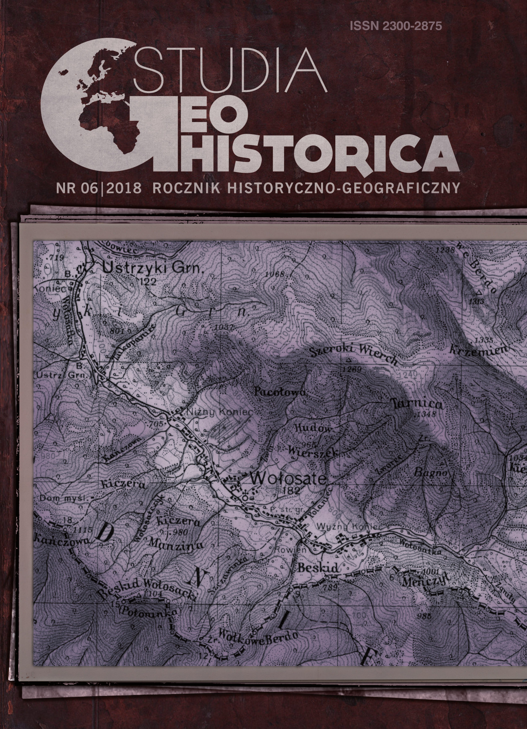
Author(s): Henryk Rutkowski / Language(s): English / Issue: 6/2018

The main topic of this paper are the borders of Poland in the 16th century. The country’s state and province borders were first delineated by Bernard Wapowski on his 1526 map from (scale 1:1,000,000). While the map is known only from fragments, Gerardus Mercator used Wapowski’s borders in his map of Europe published in 1554. In 1880, Stanisław Smolka proposed elaborating maps of territorial divisions of the Polish-Lithuanian Commonwealth in the 16th century. The first implementation of this program was the Atlas of the Ruthenian Lands of the Crown, elaborated by Aleksander Jabłonowski (to the scale of 1:300,000) and published in 1904. In 1964, a plan to publish a series of maps under the title of ‘Historical atlas of Poland: detailed maps of the 16th century’ was announced by the Institute of History at the Polish Academy of Sciences. The series aims at to cover ethnically Polish lands within the Crown. Out of the planned eight volumes, five were published in the years 1966–2008, and then their content was combined and published in English in 2014. The newest volume to date, published in 2017, concerns Greater Poland. Central large-scale maps (to the scale of 1:250,000) depict all towns and villages that existed in the second half of the 16th century. The maps indicate state borders, borders of voivodeships, lands, districts, and, in relation to lands owned by the Roman Catholic Church, the borders of dioceses, archdeacons and parishes. Settlements and borders of state administration were recreated with the use of extraordinary tax registers called pobor, and the basis for marking church boundaries was the documentation of canonical visitations. Additional maps to the scale 1:500,000 concern the distribution of landed property, with borders marked between various categories of land ownership. Interpolation of settlements belonging to different administrative units and having a different ownership status was used as a method in the reconstruction of borders of territorial units. This is the most detailed study on the shape of borders on historical Poland lands, not only presenting this element of geographical space in the 16th century, but also serving to further our understanding of border shapes in the earlier and later centuries. 

More...
A Karib-térség fogalmának értelmezési kísérletei

A Karib-térség fogalmának értelmezési kísérletei

Author(s): Emőke Horváth / Language(s): Hungarian / Issue: 1/2014

In the past fifteen years researchers have reinterpreted the notion of the Caribbean, and this paper focuses on the analyses of the transformation. The oldest concept related to the topic concentrated on the chain of islands from Florida to Venezuela. The historical synonyms of the Caribbean islands were Antilles and West Indies. The common features of the region, the sugar plantations cultivated by forced labour of the slaves, were extended to Belize, Guiana (British Guiana) and Suriname (Dutch Guiana), although their territory belonged to the Mainland of Central America and South America. The third interpretation concentrates on the geopolitical approach and includes, besides the historical definition the countries, the mainland of Central America (Guatemala, Honduras, El Salvador, Nicaragua, Costa Rica, Panama). The political and economical urge of the last century transformed the concept, which has embraced a wider definition, Cuenca del Caribe or the Caribbean Basin, the most common use today relating to the chain of the islands, the countries of mainland Central America, Guiana, Suriname, Mexico, Columbia and Venezuela. Finally, the author attempts to create her own interpretation.

More...
A közigazgatási térfelosztás és a kisebbségi kérdés kapcsolata az 1968. évi román megyereform tükrében

A közigazgatási térfelosztás és a kisebbségi kérdés kapcsolata az 1968. évi román megyereform tükrében

Author(s): László Gulyás / Language(s): Hungarian / Publication Year: 0

More...
A picture of the Slavic world through the prism of a 19th century Macedonian manuscript (transfering knowledge and ideas)

A picture of the Slavic world through the prism of a 19th century Macedonian manuscript (transfering knowledge and ideas)

Author(s): Biljana Ristovska-Josifovska / Language(s): English / Issue: 1/2019

The «Slavic-Macedonian General History», a manuscript from the end of the 19th century, is the object of our interest. The author, Ǵorǵija M. Pulevski, died in 1893 and the manuscript remained unpublished until 2003. The work is comprised of three parts: a historical text presenting events from the earliest history through the Ottoman rule, up to the foundation of the national states of the Balkan Slavic peoples; an ethnography of the Balkan population; and a section on grammar. Taking the first steps in writing historiography, the author based his work on concepts of various authors. He glorified Macedonia’s past and highlighted the Slavic element in the Macedonian ethnogenesis, but he also wrote of the Balkan peoples, especially Slavic peoples. Considering representations of the past, we take into consideration the historical circumstances, characteristics of the time, as well as the author’s personal identity and views. In this analysis we try to define the place of this manuscript among contemporary works, analyzing it as a historical display.

More...
A PROPOSAL FOCUSED ON A METHOD FOR THE CALCULATION OF THE CONVERGENCE OF THE TWO BANKS OF THE DNIESTR
2.00 €
Preview

A PROPOSAL FOCUSED ON A METHOD FOR THE CALCULATION OF THE CONVERGENCE OF THE TWO BANKS OF THE DNIESTR

Author(s): Eugen Străuţiu / Language(s): English / Issue: 2/2018

Following the armed conflict in 1992, the Moldovan society, on the left bank of the Dniester broke, from a political and administrative point of view, proclaiming itself a separate state under the name "The Moldovan Dniester Republic" – which is unrecognized until today at an international level.The negotiation process, started in 1992, did not produce significant convergence effects - although issues related to the everyday life of the population are resolved today at a faster pace than ever before.The present article aims at investigating, principally and (as much as possible) quantitatively, to what extent the political divergence has evolved over two decades and a half, and to what extent it finds itself in economic, military and civil society divergences. In conclusion, we will try to evaluate the chances of a convergence process between the two banks of the Dniester in the near future.

More...
A székelyföldi unitáriusok demográfiai térfolyamatai a népszámlálási adatok tükrében

A székelyföldi unitáriusok demográfiai térfolyamatai a népszámlálási adatok tükrében

Author(s): Tamás Illés / Language(s): Hungarian / Issue: 1/2019

Research on Unitarians has a distinguished tradition, mainly focusing on the historical features directly linked to this denomination, with a special attention paid to the events of the second half of the 16th century. However, placing denominational changes in geo-spatial terms has been rather neglected so far and a comprehensive scrutiny aiming to contextualize the spatial dynamics of Unitarian communities on a regional scale is missing. In order to remedy this shortcoming, this article addresses the territorial aspects of Unitarians’ population changes between 1850 and 2011, relative to other denominations in the area. Data from the 1850, 1880, 1910, 1941, 1992, 2002 and 2011 censuses are the primary sources, to which several quantitative methods have been applied. Additionally, fourteen thematic maps have been created. Th e analysis focuses on the counties of Mureș, Harghita and Covasna, the EU’s NUTS 3 administrative units of Székely Land. The results show that Unitarians have increased their numbers in the region since 1850. However, they have lost space, in terms of geographic distribution, to other denominations. And so the formerly prosperous Unitarian settlements have been gradually disadvantaged in the changing socio-economic milieu.

More...

A Theoretical Exploration of a Sundial of the Franciscan Friary in Dubrovnik (Croatia)

Author(s): Milutin Tadić,Zorica Prnjat / Language(s): English / Issue: 3/2018

The Franciscan friary in Dubrovnik (Croatia) has two old wall sundials mounted in the small and large monastery cloisters. Both indicate equinoctial hours according to the apparent solar time. It is known for one who made it and the year it was made in — Paško Baletin in 1770, and for the other, there are no data. The second sundial has two scales; on the upper scale, the direction of the shadow indicates hours counted from midnight (Ore francese), whereas on the lower scale, the hours counted from the previous sunset are indicated by the tip of the shadow i.e. its “sunlet” (Ore italiche) as it has been believed so far. In order to check this, we calculated both scales, made drafts and compared them with the existing sundial scales: hour lines on the upper scale coincide, while on the lower scale all calculated hour lines deviate from the existing lines towards the west. However, when the calculations for the lower scale are done in accordance to the hours counted from the end of the civil twilight (Ore italiche da campanile) there is complete compatibility. This was confirmed by on-site observation of the sundial. It remains to search through Dubrovnik archives to discover when the two-scale sundial was made. The last-mentioned variant could have been brought to Dubrovnik in the second half of the 18th century, and since then there was a need to construct a two-scale sundial.

More...
A Timber-Grave Complex in Egypt around 3200 BC
2.00 €
Preview

A Timber-Grave Complex in Egypt around 3200 BC

Author(s): Jan G. P. Best / Language(s): English / Issue: 0/1990

More...
A Touristic Approach of a Literary and Geographical Space: Transylvania

A Touristic Approach of a Literary and Geographical Space: Transylvania

Author(s): Cosmin-Gabriel Porumb-Ghiurco / Language(s): English / Issue: 9/2018

StudyingTransylvania as a literary and geographical space or as a geo-literary space also involves an approach from the field of cultural tourism studies. As a geographical and historical region of Romania, Transylvania is one of the most notorious tourist destinations in the world. Its literary notoriety plays an important role in attracting tourists and building th eregion’s touristic image(ry) often considered as a social and cultural construct due to its West-East antithesis. In this paper, we study the interconnectivity between works of fiction as created cultural forms and their impact on tourism industry and consumer society. The tourist is thus perceived both as a consumer and homo ludens in the postmodern contemporary context. Therefore, the focus is on the acknowledgement that fictional is employed in the non-fictional framework so as to produce anthropic tourist attractions. In the present study, we took into account the fictional profile of Transylvania as a framework for the phenomenon of escapism, which involves the traveller-reader binomial. Thus, studying the ways and means through which the illusion of the fictional is nowadays perpetuated into these places and used to attract avid readers and cinephiles is one of the main research targets.

More...
ACCESS TO INTERNATIONAL JUSTICE IN KOSOVO – LESSONS LEARNT
2.00 €
Preview

ACCESS TO INTERNATIONAL JUSTICE IN KOSOVO – LESSONS LEARNT

Author(s): Gamurari Loredana / Language(s): English / Issue: 2/2018

Since 1999, the accountability for human rights violations committed in Kosovo during and after the war was addressed by ICTY, UNMIK and EULEX. However, a whole set of crimes committed in the aftermath of the war were not properly addressed. The research aims to understand whether international judicial mechanisms intervening in Kosovo until today, successfully planted the seeds for the blooming of post-conflict justice. The paper adopts a qualitative approach, including analyses of cases, reports and interviews. The findings show that both international and local actors in many cases could not ensure justice for war crimes committed in the country, which brought to the conceiving of the Specialist Chambers, an extraterritorial court with no local personnel, but under Kosovo national legislation. The paper focuses on previous experiences to understand if the lessons have been learnt, showing the challenges that the new Specialist Chambers will have to overcome to bring justice.

More...
Adalya Adına Dair

Adalya Adına Dair

Author(s): Mustafa Oral / Language(s): Turkish / Issue: 76/2013

In this article, we emphasis on the topic of today’s Antalya city’s one of the ancient names of Adalya’s origin name. Antalya’s region and Adalya city’s toponomic relics of past hasn’t been processed enough and the subject of historical geography hasn’t been processed in a satisfactorily way. In this article, we have tried to show the researches which we have done about these facts: In the ancient history of Adalya city as well as the otocton people’s basic effections on Bergamus, Girit, Persian, Semitic and Greek effects mixed by historical workings haven’t been reflected or spread out enough for today’s public opinion. Especially these elements expect the effects of Bergamus and Greek ignored in a deliberate way. Also, Hebrew and Persian effects have been exposured as if an aware of forgetting. It is a more dore approach to say that the Adalya city’s name, comes from Attelia name and it has been changed into Antalya and so the Adalya name comes from this. In the source of Adalya name, legend, myth and folks materials point to the local people’s memory. In this region, despite of Olympose’s Moses’ Thalia, it seems possible to be source of the name Adalya, there are still more important options. We examined all these under etgmologic and historical facts evidences with all details.

More...
Result 1-20 of 954
  • 1
  • 2
  • 3
  • ...
  • 46
  • 47
  • 48
  • Next

About

CEEOL is a leading provider of academic e-journals and e-books in the Humanities and Social Sciences from and about Central and Eastern Europe. In the rapidly changing digital sphere CEEOL is a reliable source of adjusting expertise trusted by scholars, publishers and librarians. Currently, over 1000 publishers entrust CEEOL with their high-quality journals and e-books. CEEOL provides scholars, researchers and students with access to a wide range of academic content in a constantly growing, dynamic repository. Currently, CEEOL covers more than 2000 journals and 690.000 articles, over 4500 ebooks and 6000 grey literature document. CEEOL offers various services to subscribing institutions and their patrons to make access to its content as easy as possible. Furthermore, CEEOL allows publishers to reach new audiences and promote the scientific achievements of the Eastern European scientific community to a broader readership. Un-affiliated scholars have the possibility to access the repository by creating their personal user account

Contact Us

Central and Eastern European Online Library GmbH
Basaltstrasse 9
60487 Frankfurt am Main
Germany
Amtsgericht Frankfurt am Main HRB 53679
VAT number: DE300273105
Phone: +49 (0)69-20026820
Fax: +49 (0)69-20026819
Email: info@ceeol.com

Connect with CEEOL

  • Join our Facebook page
  • Follow us on Twitter
CEEOL Logo Footer
2021 © CEEOL. ALL Rights Reserved. Privacy Policy | Terms & Conditions of use
ICB - InterConsult Bulgaria ver.1.5.2209

Login CEEOL

{{forgottenPasswordMessage.Message}}

Enter your Username (Email) below.

Shibbolet Login

Shibboleth authentication is only available to registered institutions.