Cookies help us deliver our services. By using our services, you agree to our use of cookies. Learn more.
  • Log In
  • Register
CEEOL Logo
Advanced Search
  • Home
  • SUBJECT AREAS
  • PUBLISHERS
  • JOURNALS
  • eBooks
  • GREY LITERATURE
  • CEEOL-DIGITS
  • INDIVIDUAL ACCOUNT
  • Help
  • Contact
  • for LIBRARIANS
  • for PUBLISHERS

Content Type

Subjects

Languages

Legend

  • Journal
  • Article
  • Book
  • Chapter
  • Open Access
  • Geography, Regional studies
  • Physical Geopgraphy

We kindly inform you that, as long as the subject affiliation of our 300.000+ articles is in progress, you might get unsufficient or no results on your third level or second level search. In this case, please broaden your search criteria.

Result 681-700 of 1301
  • Prev
  • 1
  • 2
  • 3
  • ...
  • 34
  • 35
  • 36
  • ...
  • 64
  • 65
  • 66
  • Next
Изучаване на тема „Китай“ по география и икономика след образователната реформа в българското училище

Изучаване на тема „Китай“ по география и икономика след образователната реформа в българското училище

Author(s): Tamara Draganova / Language(s): Bulgarian Issue: 1/2021

The article presents the normative and didactic specifics in the study of the China topic in the process of teaching Geography and Economics after the educational reform in Bulgaria. It outlines the content analysis and the situational analysis of the geography of the countries according to the state educational standards, curricula and textbooks in Geography. The article also defines the rules for studying a country and presents a didactic interpretation of the content aspects of studying China in the textbooks of Geography and Economics in the new educational realities.

More...
მიწისძვრები საქართველოში ისტორიული წყაროების მიხედვით: 1089 წლის მიწისძვრა

მიწისძვრები საქართველოში ისტორიული წყაროების მიხედვით: 1089 წლის მიწისძვრა

Author(s): Darejan Kldiashvili / Language(s): Georgian Issue: 6/2021

Catastrophic natural disasters have always played a key role in shaping human history. Territory covering Azerbaijan, Armenia, Georgia and the eastern part of Turkey is within the zone of high seismic activity. Analysis of the historical and instrumental seismological data shows, that strong earthquakes with magnitude up to 7.0-7.5 have occurred here. Georgian, Armenian, as well as Oriental and European written sources, also sites of material cultural heritage, over a long chronological period, have preserved evidence of the earthquakes and other natural phenomena occurring in the region and the adjacent seismic zones. In various written sources we come across the interesting observations on the sites of the strong earthquakes, as well as frequency and attending anomalous natural phenomena. As a rule, the historical sources give indications of the destructive consequences which often caused ecological catastrophes in the region, as well as political and economic depression, change in the demographic picture, and mass migration. In the current paper show the results of the study of an earthquake which occurred in Georgia on Easter Sunday, just shortly before the beginning of the reign Davit IV Bulder (1089-1125). The Post earthquake “terrible” aftershocks were felt over a year. According to the historian of Davit: „Thus on Easter Day, the very of the Resurrection of Our Lord Jesus Christ, a day which should have been one of rejoicing and peace, The Lord looked down in anger and caused the earth to tremble to its foundations, with such violence that lofty mountains and solid rocks were ground into semblance of dust, towns and villages were destroyed, churches tumbled to the ground and houses, engulfed and shattered, turned into tombs for those who dwelt in them. N the course of these events T'mogvi collapsed in ruins, with Niania's son Kaxaber and his wife. And there were terrible earthquakes like this one until the end of the year, in which numberless people perished.“ The epicenter of the earthquake apparently was on Javaxeti plateau, in the Artani Mtkvari Valley. Historical sources give us the possibility to assume that it was a strong earthquake which covered the entire South and East Georgia from Javakheti Plateau to Iori Plateau including Davit Gareji desert, namely: rock-cut monasteries of the western massif, located along the Karaia-Rustavi direction and Alaverdi St. George Cathedral (first half of the 11th century) located in the Alazani-River valley in Kakheti. Seismic research of the 1089 April 1earthquake suggests that it was one of the large and destructive earthquakes in the Georgia with magnitude up to 7.0-7,5 and microseismic intensity 9 (MSK scale).

More...
Zmiany w podejściu do gospodarowania wodą opadową i roztopową w strefie podmiejskiej z perspektywy mieszkańców

Zmiany w podejściu do gospodarowania wodą opadową i roztopową w strefie podmiejskiej z perspektywy mieszkańców

Author(s): Dorota Mantey / Language(s): Polish Issue: 1/2022

The consequences of climate change have shifted the approach to the rainwater discharge. New legal regulations, which force the inhabitants to change their behavior and impose additional financial burdens on them, have become an opportunity to revise the existing social attitudes towards the management of rain- and meltwater in suburban settlements. The aim of the article is to identify attitudes towards small retention in the context of changes in water law (both introduced and planned) among the inhabitants of three types of suburban areas in the Piaseczno municipality near Warsaw. The study verifies the hypothesis according to which the attitudes towards small retention differ depending on the type of built environment. It also answers the question of whether the type of suburban areas should differentiate the actions of local authorities aimed at rationalizing rainwater management. The article presents the results of a survey and interviews conducted among those residents of the municipality who have the option of using small retention on their own plot. Contrary to urban villages, residents of suburban areas with more dispersed housing and less paved surface are more open to the use of more effective small retention devices, in order to reduce the costs associated with the use of water and/or sewage, and pay a lower rain tax after its possible introduction. At the same time, they feel much more obliged to manage rainwater on their own property, without transferring full responsibility to the municipalityincluding the costs associated with it. On the other hand, the municipality is expected to adjust its intervention and subsidies to the specificity of individual settlements.

More...
Variability of air temperature during summer from the period 1961-2021 in the southwest of Romania, in the context of climate change

Variability of air temperature during summer from the period 1961-2021 in the southwest of Romania, in the context of climate change

Author(s): Ion Marinica,Andreea Floriana Marinică / Language(s): English Issue: 1/2022

The periods of warming and cooling of the weather on Earth followed one another with great irregularity and caused significant variations in air temperature but allowed the existence of life and especially of the human species. In this paper we have analysed the variation of air temperature in Oltenia in the period 1961-2021. A number of our other works have analysed the variability of the climate in this part of Romania. After the warm period of 1945-1955, a gradual cooling of the weather followed in summers and during the period 1966-1984 (for 20 years). In summers, no thermal maximum of ≥40°C was registered. The period 2000-2021 (22 years) was the warmest of all the meteorological observations in Oltenia and many annual, monthly and daily climate records were surpassed. At the same time, during the analysed interval, the melting rate of the ice in the polar areas intensified a lot and exceptional thermal maxima were registered. The heat waves during the summers were more and more intense, more frequent and longer in duration. The paper is useful to all those interested in climate variability in Oltenia.

More...
Multicriterial analysis of the relief suitability for spatial planning in Guruslău Depression.

Multicriterial analysis of the relief suitability for spatial planning in Guruslău Depression.

Author(s): Andreea Costea,Ioan-Aurel Irimus,Sorin Filip / Language(s): English Issue: 1/2022

The present paper aims to assess the suitability for spatial planning of a depression area. For this purpose, a spatial analysis model was developed using GIS techniques, integrating databases representing the morphometric parameters of the relief (depth of fragmentation, density of fragmentation, surface exposure, slope) and additional criteria (land use, the geology and the soil erosion rate.) These were qualitatively evaluated on a scale from 1 to 5 (1-very favourable; 5-unfavourable) and were used to generate the map of relief suitability for spatial planning. The obtained results highlight the fact that the analysed area has high and very high favourability for spatial planning, both as a whole and at the level of the individual analysis of the territorial administrative units.

More...
The Probability of Landslides in the Territorial Administrative Unit of Cuzdrioara.

The Probability of Landslides in the Territorial Administrative Unit of Cuzdrioara.

Author(s): Gheorghe Roșian,Csaba Horváth,Liviu Muntean,Rozalia Benedek / Language(s): English Issue: 1/2022

The location of the Cuzdrioara Territorial Administrative Unit in the northern part of the Transylvanian Basin, at the meeting position of the Someșan Plateau and the Someșului Mare Corridor, indicates the existence of a fluvial relief. It is characterized by the presence of an alternation of valley passes and interfluvial passes, between which the connection is made through slopes. Their presence, to which are added the particularities of the geological substratum and land use, indicates the existence of some surfaces susceptible to landslides. To identify them, GIS techniques were used, which implied processing the existing information to obtain the map of landslide probability. It will be one of the necessary tools for the management of the hazardous phenomena created by landslides. At the same time, the information obtained can be used by decision-makers in the current and future urban planning actions.

More...
Depositing capacity of winter wheat stem segments under natural drought during grain filling in Ukrainian forest steppe conditions

Depositing capacity of winter wheat stem segments under natural drought during grain filling in Ukrainian forest steppe conditions

Author(s): V. V. Morgun,M. V. Tarasiuk,G. O. Priadkina,O. O. Stasik / Language(s): English Issue: 2/2022

Drought is a major abiotic factor adversely affecting wheat productivity. Water deficit reduces significantly photosynthesis and hence the remobilization of stored assimilate reserves from the stem becomes important sources for grain filling. We assessed the ability of different stem internodes and leaf sheaths to deposit and remobilize reserve assimilates as well as their role in grain yield formation in 6 winter wheat varieties under drought conditions during the period of grain filling. The dry weight and content of water-soluble carbohydrates in the dry matter of stem internodes and leaf sheaths of the main shoot was determined at anthesis, the beginning of milk ripeness and full grain ripeness. The total amount of water-soluble carbohydrates in stem segments was calculated as the product of their specific content in the dry matter of the stem segment and its mass. The amount of remobilized dry matter and water-soluble carbohydrates for each segment was estimated as the difference between the appropriate values at anthesis or milk ripeness and full ripeness. The maximum accumulation of water-soluble carbohydrates in the stem was reached at early milk ripeness. The most productive varieties Kyivska 17 and Horodnytsia had the largest amount of remobilized water-soluble carbohydrates in all internodes. Depositing capacity of the second and third (counting from the top) internodes was higher compared to others and has a significant effect on the grain productivity of wheat varieties studied. Despite significant variability and strong genotype x year interaction of the relationships between depositing capacity traits of different stem segments and grain productivity, mainly tight correlations were found for dry matter and total water-soluble carbohydrates accumulation and remobilization in second and third internodes with yield and grain weight per spike. The obtained data suggests that the remobilization of deposited water-soluble carbohydrates is an important factor contributing to the filling of winter wheat grain in arid conditions and more detailed studies of relationships of depositing capacity of individual stem segments with yield can be useful for development of breeding tools for further genetic yield improvement.

More...
County-level method for identifying Romanian ecological corridors: environmental and spatial planning issues

County-level method for identifying Romanian ecological corridors: environmental and spatial planning issues

Author(s): Antonio Valentin Tache,Oana-Cătălina POPESCU,Alexandru-Ionuţ Petrişor / Language(s): English Issue: 1/2021

A solution for the habitat fragmentation, decline of biodiversity, loss of ecosystems and ecosystem services can be to increase the number of protected areas and the connectivity between them, by creating ecological corridors. Since this conservation practice is becoming more relevant considering the climate change, the concept of ecological connectivity must be integrated in most political frameworks, especially in relation with the spatial development, requiring appropriate legislation. The article aims at proposing a new technique of ecological connectivity modeling, demonstrated by a specific methodology aiming to identify the ecological corridors used the brown bear (Ursus arctos) within the Natura 2000 sites in the Romanian Carpathian Mountains covered by the Buzau County. The processed GIS layers together with the ArcGIS.x Corridor Design Tool were used to map the permeability in the studied area and thus to identify the ecological corridors. The obtained results are useful tools for spatial planners that must integrate, adapt and accept these corridors in their plans. It is the first study published at national level, a novel one, in which ecological corridors for the brown bear are identified based on a County Land Use Plan, embedding the ecological dimension in the concept of spatial planning.

More...
Le vignoble de Bordeaux: un vignoble en crise profonde

Le vignoble de Bordeaux: un vignoble en crise profonde

Author(s): Michel Rejalot / Language(s): French Issue: 1/2021

For more than fifteen years, the Bordeaux vineyard is going through a crisis. From a commercial point of view, crisis is linked to the decrease in consumption, not only in the domestic market, but, without exception, also in foreign markets. Stagnant at very low levels, prices reflect these difficulties, especially for entry and intermediate ranges. This commercial crisis brings in turn a crisis of the vineyard and a social crisis. It can be seen in the reduction in number of the land structures, entrepreneurial structures, and also the reduction in planted areas. The research of lower production costs, let probably see an increase of insecurity job for the poorest vineyard working class and seasonal workers. Many observers note a gap increase between market expectations on the one hand and the bordeaux wine organoleptic characteristics, representing an identity on the other hand. Facing development of new modes of consumption (light white wines, sparkling wines and light rosé wines), Bordeaux wines express what the new wine consumers generation is nowadays rejecting: heavy and alcoholic red wines drunk during protocol and solemn meals.

More...
The Landslides within the Lower Bic Plain(Republic of Moldova):Typology and Spatial Distribution

The Landslides within the Lower Bic Plain(Republic of Moldova):Typology and Spatial Distribution

Author(s): Angela Canțîr / Language(s): English Issue: 1/2020

The Lower Bic Plain is located in the southeast part of Moldova, occupying a total area of 2663 km². Geology, relief, climate, hydrography, vegetation and especially human intervention, which occur in this region, led to the deployment of geomorphological processes on extremely large surfaces. Among the processes prevailing on the territory of The Lower Bic are landslides, affecting about 2138,03 ha of the total area of the investigated territory. Typology analysis and spatial distribution of the landslides on the territory of the plain was conducted under a geomorphologic inventory of the affected areas by this process. For identification, mapping and analysing these processes topographic maps (scale 1:25 000), geological maps (scale 1:200 000) and ortophotoplans of 0,5 m resolution (2007 edition)were consulted, using MapInfo 9 and Arc GIS 9.3 software and also field observations. The spatial distribution of landslides reveals their higher prevalence in the NS direction with a rare spread to NW and SE. Even though many degraded areas were improved through anti-erosion work, performed until 1990, conditions have been created that led to the resumption of geomorphological processes.

More...
A SYSTEMIC ANALYSIS MODEL FOR THE ENVIRONMENT
COMPONENTS IN METAL MINING AREAS

A SYSTEMIC ANALYSIS MODEL FOR THE ENVIRONMENT COMPONENTS IN METAL MINING AREAS

Author(s): Nicolae Luduşan,Levente Dimén,Dorin Popa,Monica Angela Bara / Language(s): English Issue: 22/2022

The impact that mining activities and capitalization of nonferrous metal ores have on the environmental conditions cannot be addressed sequentially, but only as a whole, thus leading to a system-type approach of the phenomenon. From this perspective, the entire objective reality of a hydrographic basin, taken as a whole, is considered to be a vast system that behaves like an entity and whose dynamics is controlled by the laws that govern the functionality and stability of systems.

More...
REMOVAL THE HEAVY METAL IONS FROM ACIDIC MINE DRAINAGE GENERATED AT “ROSIA MONTANA” GOLD MINE (ROMANIA) BY USING CYPRINUS CARPIO SCALE AS BIOSORBENT

REMOVAL THE HEAVY METAL IONS FROM ACIDIC MINE DRAINAGE GENERATED AT “ROSIA MONTANA” GOLD MINE (ROMANIA) BY USING CYPRINUS CARPIO SCALE AS BIOSORBENT

Author(s): Geanina Elena Damian / Language(s): English Issue: 22/2022

Biosorption of heavy metals by different waste materials is one of the treatments that has emerged as an environmentally friendly method for removing metals from aqueous solutions. As previous studies reported the potential of chemical pre-treatments to enhance the activity of fish scales in removing heavy metals from synthetic wastewater, in the present study, the biosorptive potential of Cyprinus carpio scales pre-treated with 1 M NaCl, 0.1 M NaOH and 2% soluble potassium salts of humic acids for the removal of Fe3+, Mn2+ and Zn2+ from real acidic mine drainage (AMD) was investigated. Before and after the biosorption process, the biosorbent was characterised using scanning electron microscopy - energy-dispersive X-ray spectroscopy (SEM-EDX). Experiments to determine the effect of the chemical pre-treatment agent on the sorption process were performed. The results showed that this inexpensive biowaste offers great potential for the removal of metal ions since a solid:liquid ratio of 1:50 (g:mL) was sufficient to reduce the Zn concentration below the values established by Romanian legislation, after 240 min of stirring. In the investigated experimental conditions, about 100 %, 82.3 % and 98.08% of iron, manganese, and zinc ions were removed from AMD solution after 240 min of contact with the finest-grained Cyprinus carpio scales sample pre-treated with 0.1 M NaOH.

More...
Neolitska naselja u Gornjoj Tuzli u kontekstu geološke strukture sjeveroistočne Bosne

Neolitska naselja u Gornjoj Tuzli u kontekstu geološke strukture sjeveroistočne Bosne

Author(s): Dženan Brigić / Language(s): Bosnian Issue: 6/2022

This paper encompasses observation of geological and geographical determinant of Northeastern Bosnia and changes that occurred during Neogene up until beginning of Holocene, when Tuzla basin have been flooded by the Paratetis (old sea). As a result, geological formations have developed from which salt formation is the most interesting one. There will be an analisys of Tetima, locality rich with ore of salt, situated further north from Gornja Tuzla where the spring of river Jala is, which carried halit (rocky salt) down the stream to the area where Neolithic settlement was built. From geographical aspect, territory of todays Gornja Tuzla is surrounded by the hills, so wider expansion was hardly possible, like it happened later in Donja Tuzla, that is today city of Tuzla. A logical question arises: why didn’t Gornja Tuzla happened ni Donja Tuzla, what has influenced neolithical population to inhabit this area?

More...
The genus Crataegus (Rosaceae) in Armenia (an updated review)

The genus Crataegus (Rosaceae) in Armenia (an updated review)

Author(s): M. V. Sargsyan / Language(s): English Issue: 3/2022

The Rosaceae family plays a leading role in the dendroflora of Armenia. The Pyrus, Sorbus, Crataegus, Cotoneaster, Rubus and Rosa genera representing the family are of great importance in Armenia in the formation of various plant coexistences. With its species composition and taxonomic diversity, Crataegus is one of the largest genera in the Rosaceae family. Growing in Armenia in low, medium and high mountain zones, Crataegus has a great role in the formation of dendroflora: they are an important element of a number of forest coexistences, form a sub-forest with other representatives of dendroflora, grow in arid sparse forests, scrub, shoreline areas of mountain rivers. Crataegus is a valuable plant resource. Some species produce tasty and nutritious fruits that are rich in sugars, organic acids, mineral salts and vitamins. Since ancient times, the people of Armenia have used it in food and folk medicine, for example there is a decoction of hawthorn root and bark dyed threads. Currently, Crataegus has great economic importance. Drought-resistant and frost-resistant species are used as grafts for obtaining high-value varieties of apple, pear, and quince, decorative species are suitable for greening cities and settlements, creating living fences. Furniture and carpentry tools are made from its hard and strong natural wood. Due to their hardiness, some species of Crataegus are promising for the creation of arid arboretums in the lower and middle mountain zones of Armenia. In Armenia the genus Crataegus is represented by 23 species belonging to three sections: Crataegus, Pentagynae C. K. Schneid. and Azaroli Loud. Species C. ulotricha Pojark. ex Gladkova, C. razdanica Pojark. ex Sargsyan, C. gabrielianae Pojark. ex Sargsyan, C. susanykleinae Gabrieljan et Sargsyan and C. gregorianii Gabrielian et Sargsyan are endemic to Armenia. An updated key is provided to identify species based on new data. Altitudinal and geographical distribution of species, habitat, flowering and fruiting time are given.

More...
Rare species of Carabidae and Cicindelidae in Dnipropetrovsk Region, Ukraine

Rare species of Carabidae and Cicindelidae in Dnipropetrovsk Region, Ukraine

Author(s): A.V. Putchkov,V. V. Brygadyrenko / Language(s): English Issue: 3/2022

Dnipropetrovsk Region is situated in the steppe zone of Ukraine, in conditions of insufficient moisture. Forest vegetation covers only 5.1% of the region. Over 80% of the region’s area is used for agricultural purposes. A total of 281 species of ground beetles is known for the region, of which this article gives the data on biology and distribution of 82 species that need protection: Cephalota atrata, C. besseri, C. elegans, Cicindela maritima, C. soluta, Cylindera arenaria, Leistus terminatus, Notiophilus rufipes, Calosoma sycophanta, C. denticolle, C. investigator, Carabus stscheglowi, C. clathratus, C. excellens, C. hungaricus, C. besseri, C. estreicheri, C. sibiricus, Blethisa multipunctata, Elaphrus uliginosus, Scarites terricola, Dyschirius chalceus, Dyschirius obscurus, Blemus discus, Epaphius secalis, Bembidion ephippium, B. aspericolle, Pogonus cumanus, Pogonistes convexicollis, Patrobus atrorufus, Stomis pumicatus, Pedius inquinatus, Pterostichus chamaeleon, P. elongatus, P. macer, P. melas, Taphoxenus gigas, Laemostenus terricola, Agonum impressum, A. marginatum, A. monachum, A. sexpunctatum, A. viridicupreum, Olisthopus sturmii, Synuchus vivalis, Amara chaudoiri, A. crenata, A. equestris, A. fulva, A. sabulosa, Curtonotus convexiusсulus, Anisodastylus poeciloides, Diachromus germanus, Acupalpus interstitialis, A. suturalis, Stenolophus discophorus, Daptus vittatus, Harpalus cephalotes, H. dispar, H. hirtipes, Н. laeviceps, H. luteicornis, H. melancholicus, H. steveni, H. subcylindricus, Microderes brachypus, Ophonus diffinis, Dixus eremita, Panagaeus bipustulatus, Callistus lunatus, Dinodes decipiens, Chlaenius alutaceus, Ch. festivus, Licinus cassideus, Badister dorsiger, Masoreus wetterhalli, Lebia humeralis, Demetrias imperialis, Cymindis axillaris, Polystichus connexus, Brachinus ejaculans, B. hamatus, Mastax thermarum. To formalize the data on each species, the article provides characteristics of its ecological niche: thermal preferendum, hygro-preferendum, biotopical characteristic, biogeohorizon, trophic preferences, practical significance and protection measures. The main factors of decline in diversity of the fauna of ground beetles in Dnipropetrovsk Region are arable farming, chemical treatment of agricultural land, unregulated cattle grazing, recreational loading, large scale construction in floodplain areas.

More...
PRVI PRILOG POZNAVANJU ORTOFAUNE NASELJA PROKOSOVIĆI

Author(s): Kasim Memić / Language(s): Bosnian Issue: 14/2022

The village of Prokosovici is located on the territory of the municipality of Lukavac and is located on the shore of the largest hydro reservoir Modrac (water management facility of this type) in Bosnia and Herzegovina. The survey of the ornithofauna of Prokosovici was conducted in the spring-summer period of 2021. During the research, the presence of 42 species of birds from 12orders and 26 families was recorded. For the area of about 4 km2 or 402.12 ha. where bird watching was done, this represents a large number. The great degradation of the investigated area, where the negative influence of the anthropogenic factor in the past and nowadays is continuously extremely pronounced, imposes the necessity of monitoring the state of the living world.

More...
Jan Sarnicki - nauczyciel, geograf, twórca map plastycznych
4.50 €
Preview

Jan Sarnicki - nauczyciel, geograf, twórca map plastycznych

Author(s): Stefan Witold Alexandrowicz / Language(s): Polish Issue: 12/2009

Obszerny biogram geografa i nauczyciela licealnego Jana Sarnickiego (1904-1985), opatrzony barwnymi blokdiagramami i mapami plastycznymi, których w swoim dorobku nauczyciel posiadał kilkadziesiąt.

More...
O cyfrowej mapie geologicznej Ziemi Wadowickiej Staszica, Przekroju przez Babią Górę Puscha, karpackich formacjach  Hoheneggera i rybkach tropikalnych z inwałdzkiej Krakowicy (ciekawostek geologicznych część I).
4.50 €
Preview

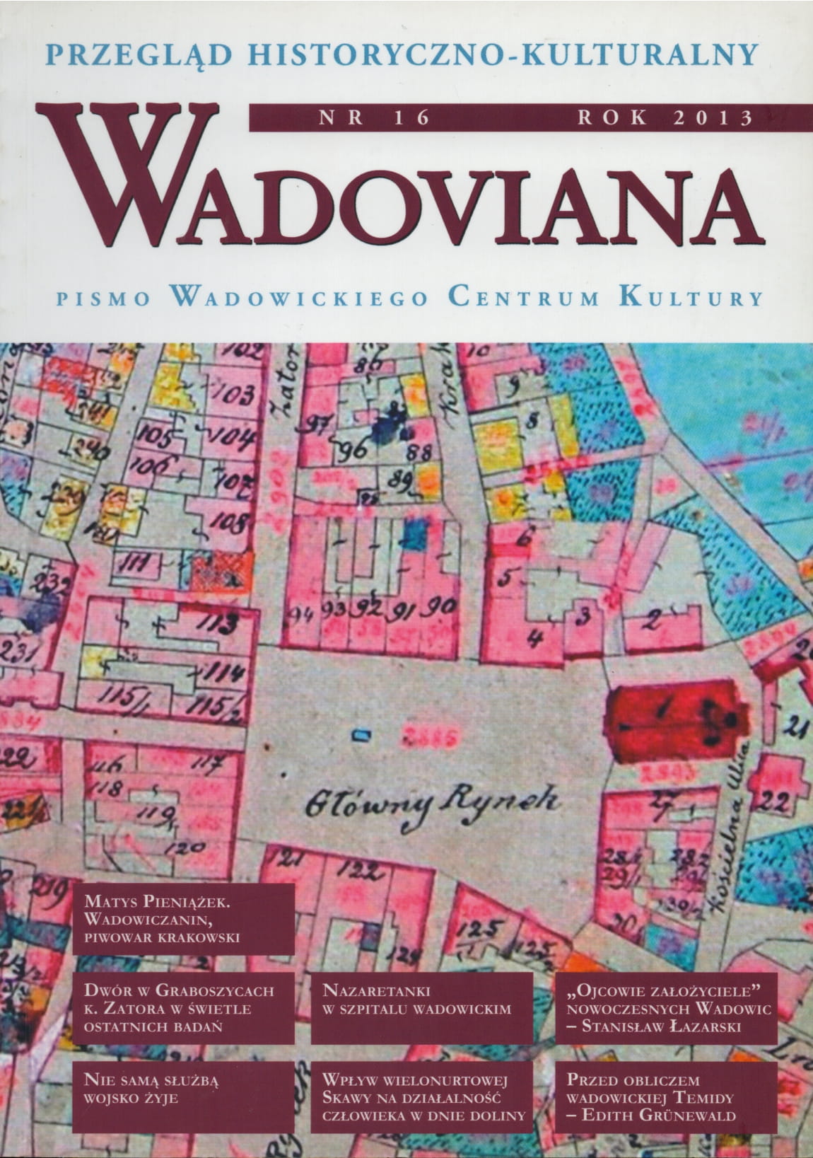
O cyfrowej mapie geologicznej Ziemi Wadowickiej Staszica, Przekroju przez Babią Górę Puscha, karpackich formacjach Hoheneggera i rybkach tropikalnych z inwałdzkiej Krakowicy (ciekawostek geologicznych część I).

Author(s): Janusz Kotlarczyk / Language(s): Polish Issue: 16/2013

Autor, geolog i archeolog, profesor AGH i członek PAN, przedstawił w swoim artykule kilka zagadnień związanych z badaniami geologicznymi na terenie Ziemi Wadowickiej. Przybliżył m.in. dzieło Stanisława Staszica "O ziemiorodztwie Karpatow i innych gor i rownin Polski", w którym mapa geologiczna obejmuje swym zasięgiem także Ziemię Wadowicką. Obszar ten znalazł się również na mapie geologicznej wybitnego geologa J.B. Puscha, profesora Akademii Górniczej w Kielcach (1816-1826), w składzie większego atlasu. Janusz Kotlarczyk opisał również szczegóły mapy stratygraficznej Karpat autorstwa Ludwiga Hoheneggera (1866 r.), która obejmowała obszar byłej Rzeczypospolitej Krakowskiej i przyległego od południa fragmentu Karpat, łącznie z fragmentem Ziemi Wadowickiej. Ciekawostką, na którą jeszcze zwrócił autor, były ślady ryb kopalnych odnalezione w Krakowicy, nieistniejącym dopływie Wieprzówki w dolinie łanów inwałdzkich.

More...
Marian Książkiewicz i jego "Arkusz Wadowice"
4.50 €
Preview

Marian Książkiewicz i jego "Arkusz Wadowice"

Author(s): Stefan Witold Alexandrowicz / Language(s): Polish Issue: 14/2011

Artykuł poświęcony postaci wybitnego geologa prof. Mariana Książkiewicza i jego pracom w zakresie tworzenia map geologicznych wykonanych na podkładzie topograficznym, ukazujących występowanie skał i utworów pokrywowych o określonym składzie i oznaczonym wieku. W artykule omówiona została jedna z prac prof. Książkiewicza, "Arkusz Wadowice" - mapa wraz z opisem formacji i struktur geologicznych - wydany na rok przed wybuchem II wojny światowej.

More...
Някои особености на самовъзстановяването на ландшафтите в България

Някои особености на самовъзстановяването на ландшафтите в България

Author(s): Nikola Todorov,Maria Petrova-Sapundzhieva / Language(s): English,Bulgarian Issue: 1/2019

Reclamation of landscapes after their anthropogenization significantly complicates their structure. An important problem is artificial afforestation with coniferous forests after logging or to prevent erosion. The formation of new anthropogenic-natural territorial complexes with low bio-productiveness are not sustainable so they are vulnerable. An illustrative example of the peculiarities of self-restraining processes in the interference of unusual for the respective landscape wood species are the mountains of Western and Central Bulgaria.

More...
Result 681-700 of 1301
  • Prev
  • 1
  • 2
  • 3
  • ...
  • 34
  • 35
  • 36
  • ...
  • 64
  • 65
  • 66
  • Next

About

CEEOL is a leading provider of academic eJournals, eBooks and Grey Literature documents in Humanities and Social Sciences from and about Central, East and Southeast Europe. In the rapidly changing digital sphere CEEOL is a reliable source of adjusting expertise trusted by scholars, researchers, publishers, and librarians. CEEOL offers various services to subscribing institutions and their patrons to make access to its content as easy as possible. CEEOL supports publishers to reach new audiences and disseminate the scientific achievements to a broad readership worldwide. Un-affiliated scholars have the possibility to access the repository by creating their personal user account.

Contact Us

Central and Eastern European Online Library GmbH
Basaltstrasse 9
60487 Frankfurt am Main
Germany
Amtsgericht Frankfurt am Main HRB 102056
VAT number: DE300273105
Phone: +49 (0)69-20026820
Email: info@ceeol.com

Connect with CEEOL

  • Join our Facebook page
  • Follow us on Twitter
CEEOL Logo Footer
2025 © CEEOL. ALL Rights Reserved. Privacy Policy | Terms & Conditions of use | Accessibility
ver2.0.428
Toggle Accessibility Mode

Login CEEOL

{{forgottenPasswordMessage.Message}}

Enter your Username (Email) below.

Institutional Login