Cookies help us deliver our services. By using our services, you agree to our use of cookies. Learn more.
  • Log In
  • Register
CEEOL Logo
Advanced Search
  • Home
  • SUBJECT AREAS
  • PUBLISHERS
  • JOURNALS
  • eBooks
  • GREY LITERATURE
  • CEEOL-DIGITS
  • INDIVIDUAL ACCOUNT
  • Help
  • Contact
  • for LIBRARIANS
  • for PUBLISHERS

Content Type

Subjects

Languages

Legend

  • Journal
  • Article
  • Book
  • Chapter
  • Open Access
  • Geography, Regional studies
  • Physical Geopgraphy

We kindly inform you that, as long as the subject affiliation of our 300.000+ articles is in progress, you might get unsufficient or no results on your third level or second level search. In this case, please broaden your search criteria.

Result 641-660 of 1301
  • Prev
  • 1
  • 2
  • 3
  • ...
  • 32
  • 33
  • 34
  • ...
  • 64
  • 65
  • 66
  • Next
PRILOG POVIJESTI VELEBITSKIH PLANINARSKIH OBJEKATA

PRILOG POVIJESTI VELEBITSKIH PLANINARSKIH OBJEKATA

Author(s): Ante Rukavina / Language(s): Croatian Issue: 1/1980

Nakon istjerivanja Turaka iz Like godine 1689. postupno su se stabilizirale prilike u krajevima oko Velebita, a sigurnost stanovništva i putnika postajala je sve veća. Velebit je prestao biti pozornica nepoštednih bitaka, a u novim, smirenijim prilikama postaje poprište znanstvenih istraživanja. Način života i običaji velebitskih gorštaka, bogat biljni i životinjski svijet, brojni povijesni nalazi, njegova golema prostranstva s velebnim vidicima i raskošna raznolikost obronaka privlače znanstvenike mnogih evropskih naroda i zemalja već u XVIII stoljeću. Osobito ih je puno iz Austrije i Mađarske, što rezultira iz ondašnjih političkih prilika, no tim se strancima ne može poreći dobronamjernost i iskreno zanimanje za našu najljepšu planinu.

More...
Timothy Clark, The Value of Ecocriticism

Timothy Clark, The Value of Ecocriticism

Author(s): Said Mentak / Language(s): English Issue: 1/2021

Review of: SAID MENTAK - Timothy Clark, The Value of Ecocriticism, Cambridge University Press, 2019.

More...
Apprising the local and global implication of ambient air Quality Index of Kaduna Metropolis, Nigeria

Apprising the local and global implication of ambient air Quality Index of Kaduna Metropolis, Nigeria

Author(s): Mwanret Gideon Daful,Taiye Oluwafemi Adewuyi,Dadan-Garba Aliyu,Akinwumi Olumide Oluwole,Muktar Namadi Muhammad,Cyril Kanayochuku Ezeamaka / Language(s): English Issue: 1/2020

This study apprises the local and global implication of ambient air quality index of Kaduna Metropolis, Nigeria. With the point of investigating the spatial and transient dissemination of the Air Quality Index (AQI) of Carbon monoxide (CO), Sulfur dioxide (SO2), and Particulate Matter (PM10) and their suggestions on human wellbeing, in view of neighborhood and global measures. Data were collected during the raining season and dry harmattan weather. From traffic, Industrial, commercial and residential areas, utilizing validated portable pollutant monitors (MSA Altair 5x Gas Detectora) to collect data on the concentration of air pollutants (CO and SO2) and (CW-HAT200 Particulate Counter) for the concentration of particulate matters (PM10). Equal allocation stratify sampling and purposive sampling were utilized for the selection of sample points. The data were analyzed in line with USEPA Air Quality Index calculation approach and using descriptive statistics. The findings reveal that the AQI of Kaduna Metropolis ranges from good to hazardous, CO has 57.57% and 24.24% of the sample sites AQI ranging from unhealthy to hazardous based on WHO/USEPA and NESREA standards respectively. Equally SO2 has about 91%, 34.23%, 42.42% of the sites AQI ranging from unhealthy to hazardous base on WHO, USEPA and NESREA standards respectively. PM10 has 75.76% and 18.18 of the sites AQI as hazardous base on WHO and USEPA standards, whereas none of the sites AQI is hazardous base on the NESREA standard. Further analysis shows that the northern part of the metropolis has more sites with unhealth AQI than the southern part of the metropolis. Also, the traffic land use has more of its sites AQI ranging from unhealthy to Sensitive group to hazardous. In conclusion this study provides empirical data on the AQI of Kaduna metropolis which ranges from good to hazardous. Thus, the need for the enforcement agencies to strictly enforce the guide lines regulating ambient pollution in the study area.

More...
The end of agency and the last man

The end of agency and the last man

Author(s): Jarl Kampen,Laurenc L. De Vita / Language(s): English Issue: 3/2021

Aim: In order to address the question whether a more sustainable society requires a change of purpose or a change of system, we must first resolve the issue of human agency. Is humanity free to choose its own destiny, or is humanity’s future determined by contingency of conditions and choices of the past? Design / Research methods: On the basis of cumulated knowledge and carefully cited literature, we defend the thesis that human agency is at best a minor factor in the determination of the future even in the short term. Conclusions / findings: We conclude that significant decrease of resources depletion and greenhouse gas production may sustain humanity in the middle to long term, but the proven lack of human agency allows only to predict the complete demise of humanity in the short term. Originality / value of the article: We apply the method of dialogue to show historical points of focus with respect to the issue of human agency. This paper is of interest to those organizing projects of socio- and or geo-engineering, since it describes the likely limitations of agency in regards to social structure, and so implies that actions will always have unintended consequences, which will drive more actions.

More...
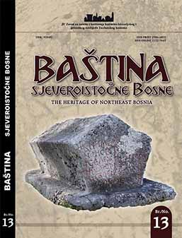
DJEVOJAČKA PEĆINA – PRIRODNA I ETNOLOŠKA OBILJEŽJA

DJEVOJAČKA PEĆINA – PRIRODNA I ETNOLOŠKA OBILJEŽJA

Author(s): Salih Selimbašić / Language(s): Bosnian Issue: 13/2021

In this paper, the author wants to show the village of Brateljevici and the famous place Maiden's cave, located on the northern slopes of the mountain area Karaula, Garez and Smolin, through whose valley a small river Bukovica flows. The cave is located one kilometer west from the inhabited part of the village Brateljevici about 30-40 meters above the right bank of the river Bukovica, which is a tributary of the Drinjaca river. A broader elaboration on the Maiden's Cave and the Brateljevici will be explained by the author in the further text of this paper

More...

Climate evolutionary trends resulting from a thermo-pluviometric profile made between the Carpathian peaks and the Dniester Valley

Author(s): Mădălina-Naomi Jibu,Dumitru Mihăilă / Language(s): English Issue: 1/2021

The change in the parameters for the climatic elements and phenomena has become the main topic of many current researches. Given to the complexity and the local distinctions of the climatic factors, these changes are not homogenous and thus some regions get warmer, while others get colder, some become more arid, others more humid. The purpose of the current study is to identify the thermo-pluviometric changes recorded in the geographical area localized between the Eastern Carpathians and the Dniester Valley, based on the meteorological data registered between 1961 – 2010 at the Ceahlău-Toaca, Suceava, Iași (in Romania), Chișinău, and Tiraspol (in the Republic of Moldova meteorological stations. In order to determine the evolutionary trends, the Mann-Kendall test was applied combined with Sen`s slope. Therefore, based on the research performed, it was found that, during the 1961 – 2010 period, in the area localized between the Carpathians and the Dniester, there has been a general trend of climatic warming and a slight decrease of the rainfall quantity (especially for the Ceahlău mountain area). This result is confirmed and reinforced by other studies of climate conducted at European level, hence allowing these climate trends to be integrated easily into the general trend of regional warming.

More...

Trends in air temperature and atmospheric precipitation in Botoşani between 1961 and 2017

Author(s): Ionuț-Daniel Strătilă,Dumitru Mihăilă,Adriana-Augustina Șușu / Language(s): English Issue: 1/2021

Air temperature and precipitations are major factors affecting the climate of a certain place. They define the basic matrix of the climate, and their evolution are of interest for the whole of both human and scientific community. The purpose of the present study is to highlight the sign and the magnitude of the trend in the air temperature at Botoşani city weather station for the whole period 1961-2017, and for both its major subdivisions (1961-1990 and 1991-2017, respectively) throughout different temporal subsets (from the level of an average year to the level of a month). Besides air temperature, we determined the evolutive trend in the amount of rainfall using a similar methodology (based mainly on the Mann- Kendall and t tests). Following our approach, we showcased the thermal and pluviometric reality at Botoşani, which is in a continuous change (as for the temperature values) or in a relatively dynamic balance (with respect to the amount of precipitations). More precisely, at Botoşani, against an annual average temperature of 9.4°C and an annual average of precipitations of 569.0 mm, after the year 1961 and mostly after 1990, the tendency was positive, which indicates an increase in air temperature. From a thermal point of view, considered annualy, seasonally and by warm and cold seasons (excepting autumn, with an insignificant increase), air temperature displayed a representative increase in value over the assessed period (1961-2017). On the whole, the annual temperature values increased by 0.32°C / decade, which presents a maximum statistical significance. Annual amount of rainfall increased over the period 1961 – 2017 by 4.46--5.35 mm/ decade, but this was not statistically significant.

More...

Contribution to the knowledge of the scattered villages in the small and medium size mountains of northern Romania (Țibău Mountains case study)

Author(s): Cezar Cernușcă / Language(s): English Issue: 1/2021

The present study is about the smallest rural settlements in the upper Bistrița river valley geographical region and even in the larger ethnographic region of Țara Dornelor. The main effort was made to analyze these mountain hamlets using available sources such as direct and indirect observation and gathering of credible information from the locals by verifying and synthesizing it. In doing so, we were able to establish that the inhabitants of these mountain hamlets have overcome the harsher climatic conditions in the small and medium mountains of northern Romania, managing to adapt and even prosper until recently due to their resilience, the abundance of valuable resources and other day-to-day living advantages.

More...

Severe weather events in Moldavia region, on June 23, 2019

Author(s): Diana-Corina Bostan,Adrian Timofte,Sorin Bostan / Language(s): English Issue: 1/2021

The forecast of torrential rainfall is quite laborious and sometimes difficult. The difficulty lies in estimating the quantitative threshold and the spatial distribution of rainfall. Such a study is necessary because it has been found that in the last 30-40 years, the severity of convective phenomena has increased. Through such studies, it is desired to improve the short and very short-term weather forecasts, so that the population and the authorities can limit, as much as possible, the damage in the field. In operational meteorology we constantly work with the concepts of isobars, isohypses, isohyets. In our study, we used another meteorological parameter, less used in the operative routine (in addition to those commonly used) - the equipotential temperature, respectively the map of vertical section with the distribution of isentropes, to analyze severe meteorological phenomena, which took place in the Moldavia region. Forecasts are easy when forecast models are heading in the same direction. But, things get complicated when the atmospheric instability is much more severe than initially anticipated and the phenomena are in full development. The solution to this is found in the fact that the forecasting activity also has a special segment - very short-term forecasts, namely nowcasting forecast (which is based on the interpretation of radar imaging). In this paper, such an example is presented. Due to minor changes in the air circulation in the lower troposphere, the convective phenomena were much more severe than those anticipated by the forecast models. On June 23, 2019, 23 immediate warning messages were issued until midnight, regarding torrential rains, storms and hail. From those issued, 21 were orange code warnings and 2 were red code warnings. In this way, the authorities intervened in due time, so that the losses in the field were minimized as much as possible.

More...

Georeferenced gridded data handled by GMT: cartographic solutions for geophysical mapping

Author(s): Polina Lemenkova / Language(s): English Issue: 1/2021

The functionality of Generic Mapping Tools (GMT) to process and visualize geospatial information is crucial to the development of the advanced cartographic method. This paper presents modelling and spatial analysis of the marine geological data using GMT shell scripting. GMT demonstrated effective cartographic solutions for visualization of the georeferenced data. The particular feature of GMT consists in its scripting modular approach that enables to use machine learning to explore reliable georeferenced data. Here, the study applies a sequential shell scripting to devise GMT modules for depicting marine geological data on the Mariana Trench. The data cover bathymetry, geophysics, tectonics and geology. The first method makes use of the 'nearneighbor' GMT module for grid contour modelling using Nearest Neighbor algorithm. This form of modelling classifies the geospatial data based on a similarity. The second method presents surface modelling from the initial XYZ-ASCII dataset by a combination of the 'blockmean' and 'surface' modules. The third method includes the use of the modules 'grdimage', 'psbasemap' and 'grdcontour' for plotting. Compared to GIS methods in which data are processed in a menu, GMT presents the console-based approach which automates cartographic data processing. The results present seven new maps and explanations of scripts.A combination of visual approaches applied using a color fill and various textures to represent data, which is effective in allowing readers to assess geophysical setting. The study demonstrated the effectiveness of GMT in geodata visualization.

More...

Assessment of flood runoff and land cover changes in the Căinari river basin

Author(s): Ana Jeleapov / Language(s): English Issue: 1/2021

The present research is dedicated to assessment of flood runoff of the Căinari river situated in the northern part of the Republic of Moldova. A special attention is paid to evaluation of flood runoff temporal and spatial distribution and its changes due to different factors. Direct and indirect methods were used in order to perform the research tasks. General and statistical analysis was applied to estimate temporal evolution, trends, cycle fluctuations and to calculate statistical parameters and values of different return period of the Căinari river flood runoff characteristics measured at Sevirova station (1954-present). Spatial distribution of flood runoff and its changes due to land use management activities from the last 3 decades was performed using SCS-CN model. Analysis of temporal dynamics shows that in the last 60 years the trend of peak discharges is decreasing while the one of flood runoff depth is slowly increasing. Main flood runoff characteristics are: average peak discharge - 16.3 m3 /s, depth - 4.41 mm, volume - 3.6 mln. m3 , total duration - 9.0 days. Flood events monthly distribution is as follows: June – 34 %, July – 25 %, May – 14 %. Flood runoff modeling was performed for ungauged tributaries of the Căinari river in condition of equal rainfall of 100 mm, land cover for 1982 and 2013 and 3 soil moisture conditions: dry, wet and average. Average modeled flood runoff values are 58 mm, 28 mm in case of dry soil and 84 in case of wet soils. General dynamics shows that for the last 3 decades the flood runoff has slightly decreased due to increasing grassland and orchards areas and decreasing share of arable land.

More...

Air temperature trend analysis of Târgu Mureș, Romania, between 1986- 2020

Author(s): Ion Buglea / Language(s): English Issue: 1/2021

One of the processes with the greatest impact on humanity in the second half of the twentieth century was global warming. Detection, estimation and prediction of trends are important aspects of climate research (Hansen and Lebedeff, 1987). Trends have become the most frequently used technique to identify climatic variability on a regional and local basis (Amadi et. al., 2014). Trend is a long-term change (increase or decrease) in a time series (Ragatoa, 2018). In the current context of climate change, we considered that a study on the evolution of air temperature in the last 35 years is needed, especially since it is the first study of its kind for this area. The aim of this study was to highlight long-term trends (magnitude and direction) in terms of air temperature (average, minimum, maximum, anomalies), at different time scales (multiannual, seasonal and monthly), in the city of Târgu Mureș, between 1986-2020. The analyzed data series come from the archive of the National Meteorological Administration with the records made by the local meteorological station. The analysis was performed using MS Excel spreadsheets with MAKESENS software to evaluate trend and data distribution (Mann-Kendall, Sen's slope, Kurtosis and Skewness). According to the results of the Mann-Kendall test and the estimation of the slope of Sen, there were statistically significant positive trends in the warmer months (June, July and August). Average temperature values increased by up to 1.6° C, and the average slope varied by 0.049° C / 35 years. Regarding the multiannual average, with one exception (2011), the last 13 years have shown positive trends. Consequently, the average annual temperature in Târgu Mureș shows obvious growth trends in the last 35 years.

More...
O IZVORIMA SLANE VODE KOD STUBICE I SLANJA PREMA ARHIVSKIM PODACIMA I TERENSKOM ISTRAŽIVANJU

O IZVORIMA SLANE VODE KOD STUBICE I SLANJA PREMA ARHIVSKIM PODACIMA I TERENSKOM ISTRAŽIVANJU

Author(s): Spomenka Vlahović / Language(s): Croatian Issue: 32/2021

The paper presents new data on the discovery of historical documentation important for understanding the saltwater source near Slani potok near Stubica and two saltwater sources near the village of Slanje near Varaždinske Toplice. As salt has played a very important role in human and animal nutrition since time immemorial and in various epochs of human civilization has had a great influence in various cultures around the world. In chronological order, a cross-section of events related to the research of the water source Slanja, the so-called Slanca, and for the first time historical very valuable sketches of the mentioned localities made by Alojz Rikard Schmiedt are shown. During the research conducted in 2018, when the aforementioned archival documentation was discovered in the Croatian State Archives in Zagreb, it was the new basis for the conducted field research at the aforementioned Slanje site. Given that over time these water sources have fallen into oblivion and are now in a state of disrepair, they are no longer used, this paper therefore has the main goal to draw the attention of experts to their value and importance in the need for new interpretation, valorization and popularization of special branch of geological heritage of the Republic of Croatia which is today located in the area of Varaždin County. The paper also presents other valuable historical data for this area, as well as other new scientific knowledge gained through research.

More...
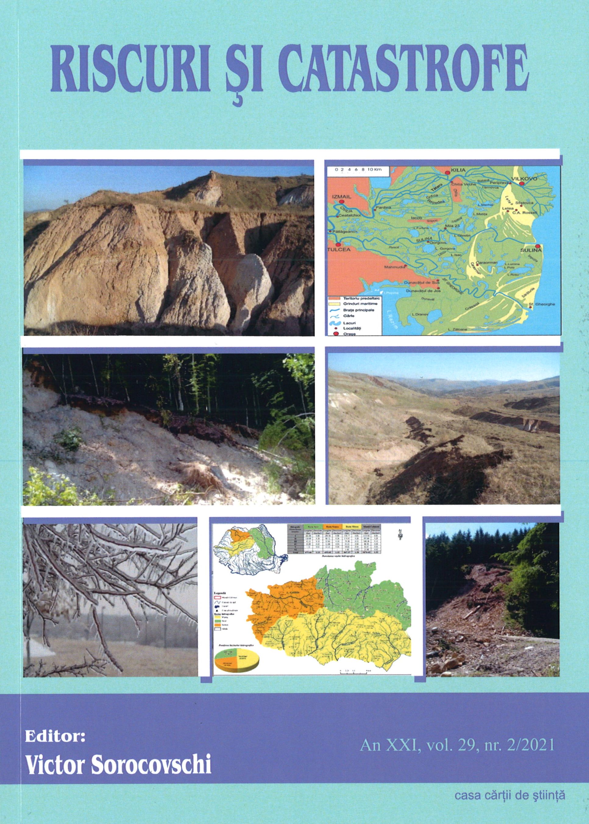
Freezing rain phenomena. Case study: Bucharest metropolitan area, January 24-29, 2019.

Freezing rain phenomena. Case study: Bucharest metropolitan area, January 24-29, 2019.

Author(s): Manuela Bărbărie,Albu Anca,BRATU DARIA,Silviu Costachie / Language(s): English Issue: 2/2021

The paper has a structure with four parts and presents the climatic risk aspects that happened in Romania during the winter of the year 2019, concentrating on Bucharest, where a very rare and dangerous phenomenon occurred, `freezing rain`. The first part contains the theoretical analysis of the subject under discussion (the notion of risk and freezing rain), in the second part we analyzed the synoptic context (the causes that led to the phenomena) and the data collected, the third part presents the results of the research (the duration of phenomena and the case study in the city), and the last part deals with proposed measures in order to reduce the risk of freezing rain, measures that can apply to any dangerous weather phenomena with freezing deposits. Therefore, the study aims to analyze this risk starting from the theoretical explanation of the synoptic context that generated its production to the quantitative analysis of the phenomena. To achieve this objective, the periods ECMWF models and the synoptic databases were accessed, with the help of which the representation and evolution of the phenomena was managed.

More...
The variation of the average water flow from the Căliman Mountains.

The variation of the average water flow from the Căliman Mountains.

Author(s): Hirlav Costin / Language(s): English Issue: 2/2021

The variation of river water runoff is a normal phenomenon, given the close link between runoff and atmospheric precipitation, both components of the water balance. The variation of the flow over a period of time can be calculated using several simple and complex indicators, among which the most important are the absolute and relative deviation, the standard deviation (deviation) and the coefficient of variation. In the Căliman Mountains, no analysis of the variation of river water flow has been made so far, this work being the first of its kind. Following this work, it was observed that the variation of water flow from these rivers in the period 1950-2010 depended strongly on the variation of climatic elements (precipitation and temperatures), but also on the characteristics of river basins, both annually and seasonally.

More...
Meteorological situations that generated exceptional discharges along the Danube River. (Case study- the situation of April 2006).

Meteorological situations that generated exceptional discharges along the Danube River. (Case study- the situation of April 2006).

Author(s): Ion Marinica,Mihai Bocioacă,Simona Rusu / Language(s): English Issue: 2/2021

For Europe, the undisputed importance of the Danube can be rendered by some general data: Its hydrographic basin surface exceeds 817000 km2, i.e. about 10% of that of the continent, its length is 2857 km and its mean multiannual discharge is about 6500 m3/s, thus ranking second to Volga river. Romania is the country with the largest surface situated within Danube’s basin (97.4%), representing 29% of Danube’s hydrographic basin. The water resources of the Danube in Bazias section amount to 173 billion m3, 30 billion m3 of which are technically usable resources.Our analysis aimed at determining those complex meteorological situations at the European continent level that triggered exceptional discharges along the Danube river, resulting in severe flooding, causing in turn heavy damages, fatalities, population evacuations and considerable rehabilitation costs. A complex analysis was performed, of statistical-synoptic type and those complex meteorological situations were identified that determined the occurrence of such disasters. Discharges and levels of the Danube were used along the whole measuring period, data from the archive of the National Meteorological Administration, and data, map and image archives from Wetterzentrale (Kartenarchiv, NCEP, NCAR, AVN etc.). The complex meteorological situations at the level of the European continent that triggered exceptional discharges along the Danube correlate with intense cyclonic activity, of both the Icelandic and the Mediterranean cyclones, with the negative phase of the North-Atlantic Oscillation and with decreasing or minimum solar activity (according to data from NOAA's Space Environment Center). The most disastrous floods occurred in the spring of 2006. The paper is important for meteorologists, in their weather forecasting activity, for hydrologists, in their hydrological forecasting and for the institutions involvedin flood management.

More...
Characterization of the water flow regime of the rivers from the Căliman Mountains (1950-2010) based on the Pardé Coefficient.

Characterization of the water flow regime of the rivers from the Căliman Mountains (1950-2010) based on the Pardé Coefficient.

Author(s): Hirlav Costin,ADRIANA MIHAELA PORCUȚAN / Language(s): English Issue: 2/2021

The Pardé coefficient, first introduced by Maurice Pardé in 1933, is the most famous water regime classification system in the world, and can be calculated and adapted to any river on the globe, based only on the average flow of rivers. In the Căliman Mountains, an analysis of the river’s water flow regime has not been performed according to this coefficient so far, this work being the first of its kind. Following the completion of this paper, it was observed that the variation of climatic elements (precipitation and temperatures) in the period 1950-2010 influenced more the regime at a seasonal than at a year level. Changes were observed at the level of the season with the lowest runoff, at the stations from Someș River basin, changing in the analyzed period from winter to the beginning of the period, in autumn after the year 2000.

More...
Landfill fires in Romania

Landfill fires in Romania

Author(s): Magdalena Drãgan,Gabriela Munteanu Cocean / Language(s): English Issue: 2/2021

Multiple hazards to human health and the environment are associated with a lacking waste management. Among them, landfill fires suddenly release large amounts of various chemicals, leading to environmental pollution and to potential impacts upon human health in the affected areas. The low level of separate collection and recycling of municipal waste in Romania leads to the accumulation of biowaste and other combustible waste (paper, plastic and textiles) in landfills, increasing the risk of landfill fires. Inventorying and monitoring the effects of such inadvertent events is a necessary step towards a thorough assessment of the environmental pollution at regional level. By using a waste fires database and reviewing press reports on large landfill fires, we have identified the spatial distribution of landfill fires in Romania, between 2016 and 2020. While the national annual average is rather low (around 35 fires per year), we were able to identify several hotspots of frequent landfill fires. Such sites draw attention to the ineffective municipal waste management in Romania and to the need for a better environmental monitoring in areas affected by landfill fires.

More...
Land degradation in the Iara hydrographic basin.

Land degradation in the Iara hydrographic basin.

Author(s): Gheorghe M. Rus,Ioan-Aurel Irimus,Csaba Horváth,Gheorghe Roșian / Language(s): English Issue: 2/2021

The hydrographic basin of the Iara River, a former mining area (territory imposed over the Iara Depression) presents numerous locations with degraded lands following the mining activity (in the former exploitation points at Făgetu Ierii, Mașca, Măgura Ierii, Băișoara), as well the development of massive deforestations in the upper sector of the Iara River (upstream of Valea Ierii commune). On medium and long term, these degraded lands are and will be included in ecological protection and conservation projects, so that, for example, the former mining points can be introduced in the tourist circuits. We mention that currently there is already a trend in this regard, in countries such as Poland, Slovakia, where former mining operations are included in tourist circuits, and tourist numbers are increasing in these locations (example - Silesia region). Thus, the transition must be made from the former Iara mining area, to a tourist area in which we hope that tourism will become the main economic activity. We add that, at present, there is only one exploitation point (of industrial dacite - in Băișoara locality), and tourism is relatively in an incipient phase (in Iara commune), while in Băișoara and Valea Ierii communes tourism is much more developed compared to Iara. On the other hand, there are many degraded lands following the geomorphological processes within the Iara Depression (landslides, ravines, gully erosion) in Iara, Făgetu Ierii, Agriș, Valea Agrișului, the low area of Băisoara (overlapping the Iara Depression). Thus, in the present study we aimed to classify degraded lands from the Iara river basin in two categories, namely: degraded lands caused by anthropogenic intervention, and degraded lands generated by geomorphological processes (practically based on a natural cause). For this GIS technology was used, to achieve the classification of degraded lands; also prior and after the use of GIS technology, numerous field trips were made to gather information, take pictures, take soil samples, as well as for confronting the reality in the field, following the creation of the cartographic material.

More...

Characteristics of the degradation of agricultural surfaces in the southern Bărăgan Plain, through rain-erosion processes

Characteristics of the degradation of agricultural surfaces in the southern Bărăgan Plain, through rain-erosion processes

Author(s): Florin Achim / Language(s): English Issue: 2/2021

The Southern Bărăgan Plain is a geographical unit where the rainfall processes have a moderate action, even reduced in some places, taking into account the low rainfall as well as the morphology and morphometers of the relief. These processes have an impact on man and human activities, primarily through the action they have on land on which intensive agriculture is practiced or even on inhabited areas.

More...
Result 641-660 of 1301
  • Prev
  • 1
  • 2
  • 3
  • ...
  • 32
  • 33
  • 34
  • ...
  • 64
  • 65
  • 66
  • Next

About

CEEOL is a leading provider of academic eJournals, eBooks and Grey Literature documents in Humanities and Social Sciences from and about Central, East and Southeast Europe. In the rapidly changing digital sphere CEEOL is a reliable source of adjusting expertise trusted by scholars, researchers, publishers, and librarians. CEEOL offers various services to subscribing institutions and their patrons to make access to its content as easy as possible. CEEOL supports publishers to reach new audiences and disseminate the scientific achievements to a broad readership worldwide. Un-affiliated scholars have the possibility to access the repository by creating their personal user account.

Contact Us

Central and Eastern European Online Library GmbH
Basaltstrasse 9
60487 Frankfurt am Main
Germany
Amtsgericht Frankfurt am Main HRB 102056
VAT number: DE300273105
Phone: +49 (0)69-20026820
Email: info@ceeol.com

Connect with CEEOL

  • Join our Facebook page
  • Follow us on Twitter
CEEOL Logo Footer
2025 © CEEOL. ALL Rights Reserved. Privacy Policy | Terms & Conditions of use | Accessibility
ver2.0.428
Toggle Accessibility Mode

Login CEEOL

{{forgottenPasswordMessage.Message}}

Enter your Username (Email) below.

Institutional Login