Cookies help us deliver our services. By using our services, you agree to our use of cookies. Learn more.
  • Log In
  • Register
CEEOL Logo
Advanced Search
  • Home
  • SUBJECT AREAS
  • PUBLISHERS
  • JOURNALS
  • eBooks
  • GREY LITERATURE
  • CEEOL-DIGITS
  • INDIVIDUAL ACCOUNT
  • Help
  • Contact
  • for LIBRARIANS
  • for PUBLISHERS

Content Type

Subjects

Languages

Legend

  • Journal
  • Article
  • Book
  • Chapter
  • Open Access
  • Geography, Regional studies
  • Physical Geopgraphy

We kindly inform you that, as long as the subject affiliation of our 300.000+ articles is in progress, you might get unsufficient or no results on your third level or second level search. In this case, please broaden your search criteria.

Result 621-640 of 1301
  • Prev
  • 1
  • 2
  • 3
  • ...
  • 31
  • 32
  • 33
  • ...
  • 64
  • 65
  • 66
  • Next
Природне карактеристике као услов развоја територије општине Обреновац

Природне карактеристике као услов развоја територије општине Обреновац

Author(s): Milena Panić,Jasmina Đorđević / Language(s): Serbian Issue: 2/2006

The main objective of research in this study is definition, extraction and evaluation of elements, consisting natural complex within the area of Obrenovac Municipality. An Evaluation has been performed regarding mentioned, as one of main factors for positioning and environmental development of economy and settlements. In order to rationally use the environment for agriculture, development and tourism an partial and synthetic evaluation was performed on separate natural complex components (geology, geomorphology, climate, hidrography, pedology and biogeography characteristics), and their influence as geopotential for the development of examined area.

More...
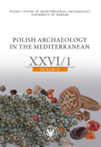
Report on the archaeological survey at Gebelein in the 2014, 2015 and 2016 seasons

Report on the archaeological survey at Gebelein in the 2014, 2015 and 2016 seasons

Author(s): Adam Grylak,Taichi Kuronuma,Vincent Oeters,Lawrence Xu-Nan,Dawid F. Wieczorek,Daniel Takács,Piotr Witkowski,Julia M. Chyla,Wojciech Ejsmond / Language(s): English Issue: XXVI/2017

All periods of Egyptian history are represented at Gebelein and it encompasses many kinds of archaeological site found in the Nile valley (that is, cemeteries, settlements, fortifications, temples, rock quarries etc.). The area was a significant centre in the history of ancient Egypt, but its exact role and the reasons for its importance still awaits explanation. That is why the Gebelein Archaeological Project was initiated. The field survey of Gebelein, which started in 2014, aims to recognise the topography of the area and the degree of destruction of the sites and to locate archaeological remains as well as to determine their interpretation and dating. This report outlines the results of work conducted during seasons 2014, 2015 and 2016, which encompassed the archaeological and epigraphic field surveys, geophysical prospection as well as work conducted in the rock-cut chapel of Hathor.

More...
Fotografia lotnicza jako narzędzie do identyfikacji kopalnych poligonów mrozowych – przegląd literatury

Fotografia lotnicza jako narzędzie do identyfikacji kopalnych poligonów mrozowych – przegląd literatury

Author(s): Maciej Dąbski,Patrycja Fabijańska / Language(s): Polish Issue: 3/2019

The article is a literature review concerning the use of aerial photography in identifying fossil frost polygons.In Poland, research on this topic has been conducted since the 1970s and concentrated in Wielkopolska(a young-glacial area), where sand wedges formed in the glacial till of Wisła Glaciation. In order to cover the issuein a broader sense, the authors also provide examples and methods that have been applied in other areas of outsidePoland. The presence of anthropogenic objects (modern and archaeological), sometimes makes it difficult to detectfrost polygons. Under favorable conditions for soil moisture and land use, aerial photography based on visible radiationfacilitates the mapping of fossil frost structures that indicate the occurrence of Pleistocene permafrost.

More...
Ocena tempa i kierunków zarastania jezior przy wykorzystaniu znormalizowanego różnicowego wskaźnika wegetacji NDVI na przykładzie jeziora Gardno

Ocena tempa i kierunków zarastania jezior przy wykorzystaniu znormalizowanego różnicowego wskaźnika wegetacji NDVI na przykładzie jeziora Gardno

Author(s): Roman Cieśliński,Kamil Mironik,Artur Młodzik / Language(s): Polish Issue: 3/2019

The development of aquatic vegetation in the littoral zone significantly change the nature of the immediate surroundings of the lake basin. However, the process of disappearance is affected not only by the lush succession of water vegetation, but also by the supply of bottom material, introduced by watercourses. The aim of the study isestimate the rate of overgrowth coastal reservoirs on example of Gardno lake, based on the normalized differential NDVI vegetation index. The assessment of the changes, taking place in the individual summer seasons within thelake basin, a thorough analysis based on satellite imagery performed for 2000-2014. The main aim, was to developan appropriate method to determine the extent of expansion of water vegetation on the example of a selected lake. Preliminary results, compiled with monthly average air temperatures and monthly mean precipitation totals, performed relationships between effective overgrowth and local meteorological conditions. The observed changes, inthe ever-growing littoral zone allow, us to suppose that the Gardno lake was going to disappear.

More...
Synergies in the Land Use Sector: What Is the Best Policy Approach When Co-benefits and Trade-offs Are Involved?

Synergies in the Land Use Sector: What Is the Best Policy Approach When Co-benefits and Trade-offs Are Involved?

Author(s): Martín López Ramírez / Language(s): English Issue: 53/2019

Mitigation and adaptation are the main strategies to address climate change. Both of them are interrelated instruments and key elements of an integral approach to tackle the phenomenon. This interrelation is particularly strong in the land use sector, an area in which practically any policy has a significant effect on the goals of both strategies. Yet, in practice, mitigation and adaptation are treated as two different instruments. A poor understanding about the interactions between the mentioned strategies remains as a barrier to implement the integrated approach. To contribute to fill-in this knowledge gap, a hypothetical ecologic-economic system simulated under deep uncertainty was used to test environmental and welfare implications of different policy configurations. Taking the unregulated economy as a benchmark, the outcomes of the mentioned interventions were classified as synergies or different forms of trade-offs. Results indicate that measures based on internalization of externalities overcame monetary compensation schemes. Moreover, when externalities were corrected, synergies were more frequent and associated to higher environmental and welfare gains. Furthermore, the policy configuration that exhibited best synergic properties was an intervention integrating mitigation and adaptation measures. This indicates that synergies may be more accessible than previously considered, however, current policy approach and incentives may not be the best tools to trigger them.

More...
JAMSKI SUSTAV LUKINA JAMA-TROJAMA NAJZNAČAJNIJE SPELEOLOŠKO OTKRIĆE U PROSTRANSTVU DINARSKOGA KRŠA

JAMSKI SUSTAV LUKINA JAMA-TROJAMA NAJZNAČAJNIJE SPELEOLOŠKO OTKRIĆE U PROSTRANSTVU DINARSKOGA KRŠA

Author(s): Branko Jalžić / Language(s): Croatian Issue: 1/1994

Das ausgedehnte dinarisehe Karstgebiet ist in der Welt wegen seiner Bedeutsamkeiten sehr bekannt. Darum haben viele heimische und auslandische Erforscher im Laufe der Jahrhunderte die unterirdisehe Welt dieses Ciebiets geduldig erforscht. Der Autor stellt die Entdeckung des Höhlensystems Lukina Jama-Trojama dar, seine geographische Lage, Zugang zu diesen Höhlen, Lauf der Erforschungen, ihre Erfolge und Bedeutung. Er betont die VA'ichtigkeit dieser Entdeckung: auf Grund ihrer Erforschungen, konnten Speläologen die geologische Struktur dieses Teils des Yelebits besser kennelernen, und haben festgestellt, daß diese Höhle die steilste Karsthöhle der Welt ist. Unter anderem, beschreibt der Autor die unterirdisehe Fauna und die Entdeckung des Höhlenkäfers aus der Familie Bathysciinae, der wahrscheinlich eine neue Art und Reihe darstellt.

More...
PREDGORSKE STEPENICE (PEDIMENTI) GORSKOG HRPTA JUŽNOG VELEBITA

PREDGORSKE STEPENICE (PEDIMENTI) GORSKOG HRPTA JUŽNOG VELEBITA

Author(s): Andrija Bognar / Language(s): Croatian Issue: 1/1992

The transverse profile of the South Velebit, range is characteristic for its stepslike delineation. This property also substantiates a theory of a very complex evolution of the South Velebit during the orogeny development stage, marked by the alternate uplifts and relative endogenic passivness, favourable for denudation and pediplanation processes. Such a development resulted in the formation of the two clearly defined steps; one, the older and higher and the other one, younger and lower. Despite of their regional distribution, their discontinuity and different altitudes are very significant. Namely, while both of the pediments are very well developed on the seaside slope, the another Lika-slope is characterized only by the higher pediment, resulting undoubtedly from the specific morphotectonic evolution of the mountain range. Distribution, genesis and properties of the Jelar deposits are indicators of the pedimentation and pediplanation processes, during Upper Eocene until Lower Neogene. Their morphologic activity is connected with a formation of the higher and older fold-pediment. Due to the pediplanation processes, the extreeme south-east and north-west parts of the present day mountain range have been modified into one denudation level of peneplanation. Intensive tectonic, prevailingly fault-movements during neotectonic development stage, from the Mid Miocene onwards, lifted the mountain range to its present altitudes. The older pediment and a pediplane level have been disarranged. In the course of a neotectonic development stage, there was obviously one stage of tectonic passivness in Pliocene, favourable for processes of peneplanation and denudation. This stage is connected with formation of the younger pediment, whereby it probably developed during arid and cold glacial periods. Due to the recent tectonic movements in Quarternary era, this pediment has been also disarranged.

More...
ANALIZA GUSTOĆE PONIKAVA NA SJEVERNOM VELEBITU I SENJSKOM BILU

ANALIZA GUSTOĆE PONIKAVA NA SJEVERNOM VELEBITU I SENJSKOM BILU

Author(s): Sanja Faivre / Language(s): Croatian Issue: 1/1992

The analysis of the dolines density on the North Velebit and Senjsko Bilo is shown. On 947 km2 has been registrated 18 059 dolines. One of the basic characteristic is the regular ranges of dolines, principally in direction NW-SE, and the regular change of the zones of bigger and smaller density. This indicate that the influence of the fault zones is essencial. The disposition of the ranges of dolines density has an exceptional morphostructural importance. There are three main fault zones: 1. Melnice-Kuterevo NW-SE, 2. Krasno-Lipovo polje WNW-ESE, 3. Bakovac fault zone E-W. The highest intensity of the dolines density is related to a wider area of convergention of three mentioned fault zones i.e. to the SE edge of Senjsko bilo, weider area of Lipovo polje and Bakovac.

More...

Assessment of the soil loss caused by riverbank erosion in Serbia

Author(s): Marko Langović,Slavoljub Dragićević,Ivan Novković,Nenad Živković,Radislav Tošić,Boban Milojković,Zoran Čvorović / Language(s): English Issue: 1/2021

Riverbank erosion and lateral channel migration are important geomorphological processes which cause various landscape, socio-economic, and environmental consequences. Although those processes are present on the territory of Serbia, there is no available data about the soil loss caused by riverbank erosion for the entire country. In this study, the spatial and temporal dynamics of the riverbank erosion for the largest internal rivers in Serbia (Velika Morava, Zapadna Morava, Južna Morava, Pek, Mlava, Veliki Timok, Kolubara) was assessed using remote sensing and GIS. The aim of this paper is to determine the total and average soil loss over large-scale periods (1923-2020), comparing data from the available sources (aerial photographs, satellite images, and different scale paper maps). Results indicated that lateral migration caused significant problems through land loss (approximately 2,561 ha), especially arable land, and land use changes in river basins, but also economic loss due to the reduction of agricultural production. Total and average soil loss was calculated for five most representative meanders on all studied rivers, and on the basis of the obtained values, certain regularities about further development and dynamics of riverbank movement are presented. A better understanding of river channel migration in this area will be of a great importance for practical issues such as predicting channel migration rates for river engineering and planning purposes, soil and water management and land use changes, environment protection.

More...
SARS COV11 AND OTHER CALAMITIES IN ADAM NEVILL’S LOST GIRL

SARS COV11 AND OTHER CALAMITIES IN ADAM NEVILL’S LOST GIRL

Author(s): Kubra Baysal / Language(s): English Issue: 1/2021

Speculating about future based on the present, climate change fiction (cli-fi) proves its potential to predict the environmental and social repercussions of anthropogenic transformation(s) on Earth. As a cli-fi novel, Lost Girl (2015) envisions the collapse of the world through grim depictions of the nonhuman environment and restless societies and recounts the dangerous quest of a father to find his lost daughter amidst (un)natural disasters, pandemics, and chaos. In the realistic world of Lost Girl, new strains of deadly viruses take hold of the world. Prophesying the corona- virus pandemic and other calamities that came out to be true in 2020 such as the destructive wildfires in Australia or the heatwaves in Europe among others, Lost Girl has a realistic touch leaving a wake-up call effect on the reader to change their anthropocentric way of living through a posthuman perspective.

More...
Warunki i perspektywy rozwoju wewnątrzmiejskiej żeglugi pasażerskiej na przykładzie Gdańska

Warunki i perspektywy rozwoju wewnątrzmiejskiej żeglugi pasażerskiej na przykładzie Gdańska

Author(s): Marcin Połom,Maciej Tarkowski,Krystian Puzdrakiewicz / Language(s): Polish Issue: 1/2020

Emission of pollutants to the environment from transport is one of the key drivers of climate change. European countries, including Poland, are trying to change their own transport policy, so that in various modes of transport a greater role is played by means partially or completely powered by electricity. Gdańsk, as a city with a coastal location and having access to a network of canals and rivers, plans to develop intra-city water tramway lines. It is planned to use modern electric or hybrid passenger ships for this purpose. The article presents the main conditions for the functioning of the existing connections inside Gdańsk. The socio-economic background and the connection of waterways with the transport network of Gdańsk were characterized. The assumptions of the new network of ferry connections were presented and their impact on the environment was analyzed. The last part of the article characterizes the potential financial, socio-economic and environmental impacts.

More...
The Leading Mid-European Astronomer Marian Wolfgang Koller

The Leading Mid-European Astronomer Marian Wolfgang Koller

Author(s): Stanislav Južnič / Language(s): English Issue: 2/2021

Marian Wolfgang Koller used to be considered the very best astronomer from Carniola next to Augustin Hallerstein. Today, his work connected with the Dalton Minimum is again in limelight as the alternative explanation of global warming phenomena. Koller wrote precise notes of six semestrial courses of Josef Stefan to promote Stefan’s talents. By using the international connection of his patron Koller, Stefan published at least twenty articles in the British Philosophical Magazine, some of them also in Paris and Geneva.

More...
Jūrinės simbolikos teritorinė sklaida Klaipėdos miesto viešosiose erdvėse

Jūrinės simbolikos teritorinė sklaida Klaipėdos miesto viešosiose erdvėse

Author(s): Daiva Verkulevičiūtė-Kriukienė,Modesta Vaitkutė / Language(s): Lithuanian Issue: -/2021

The geographical location of Klaipeda city determined that a suitable space for the formation of maritime culture was created here. There are a number of exceptional objects of small and large architecture in the public spaces of the city, some of which are related to the sea. However, it must be stated that the city still lacks objects that glorify famous personalities who have contributed to the fostering of maritime culture and the promotion of Lithuania as a maritime country. Methods used in the research: observation, object photography, cartographic, expert surveys. The study analyzes the diversity of maritime symbols and their territorial distribution in the public spaces of Klaipeda city. Trends in the renewal and further development of maritime elements are also presented in order to form the image of the city and foster maritime culture. This research should expand the boundaries of cognition of maritime culture and contribute to the strengthening of the maritime image of Klaipeda city.

More...
Gelionių ir Žaliojo ežerų morfometrija

Gelionių ir Žaliojo ežerų morfometrija

Author(s): Marijus Pileckas,Tauras Alekna,Vaidotas Valskys / Language(s): Lithuanian Issue: -/2021

Bathymetric surveys of Gelionys and Žaliasis Lakes (located in the Baltic Uplands, Aukštadvaris Regional Park, Lithuania) were carried out on April 21, 2020, from a boat with attached Lowrance HDI SKIMMER XDCR transducer (200 kHz), Simrad GO5 chartplotter and Lowrance Point-1 GPS/Glonass receiver. At the same time, the shorelines of the lakes were revised. Average distance between profiles was ~10 m and depth measurement accuracy up to 2–5 cm. Accuracy of water surface elevation measurement using GNSS receiver Topcon Hiper SR up to 1–2 cm. Later, detailed (0.5 × 0.5 m) digital lake bottom models (DEM) were developed, bathymetric plans of the lakes were created, the main morphometric features were calculated, the boundaries and area of the lake catchments were defined, and the physical-geographical characteristics of the lakes were described based on field observations and various data. Gelionys and Žaliasis are small lakes of glaciokarst origin. Gelionys Lake is oval-shaped while shape of Žaliasis Lake is closer to the circle. Despite small surface area the lakes are quite deep. According to survey data, the surface area of Gelionys Lake is 4.79 ha, water surface elevation 216.1 m a.s.l., maximum depth 19.8 m, mean depth 6.0 m, volume 288.3 thousands m3 , catchment area 71 ha. The surface area of Žaliasis Lake is 2.14 ha, water surface elevation 120.9 m a.s.l., maximum depth 15.84 m, mean depth 5.7 m, volume 122.2 thousands m3 , catchment area 60 ha. During the observation period (from May of 2018 to September of 2020), the annual amplitude of water level fluctuations in Gelionys Lake reached up to 0.47 m, and in Žaliasis Lake up to 0.33 m.

More...
The Uruguay River: A Permeable Border in South America

The Uruguay River: A Permeable Border in South America

Author(s): Eunice Nodari,Marcos Gerhardt / Language(s): English Issue: 1/2021

The Uruguay River basin in South America has held a social, cultural, environmental, and economic relevance for many centuries. The river flows for about two-thousand kilometers, linked to an important remnant of native forest, the Selva Misionera in Argentina, and to a Brazilian conservation unit for biodiversity, the Turvo State Park. The Uruguay River is fed by several other important rivers, forming a basin region in which thousands of people live and work. The history of the Uruguay River is intensively linked to the permeable borders between Brazil, Argentina, and Uruguay where different social groups circulated in diverse historical time periods. Forests along the river played a very important role with emphasis on the extraction and trade of yerba mate (Ilex paraguariensis, Saint-Hilaire), a forest product widely consumed in southern America, and also the timber extraction from native forests, during the nineteenth and twentieth centuries. As a result, a profound socio-environmental transformation took place with the reconstruction of regional landscapes shaped by the Uruguay River basin.

More...

Przyrodnicze i antropogeniczne uwarunkowania funkcjonowania krajobrazu równiny łowicko-błońskiej na przykładzie fragmentu Gongolina-Pawłowice

Author(s): Andrzej Harasimiuk,Agnieszka Sosnowska,Tomasz Grabowski / Language(s): Polish Issue: 3/2021

The Łowicz-Błonie Plain is a flat and monotonous part of the late-glacial landscape. The parent material is dominated by loam, silt and clay covered with sand of various thickness. The main aim of the study was to indicate the natural and anthropogenic determinants of the fertile plain landscape’s functions, which has been intensively used for agriculture. Natural environmental conditions are determined by the vicinity of contrasting in humidity and trophism areas. The current state of the natural environment is the result of both the natural basis and anthropogenic transformations. The biggest changes in expanding the possibilities of using the trophic potential are related to artificial water drainage system.

More...

Antropogeniczne przekształcenie rzek na Ponidziu Pińczowskim

Author(s): Jarosław Suchożebrski / Language(s): Polish Issue: 3/2021

One of the three basic components of assessing ecological state is the determination of hydromorphological conditions occurring in river channels and valleys. In this paper an effort has been taken to check usefulness for such evaluations River Habitat Survey (RHS) – British research method, which is used in Poland for classification of ecological quality of surface waters from the view-point of their actual hydromorphological state. The possibilities of using this method in field teaching of geography students were checked. For this purpose, the RHS method was modified and adapted to the needs of field exercises. Research was conducted in Nida Riverside region, near Pińczów (świętokrzyskie voivodeship, Poland). Collected material makes it possible to calculate synthetic indicator HMS (Habitat Modification Score) which allow the hydromorphological state of a river to be presented in numerical form and assessing river modification by human activities. The research released advantages of the RHS in field teaching of students. The method can also be used in field exercises with secondary school students.

More...

Główne kierunki oraz historyczne i krajobrazowe uwarunkowania przemian pokrycia terenu okolic Pińczowa w latach 1839–2000

Author(s): Maria Zachwatowicz / Language(s): Polish Issue: 3/2021

The transformations of cultural landscapes are related to and result from environmental conditions and human impacts. The article describes the main directions of land cover changes in the vicinity of Pińczów in the years 1839–2000. The identified land use patterns were shown and discussed against the background of natural landscape characteristics, and anthropogenic influences associated with socio-political and economic situation of the region in the analyzed period.

More...
Ecology of zoophilic flies in livestock biocenoses of Ukraine

Ecology of zoophilic flies in livestock biocenoses of Ukraine

Author(s): A. P. Paliy,A. N. Mashkey,L. I. Faly,O. S. Kysterna,A. P. Palii,H. I. Rebenko / Language(s): English Issue: 3/2021

In modern animal husbandry of Ukraine, there are still some unresolved issues related to the high number of zoophilic flies in the territories of facilities and the spread of animal infectious and parasitic diseases. A detailed study of bioecological peculiarities of the dominant zoophilic fly species contributes to improving the effectiveness of measures to control ectoparasites. 27 zoophilic fly species have been found in animal breeding complexes. The maximum number of parasitic Diptera species was recorded on cattle-keeping premises. The biological properties of Neomyia cornicina (Fabricius, 1781) (size, shape, colour, duration of preimaginal phase development) were studied. Also, we studied the dynamics of the number and daily activity of dominant fly species (Musca domestica Linnaeus, 1758, M. autumnalis De Geer, 1776, Stomoxys calcitrans (Linnaeus, 1758)). When studying the intraspecies competition, a high-degree survival of M. domestica and M. autumnalis was determined in the conditions of critical nutritional deficiency (0.5 g of nutrient medium per larva) and increased density of individuals (the imago emergence was 38.6% and 34.0%, respectively). In similar maintenance conditions, the emergence of N. cornicina imago was low (14.6%). With a two-fold increase in the insectarium volume and in the amount of nutrient medium (1 g per larva), the imago emergence of M. domestica, M. autumnalis and N. cornicina increased to 64.0%, 39.2%, and 24.0%, respectively. With an even greater increase in the amount of nutrient medium (2 g per larva), the maximum emergence of imagoes of all the studied fly species was observed (M. domestica, M. autumnalis, and N. cornicina: 96.6%, 91.2% and 72.6%, respectively). In the conditions of interspecific competition, M. autumnalis suppressed N. cornicina even in conditions of a sufficient amount of nutrient substrate. In the competition between M. domestica and M. autumnalis, house fly dominated. Increasing the nutrient medium volume narrowed the gap between the competing species.

More...
İslâm Coğrafyacılarında Halep Nehri

İslâm Coğrafyacılarında Halep Nehri

Author(s): Hayri Alkan / Language(s): Turkish Issue: 2/2021

Water resources are indispensable element of life. Because, water offers great importance for the structure of the earth and the life of living things. Furthermore, it plays a major role in the shaping of religious, cultural, political, economic and social life. Water resources/rivers have enabled the establishment of prosperous and abundant settlements that are especially offered to mankind. It is such that the city of Aleppo, which is strategically located in an important point, is the best example to this. The Kuveyk River which is Aleppo's largest river, has met the water needs of both people and some gardens throughout history. The river has been passing through the settlements such as Aleppo, Azaz, Kınnesrin, Dabık and Ayntab. But there are different opinions about the emergence of the river. Especially, there are have been information about Aleppo River on geopraphiers Ibn al-Adim, Ibn Havqal, Abu Zayd al-Balkhi, Hasan b. Ahmed alMuhellebi al-Azizi, Abu Abdullah Muhammed a. Ahmed al-Ceyhani, Ibn alMunadi, Ibn al-Fakih, Ibn Rusta and Siraj al-Din Ibn al-Wardi. In this article, these scattered information would be given totally. Later, the article would be ended with Conclusion.

More...
Result 621-640 of 1301
  • Prev
  • 1
  • 2
  • 3
  • ...
  • 31
  • 32
  • 33
  • ...
  • 64
  • 65
  • 66
  • Next

About

CEEOL is a leading provider of academic eJournals, eBooks and Grey Literature documents in Humanities and Social Sciences from and about Central, East and Southeast Europe. In the rapidly changing digital sphere CEEOL is a reliable source of adjusting expertise trusted by scholars, researchers, publishers, and librarians. CEEOL offers various services to subscribing institutions and their patrons to make access to its content as easy as possible. CEEOL supports publishers to reach new audiences and disseminate the scientific achievements to a broad readership worldwide. Un-affiliated scholars have the possibility to access the repository by creating their personal user account.

Contact Us

Central and Eastern European Online Library GmbH
Basaltstrasse 9
60487 Frankfurt am Main
Germany
Amtsgericht Frankfurt am Main HRB 102056
VAT number: DE300273105
Phone: +49 (0)69-20026820
Email: info@ceeol.com

Connect with CEEOL

  • Join our Facebook page
  • Follow us on Twitter
CEEOL Logo Footer
2025 © CEEOL. ALL Rights Reserved. Privacy Policy | Terms & Conditions of use | Accessibility
ver2.0.428
Toggle Accessibility Mode

Login CEEOL

{{forgottenPasswordMessage.Message}}

Enter your Username (Email) below.

Institutional Login