Cookies help us deliver our services. By using our services, you agree to our use of cookies. Learn more.
  • Log In
  • Register
CEEOL Logo
Advanced Search
  • Home
  • SUBJECT AREAS
  • PUBLISHERS
  • JOURNALS
  • eBooks
  • GREY LITERATURE
  • CEEOL-DIGITS
  • INDIVIDUAL ACCOUNT
  • Help
  • Contact
  • for LIBRARIANS
  • for PUBLISHERS

Content Type

Subjects

Languages

Legend

  • Journal
  • Article
  • Book
  • Chapter
  • Open Access
  • Geography, Regional studies
  • Maps / Cartography

We kindly inform you that, as long as the subject affiliation of our 300.000+ articles is in progress, you might get unsufficient or no results on your third level or second level search. In this case, please broaden your search criteria.

Result 681-700 of 1162
  • Prev
  • 1
  • 2
  • 3
  • ...
  • 34
  • 35
  • 36
  • ...
  • 57
  • 58
  • 59
  • Next

Mapping of very shallow geothermal potentials in rural areas of Bavaria

Author(s): David Bertermann,Hans Schwarz,Mario Rammler,Nikola Jocić / Language(s): English Issue: 1/2024

Climate change is a rising issue which strongly influences contemporary society. Therefore, the utilization of sustainable non-fossil energy sources is one of the most important goals in order to reduce greenhouse gas emission. Utilization of geothermal energy for heating and cooling buildings or residential units is one of the significant steps in providing sustainable and renewable energy supply. This paper presents very Shallow Geo-thermal Potentials (vSGP) of German federal state Bavaria, with special focus on rural are-as. Main goal of the study was to analyze the potentials for utilization of very shallow geo-thermal systems in terms of thermal conductivity and heat extraction. High-resolution soil maps containing information of grain size conditions served as an area-wide data basis for the research, while the analysis and visualization of the results were conducted by GIS software. Thermal conductivity as well as system-specific heat extraction were calculated depending on soil texture and climate conditions. Thermal conductivity results are intend-ed to be further used as the basic parameter for planning and installing horizontal geo-thermal heating and cooling systems.

More...

ANALYSIS AND MAPPING OF AREAS VULNERABLE TO FLOOD IN YOLA METROPOLIS.

Author(s): Patrick Shehu,Bulus Azi Musa,Mediya Emmanuel Bitrus,Ayaka Taimako Yakubu / Language(s): English Issue: 7/2022

Intensification in the occurrence of floods globally and indeed in Nigeria with their devastating impacts on lives and properties is worrisome. To this end, the study involved Analysis and Mapping of Areas Vulnerable to Flood in Yola Metropolis. The purposive sampling technique was applied to select five judged worst flood vulnerable areas. Data were acquired through field observation, historical records, and hydrological data. Geographic Information System and Global Positioning System were applied in processing acquired spatial information. The result showed that the bulk of the study area is exposed to flood due to its low altitude, most of the areas are made up of planes with a gradient less than 1.6 thus highly vulnerable, areas with a gradient of 1.7 to 4.5 were marginally vulnerable and most of the areas were already developed, thereby increasing the susceptibility of the inhabitants to flood. Most parts of the communities were within a kilometre to river Benue and Chonji which is high vulnerability to flood. Doubeli, Jambutu, Limawa, and Rumde areas are within the zones with a high tendency for flow accumulation while the Bole-Yolde Pate ward is within areas with low tendency. Also, identified that clay soil is highly vulnerable due to its low infiltration, clay-loam is vulnerable, while sandy and sandy-loam which have high infiltration are not vulnerable. The study concludes and recommends that Government should come up with a policy that restricts development along with or around flood vulnerable areas and advice those already living in such areas to relocate. Also, results obtained in this study could be used by stakeholders and the government as a guide for effective flood management.

More...

The online destination image of the protected area Bicaz Gorges-Hășmaș National Park

Author(s): Elena Măgdălin,Alexandra Cehan / Language(s): English Issue: 1/2022

The purpose of this paper is to analyse the online destination image of the protected area Bicaz Gorges-Hasmas National Park. Four objectives have been formulated, as it follows: (1) analyzing tourists’ visiting behaviour at the destination, (2) evaluating tourists’ appreciation of the different attractions inside the destination and implicitly comparing these attractions, (3) identifying the most emblematic elements of the online image for the analysed attractions and (4) identifying the issues that exist at the destination as perceived by tourists. The analysis of user-generated content from TripAdvisor and Google Maps platforms led to the folowing results for the study area: the National Park is characterised by high seasonality, with the peak season during the summer months; there is a certain uniformity regarding the geographical origin of the tourists who visited different locations inside the National Park; there is a generally positive opinion regarding the destination, which is perceived as ”beautiful”, ”wonderful”, and even ”spectacular”; the issues related to the road infrastucture or to crowdedness (especially around Red Lake) represent the main negative comments of tourists regarding the destination. The results of this analysis can be of practical use in terms of developing future marketing campaigns and for designing strategic plans for solving the identified issues at the destination.

More...

Mapping the risk of forest fires in the watershed of Oued Bougous (Northeast of Algeria)

Author(s): Boubaker Khallef,Rabah Zennir / Language(s): English Issue: 1/2022

The objective of this study is to map the risk of 3 forest fires at the scale of the Oued Bougous watershed in the extreme northeast of Algeria using remote sensing and GIS. We used a fire risk mapping model which is based on a number of parameters, namely: the type of vegetation, the slope, the exposure, the proximity of roads and agglomerations. The result obtained revealed that 79.88% of the study area represents a very high to high risk. This risk is essentially linked to highly flammable vegetation, steep slopes, southern exposure, a dense road network and a significant human presence within the forest. The established fire risk index map is a real decision-making tool, but it remains insufficient, because there are other anthropogenic factors that trigger forest fires that are not taken into account by the adopted model, such as the agricultural practice especially the harvest campaign and the border situation of the watershed with Tunisia.

More...
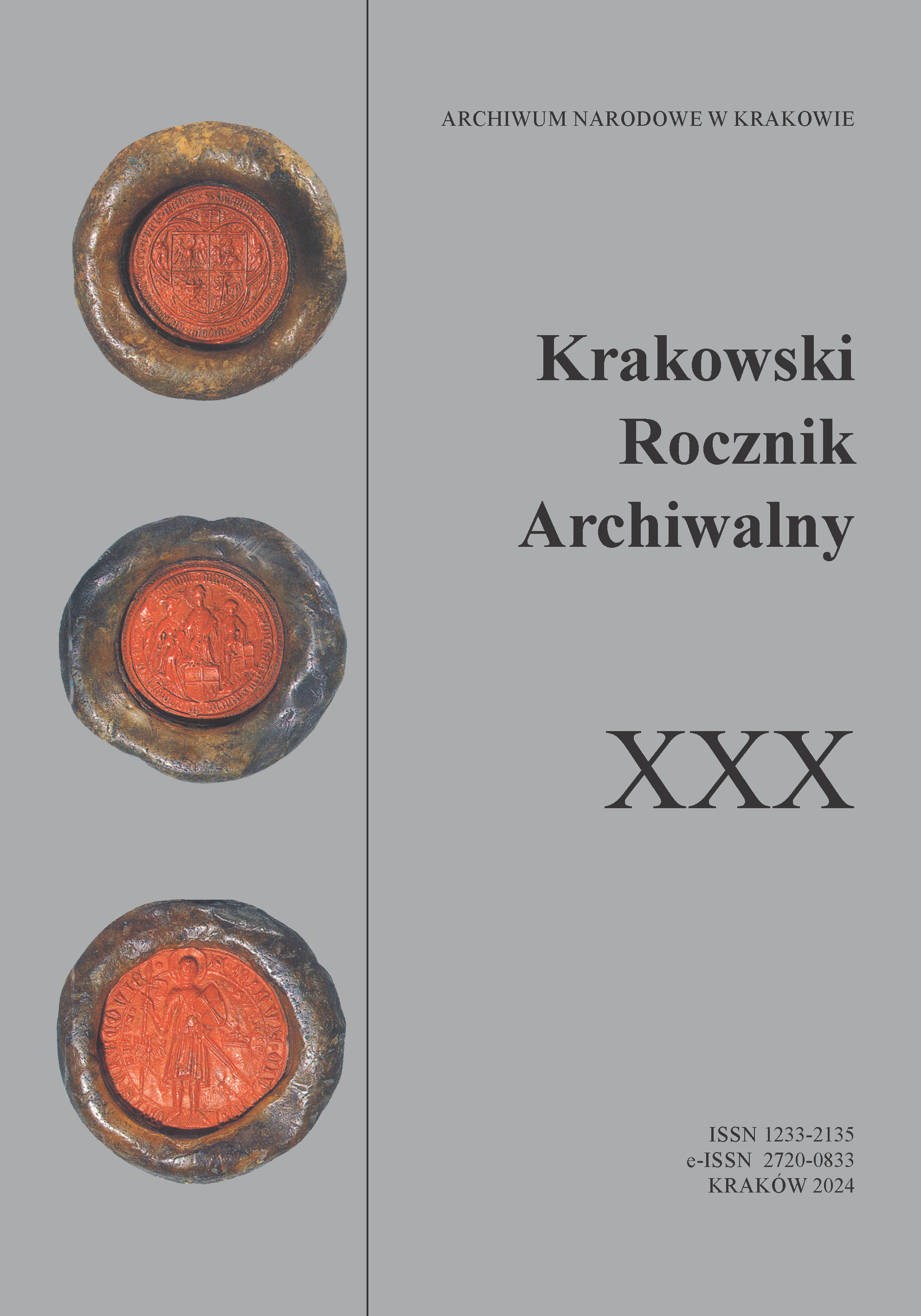
O badaniach archiwalnych krajobrazu kulturowego Krakowa ze szczególnym uwzględnieniem ogrodów

O badaniach archiwalnych krajobrazu kulturowego Krakowa ze szczególnym uwzględnieniem ogrodów

Author(s): Agata Zachariasz / Language(s): Polish Issue: XXX/2024

An important feature of Krakow’s landscape are its historic green areas. Everyone knows the Planty or Jordan Park, but there are also other gardens, parks, green areas, squares and streets, with all of them contributing to the system of urban green areas. The aim of the article is to show the usefulness of archival research undertaken in architectural and landscape design for historic green areas. The work uses archival research, literature studies, field work and factual analysis, historical-interpretive methods and comparative studies. The course of conservation proceedings in the reconstruction of historic green areas is presented, with the study of archives being an important element of the designer’s work. Various scales of planning and design as well as forms of greenery are presented, mainly from Krakow and the surrounding area. They serve as an example to show archival sources (including maps, designs, photographs, and written sources) being used directly or indirectly in reconstruction or revalorization projects of garden art objects. Selected issues related to cartography, especially the Galician cadastral map, are discussed using examples. Pleasure gardens, parks and gardens inside urban blocks – in dense urban development, plants and architectural details, and regulatory plans are shown, and greenery issues are discussed in the context of panoramas and views. Finally, the importance of collecting various types of source materials for the reconstruction of composed greenery constituting an integral part of the cultural landscape is emphasised.

More...
Promišljanje kartografije kao skupa praksi za konstrukciju znanja u etnološkim istraživanjima

Promišljanje kartografije kao skupa praksi za konstrukciju znanja u etnološkim istraživanjima

Author(s): Ivana Štokov / Language(s): Croatian Issue: 47/2024

The text analyzes the existing ethnological cartography as a knowledge-construction process. The aim of the paper is to use digital technology (GIS) and reflections on the mapmaking process to highlight cartography as a set of practices for knowledge construction. The author will explore mapping practices that have influenced map-making, as well as knowledge construction processes during map-making using digital tools, specifically ArcGIS software. This study is based on ethnological data collected through questionnaires for the Ethnological Atlas of Yugoslavia. The research focuses on how cartography objectifies knowledge, as well as how digital technology, especially GIS, can enhance the processes of analysis, synthesis, and visualization of ethnological data.

More...
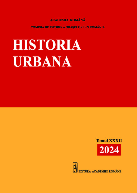
Inginerul Moritz von Ott și planurile „pierdute” ale orașelor București și Târgoviște (1820)
4.50 €
Preview

Inginerul Moritz von Ott și planurile „pierdute” ale orașelor București și Târgoviște (1820)

Author(s): Laurențiu Rădvan,Mădălin Focșa / Language(s): Romanian Issue: 32/2024

Since 1770, the history of Wallachia has been enriched with a new type of source, one coming from cartography, the urban plans. The oldest maps of a local city were those of the capital of Bucharest and date back to the Russian-Turkish war of 1768–1774; the reasons for the topographical survey were not of geographical or historical interest but were based on the need of the armies involved in the war to know as well as possible the occupied territory. While the first three plans were drawn up by the Russian army surveyors before the Kuciuk-Kainardji peace treaty of 1774, in the next war, from 1788–1792, the concern to know the plan of the city shifted to the Austrian army surveyors. The plans of Ernst and Purcel (1789, 1791) make a great step forward in terms of rendering the topography of the city, but further progress is made in the next war, from 1806–1812, by Russian engineers with two new plans. All these plans were taken to Petersburg, Moscow, or Vienna, so the local authorities had no detailed plans for Bucharest. Historians know of an order given by Prince Alexander Suțu to the engineer Johann Freywald in 1819 to draw up a plan, but another engineer from Austria, Moritz von Ott, seems to have been in charge of this mission. The plan was believed to have been completed in 1823 and subsequently lost; a damaged version was found in the 1980s by Paul Păltănea in Galați. Recent research has led to the discovery of the plan at the State Library in Berlin (Staatsbibliothek zu Berlin). The map was made by Moritz von Ott in 1820 and contains valuable data on the extent of the town, the main buildings (churches, monasteries, and houses of the great boyars), and the administrative organization. As a copy of the plan came into the possession of the Prussian consul in Bucharest, Ludwig Kreuchely von Schwerdtberg, he added some notes referring to places connected with the events of 1821 in Wallachia and the Filiki Eteria movement. Even more surprising was the discovery in the same Berlin library of a plan for the city of Târgoviște, also made in 1820 by Moritz von Ott. In this case, too, we believe that the plan was made by order of Alexandru Suțu, who had given the estate of this town to his daughter Catinca as a dowry for her marriage to the great boyar Manolache Băleanu. Ott sketched the town and paid attention to the surroundings, which were part of the estate. Here, too, a copy of the plan reached Ludwig Kreuchely, who additionally noted the old fortifications of the town, which Alexander Ypsilantis, the leader of the Eteria, rebuilt in the spring of 1821. The two plans discovered in the Berlin State Library complete the picture we have of the two important cities of Wallachia. If Bucharest was the capital and was in the process of development and modernization, Târgoviște was in the opposite situation, with many of its monuments in decay and ruin, the two plans being illustrative in this respect. The documents analysed are also valuable from another point of view: for Bucharest the first plan made by an engineer at the request of the local authorities was (re)discovered, while for Târgoviște Moritz von Ott’s plan represents the first known plan of the city. Their research represents a necessary restitution, which introduces new data into academia and is useful for historians, geographers, architects, and town planners.

More...
Un itinerar de marș de la Târgu Frumos la Botoșani (1830)
4.50 €
Preview

Un itinerar de marș de la Târgu Frumos la Botoșani (1830)

Author(s): Mihai Anatolii Ciobanu / Language(s): Romanian Issue: 32/2024

A significant number of march itineraries through Romanian territory are preserved in the Russian State Military Historical Archive. These itineraries were compiled during the Great Surveying Campaign of 1828–1832. They are another type of military cartographic sources, drawn up for the Russian army during the military occupation of the Romanian Principalities. In this study, we comment on the itinerary from Târgu Frumos to Botoșani, which was made by Kuznetsov in 1830.

More...
Planul orașului Iași de Frederic Peytavin (1857)
4.50 €
Preview

Planul orașului Iași de Frederic Peytavin (1857)

Author(s): Laurențiu Rădvan / Language(s): Romanian Issue: 32/2024

From the point of view of historical cartography, the city of Iasi has a fairly good situation, one that has been continuously enriched in recent years following the discovery of unknown plans in foreign archives. An Austrian map from 1855 has been added to the city’s map heritage, along with several Russian maps, including the oldest known plan of the capital of Moldavia, made in 1739. These cartographic documents are in addition to several plans drawn up by engineers at the request of the local authorities, starting with the plans of the Italian Giuseppe de Bajardi (1819), the Austrian Joseph Raschek (1844), and the French Frederic Peytavin (1857). Surprises were also provided by these plans. While the original of the 1819 plan has not yet been identified, the 1844 plan – for which historians used a Romanian copy from the National Archives in Iasi – has recently been found in its first form, published in the meantime by Sorin Iftimi. The last plan mentioned in this series, the one from 1857, seemed to offer no surprises since the original was in the archives. It was an appearance, and in this study, we reveal the results of recent research in local archives and libraries, which showed not only the reasons for the creation of this plan only 13 years after the previous one but also added a new, unknown version. It is a version also made by Frederic Peytavin between 1855 and 1857, but in 19 colour plates. At the Romanian Academy Library, only 13 plates have survived, nine of which cover peripheral or lowland areas of the city, and four of which are more important because they capture central or densely inhabited areas. One advantage of this version is the type of buildings captured, wall buildings or wooden houses, a distinction that cannot be made in the first version. There is evidence of a significant increase in the number of buildings made of durable and more fire-resistant materials compared to modest wooden constructions, as a result of the measures taken in the building sector after the Organic Regulation. The first type of construction dominates the central area and Copou but is also found along the Păcurari road. The slums (mahalale), on the other hand, are still characterised by modest construction, with wall buildings being much rarer. With the exception of the houses in the slums or the simple houses in the centre, the plan of the stone buildings was drawn by the surveyor. For the interior of the town, it is useful to observe the local hydrography, with all the springs, the small streams that flowed into the Bahlui River, fragments of the Cacaina and Nicolina streams, along with the town’s fountains. We can consider this plan as a cadastral one, allowing us to understand the stage reached by the capital of Moldavia before the Union of 1859. Signs of modernisation were evident, especially in the central area, but less visible in the slums, where changes were still awaited.

More...

The Need To Create a 3D Cadastre

Author(s): Cosmina Mariana Cîmpean,Mihai Dorin Isac,Daniela Lucia Manea / Language(s): English Issue: 37/2024

During last two centuries population density has increased considerably resulting in a more intensive use of the land. This phenomenon increased the importance of property which also changed the perception of people in relationship with land. This change required a system in which land ownership was clearly and indisputably established. 3D technologies are more effective than 2D ones, especially when urban and regional planning and management are included, and especially when there is underground and aboveground 3D spatial infrastructure.

More...

Web GIS and Cloud Computing for Defense Decision Making

Author(s): Gabriel Ionuț Dorobanțu,Ana Cornelia Badea / Language(s): English Issue: 37/2024

The paper presents a workflow for managing and analyzing a national crisis through modern geospatial modeling techniques available in GIS. The transition of such a situation into reality leads to the planning of a complex operation, in which the mode of action must be coordinated and formed by a decision-making process based on truthful information and reflecting reality as best as possible. Modern techniques of geographic information systems support the decision-making act from the beginning of awareness of the situation, model possible actions and help to make the best decision. This modeling of reality can prevent disasters that can cause massive environmental damage, economic crises or direct threats to the population. The main goal of the work is to expose this modeled reality in a flexible way, accessible from anywhere, without having specialized knowledge based on a framework where all geospatial analysis runs independently in a centralized area, in cloud and the interaction is done through web GIS application.

More...

The Temporal Evolution, Dynamics and Current Status of Pharmacies in Sibiu County Using Free GIS Resources

Author(s): Vladimir Iordache,Cătălina Cristea / Language(s): English Issue: 37/2024

A Brief Summary of the Process of Creating an Interactive Web Map GIS is an essential technology for managing and analyzing spatial data, with vast applications in many fields. A Geographic Information System (GIS) is a technology for managing and analyzing spatial and geographic data. It combines hardware, software, and data to capture, store, analyze, manage, and present information related to locations on the Earth's surface. Using GIS, users can visualize, understand, and interpret spatial data in various ways, revealing relationships, patterns, and trends in the form of maps, reports, and charts.The present article attempts a straightforward graphical representation within a GIS environment of a database derived from various sources. The database in question originates from official websites and consists of multiple use of .xls files. The data contained therein are considered sufficient for graphical representation, as this database maintains records from multiple data series of pharmacies in Sibiu from 2017 to 2022, including numerous metadata related to each pharmacy, the most important being the address. In addition to the graphical representation of the database, the creation of a digital and interactive map (in HTML format) is also aimed for, which will be accessible via a web browser.

More...

Topo-Cadastral Works Carried Out for the Performance of the Systematic Cadastral in the Cadastral Sector No. 2 from the Location of Marpod, Sibiu County

Author(s): Iulia Teodora Marin (Hadăr),Magdolna-Eva Koncsag / Language(s): English Issue: 37/2024

Through the implementation of the National Cadastre and Land Registry Program, the systematic registration works are financed with the object of the cadastral sectors in UATs divided into extra-village, intra-village or mixed cadastral sectors, which aim to align with European standards, stimulate investments, modernize the way of managing buildings and accessing several projects through European funds.

More...

Monitoring Constructions Behavior Using Spatial Geodetic Technologies

Author(s): Alina Andreea Meșteru,Andrei Șerban Ilie,Cătălina Cristea / Language(s): English Issue: 37/2024

The present article addresses the monitoring of the behavior of three object points located on the Râușor dam crest, considering two different measurement epochs. The measurements were obtained using spatial geodetic technologies, carried out over 24 hours on two different dates and during two different measurement epochs, namely in the years 2023-2024.The processing of the measurements obtained from satellite observations conducted during the two measurement epochs was performed using a mathematical model. The goal was to determine the positions of the three object points in each epoch, and subsequently to determine their displacements.To conduct the necessary measurements for the case study, a network was used where the three points, named G501, G502, and G601, were considered new points, while point GPS4, where a permanent station is installed, was considered a fixed point.Observations were made at all four points in the network mentioned above. These observations were represented in the processing stage by observation files and navigation files. After the observation sessions, these files were input into the Emlid Studio application. Using this application, the coordinate increments and the necessary precisions for processing were extracted, taking into account the use of a local geodetic coordinate system.To determine the positions of the object points, the coordinates of the permanent station GPS4 were known, thus enabling a relative determination of the positions of the three points using these coordinates. With the coordinates of the fixed point GPS4 and the coordinate increments extracted from the Emlid Studio program, the provisional coordinates of the three new points were calculated.An important step in the processing was the development of the stochastic functional model, from which the coefficient matrix was extracted. Since the measurements were correlated, the variance-covariance matrix could also be compiled, from which the weight matrix was calculated. With all these components, the normal equation system of corrections and its inverse were developed.To determine the adjusted coordinates of the new points, the solutions to the normal system were calculated and applied to the provisional coordinates of the points. Additionally, the values of the corrections applied to the coordinate increments extracted using the Emlid Studio program were determined.For all three points located on the dam's crest, considered new points, the steps described above were followed, with processing performed for both years 2023 and 2024. The precision estimates and the calculation of the error ellipses for each point were also completed.To draw a conclusion, the coordinates of the three points obtained in the two measurement stages were compared, allowing the observation of their displacements on the North and East components, as well as altitude displacements. It was concluded that the equipment used, the chosen measurement method, the method of determining the points positions, and the coordinate system used together resulted in high precision in determining the positions of these points. This indicates that these combined methods are suitable for monitoring constructions over time.

More...

Study on the Influence of Reference Data on the Processing of Geodetic Monitoring Networks

Author(s): Raul Alexandru Moazeni,Andrei Șerban Ilie,Marin Plopeanu / Language(s): English Issue: 37/2024

The purpose of this work is twofold. Initially, it started with the desire to study potential displacements of characteristic points located on the Pecineagu Dam. Subsequently, we realized that determining the generalized inverse is an important and current topic, so we decided to pursue both aspects in parallel: monitoring the behavior of the characteristic points on the dam and determining the generalized inverse using three methods. The motivation for this study stems from the importance of dams for both the population and nature, serving multiple roles such as flood protection, irrigation, electricity production, and more.The initial data consisted of the provisional coordinates of the new points and measurements of distances and directions conducted within a local network. This network is formed by six new points (6, 7, 8, Ro, 12, 13) included in the geodetic network located at the Pecineagu Dam, a 107-meter-high rockfill dam on the Dâmbovița River in Argeș. Initially, we calculated the coefficients for distances and directions as well as the orientation angle of each station, which were later used in developing the stochastic functional model. The next step was outlining the three methods we used for determining the generalized inverse.The first method involved determining the generalized inverse using the "pinv" function integrated into the Octave application. To extract the A, P, and l matrices from the functional model, we applied the first equivalence rule, aiming to eliminate the unknowns associated with the stations orientation angles, replacing each unknown with a sum equation.The second method involved applying the S transformation with a partial minimum condition. To determine the generalized inverse using the transformation matrix S, it was necessary to first apply a reduction to the network's center of gravity regarding the coordinates. At this stage, the initial functional model was used without applying the equivalence rule.The third method was applying the "pinv" function using the initial functional model without applying the equivalence rule.After determining the generalized inverse, we proceeded with determining the corrections, applying them, and calculating the precisions and the elements of the error ellipses. As can be observed from the results, methods 1 and 2 yielded the same final matrices (both Q and x), while applying the "pinv" function without eliminating the orientation unknowns of the stations resulted in different outcomes that cannot be further used in the continuation of the adjustment. After calculating the characteristic elements of the ellipses, the precision was significantly better in the 2020 stage compared to the 2023 stage. Regarding the monitoring of the characteristic points between 2020-2023, the Fischer test was passed marginally, prompting me to also apply the Student's test. The result indicated that point 12 had displaced in both directions, while point 13 displaced only in the East direction.

More...

A Navigation Retrospective

Author(s): Aurel Sărăcin / Language(s): English Issue: 37/2024

In this article I briefly present the evolution of navigation over the centuries, orienting navigators with maps and simple and more complex instruments that evolved from antiquity to the Middle Ages and up to the 20th century. After defining the word navigation, the necessity of the ancient Greeks is explained to navigate the Mediterranean, as a result their maps highlighted only 3 continents: Europe, Libya (Africa) and Asia. Later portulanes appeared and then the planiglobe, all of which were accompanied by the instruments of thet time for sea navigation, the sextant being still used today.

More...

The Current Trends in Navigation

Author(s): Aurel Sărăcin / Language(s): English Issue: 37/2024

In this article, I briefly present the perspectives of realizing multimodal intelligent transport in Europe. The main criteria that the European directives in the field of transport have in mind are: ecological and energy efficient transport, traffic decongestion, safety and security of the transport of people and goods, as well as a good interoperability management of the different modes of transport (road, rail, maritime and air). The advantages and positive effects are presented when implementing telematics systems and Intelligent Transport Systems, interconnected for all types of transport, supported by data hubs, based on data standards in a standardized exchange format through standardized interfaces, and some electronic channels for transmitting information.

More...

The Study of the Degree of Silt Sedimentation in The Public Reservoirs of the Republic of Moldova

Author(s): Eugeniu Țiganu,Vasile Grama,Ana Vlasenco,Livia Nistor-Lopatenco / Language(s): English Issue: 37/2024

In the Republic of Moldova, public ponds and reservoirs are at the end of their exploitation period. In the context of climate change, the operation of lakes imposes requirements on the minimum flow to maintain the downstream ecosystem. Extending the exploration period, in compliance with current rules, requires hydrological and hydraulic interventions which is necessary to be done, based on multiple studies such as the study of the behavior of hydrotechnical constructions and of clogging processes. Topography, climate, vegetation, hydrology, and human actions control soil erosion which is a major problem, causing detrimental effects on agriculture and siltation of rivers and reservoirs. Thus, the given article presents the result of the study of the clogging process for one reservoir located in the Northern areas of the Republic of Moldova, in comparative analysis with the designed diagram of the storage capacity, specific to pond/lake, during the exploitation period. The topographic method based on topo-bathymetric profiles was used. The cross-sectionals profiles reveal changes in slopes in the shoreline area, in the tail of the lake and in the vicinity of the, largely, non-functional stavilles. The particular results as well as the general ones, identified by the study, highlight the major causes of the phenomenon, as well as some recommendations for accumulation.

More...

Analysis of Several Map Georeferencing Methods

Author(s): Alexandru Toaca,Doina Vasilca / Language(s): English Issue: 37/2024

Whenever one derives maps in other projections and at other scales compared to the base maps, the latter must be georeferenced. In the present article, we have studied multiple georeferencing methods employed through a series of professional applications such as AutoCAD Raster Design, AutoCAD Map 3D, ArcGIS Pro and QGIS, with the aim of making an educated choice with regards to their individual use cases. The residual errors obtained in the control points were analysed by applying different methods of transforming the Cartesian coordinates used in the georeferencing of a scanned map. For georeferencing, we used polynomial transformation with different order polynomials, a triangular method, adjustment transformation, spline transformation and similarity. For each method described above, the distances between the source and destination points were measured, reduced at the map scale and compared to the graphical precision of measuring a distance on a map. The present study centralizes the results obtained when using different georeferencing methods and can act as an aid for students or any party interested in georeferencing scanned images to create maps or perform different analyses based on georeferenced images.

More...

The Influence of the Projection Plane Altitude on the Distortions in Oblique Double Conical Map Projections

Author(s): Doina Vasilca / Language(s): English Issue: 37/2024

In double map projections, the Earth’s surface – approximated as a revolution ellipsoid – is first represented on a sphere that is then subsequently represented on the plane of the map projection. In the present study, the ellipsoid is conformally represented on a sphere, which introduces linear and area distortions. Herein we have studied the representation of the sphere on the lateral surface of a cone chosen such that the tangent parallel passes through the middle of the area of interest. Additionally, in this case, linear and area distortions also occur.The total distortions produced by double map projections must include both the distortions arising from representing the ellipsoid on the sphere, as well as those appearing when representing the sphere on the plane. Said distortions depend on the position of the point on the surface of the ellipsoid or the sphere, as well as on the latitude of the parallel which is represented as undistorted.The projection plane altitude also has a influence on the produced distortions, as can be demonstrated by changing the altitude of the projection plane. In the current article, we present this scenario for several road sections in Romania that were represented in local projection plans located at the average altitude of their respective location.

More...
Result 681-700 of 1162
  • Prev
  • 1
  • 2
  • 3
  • ...
  • 34
  • 35
  • 36
  • ...
  • 57
  • 58
  • 59
  • Next

About

CEEOL is a leading provider of academic eJournals, eBooks and Grey Literature documents in Humanities and Social Sciences from and about Central, East and Southeast Europe. In the rapidly changing digital sphere CEEOL is a reliable source of adjusting expertise trusted by scholars, researchers, publishers, and librarians. CEEOL offers various services to subscribing institutions and their patrons to make access to its content as easy as possible. CEEOL supports publishers to reach new audiences and disseminate the scientific achievements to a broad readership worldwide. Un-affiliated scholars have the possibility to access the repository by creating their personal user account.

Contact Us

Central and Eastern European Online Library GmbH
Basaltstrasse 9
60487 Frankfurt am Main
Germany
Amtsgericht Frankfurt am Main HRB 102056
VAT number: DE300273105
Phone: +49 (0)69-20026820
Email: info@ceeol.com

Connect with CEEOL

  • Join our Facebook page
  • Follow us on Twitter
CEEOL Logo Footer
2025 © CEEOL. ALL Rights Reserved. Privacy Policy | Terms & Conditions of use | Accessibility
ver2.0.428
Toggle Accessibility Mode

Login CEEOL

{{forgottenPasswordMessage.Message}}

Enter your Username (Email) below.

Institutional Login