
We kindly inform you that, as long as the subject affiliation of our 300.000+ articles is in progress, you might get unsufficient or no results on your third level or second level search. In this case, please broaden your search criteria.

Methods and algorithms for aerial and radar image processing, that facilitating analysis of information are considered in this monograph and they have been successfully applied in solving problems in radiophysics, optics and radiolocation. The monograph consists of three parts. In the first part, the features of the human visual perception and the digital image formation are discussed. In the second part, different mathematical models and algorithms for image transformation and restoration, which could be applied to photo and radar images, are considered. In the third part, effectiveness of considered methods is shown and the study results of application of different methods and algorithms are illustrated by many examples.
More...
Methods and algorithms for aerial and radar image processing, that facilitating analysis of information are considered and they have been successfully applied in solving problems in optics and radiolocation areas. The book consists of four parts. In the first part an analysis of the theory and modern high efficient models for digital image processing is done. In the second part an evaluation and an analysis of radar and optical systems for surveillance are done. In the third part an evaluation of different methods is done and algorithms for radar and optical image transformation and restoration are obtained. In the fourth part the computer simulations of the developed algorithms for processing of radar and optical image are presented. The analized algorithms are evaluated, and the effectiveness of these algorithms is determined, using real aerial pictures and images from synthetic aperture radar made from unmanned aerial vehicle.
More...
Myanmar has crafted a neutral foreign policy since its colonial years to avoid leaning too much on any foreign power, but a spiraling political crisis at home is pushing it toward China as a buffer against international outrage. Myanmar faces charges of genocide against the Rohingya. China has backed Myanmar in the UN. In fact, China is in a similar situation. China is grappling with international criticism over perceived repression of ethnic Uighur people. Myanmar is exposed to various words and loud in the international community. So Myanmar wants to improve relations with China and is turning into an active cooperative attitude as a strategy to secure a friendly army. This paper shows how the diplomatic relations between Myanmar and China are changing, and how Myanmar’s foreign strategy toward China is approaching. Also this article analyzes the outlook of diplomatic relations and the implications of the current situation.
More...
digital copy of Vol I, published in LEIPZIG, 1917, by Verlag von Dr. Iwan Parlapanoff
More...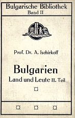
digitized copy of Vol. II, published in LEIPZIG, 1917, by Verlag von Dr. Iwan Parlapanoff
More...
How do different arts - cinema, theater, literature, music - tell the story of the transition to democratization? This was the main topic discussed at a Round Table, held in the end of September at G8 Cinema by researchers for the project ‘The Transition after 1989 - Interpretations of Historical Change, Social Experience and Cultural Memory in Contemporary Bulgarian Literature’. The cultural heritage of Transition was at the center of discussions about the memory, the clash between the image of freedom and the market mechanisms of governing culture and art and the role of the media.
More...
The International scientific conference "Disinformation: the new challenges" brought together 16 participants - established researchers, PhD students and journalists - from Bulgaria, USA, Canada, Germany. The presented papers reflect various aspects of the problem of disinformation: the impact of disinformation on political processes, regulatory approaches to curbing disinformation, journalistic practice of fact-checking and debunking disinformation, the role of social media in disseminating and amplifying disinformation.
More...
The study presents the contributions of Raina Katsarova (1901-1984) - one of the pioneers in establishing the Bulgarian traditional music in the first specializated music programs on Rodno Radio and Radio Sofia. It presents a researcher with experience in field work and thousands of recordings of traditional music, with publications of song collections and academic works, but also a citizen, cultural figure, public activist, media figure. The activities of Raina Katsarova as an educator, music journalist and media critic are discussed; her talks and song tales on the radio; her activities in defense of faith and rituals in the media of totalitarian Bulgaria; her role in publicizing Bulgarian traditional music on air around the world as an ambassador of Bulgarian culture, folklore and science. It is concluded that the traces of her activity in the media cover the history of Bulgarian radio, understood in the middle of the twentieth century as a public good and cultural force. It is clear to everyone that music on the radio matters. Raina Katsarova's radio appearances show how ethnomusicology is also important in and for radio.
More...
The text presents the main conclusions based on the study of the political messages in the Turkish series broadcasted on Bulgarian television and on Netflix. The main political messages in the series, showed on Bulgarian television, are the responsibility for decisions, connect with the life of a woman and a child. Among the important political topics are: migration, education abroad and returning home, conflicts between rich and poor.
More...
In the proposed text is sought to answer the question of whether and when we can talk about serialization in the international information flow. An attempt has been made for some systematization of the possible types of serialization, among which the anniversaries stand out. There are two major branches – the traditional serialization and the one generated by the possibilities of new technologies. The example with the ‘Tiananmen Papers’ is considered in more detail. It is also worth noting the borrowing serialization, shown in two examples of connecting processes in the present with such from the recent or very distant past.
More...
This paper aims at exploring inter-organizational collaboration during emergency response at local level. Specifically, this paper analyzes collaborations between public, private, and non-governmental organizations that evolved in response to 2016 Hurricane Matthew, in Haiti. While governments play a large role in responding to disasters and managing recovery, many disasters are far too large and complex to handle by themselves. That’s where inter-organizational collective action comes to assist and support the relief of the victims. However, considering how problematic disaster collective response action was during the 2010 earthquake in Haiti, this study is guided by the desire to explore what exactly was accomplished on the ground during Hurricane Matthew in terms of efficiency and satisfaction. Moreover, the use of communication and information is also investigated. Research findings revealed that: a) the destruction of information infrastructures hampered communication efficiency; b) the Directorate for Civil Protection (DPC) failed as main national disaster agency to coordinate all the sectors; c) and finally, a lack of leadership and trust were found between involved organizations. The author recommends the use of smart technologies to enhance communication structure, and advocates for a new collaborative culture built on trust and transparency between stakeholders.
More...
knowledge. Today this process is driven by the new information and communications technologies. While digitisation is permeating all areas of life, it has become clear that technological revolution is not just a purely technical (or economic) process, but also a social one and it is not gender-neutral. Technology can help women and girls access new opportunities, means of expression and channels for participation. However, technological boom can also cause imbalances in the convergent environment. People will need a variety of skills to be able to contribute on an equal footing to the digital transformations but these skills are not equally distributed across all social groups. Debates nowadays extend even further to encompass artificial intelligence and experts have repeatedly underlined that advanced automation technologies can bring about not only great opportunities for humanity but also risks. Challenges can stem from the accelerated use of artificial intelligence without respecting such categories like gender, ethnic and socioeconomic diversity. International bodies raise the admonition that “transparency and accountability for the data behind AI is critical to reducing bias, but very difficult to govern or enforce.” The 2030 Agenda for Sustainable Development and its 17 Sustainable Development Goals (SDGs) [1] embody a human rights’ based roadmap for progress that is sustainable and leaves no one behind. Achieving gender equality and women’s empowerment is a crucial goal among others in this important set of priorities for humanity. Only by ensuring the rights of women and girls across all the goals will we get thriving economies, a sustaining environment now and for future generations and genuine social inclusion for a smart society. The article will present a new elaborated version of the summary of the research on gender issues in the converged environment done in the period 2018 – 2020 within the EC COMPACT project.
More...
The paper analyzes the main aspects of ambient advertising, metaverse and smart cities. This type of advertising is creative, relatively inexpensive and uses the context of a city’s area to provide a new experience to its residents and tourists. The article aims at displaying the overlapping of this marketing communication with the urban context and how both companies and municipalities could benefit from using it. The types of ambient advertising are studied, as well as their application in the communication of organizations with people in cities. Through content analysis and case studies the connection between ambient advertising and metaverse urban areas with its residents is studied. This paper adds on several previous studies [1, 2, 3] and some others in the context of smart cities and metaverse ambient advertising, while proposing an additional method of tracking user experience – eye tracking. Key elements of ambient advertising, the metaverse and smart cities are studied, as well as interactivity and connectivity. Through the analyzed examples the positive aspect of using this marketing communication is displayed, since it makes it possible for the residents to see the same environment in a new and interactive way. Thus, the connection between them and the urban space becomes stronger and more entertaining. This paper could be of interest to academicians and practitioners in the sphere of marketing and advertising, as well as representatives of municipalities, who aim at providing their residents an additional level of experience with the urban areas of the future.
More...
The paper considers the specific problem of the land property outside Italy in the Roman provinces during the period of the late Roman Republic and the early Principate. The author studies how the Roman government faced the new problems that the conquest created and what Rome actually did when first met the Hellenistic concepts of the land property in the conquered territories and how they were applied or modified according to the traditional Roman law principles and regulations. It is emphasized that the need to organize the territory and to define the property of the people who lived on that territory or the rights which they had to the land for a very first time occurred in Sicily which the Romans organized as the first Roman provincia. The article examines the organization of Sicily according to Lex Hieronica, it considers the exemptions and immunities of some cities from the general legal regime of the province, and studies the collection of public revenues and the payments for the taxes for the exploitation of the land – vectigal et vectigalia publica. Key notions and terms like possessio, dominium, mancipatio, vectigal, vectigalia, tributum, stipendium are cleared and special attention is paid to the correct use of the Latin legal terminology. Some of the most important fragments from the Institutes of Gaius about the provincial property are examined and is made a carefully study of his language and the legal aspects of his consideration of the rights that the individuals had over the provincial lands. The research presents in details the organization of other provinces in the late Roman Republic and the early Principate and deals with the richest Roman province – Asia, which brings huge revenues to the Roman budget. Central part of the study is dedicated to the legal regime of the provincial land and the author considers the main opinions on this topic in the recent Roman legal doctrine and translates and analyzes the relevant classical Latin texts in the sources and provides an important bibliography on the problem, he tries also to define the Roman concept for „provincial property“ which for sure was not identical with the dominium ex iure Quiritium in Italy.
More...
The use of expert knowledge is an essential part of media communication, especially during crises. The text highlights basic concepts of expertise, knowledge and journalists' understanding of their usage in media. The text analyzes the point of view of experts towards the critical function of journalism in the recognition of expert knowledge and its dissemination. For this purpose, interviews were conducted with 7 experts who participated in interviews and television shows during various crises. The text is part of a dissertation on "Expert speaking during crises and the critical function of journalism".
More...
Territorial development disparities are an undeniable reality for all the countries of the world, which implies that no country can practically avoid them. However, how different countries respond to these disparities is another matter. The effectiveness of policies in overcoming territorial development disparities depends significantly on how deeply these disparities are recognized and studied. In this context, assessing disparities in territorial development is necessary, and the article proposes a methodology for its implementation. The methodology examines territorial development indexes and their relative standard deviation. In the article, the developed methodology was also applied to 10 countries, as a result of which the levels of territorial development disparities in Canada, Poland, Bulgaria, Hungary, Finland, Serbia, Georgia, Moldova, Kazakhstan, and China were evaluated. Based on the assessments, general conclusions are also presented for each country in the article.
More...
The article examines the question of how the concepts of nature and coexistence 2.0 have been constructed in the web 2.0 space, as well as their importance for conservation policy and decision making regarding human-nature coexistence. The object of analysis is the widely known case of a human-brown bear conflict that occurred near the town of Belitsa, municipality f Razlog, which initiated heated debates in the web 2.0 space in the context of the “innocence” of the brown bear. The analysis of the discussions falls within popular discourse of “re-connection” and “living in harmony” with nature constructed by global environmental agencies, as well as within the novel calls and proposals for coexistence between humans and nature. The article concludes that the construction of nature and coexistence 2.0 appears to serve conservation goals, but foregrounds their paradox of re-connecting with nature yet living at a distance from it.
More...
The article aims at presenting the activities of the people of the municipality of Garmen, Southwest Bulgaria, related to the socialization of tangible immovable religious heritage of local importance and their vision for changing it into a tourist product. There is no specialized local policy regarding cultural heritage, but voluntary initiatives to restore Orthodox sites and the spaces around them involve people of different faiths. As a result of their civic activism, a collective sense of attachment to heritage is strengthened, which in turn becomes an important element of their regional identity. The results of an ethnological study conducted in April–May 2022 in the villages of Garmen, Dabnitsa and Skrebatno are presented. The data were collected through open-ended interviews with representatives of the municipality of Garmen and people who live near the cultural values and are committed to the cause of their restoration and socialization.
More...