Cookies help us deliver our services. By using our services, you agree to our use of cookies. Learn more.
  • Log In
  • Register
CEEOL Logo
Advanced Search
  • Home
  • SUBJECT AREAS
  • PUBLISHERS
  • JOURNALS
  • eBooks
  • GREY LITERATURE
  • CEEOL-DIGITS
  • INDIVIDUAL ACCOUNT
  • Help
  • Contact
  • for LIBRARIANS
  • for PUBLISHERS

Content Type

Subjects

Languages

Legend

  • Journal
  • Article
  • Book
  • Chapter
  • Open Access
  • Geography, Regional studies
  • Regional Geography

We kindly inform you that, as long as the subject affiliation of our 300.000+ articles is in progress, you might get unsufficient or no results on your third level or second level search. In this case, please broaden your search criteria.

Result 1-20 of 5887
  • 1
  • 2
  • 3
  • ...
  • 293
  • 294
  • 295
  • Next

The Economic Regionalism and Its Linguistic Aspects. The Model of Inside-Outside Regionalism

Author(s): Irah Kučerová / Language(s): English Issue: 08/2014

Rebirth of the regionalism, that is being expressed i. e. by a globalization of the world economy, is regional resistance. The strategic aspects are doing crucial parts in a development of the regionalism. Regionalism is distributed among other things through language, which is then institutionalized and ritualized for regional affiliation. The aim of the study is to link research regionalism practiced in its form with the meaning of language as one of the region-forming factor. Methodologically, the study is focused on qualitative research new regionalism and the role of language in its context.

More...
REGION JAKO ISTOTNY SKŁADNIK WIEDZY GEOGRAFICZNEJ W KONTEKŚCIE FUNKCJI ODLEGŁOŚCI

REGION JAKO ISTOTNY SKŁADNIK WIEDZY GEOGRAFICZNEJ W KONTEKŚCIE FUNKCJI ODLEGŁOŚCI

Author(s): Jan Łoboda / Language(s): Polish Issue: 1/2017

The observation, results and regularities quoted so far bring about several theoretical and practical remarks. Let us present the most essential of them. The function analysis, expressing the investigated distance function analysis referring to various places in space, meet many difficulties in a total presentation. The available data, used most frequently, are only samples taken from a definite place, point in space or subjectively defined time. Still, there exists an essential problem for geographical investigation, namely to what extent these samples are representative of the surrounding reality. The interpretation of the finding obtained in this way brings about almost analogous problems. The above refers to space observation. Moreover, the relativity of distance measures is not enough to treat these conventional premises and instruments as absolute.

More...
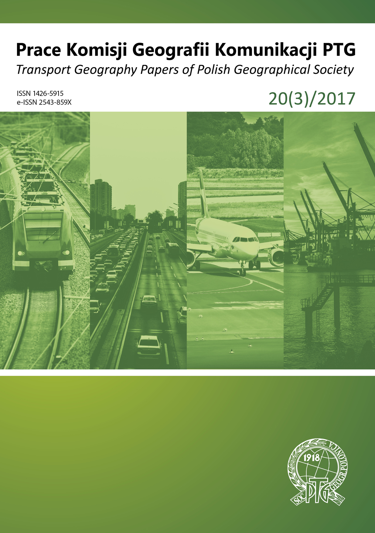
Ocena systemu transportowego gminy suburbialnej na przykładzie Konopisk (powiat częstochowski)

Ocena systemu transportowego gminy suburbialnej na przykładzie Konopisk (powiat częstochowski)

Author(s): Gabriela Przeniosło,Jakub Taczanowski / Language(s): Polish Issue: 3/2017

The aim of the paper has been to assess the transport system of the commune (Polish: gmina) of Konopiska (Śląskie voivodeship, southern Poland). As the area which has been analysed is located in the metropolitan area of the city ofCzęstochowa increasing suburbanization processes can be observed there. They result in constant increase in the number ofinhabitants of the commune which is a challenge for its transport system. That is why the road network and public transportsystem in particular should be modernised and developed. Apart from the main line from Konopiska village to the city ofCzęstochowa the existing bus network is not well developed and does not provide an attractive alternative to private car. Thesolutions suggested by the authors of the present article include the development of the bus system with lines also connectingperiphery villages and bus stop modification in order to increase the accessibility to public transport. Another proposalis a new bus line to the nearest railway station.

More...
Youthification in the Metropolitan Area of Cluj

Youthification in the Metropolitan Area of Cluj

Author(s): Vlad Cocheci,Andrei Mitrea / Language(s): English Issue: 2/2018

This research exercise aims to identify all areas affected by whatis now known as ‘youthification’ in the Metropolitan Area of Cluj. Broadlyspeaking, an area touched by youthification witnesses a massive arrival ofyoung adults, who invest in housing, but only remain there until they age.Youthification is usually the second phase within an encompassing processof gentrification. To gain a clearer picture of this phenomenon, weemployed a snapshot of the situation recorded by the Population andHousing Census of 2011. Using this image as a starting point, we thenapplied statistical thresholds aimed at measuring the presence andintensity of youthification within different areas. Thereafter, we looked atareas exhibiting the same level of youthification, in order to find thosecommon traits of their young adult inhabitants that might prove relevantfor their choices in matters of housing. Once completed, our efforts resultedin the first map showing the areas affected by youthification within theMetropolitan Area of Cluj. In addition, we reached the followingconclusion: Young adults who live in the city are more likely to still beenrolled in a form of education and less likely to be married or to havechildren than those who live in the suburbs or in rural areas. Thisobservation implies that there might be some hidden dependency relations,which are at work in shaping the choice of housing.

More...
A multi-objective optimization approach of housing in Algeria. A step towards sustainability

A multi-objective optimization approach of housing in Algeria. A step towards sustainability

Author(s): Khadidja El-Bahdja Djebbar,Souria Salem,Abderrahmane Mokhtari / Language(s): English Issue: 2/2018

The present study focuses on the evaluation of the energy and environmental performance (EEP) of a typical multi-storey building in Tlemcen, Algeria. It aims to contribute to the development of Algeria’s thermal regulation by establishing a list of actions to be taken in short, medium and long term, in terms of thermal rehabilitation in existing housing areas as well as in new ones, in urban regions with a similar climate. An appropriate multi-criteria methodology is developed by determining its thermal performance using a static method as well as establishing a multi- objective strategy of EEP optimization. The assessment of: the potential of primary-energy-saving and that of the CO2-emissions’ reduction and indoor-environmental-quality of a real state of construction by simulation using DesignBuilder software, together with investment-cost are reported. Therefore, this study is conducted using the potential of parametric evaluation methodology to investigate the impact of passive energy-efficiency-measures on the building envelope from energy, environmental, economic and thermal-comfort points of view. Insulation and ventilation reduction are the main measures saving more than 75% of energy and 44% of CO2-emissions. Besides, the winter comfort is significantly improved. But from the economic standpoint, policy measures must be taken; namely tariffs reforms and energy control law enforcement.

More...
Main sources of pollution and its effects on health and the environment in Annaba

Main sources of pollution and its effects on health and the environment in Annaba

Author(s): Hayet Mebirouk,Fatiha Boubendir-Mebirouk,Walid Hamma / Language(s): French Issue: 2/2018

The industrial city of Annaba suffers from pollution enormously.It has negatively affected the health of those inhabitants who haveproblems especially respiratory. We then asked ourselves questions on thevarious sources of pollution and the means of fighting against them. Afterinvestigation, we have found the sources of pollution that are theatmospheric pollution, the industry, the car traffic, the public landfill, thehigh voltage, the wastewater and the acoustic pollution.To fight against pollution, the city must have a center for satellitemanagement of natural hazards, technological risks and risks due tohuman activities. It is also necessary to mobilize all actors involved in thefield, to raise awareness of the inhabitants and to respect internationalregulations and national legislation.

More...
Forecasting and risk management in Tlemcen: Legislation and urban master plans

Forecasting and risk management in Tlemcen: Legislation and urban master plans

Author(s): Walid Hamma / Language(s): French Issue: 1/2018

Tlemcen suffered several disasters since the country's independence in 1962. Some disasters come back every year such as floods, pollution, landslides and forest fires. This city has experienced four urban master plans which are those of 1960, 1966, 1977 and 1998. They have not achieved their objectives to prevent and manage the risks facing the city. Dice then, we have questioned the conformity of the city to the legal framework of prevention and risk management, the involvement of urban master plans to generate risks, and the application on the ground of proposals of struggle against risks. To answer these questions, we first checked the compliance of urban configuration of the city to the legislation, especially respect for urban servitudes, the removal of hazardous activities from urban fabrics, and the projection of safe accommodation area in the event of disasters. Then we have detected out the urban orientations that have caused risks. Finally, we calculated the rate of implementation of the proposals of each plan. It turns out that the regulation is not respected, some proposals have created risks where 46617 constructions are threatened and actions are not completed, since the four plans were implemented at 78.57%, 0%, 88.88% and 4.76%.

More...
Problems of urban violence: The case of Boulevard Macta in Sidi Bel Abbes

Problems of urban violence: The case of Boulevard Macta in Sidi Bel Abbes

Author(s): Lamia Khadidja Beghdoud,Malika Kacemi,Mohammed Tewfik Bouroumi,Walid Hamma / Language(s): French Issue: 1/2018

In Algeria, for some decades, the architecture has undergone a certain turn, switching into the infernal cycle where the buildings are ultra-secure. The fear exacerbated by the numerous attacks (robberies, rapes, murders) has led the state but also individuals to protect themselves by constructing otherwise. Sidi Bel Abbes is known in western Algeria by a large number of aggression and robberies. We chose the Macta boulevard as a case study where we asked ourselves about the architectural metamorphosis of buildings that faces urban violence and its impact on the urban landscape. In order to answer this question, we have adopted three approaches that are primarily historical through the study of the stratification of the neighborhood. Next, the landscape approach through the study of metomorphic urban environment. Finally, social through the study of practices, representations and the appropriation of space. It turns out that this district which dates from the colonial era has undergone many changes through the removal of the entrance garden, the placement of metal grilles at the window level, the removal of the dwelling at the level of the ground floor, the raising of fence walls and placement of barbed wire. These actions have disfigured this district.

More...
Toys for Carpet Knights: Urban Travel Behaviour and Attitudes in the City of Cluj

Toys for Carpet Knights: Urban Travel Behaviour and Attitudes in the City of Cluj

Author(s): Cristian Tosa,Andrei Mitrea / Language(s): English Issue: 1/2018

This is an exercise in studying travel behaviour among morning commuters within the metropolitan area of Cluj, Romania, as well as their attitudes towards urban transport. We have designed and conducted an on-line survey amongst two major occupational groups, namely private and state sector employees. This survey concentrated upon the social and economic characteristics of these two commuter groups, while taking into account existing structural and functional patterns within the built environment. We have received answers that point to a noticeable difference between private and state sector employees, but the overall results are deeply worrying: Travel behaviour in Cluj is surprisingly immune to common sense. It is, however, deeply indebted to personal comfort. Hence, considering current development patterns affecting Romanian cities, this research exercise critically examines travel behaviour and calls for a paradigm shift, which would hopefully lead to more effective transport policies.

More...
Urban green infrastructure: The role of urban agriculture in city resilience

Urban green infrastructure: The role of urban agriculture in city resilience

Author(s): Thomas Panagopoulos,Ilze Jankovska,Maria Boștenaru Dan / Language(s): English Issue: 1/2018

Studies about the subject of cultivated land confirmed that it is the part of urban informal open space and the specific land using form in the city’s natural area. It has ecological, cultural, social and socio-economic value and help to achieve more sustainable urban forms. The European practice shows that the functions of allotments are changing in the city development process from the producing to the function of traditional city greenery which does not demand the city’s budget money. The moving of population into cities drives increasing demands for residential buildings and other urban built up land. From the city planning point of view it is convenient to develop the allotment territories which usually are located near the city centre and has appropriate infrastructure. However the allotments are very popular among the unprosperous people and elders because of contact with the nature and some economic benefits from cultivating the land. Studies show that the complex metropolitan systems cannot be managed by a single set of top-down governmental policies; instead, they require the coordinated action of multiple independent players operating under locally diverse biophysical conditions and constraints, constantly adjusting their behaviour to maintain an optimal balance between human and ecological functions. The increase in urban agriculture in many European cities has been part of a response to a sense of a global crisis, attesting to the resilience of the people living in cities. However, the citizens involved have much to gain from municipal intervention, which can provide and operate some important for agriculture communal infrastructures and define a set of rules. The municipality is also in an ideal position to design and apply a comprehensive strategy for its territory. In conclusion, municipal intervention is instrumental for urban agriculture and for the city’s resilience because is as a vital source of food and occupation in times of crisis and help in adaptation to the climate or other sudden change consequences.

More...
Urbanism, climate change and floods: Case of Tlemcen city

Urbanism, climate change and floods: Case of Tlemcen city

Author(s): Adjim Hayat,Abdelkader Djedid,Walid Hamma / Language(s): French Issue: 1/2018

After a drought during the 1990s, Tlemcen has experienced heavy rainfall in recent years which caused several floods. They have become frequent and usually cause large damage. We then asked ourselves questions about the reasons for this deregulation of rainfall and floods. We have assumed that climate change has led to deregulation of precipitation and that the urbanization and morphology of the site are the causes of the floods. For this, we analyzed the rainfall data and study the configuration of the town of Tlemcen. We noticed then that Tlemcen town undergoes the climate changes effects per a diminution of the multi-annual mean of rainfall between 1974 and 2008, and a slight displacement of the rainfall from April to November after 2008. Finally, the principal reason of floods is the thoughtless urban sprawl on the water courses also favored by an unfavourable topography.

More...
Method of rehabilitation of old urban fabrics of Tlemcen

Method of rehabilitation of old urban fabrics of Tlemcen

Author(s): Walid Hamma / Language(s): French Issue: 4/2017

Tlemcen is an ancient city that has an architectural and urban heritage testifying to 18 centuries of history. This city experienced ten rehabilitation strategies that created several architectural and urban interventions to save it. These rehabilitation strategies that are spread from 1960 to 2009 have not yielded the expected results and the city is in continuous degradation. Therefore, we wondered about the real reasons that led to these failures. For this, we compared the different methods of intervention to the theoretical model which is a fusion of several effective methods. It turns out that the majority of these procedures have shortcomings. In addition, these rehabilitations were carried out in a piecemeal manner. If we add the confusion in the prerogatives and the non-involvement of civil society, the reasons for these failures become evident. In conclusion only an effective rehabilitaion method can take over the historic town of Tlemcen in a global way.

More...
Identification of urban flood vulnerability in eastern Slovakia by mapping the potential natural sources of flooding - implications for territorial planning

Identification of urban flood vulnerability in eastern Slovakia by mapping the potential natural sources of flooding - implications for territorial planning

Author(s): Lenka Gaňová,Martina Zeleňáková,Pavol Purcz,Daniel Constantin Diaconu,Tomáš Orfánus,Žofia Kuzevičová / Language(s): English Issue: 4/2017

The aim of the presented study was to assess the distribution of flood-risk potential (FRP) at the regional scale. A progressive approach integrating geographical information system (GIS) with two different methods of multicriteria analysis (MCA) – analytic hierarchy process (AHP) and ranking method (RM) was applied in the process. In the analyses, the most causative factors for flooding were taken into account, urban spatial planning, such as soil type, daily precipitation, land use, size of the catchment and average basin slope. A case study of flood vulnerability identification in the Hornád and Bodrog catchments’ areas in eastern Slovakia has been employed to illustrate two different approaches. Spatial estimation of FRP should be one of the basic steps for complex geoecological evaluation and delimitation of landscape considering water resources management, groundwater pollution, prediction of soil erosion and sediment transport and some other important landscape-ecological factors. The obtained results indicate that RM method shows better results as related to the existing floods in the recent years in Bodrog and Hornád catchment than AHP method.

More...
The role of tourism in structural dynamics of the economic profile of Sighişoara City

The role of tourism in structural dynamics of the economic profile of Sighişoara City

Author(s): Ana Maria Ilie,Grigore Vasile Herman,Ana-Maria Ciobotaru,Alexandra Grecu,Roxana Andreea Radu,Mircea Cristian Vişan,Mihaela Giurgia / Language(s): English Issue: 4/2017

Tourism activity is complex, it emplies the presence of resources (natural and / or anthropic) to determine the activity itself, to which we can add the presence of the general tourism infrastructure at its highest standards. Lastly, it includes also the active participation of the human factor. In the working methodology, we have used statistical data, between the years 2000-2014, for the following indicators: number of companies, number of employees, turnover and profit. The tourism industry sustains the progress of Sighisoara’s economy, indicates the development of society, causing the city to be included on the list of most sought after tourist destinations, both nationally and internationally. At the same time, tourism determines social welfare by generating new jobs, limiting unemployment, balancing labor, which is a surplus in other sectors (primary and secondary). Results are expressed through graphical representations showing the share of total tourism sector indicators above. It also shows how tourism affects local economic activity and its place in relation to other economic activities.

More...
Main challenges of residential areas

Main challenges of residential areas

Author(s): Oana Luca,Florian Gaman,Cristina Iacoboaea,Florian Petrescu,Mihaela Aldea / Language(s): English Issue: 2/2017

The present article is a position paper aiming to initiate a professional debate related to the aspects related to the urban dysfunctions leading to the wear of the residential areas. The paper proposes a definition of the wear process, identify the main causes leading to its occurrence and propose a number of solutions to neutralise the dysfunctions. The three wearing phases of residential areas components are emphasized, exploring their lifecycle. In order to perform the study of urban wear, the status of the residential areas components can be established and monitored, and also the variables of the function that can mathematically model the specific wear process may be considered. The paper is considered a first step for the model adjustment, to be tested and validated in the following steps. Based on the mathematical method and model, there can be created, in a potential future research, the possibility of determining the precarity degree for residential areas/neighbourhoods and cities, by minimising the subjective component of the analyses preceding the decision for renovation or regeneration.

More...
Resilience of historic cities and adaptation to climate change

Resilience of historic cities and adaptation to climate change

Author(s): Alexandra Keller,Nicola Chieffo,Edmond Opritescu,Marius Mosoarca,Antonio Formisano / Language(s): English Issue: 1/2017

In recent years the interest for the resilience of cities and historic urban centers is growing. Climate change is one of the challenges of this century and it is having a great impact on the society and economy of cities and buildings. According to climate change scenarios cities will have to face frequent extreme events in the future years, like droughts, heat waves, abundant precipitations or snowfalls. However, there are little studies that try to analyze the effects from different points of view and to find a solution that can have an impact on buildings, the town environment as well as on the well being of the society. Therefore this article proposes a complex assessment and intervention strategy based on the case study of Oravita, a small mountain town from the western part of Romania, that will improve the resilience of the town trough a multidisciplinary approach. The aim is to understand and to adapt the historic town to the contemporary climatic needs by an interdisciplinary holistic understanding of the context through different professional views: architectural, landscape architecture, historical, engineering, social, economical and geographical.

More...
Theoretical Aspects of Territorial and Metropolitan Governance

Theoretical Aspects of Territorial and Metropolitan Governance

Author(s): Oana Catalina Popescu,Jianca Ştefan-Gorîn,Antonio Tache / Language(s): English Issue: 1/2017

In order to become engines of development, large cities require modernization in the area of urban governance. The first part of the article focuses on theoretical concepts of governance and territorial governance, including the instruments that promote good governance, such as the fight against corruption, and its measurement indicators. The second part of the article deals with governance in metropolitan areas, describing several metropolitan bodies of governance, specialised in spatial planning and transportation, discussing the need of coordination and the collaborative approach as a premise for ensuring better transport accessibility and more harmonized spatial plans. Finally, the article presents solutions and recommendations for an efficient reform of metropolitan governance.

More...
Comparison of Vitality Between Two Streets of Tehran

Comparison of Vitality Between Two Streets of Tehran

Author(s): Mehrnaz Molavi,Fatemeh Jalili / Language(s): English Issue: 4/2016

This is the urban spaces that make living in a city pleasant and the urban landscape delightful. Vitality, an indispensable feature in the life of a city, is an undeniable gap in many urban spaces today. Spaces lacking vitality make no passion to stop within them and no incentive to pass by them. Over time urban spaces are getting uncrowded and deprived of social life and this event puts the current urban spaces of a country seriously in danger. Given the vitality impact on desirability of urban spaces and the research concern toward this on-the-wane quality, two important streets of Tehran, Enghelab and Vali-e-Asr, were compared to investigate the effective factors in vitality more thoroughly and in terms of several needs of people in urban spaces. According to different spirits of the two streets as well as positive and negative effective factors, the amount of vitality criteria in both spaces was studied through surveys. In this regard, 200 questionnaires, prepared by the authors, have been analyzed. SPSS software was used for statistical analysis and the results were demonstrated in charts. These figures confirm the vitality potential of both spaces. However, it was concluded that the spirit in each of the spaces was different as the atmosphere of the Vali-e-Asr Street was commercial-recreational and the atmosphere of the Enghelab Street was commercial-cultural. The vitality amount of each of them is compared on the basis of their spirits. To strengthen the vitality and encourage people to engage more with the space, some suggestions have been finally presented.

More...
Analysis of Restrictive Environments in the South-West Oltenia Development Region

Analysis of Restrictive Environments in the South-West Oltenia Development Region

Author(s): Radu-Matei Cocheci / Language(s): English Issue: 4/2016

Restrictive environments can be defined as an area within a territorial system where development is constrained either by natural factors or anthropogenic factors. This paper aims to identify restrictive environments through multi-criteria analysis of Romania’s South West Oltenia development region, known for its issues regarding open-pit mining, desertification or flood risk. In order to achieve this, I proposed a typology of restrictive environments, based on an extensive literature review of natural and anthropogenic factors that can limit development. For each of the ten environmental restrictiveness types identified, several criteria were proposed, which were then weighted as a result of a questionnaire addressed to experts in the field of territorial planning. Based on the questionnaire results, an index of environmental restrictiveness is computed at LAU 2 level for the entire South-West Oltenia development region. The territorialized index highlights the environmental restrictiveness of areas susceptible to flood risk (e.g. along the Jiu valley), but also the problems faced by mining areas (Motru-Rovinari) or isolated mountain areas. The computed index represents a first step towards the definition of potential inter-communal cooperation structures, that could become the object of territorial planning instruments aimed at mitigating restrictive environments.

More...
The first cities of the world in a bird’s-eye view

The first cities of the world in a bird’s-eye view

Author(s): Oana Catalina Popescu,Jianca Ştefan-Gorîn / Language(s): English Issue: 3/2016

The paper presents an overall view of the first cities of the world which are considered to be the origin of urbanization, as they are reflected in historical bird’s-eye views and maps, on one hand, and in aerial views, obtained using modern technologies such as aerial photogrammetry, on the other hand. Historical bird’s-eye views of ancient cities, having a more artistic style rather than a technical one and requiring thousands of hours to be created, have been replaced nowadays with aerial photography allowing realistic representations. The paper illustrates several bird’s-eye views and maps created between the 16th and 18th centuries by famous engravers in order to picture well-known cities, referring at the same time to modern digital techniques that are used today to map, visualise, analyse and manage remains of ancient cities. The use of new research methods in archaeology, such as aerial photogrammetry, high resolution satellite imagery, UAVs, GIS and GPS techniques combined with classical surface or sub-surface survey tools is being exemplified in the case of 5 cities, origin of urbanization, constituted in the first 4 millenniums BC.

More...
Result 1-20 of 5887
  • 1
  • 2
  • 3
  • ...
  • 293
  • 294
  • 295
  • Next

About

CEEOL is a leading provider of academic eJournals, eBooks and Grey Literature documents in Humanities and Social Sciences from and about Central, East and Southeast Europe. In the rapidly changing digital sphere CEEOL is a reliable source of adjusting expertise trusted by scholars, researchers, publishers, and librarians. CEEOL offers various services to subscribing institutions and their patrons to make access to its content as easy as possible. CEEOL supports publishers to reach new audiences and disseminate the scientific achievements to a broad readership worldwide. Un-affiliated scholars have the possibility to access the repository by creating their personal user account.

Contact Us

Central and Eastern European Online Library GmbH
Basaltstrasse 9
60487 Frankfurt am Main
Germany
Amtsgericht Frankfurt am Main HRB 102056
VAT number: DE300273105
Phone: +49 (0)69-20026820
Email: info@ceeol.com

Connect with CEEOL

  • Join our Facebook page
  • Follow us on Twitter
CEEOL Logo Footer
2025 © CEEOL. ALL Rights Reserved. Privacy Policy | Terms & Conditions of use | Accessibility
ver2.0.428
Toggle Accessibility Mode

Login CEEOL

{{forgottenPasswordMessage.Message}}

Enter your Username (Email) below.

Institutional Login