Cookies help us deliver our services. By using our services, you agree to our use of cookies. Learn more.
  • Log In
  • Register
CEEOL Logo
Advanced Search
  • Home
  • SUBJECT AREAS
  • PUBLISHERS
  • JOURNALS
  • eBooks
  • GREY LITERATURE
  • CEEOL-DIGITS
  • INDIVIDUAL ACCOUNT
  • Help
  • Contact
  • for LIBRARIANS
  • for PUBLISHERS

Content Type

Subjects

Languages

Legend

  • Journal
  • Article
  • Book
  • Chapter
  • Open Access
  • History
  • Archaeology

We kindly inform you that, as long as the subject affiliation of our 300.000+ articles is in progress, you might get unsufficient or no results on your third level or second level search. In this case, please broaden your search criteria.

Result 14841-14860 of 16933
  • Prev
  • 1
  • 2
  • 3
  • ...
  • 742
  • 743
  • 744
  • ...
  • 845
  • 846
  • 847
  • Next
Epigrafik Belgeler ve Antik Edebi Eserler Işığında Magnesia ad Sipylum

Epigrafik Belgeler ve Antik Edebi Eserler Işığında Magnesia ad Sipylum

Author(s): Yasemin Sargın / Language(s): Turkish Issue: Sp. Issue/2020

Magnesia ad Sipylum is a Lydian City established on the northern foothills of Mount Sipylos (Spil/Manisa), within the borders of the modern Province of Manisa. Topographically, the city overlooks the fertile Gediz Plain irrigated by the Hermos (Gediz) River. Its location on the intersection of ancient itineraries gives the city commercial and strategic importance. Magnesia, located about 32 km northeast of Smyrna (Izmir), has had good relations with this neighboring city. This relation is also documented by an epigraphic inscription which contains the decree of sympoliteia between the two cities, dated to 243 BC. A few archaeological remains and epigraphic documents have survived from the ancient city. Further the information of the city is acquired by the accounts of ancient writers. This study aims to present current information on Magnesia ad Sipylum in terms of historical-geography and socio-cultural aspects within the possibilities provided by epigraphic documents and ancient literary works.

More...
Чужой в тандеме с хищником: звериные статусы и воинские ранги погребенных Солохи
4.50 €
Preview

Чужой в тандеме с хищником: звериные статусы и воинские ранги погребенных Солохи

Author(s): Sergei Aleksandrovich Kozlov / Language(s): Russian Issue: 3/2021

The present article attempts to transcode the “animal” status of those buried in the first monumental burial ground of the Scythians in the Lower Dnieper region — the famous Solokha barrow. Solokha’s materials are seen as an optimal case for such kind of study. On the one hand, two burials from different periods and of different statuses were found underneath the mound. On the other hand, each of the burials contained artefacts with depictions of wild and mythological predators, which makes it possible to correlate the statuses of the buried with the depictions of beasts. Based on the analysis of the funeral contexts in Solokha, and taking into account the semantics of animal styles, it is possible to conclude that the lateral grave belonged to a legitimate king of the Scythians (conventionally, “Oktamasades”) whose status was clearly marked by feline-shaped predators, and the central one — to a “prince” (conventionally, “Orikos”) who died at a young age and forever remained on the primary, “wolf” stage of military initiation.

More...
Ландшафтное окружение городищ и курганов скифского времени в донской лесостепи
4.50 €
Preview

Ландшафтное окружение городищ и курганов скифского времени в донской лесостепи

Author(s): Yury D. Razuvaev,Yury G. Chendev / Language(s): Russian Issue: 3/2021

The article offers a reconstruction of the landscape in the 6th—3rd centuries BC in the environs of 24 sites of Scyphoid and Gorodets archaeological cultures. Information on previous soil and palynological analyses is summarized, and the results of the latest studies of buried soils are published. A modern soil map offers an approximate view of the vegetation of the Don basin in the past. Hillforts and barrows of the Scyphoid culture are concentrated in the territories of typical forest steppe, while the fortified settlements of Gorodets are found in the more forested northern territory. This may be due to the difference in management systems, especially farming (tillage and slash-and-burn farming). Under the earthen defensive ramparts of all the studied hillforts of Early Iron Age, associated with forest valley-river landscapes, the soils with properties of forest formation have been identified, however, in many cases preserving the features of Chernozems of the drier Bronze Age. Qualities of paleosoils suggest the process of afforestation of river valleys and adjacent sections of watersheds at the beginning of Early Iron Age. Kurgans, which demonstrate the military-elitist appearance of the material culture and mobility of their creators, are situated in the interfluvial meadow-steppes and are separated from the nearest hillforts under the forests by the local relief. Localization of these and other sites confirms the existence of different economic and cultural types among the population of the Scythian era.

More...
Рецензия на: Нефедкин А. К. Изучение древнего военного искусства в России и странах СНГ (XVIII — начало XXI в.). Санкт-Петербург: «Петербургское Востоковедение», 2020, 468 с. ISBN 978-5-85803-538-1

Рецензия на: Нефедкин А. К. Изучение древнего военного искусства в России и странах СНГ (XVIII — начало XXI в.). Санкт-Петербург: «Петербургское Востоковедение», 2020, 468 с. ISBN 978-5-85803-538-1

Author(s): Sarkis S. Kazarov,Alexandr N. Kovalenko / Language(s): Russian Issue: 3/2021

book review

More...
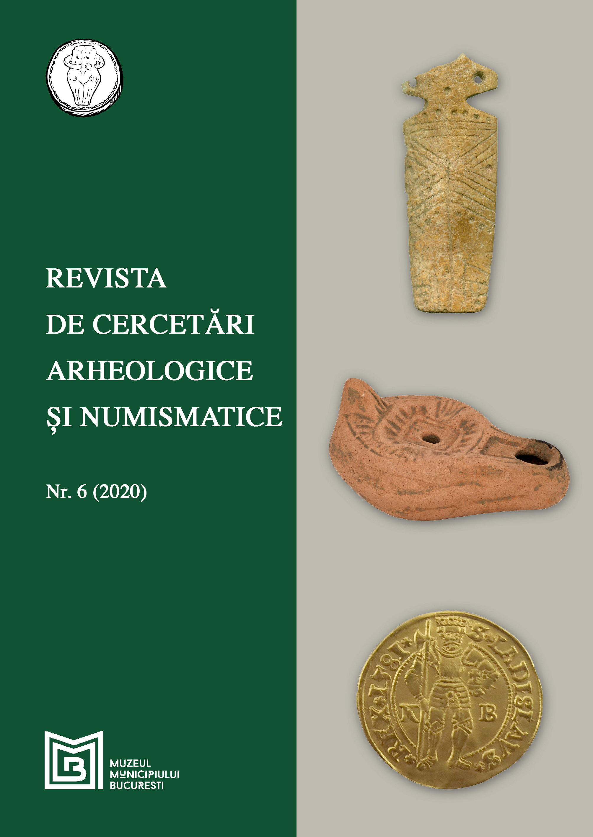
DATE PRIVIND HANUL SERAFIM. CERCETĂRILE ARHEOLOGICE DIN CADRUL FOSTEI BĂNCI MARMOROSCH BLANK (2019-2020)

DATE PRIVIND HANUL SERAFIM. CERCETĂRILE ARHEOLOGICE DIN CADRUL FOSTEI BĂNCI MARMOROSCH BLANK (2019-2020)

Author(s): Adelina Darie,Theodor Ignat,Raluca-Iuliana Moței / Language(s): Romanian Issue: 6/2020

The preventive archeological research from Marmorosch Blank in 2019-2020 highlighted some of the foundations of the former Serafim Inn, but also of other previous buildings, dating from the 17th-18th centuries. At least two stages of operation of the inn and an drainage system connected to one of the rooms have been investigated. To the east of the inn's foundations, a water pipe was identified, made from ceramic tubes embedded in the brick.

More...
SOGMATAR

SOGMATAR

Author(s): Yusuf Albayrak / Language(s): English Issue: 48/2020

Located on the Individual Mountains, about 70 km. southeast of Şanlıurfa provincial center, Soğmatar, starting from the Chalcolithic Age due to the abundance of water resources, the Middle and Early Bronze Age, The Iron Age (Bc I. Bin), the Roman period and the Islamic period until the present day uninterrupted settlement, especially in the 2nd century AD. In the 19th century, the moon came to the forefront with the worship of the God of Sin. In addition to being used as a temple area, Soğmatar was also used as a necropolis area in the Early Bronze Age and roman times. Some of the rock tombs in the necropolis area built in the Early Bronze Age were replaced during the Roman period and were reused. These tombs, which were opened in the well-entrance plan, were extended to the south during the Roman period, the well entrance part was extended to the south, the stairway corridors were opened, the entrance part was expanded and the wall cells where the dead were placed on 3 walls were opened.

More...
Siedlungsgeschichtliche Forschungen in den nördlichen deutschen Mittelgebirgsregionen

Siedlungsgeschichtliche Forschungen in den nördlichen deutschen Mittelgebirgsregionen

Author(s): Hans-Georg Stephan / Language(s): German Issue: 2/2013

The Northern German hilly landscapes and Hessen do belong to the areas with the highest concentrations of deserted medieval villages and a remarkable richness of various relicts of the historical cultural landscape in all of Europe. Quite the same is true for the favorite agricultural areas within the surroundings. The percentage of deserted villages and hamlets often is considerably higher than the total number of still surviving medieval settlements. The latter as well as the deserted villages in the area of special investigation in this article were both mostly founded in the 8th/9th centuries presumably in a rather short time within two or three generations in a period of a rapid increase of population as well as economical development and innovations. Later on there seem to have occurred two centuries of at least partial stagnations and even crisis or shrinkage of settlements, density of population and economy which caused some retreat in the settlement and cultural landscape at least in some places and regions investigated. Probably there did not happen usually migrations over wide areas outside Northwestern Europe and the coastal areas mostly threatened by the Viking raids and later in southern parts of Central Europe by the Magyars, but in general the dynamics developed in smaller regions. Generally the settlement locations in the investigated areas have been stable on the same place from an early period onwards. This stability of location may go back even to the centuries about A. D. or to the migration period in some rare cases of central places, but normally it is definitely so from the Carolingian period onwards. This seems to be a remarkable difference to usual opinions of “migrating” unstable locations of early settlements. The fact may be caused by the natural resources in hilly landscapes that differ in many ways from that in the Northern German lowlands as well as a result of the integration of Saxony in the Frankish Empire and the establishment of the special highly developed system of early medieval “Grundherrschaft”. The research about abandoned settlements and graveyards of the first millennium A. D. for its own is not sufficient at all for research. Only together with the analysis of deserted medieval villages and of persisting historical settlements it allows deeper insights and hypothetical reconstructions of the development of the cultural landscape.

More...
Mittelalterliche Siedlungen in Sachsen, Sachsen-Anhalt, Ostfalen und Thüringen: Zur Fächer übergreifenden Erforschung des ländlichen Raumes vornehmlich aus archäologischer Sicht

Mittelalterliche Siedlungen in Sachsen, Sachsen-Anhalt, Ostfalen und Thüringen: Zur Fächer übergreifenden Erforschung des ländlichen Raumes vornehmlich aus archäologischer Sicht

Author(s): Hans-Georg Stephan / Language(s): German Issue: 2/2013

Research about medieval settlements in Central Germany has a long tradition. In the 19th and up to the middle of the 20th century it was mostly a survey of written sources and analysis of historical maps whereas local people did most of all practical work in the field. A pioneer in archaeology then was Paul Grimm with his excavations and interdisciplinary work in the deserted village Hohenrode in the Southeast Harz region and in the nearby royal court at Tilleda. Because of the geographical situation not far to the eastern border of the Frankish and German Empire to the Slavonic areas there are not only very many early fortifications with an associated group of settlements but we can also identify most interesting acculturation processes. In spite of the fact that they have been known for a long time they still wait for analysis in modern multi disciplinary research. In the areas along the border zones also rural settlements were often protected by earthworks. Because of this and the establishment of “Grundherrschaft” in the zones dominated by the Saxon and Thuringian nobility the settlement structures seem to have been more stable than in the area of the Sorbic tribes. Still there is a great lack of research particularly in regard of the structure of the settlement landscape both in the traditional Germanic regions to the west of Saale and Elbe as well as in those areas which were in regard to their daily material culture we find during archaeological investigations much dominated by Slavonic traditions despite the political rule of Saxon and Frankish nobles, the king and ecclesiastical elites. The number of deserted medieval villages and the percentage of loss of fields seem to have been very different in special regions. Looking to this phenomenon it has not to be neglected that in areas which have largely stayed in the Slavonic style of life to the 11th/12th centuries the number of houses and inhabitants and the stability of the location has been much less than in the regions with predominating Germanic traditions. Modern interdisciplinary archaeological research regards to villages that have not been deserted in the middle ages are restricted to the areas with big scale coal-mining (“Braunkohlereviere”). From these small areas we recently have learnt a great deal about the development of single villages as well as about the settlement landscape. A more or less consequent care of governmental Heritage Management also for medieval settlements and other structures of the historical cultural landscape did mostly not develop before the 1990s and this caused quite a lot of small as well as some bigger new insights in the complex development both in time and space. The publications still rarely has been more than some precursory data and opinions. Longtime systematical research both in fieldwork and the analysis of data from excavations will be urgently needed for the future.

More...
Hochmittelalterliche Transformation ländlicher Besiedlungsstrukturen des schlesischen Altsiedellandes im Lichte archäologischer Forschungen

Hochmittelalterliche Transformation ländlicher Besiedlungsstrukturen des schlesischen Altsiedellandes im Lichte archäologischer Forschungen

Author(s): Krzysztof Fokt / Language(s): German Issue: 2/2013

Main goal of the presented study was to examine processes of transformation of rural settlement structures in the 12th–14th centuries in Lower Silesia, as far as they were reflected in material records documented during archaeological investigations. The analysis has been based upon two groups of settlements: 1. sites dating from the late 12th–13th centuries, where finds typical for local, traditional (“early medieval”) material culture were prevailing, 2. sites dating from the 13th–14th centuries, characterized by preponderance of “late medieval” mobile finds. Both groups of settlements were compared in order to identify: 1. spurs of innovative attempts in the settlements of the 1st group, 2. Archaic features typical only for the 1st group of sites, 3. features that would characterize both groups of settlements, 4. innovative attributes of the 2nd group of rural settlements. Results of the conducted analysis may be summarized as follows: 1. Rural settlements of the 1st group represented a developed stage of the “early medieval” model known from the 11th–12th centuries, showing only few innovations of secondary importance. 2. The fundamental shift of settlement pattern is clearly conceivable through comparison of the settlements of the 1st and the 2nd groups, concerning such features as areas of housing chambers, spatial development of particular farmsteads and rules of spatial organization of village cores. 3. Unexpectedly high was the number of archaic features identified in the 2nd group of settlements (total lack of ovens in houses, presence of sunken housing features). 4. Study of the 2nd group of sites has proven that some elements of the new, “late medieval” patterns of rural economy and settlement (as new manners of waste deposition and spatial rearrangements of settlements) were introduced in the 13th–14th centuries only in some Lower Silesian villages. Presented conclusions are preliminary. To develop more relevant vision of rural transformation in Lower Silesia, more sources and further research would be required, especially studies devoted to the regions newly colonized from the 13th century on and to the rural settlements of the 15th–16th centuries.

More...
Zur Problematik der sogenannten Endphase der hochmittelalterlichen Kolonisation und zu den Siedlungsformen in Böhmen. Die Wüstung Kří bei Sadská (Mittelböhmen)

Zur Problematik der sogenannten Endphase der hochmittelalterlichen Kolonisation und zu den Siedlungsformen in Böhmen. Die Wüstung Kří bei Sadská (Mittelböhmen)

Author(s): Tomáš Klír / Language(s): German Issue: 2/2013

The article presented characterises the so-called final phase of medieval colonisation in Bohemia in the 14th century, namely both based on the written sources and specific archaeologically documented examples. A large part of the new village foundations from this period are connected with the transformations of the manorial lords’ management and are related to the previous systematic colonisation only by the method of implementation, not the social-economic context, because the cultivated land of villages founded in the 14th century often emerged on divided areas which had formerly belonged to the manorial lord’s economic courtyards. We can then find the continuation and analogy of such foundations in later Modern periods.

More...
Burg Ruckstein/Rokštejn (Katastergebiet Panská Lhota, Stadt Brtnice/Pirnitz, Mähren), Ergebnisse der archäologischen Forschungen zwischen 1981 und 2010 und die Zukunftsperspektiven

Burg Ruckstein/Rokštejn (Katastergebiet Panská Lhota, Stadt Brtnice/Pirnitz, Mähren), Ergebnisse der archäologischen Forschungen zwischen 1981 und 2010 und die Zukunftsperspektiven

Author(s): Zdeněk Měřínský / Language(s): German Issue: 2/2013

This contribution presents an overview of the results of research into archaeological, constructional and historical aspects of the ruin of Rokštejn Castle (cadastral unit of Panská Lhota, Brtnice, Moravia). Rescue research started here in 1981 in reaction to the planned construction of the Střížov reservoir, and since 1996 has continued as study research carried out by the Institute of Archaeology and Museology of the Faculty of Arts, Masaryk University, Brno. An area of approximately 2000 m2 has been explored, with ca. 750 m2 remaining. The article outlines the history of the castle, first mentioned in written sources in 1289, and its constructional and historical development, divided into four phases: IA (last quarter of the 13th century – early 14th century) and IB (ca. 1310–1350/60); phase II when the castle was owned by the Moravian Luxembourgs in the second half of the 14th century; and phase III associated with the Valdštejns, until the period when the castle sustained damage, possibly during the Hussite wars, and its emergency reconstruction and partial use until the 1460’s (phase IV). The last section of the article is devoted to the make-up of finds, including ecofacts and the state of their processing, as well as problems that have to be addressed in relation to comprehensive research into the castle, its heritage restoration and further use.

More...
Mittelalterliche Agrarwirtschaft und Wüstungsbildung in Westfalen

Mittelalterliche Agrarwirtschaft und Wüstungsbildung in Westfalen

Author(s): Rudolf Bergmann / Language(s): German Issue: 2/2013

Focusing on rural economy Westfalia offers a wide range of different agricultural systems. This includes the plaggen-esch economy of the Muensterland (see Abb. 1), individual single farmstead farming within the central Muensterland, and the open-field system of the Boerden with up to four fields already in the 14th century, crop rotation and fallow. Finds of plough-shares indicate that there is an interesting development from those of symmetric triangular form, dating back into the 10th/11th century (Abb. 4.2), to one of an asymmetric triangle (Abb. 5.1, 5.4) belonging to the characteristic ridge and furrow plough illustrated in the ‘Sachsenspiegel’. Desertion is often thought to be the main result of the late medieval crisis of agriculture. It has affected the landscapes to the West much less than those to the middle, South and East. As can be depicted from written sources and archaeology, desertion to a smaller amount started in the 12th century, was full in progress in the vicinity of towns in the 13th/14th century, and reached its peak at the end of the 14th century. Desertion had different reasons: In the Muensterland e.g. the local nobility drove out farmers in order to enlarge their self-managed estates in the vicinity of their moated castles. In the South-East of Westfalia feuds evoked the desertion of unprotected hamlets (with no steady effect on the arable) and encouraged settlement concentration. Whilst feuds were still on progress, the arrival of the Black Death in the middle of the 14th century created an immense lack of population and led to the total depopulation of certain areas. In others the lack of cultivators was partly compensated by social classes of the rural society, that had no lands up to this time, as well as by the creation of bigger yardlands. Desertion was mainly a process of predominant settlement concentration which allowed arable to fall out of use temporarily. Owing to this fact fossilised medieval field systems like those of terraced fields in the mountainous South (see Abb. 2) and the ridge and furrow open-fields of the far South East of Westfalia (see Abb. 3) are rare.

More...
Mittelalterliche Straßenbefunde in Lenzen und Wittenberge (Brandenburg) und ihre Aussagen zur frühen Stadtgeschichte

Mittelalterliche Straßenbefunde in Lenzen und Wittenberge (Brandenburg) und ihre Aussagen zur frühen Stadtgeschichte

Author(s): Monika Brauns-Henschel / Language(s): German Issue: 2/2013

Traffic is a prerequisite as well as an important part of the processual changes taking place in connection with the inland-colonisation during the High Middle Ages. The restructuring of rural spaces and especially the emergence and the development of the cities are inseparably connected with mobility. This investigation aims to analyse the mutual relationship between the construction of roads and the development of cities, drawing on concrete examples. The analysis rests on the basis of the archaeological records of the medieval towns of Lenzen and Wittenberge in north-western Brandenburg from the last 20 years. For this purpose, road surfaces were analysed and evaluated regarding their arrangement, construction, development and chronology. Thus it was also possible to re-examine open questions and hypotheses regarding both the history of road traffic and the history of towns and cities.

More...
Záchranný archeologický výzkum na polykulturním sídlišti a pohřebišti v Obříství (okr. Mělník)

Záchranný archeologický výzkum na polykulturním sídlišti a pohřebišti v Obříství (okr. Mělník)

Author(s): Katarína Čuláková,Klára Fleková,Lucie Šmahelová / Language(s): Czech Issue: 1/2014

The site Obříství (Mělník district) is situated in old settlement area and it is known from older finds, among them the most important is funeral area from Roman period. This article is an introduction to the volume of papers, which evaluates the results of archaeological rescue excavation, which was realized in years 2008–2011 before the construction of 64 family houses on originally agricultural land.The archeological excavation gives evidence of settlement or funeral activities from Neolitihic Linear Pottery Culture to Middle Ages, except of La Tene culture. In this volume are published the results of evaluation of finds from Neolithic period, Eneolitihic period, Roman period, the Great Migrations period, Early Middle Ages and the evidence of funeral activities.

More...
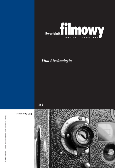
Zakamarki (nie)widzialnych miast. Techniki obrazowania 3D na przecięciu archeologii, architektury i filmu

Zakamarki (nie)widzialnych miast. Techniki obrazowania 3D na przecięciu archeologii, architektury i filmu

Author(s): Maciej Stasiowski / Language(s): English Issue: 113/2021

With the success of the BBC and PBS series such as "Italy’s Invisible Cities" (2017), "Ancient Invisible Cities" (2018), and "Pompeii: New Secrets Revealed" (2016), made in collaboration with ScanLab and employing LiDAR scanning and 3D imaging techniques extensively, popular television programmes grasped the aesthetics of spectral 3D mapping. Visualizing urban topographies previously hidden away from view, these shows put on display technological prowess as means to explore veritably ancient vistas. This article sets out to investigate cinematographic devices and strategies – oscillating between perspectives on built heritage championed by two figures central to the 19th-century discourse on architecture: Eugène Emmanuel Viollet-le-Duc and John Ruskin – manipulating the image in a rivalry for the fullest immersion into a traversable facsimile of past spatialities.

More...
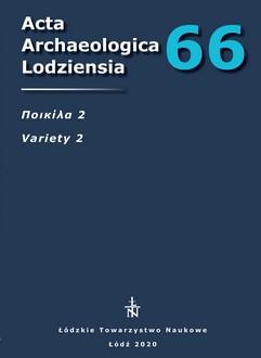
BRAMA ZACHODNIA W LEPTIS MAGNA (PORTA OEA) JAKO ŁUK TRIUMFALNY ANTONINUSA PIUSA

BRAMA ZACHODNIA W LEPTIS MAGNA (PORTA OEA) JAKO ŁUK TRIUMFALNY ANTONINUSA PIUSA

Author(s): Jakub Mosiejczyk / Language(s): Polish Issue: 66/2020

The aim of the presented study is to consider the remains of the Western Gate in Leptis Magna as a relic of the triumphal arch in the urban and social context of the city. The monument is relatively unknown and functions among researchers mainly as the monument of late ancient fortifications. The history and current state of the research on the architecture and decoration of this object is described in the light of studies and deliberations. Presented here is an iconographic analysis of the few details discovered near the monument, including a figural representation featuring a Medusa medallion. Conclusions on the stylistics of the arch decorations point to the work of craftsmen from Asia Minor. The importance of the phenomenon, which in the middle of the 2nd century begins the process of transformation of the city with the use of a newly imported raw material – marble, was emphasized. These processes resulted in the formation of the local North African architectural style in public buildings.

More...
PUBLIC OR PRIVATE? AN ATTEMPT TO INTERPRET THE SOCIAL-ECONOMIC PURPOSE AND DIFFERENCES BETWEEN WELLS LOCATED ON A PRZEWORSK CULTURE SETTLEMENT (BASED INTERDISCIPLINARY RESEARCH – EXAMPLE OF THE SITE IN KWIATKÓW)

PUBLIC OR PRIVATE? AN ATTEMPT TO INTERPRET THE SOCIAL-ECONOMIC PURPOSE AND DIFFERENCES BETWEEN WELLS LOCATED ON A PRZEWORSK CULTURE SETTLEMENT (BASED INTERDISCIPLINARY RESEARCH – EXAMPLE OF THE SITE IN KWIATKÓW)

Author(s): Magdalena Piotrowska / Language(s): English Issue: 66/2020

The aim of this article is to present the results of the archaeological analysis carried out on two wells from the site Kwiatków 11/20 (Brudzew commune, Greater-Poland Voivodeship) against a background of the geochemical and lithological data, as well as to outline the lithological and geological conditions of the surroundings of the excavated area. Within this settlement more than 100 wells were recorded. Most of the wells discovered have features of the Przeworsk culture from the first centuries AD. The analysis and interpretation of the data obtained (thanks to interdisciplinary research) helps us to understand the validity of use and functions of the wells within the site mentioned, and their social aspects. Thanks to the cooperation of specialists representing various scientific fields, it was possible to identify some differences not only in the chronology of both fields analyzed, but also in their function within the area of the settlement.

More...
Преднамеренно деформированные черепа из могильника Фронтовое-3
4.50 €
Preview

Преднамеренно деформированные черепа из могильника Фронтовое-3

Author(s): Natalia G. Svirkina,Maria V. Dobrovolskaya / Language(s): Russian Issue: 4/2021

The paleoanthropological materials from fully studied 228 burials of Frontovoye-3 burial ground it is possible to characterize the deformed skulls frequency and their shape in burials dating back to late 1st — early 5th centuries AD. We esteem the tradition of baby’s head artificial deformation as related to gender culture, which is passed on from one generation of women to the next. There were found only seven cases of deformities, which is less than 3% of the total number of individuals studied. With the contours of the skull sagittal sutures compared, traces of slight annular deformation were found on six male skulls of mature and older age. The skull of one young woman shows traces of annular deformation with the effect of slight skull elongation. We discuss the hypothesis that the tradition of insignificant deformation of baby’s head was observed by a very limited part of society. Nevertheless, this tradition has been preserved throughout the entire existence of the necropolis. The same picture can be observed in a series of paleoanthropological materials from the Roman period from the necropolises of Chersonesos, Phanagoria, and burial grounds of the Abrau Peninsula. This situation contrasts with the high frequency and significant severity of deformed skulls among the population of the Lower Don and Volga regions, Northern Ciscaucasia.

More...
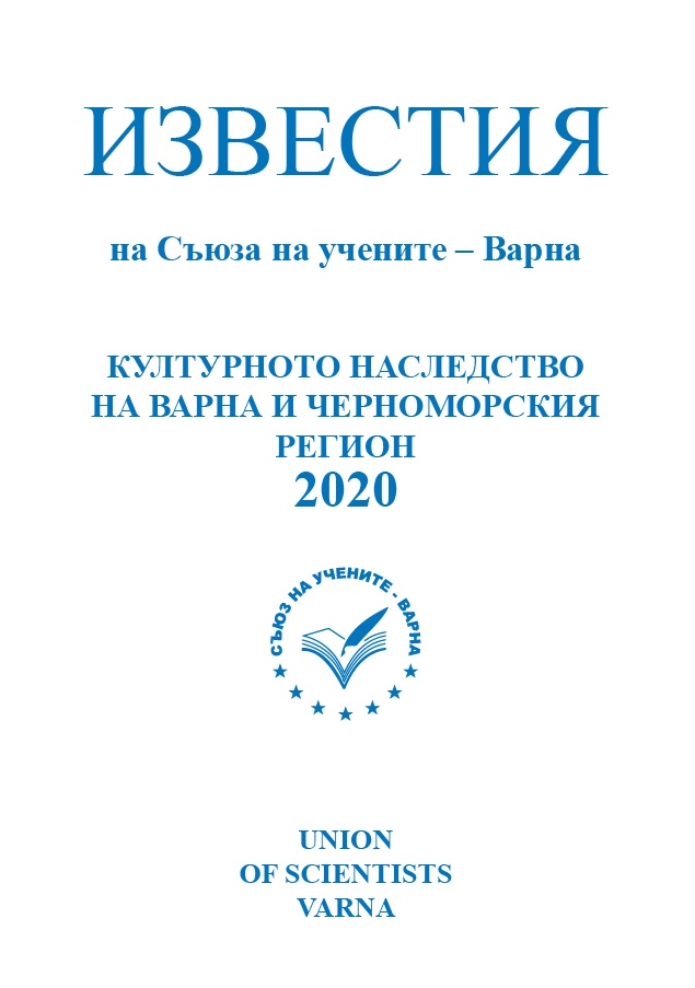
ЕДНА ГОДИНА СЛЕД ОТПЛАВАНЕТО НА МЕЖДУНАРОДНАТА ЕКСПЕДИЦИЯ “ABORA IV” ОТ ВАРНА – РЕТРОСПЕКЦИЯ

ЕДНА ГОДИНА СЛЕД ОТПЛАВАНЕТО НА МЕЖДУНАРОДНАТА ЕКСПЕДИЦИЯ “ABORA IV” ОТ ВАРНА – РЕТРОСПЕКЦИЯ

Author(s): Alexander Alexandrov / Language(s): Bulgarian Issue: 1/2020

The ABORA project has nearly 20 years of history. The leader is the German scientist and practical researcher Dr. Dominique Goerlitz, who is a follower of the Norwegian explorer Thor Heyerdahl. ABORA IV is the expedition held in 2019 from Varna to Kas, Turkey, where the voyage ended on 21.09.2019. The paper presents information about some developments since its end up to the present moment realized mainly in Germany and Bulgaria, in order to be identify the community’s attitude.

More...
Ostatci naših pretkršćanskih vjerovanja u okolici Ljubuškog u Hercegovini

Ostatci naših pretkršćanskih vjerovanja u okolici Ljubuškog u Hercegovini

Author(s): Ante Milošević / Language(s): Croatian Issue: 48/2019

In the last few decades, various branches of science, especially philology with the analysis of ancient ritual texts, toponomastic research and comparative studies of oral tales in the folklore tradition of different populations, have significantly contributed to the new knowledge of ancient beliefs and gods worshiped throughout Europe, in the period before Christianity was completely established. I have discussed these issues on several occasions, by classifying such remains in Croatia, in the new finds or the monuments that were previously known, but were interpreted differently - both chronologically and iconographically. I relied on several interesting artefacts from Dalmatia: the bronze gilded cross-shaped shackles from the early medieval cemetery in Nin, the four-headed idol from Vaćan and the equestrian relief from Žrnovnica, and, for this occasion, an old find from the area of Ljubuški, now kept in the Museum of Humac. Namely, there is a rustic and almost schematically carved head on the fragment of one pillar, which can be said to be part of the idol of a Slavic deity, with great likelihood, given several artistic analogies. The text also draws attention to the iconographic features of the face, such as the prominent mustache and triangular beard, which have some other characterizations that can be assumed to represent precisely the pre-Christian deities - in our case Perun.

More...
Result 14841-14860 of 16933
  • Prev
  • 1
  • 2
  • 3
  • ...
  • 742
  • 743
  • 744
  • ...
  • 845
  • 846
  • 847
  • Next

About

CEEOL is a leading provider of academic eJournals, eBooks and Grey Literature documents in Humanities and Social Sciences from and about Central, East and Southeast Europe. In the rapidly changing digital sphere CEEOL is a reliable source of adjusting expertise trusted by scholars, researchers, publishers, and librarians. CEEOL offers various services to subscribing institutions and their patrons to make access to its content as easy as possible. CEEOL supports publishers to reach new audiences and disseminate the scientific achievements to a broad readership worldwide. Un-affiliated scholars have the possibility to access the repository by creating their personal user account.

Contact Us

Central and Eastern European Online Library GmbH
Basaltstrasse 9
60487 Frankfurt am Main
Germany
Amtsgericht Frankfurt am Main HRB 102056
VAT number: DE300273105
Phone: +49 (0)69-20026820
Email: info@ceeol.com

Connect with CEEOL

  • Join our Facebook page
  • Follow us on Twitter
CEEOL Logo Footer
2025 © CEEOL. ALL Rights Reserved. Privacy Policy | Terms & Conditions of use | Accessibility
ver2.0.428
Toggle Accessibility Mode

Login CEEOL

{{forgottenPasswordMessage.Message}}

Enter your Username (Email) below.

Institutional Login