


Keywords: craft; tradesmen; distributive trade; the Republic of Croatia.
Distributive trade of the Republic of Croatia is an important segment of the Croatian economy. This can be confirmed by the share of distributive trade in the creation of GDP, by the share of employed persons, by the share of the number of registered enterprises and by the share of the number of active enterprises. Crafts are a manifestation of the Croatian distributive trade which, to a certain extent, contributes to the overall increase in its importance, as shown by the mentioned indicators. Crafts form part of small enterprises. Their business position is extremely unfavorable. What makes the position of crafts in the segment of distributive trade even harder is the intensified process of its expansion and concentration, with one consequence being the increased importance of a limited, small number of biggest enterprises. Tradesmen in the segment of distributive trade are mainly small independent merchants who, as a rule, own one business unit such as a shop or a repair shop. The inadequate size of such a business unit prevents the introduction of a basic sales technology on which all contemporary sales formats from supermarkets to electronic sales are based. This basic sales technology includes self-selection and self-service which contribute to the rationalization of business costs, primarily by lowering operating costs and by increasing efficiency through the possibility of increase in permeability of shops. The economic status of merchants is significantly determined by the technological basis of sales. The fragmentation of sales capacities and their technological backwardness are important factors that determine the economic strength of small independent merchants as a whole, as well as the segment of tradesmen. As a rule, tradesmen operate small shops and do not have a diversified sales structure as regards shop formats. This paper looks into the importance of crafts in the distributive trade of the Republic of Croatia.
More...
Keywords: Seal; Alexios I Komennos; Nicholas Synesios; Eustathios Kamytzes; Constantine Dalassenos Doukas; Constantine Kekaumenos
In this paper, seals found at the location of the Ras fortress (Tvrđava Ras) have been published. Inscriptions on these seals show that they used to belong to persons which could be identifi ed with certain military commanders who served under Alexios I Komnenos. The seals in question are: the seals of protonobelissimos Eustathios Kamytzes, Constantine Dalassenos Doukas, protoproedros and doux Constantine Kekaumenos and a certain person called Alexios.
More...
Keywords: Cassiodorus' Variae, the Ostrogoths; Pannonia; Dalmatia; sixth century
The article offers an analysis of selected letters from Cassiodorus' Variae, which are important for late antique history of Dalmatia and Pannonia. The study is intended to be twofold: on the one part, it examines the information that can be derived from the letters about both provinces' political, administrative, economic, social and ethnic picture in the time of Ostrogothic rule over the Eastern Adriatic and Middle Danube regions; on the other part, it explores literary and political contexts and underlying ideologies that are present in the selected letters.
More...
Keywords: Dacia; Serapis; Apollo; temples; Caracalla.
The autor is proposing another reconstruction of the building inscription of the temple of Deus Invictus Serapis from Sarmizegetusa, dating it more precisely than I. Piso did (212-217), in AD 213, before 8 October, using as main analogies the three construction plaques from Porolissum. At the same time he links this inscription with one raised as well for Apollo and Caracalla in the shrine from Tibiscum, considering both raised at the same time under the governor L. Marius Perpetuus. He proposes, based on epigraphic evidence, a visit of Septimius Severus, Caracalla and Geta at Tibiscum and Sarmizegetusa in AD 202 on their journey back from Orient and Egypt, even not recorded in the written sources. Then he discusses the journey of Caracalla along the Danube going to Orient in AD 213. The author’s conclusion is he had not enough time from 8 October when finished the expeditio Germanica to 17 December 213 when attested already at Nicomedia to travel across Dacia till Porolissum. The only acceptable trip is at Drobeta and possible to the fanum of Apollo at Tibiscum. All this inscriptions from 213 do not prove Caracalla’s visit in Dacia, but the province’s desire to get the same benefits as Pannonia and Moesia and the willing of the communities and military units to have the emperor in their places to get advantages. That was the reason everywhere in Dacia were made great preparations expecting the imperial tour, which for many never came.
More...
Keywords: identity; social groups; identification; adolescents
The research that was aimed to determine the degree of identification with social groups that we comprehend as indicators of identity formation of adolescents, as well as a contribution to the differences in the degree of identification regarding certain factors, was conducted on the sample of 182 students attending the final year of High school – the mathematics – natural sciences profile and linguistics – social sciences profile and Medical school, applying a five-level Liquert’s scale assessment. Results indicate that examinees show the highest degree of identification with micro-structures - family and peers; representatives of education – school community, sections and clubs, as the structures of egzosystem, have weaker effect, whereas macro-system structures have the weakest effect, with the exception of a significant impact of the nation. Gender of examinees, parental education and type of school they attend contribute to significant differences in the degree of identification with the family, and some of these factors contribute to identification degree with other social groups. Results are discussed within the context of Bronfenbrenner’s theory of bio-ecological system.
More...Keywords: Avars; invasion; late antiquity; Lower Danube; northern Danube; treasures
This paper is a continuation for TEODOR Ε 2002. The whole think is a commented chronology, following the ancient accounts for northern Danube invasions, in the late antiquity. It is to expect as a follow-up a study that concludes the work and answers to the main thematic questions: who are the „Sclaveni" which troubles the Justinian's Empire, when and where did they appear, what was their role for the end of Antic Roman civilisation and, specifically for this essay, what would be the expectations for field archaeology, on the left side of the Danube. Some of the comments already made come to foreword the final conclusions: the strengthening of the Limes finally worked: between 559 and 578 there were no major threats came from the Lower Danube. It follows, promptly, the Avar retortion, not because the Sclaveni had struck the Empire, but because they struck alone (and successful). Conversely of current theses, the punitive action did not submit the Sclaveni from Lower Danube area. Despite episodes that seem to prove an alliance between Avars and Lower Danube Sclaveni (like year 584, when the Qagan was fighting at Anchialos and Adragast at Adrianopole), there are proofs that at the Middle and the Lower Danube are dwelling two (or more) political entities, at least until the middle of '90s. In the last quarter of the sixth century the Sclaveni distribution in the land beyond Danube became clearer that Procopius' mentions, one generation before (they are hanging the banks of the Danube). The Avar hit from 579 was launched far in the land (if description is correct). Between general Priscus' victims we can count one just near the Danube (Adragast), and one in the inland (Musokios). Similar, the Petrus' enemies are, one (Piragast) near the Danube, and another (unnamed) about three days march inside. It is to add here that the „Helibakia" river from Priscus' campaign is not the same with „Helibakia" from Petrus campaign, because the first was developed in Eastern Walahia (Muntenia), and the second in Eastern and central Oltenia, 300 km westward. The monetary treasures berried in the final VI century are important hints about the distribution of the main political bodies of the Lower Danube Sclaveni. They are scattered mostly in the proximity of the Danube banks, eastern from Vedea river, and in south Moldavia. About these last treasures (Movileni-Galaţi, ended in 601 and Horgeşti-Bacău, ended in 602), we should say here that they are too far to be determined by Roman actions; it is more likely that the hiding of those are due to the punishment action of Avars against Antes (Roman allies), in the end of Danubian wars (602). The Avar troops followed, probably, the south Transilvania strategic way, known as „Sarmatian way", connecting the Lower Tisza and Lower Prut rivers through Oituz mountain pass. All these facts determined on the analyses of ancient accounts are important hints for building up an ..archaeological expectation". Unfortunately, that is far to be enough, as we will see in the concluding part of the study.
More...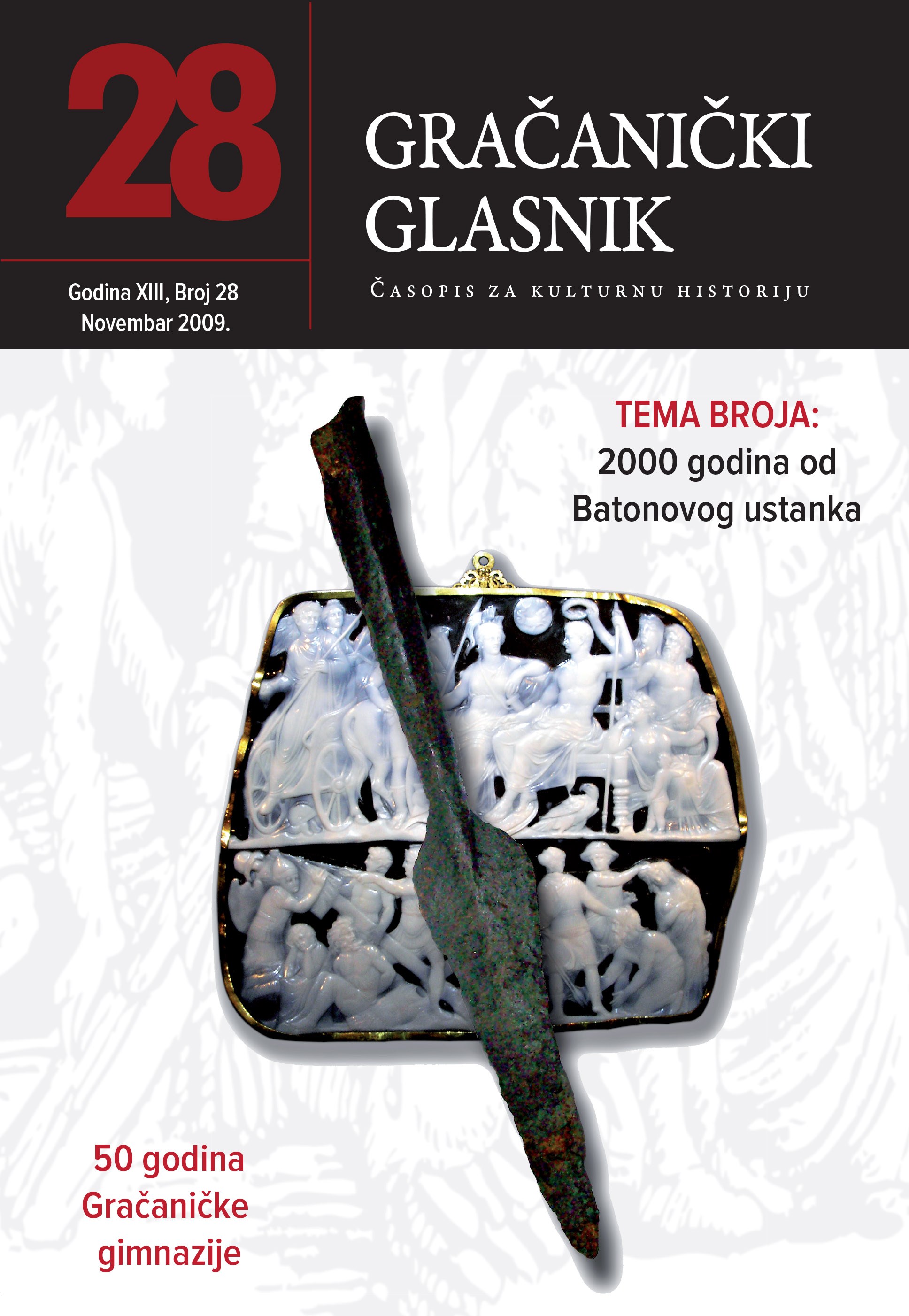
Keywords: Bellum Batonianum; North-east Bosnia; Illyria; Roman Empire; Population of Illyria;
Slom Batonovog ustanka, 9. god. nove ere, označio je definitivno pokoravanje ilirskih i panonskih plemena, prvenstveno onih koja su živjela u unutrašnjosti bosanskohercegovačkih prostora. Osim toga, taj događaj predstavljao je značajnu prekretnicu u daljnjem životu stanovnika Ilirika. Nakon što su Rimljani definitivno zagospodarili cijelim prostorom današnje Bosne i Hercegovine, prve decenije njihove uprave obilježene su nastojanjima carskih vlasti da se uspostavi trajni mir i sigurnost, a time osiguraju i prijeko potrebni uslovi za nesmetanu eksploataciju zatečenih materijalnih dobara i iskorištavanje domaće radne snage.
More...Keywords: horreum; late Roman period; grain supply (annona militaris); praefectus praetorio; grain processing
The study reviews our current knowledge on grain processing and granaries in Savaria based on the interpretation of the building inscription of a well-known horreum, with a focus on the provisioning of the late Roman army and the construction of horrea in the provinces during the 4th century.
More...Keywords: Benefiziarierabzeichen; touring car; wagon grave; Sárszentmiklós; Zsámbék; Eraviskische tribal elite; Ringknaufschwert; folding chair;
Den Gegenstand der Studie bilden zwei sog. „Benefiziarierabzeichen“, die im NO-Teil der Provinz Pannonia inferior, in Sárszentmiklós (Kom. Fejér) und Zsámbék (Kom. Pest), gefunden wurden, in je einem kaiserzeitlichen Wagengrab. Der Autor weist nach, dass diese Abzeichen ursprünglich an den begrabenen Wagen befestigt waren und die einstigen Wagenbesitzer (zugleich die vermutlichen Verstorbenen der Gräber) Unteroffiziere im principalis-Chargen (wie frumentarii, beneficiarii oder speculatores) waren, die man ins Statthalterbüro kommandiert hatte. Mit Hilfe dieser Tatsache konnte nicht nur eine neue, der Funktion nach gesonderte Gruppe der principalis - Abzeichen definiert, sondern auch die Reliefs anders beleuchtet werden, die principales auf ihren Dienstreisen auf dem Wagen sitzend darstellten. Auf Grund der nicht in direkt militärischem Kontext (z. B. in Gräbern, Heiligtümern) gefundenen Abzeichen hat der Autor versucht, einen Unterschied zwischen dem Eigentumsrecht der tatsächlich als Lanzenabzeichen getragenen und der nur mit Emblemen versehenen, meist zur Tracht oder Ausrüstung der principales gehörenden Kleinfunde (wie Fibeln, Gürtel- und Schwertriemenbeschläge) zu machen. Die Bestattung mit dem Wagen war aristokratischer Bestattungsbrauch der lokalen vornehmen Eravisker. So gehörten auch die Wagen besitzenden principales von Sárszentmiklós und Zsámbék zu dieser Stammeselite, die sich schon seit Ende des 1. Jahrhunderts zunehmend enger mit dem Heer verflochten hatte und seit der zweiten Hälfte des 2. Jahrhunderts das Statthalterbüro mit über gute Lokalkenntnisse verfügenden Unteroffizieren versah. Im Appendix der Studie werden auch vier neue Bronzebeschläge veröffentlicht, die zur Ausrüstung pannonischer principales gehörten
More...Keywords: history; archaeology; 6th century; 7th century;
More...
Keywords: Avars; Baian; Maurikios; Pomorans; Slavic musical instruments; Western Slavs
In the spring of 591 some Byzantine soldiers, members of the bodyguard of the emperor Maurikios, arrested near Herakleia (west of Constantinople) three men from a Sklauenoi tribe. These Sklauenoi carried no weapons with them but only kitharai. Under interrogation they told the emperor that their dwellings were near the end of the Western Ocean, and that they had travelled for fifteen months in order to meet the chaganos (Baian) of the Avars, to whom they had to convey a message from their chieftains. When they left him, they decided to visit the Romans because they had heard about their wealth and philanthropy, and so they had arrived in Thrace. This paper aims to discuss the background of these informations, especially the geographical location of the regions “near the end of the Western Ocean”, the type of musical instruments, they carried with them, and the credibility of the narrative as a whole.
More...
Keywords: Ancient agglomerations; communications; roads; Roman roads; topography;
Dans la première partie de cette contribution, l’auteur expose les sources plus rélévantes concernant les agglomérations et les communications antiques en Bosnie orientale, région entre la rivière Bosna à l’ouest et la Drina à l'est. On a exposé aussi quelques sources postérieures, médiévales et turques, concernant les voies de communication, parce qu'il s’agit des voies romaines. Les sources sont systématisées d’après leur nature: narratives (nr 1—7), épigraphiques (nr 1—22), parni lesquelles sont séparées les bornes miliaires des voies romaines (nr 1—17) et à la fin les sources topographiques (nr 1—117), tant qu'ils sont identifiées par la méthode archéologique. Ces dernières représentent en fait un supplément de la topographie antique de la Bosnie orientale, qui a été publié dans Tabula Imperii Romani, sur les feuilles TIR L 34 Budapest (1968) et TIR K 34 Sofia (1976). S’appuyant sur les sources, surtout topographiques, on peut reconstruire le suivant réseau des communications romaines dans la partie centrale et méridionale de la Bosnie orientale: T Voie de communication Plaine de Sarajevo (Aquaa S. . .) — montagne Romanija — vallée de Jader et Drinjača (Argentaria?, Tab. Peut.) — sources nr. 1—34. II Voie de communication menant de Drinjača (ou Konjević polje)— —Bratunac (Voljevica) — déviation pour Gradina (Domavia) — Skelaei (man. Malvesitiatium), avec la branche pour Domavia (Domavia) — sources nr. 35—56. III Voie de communication de Drinjača (ou Konjević polje) — Zvornik (Ad Drinum?) — Bijeljina — Dvorovi (Drinum flumen?, Tab. Peut.) — sources nr. 57—106. IV Voie de communication de la Plaine de Sarajevo (Aquae S ...) — Pale—Prača—Rogatica (col. Ris...?), c'est-à-dire Prača (ou Podgrab?) — Ustikolina sur la Drina supérieure — correspondance avec l’Herzégovine par la Plaine de Gacko — sources nr. 107—117. V Plaine de Sarajevo (Aquae S ...) — vallée de la rivière željeznica — Trnovo—Kalinovik (?) — la Neretva supérieure (?). VI Voie de communication Plaine de Sarajevo (Aquae S ...) — vallée de la Bosna — Zenica — Doboj — Slavonski Brod (Marsonia) (?). Les trois premières voies de communications citées ont été construites artificiellement (viae munitae), elles ont été construites probablement déjà au Ie millénaire corne voies militaires (viae militâtes), et après la pacification totale du pays et la retraite des légions de la province de ï>almatie ces communications ont été livrées à la circulation publique (viae publicae), conservées par les civitates de ce pays-là. La base de ce système a fait la voie Aquae S ... (Ilidža près de Sarajevo) — Romanija — Argentaria (Tab. Peut.), dont été tranchées de deux côtés les directions correspondantes. Le tracé de cette communication a été connu surtout sur le territoire de la Romania (Ballif, Strassen, 38—40), et maintenant ce tracé est constaté sur tout le secteur de la Plaine de Sarajevo jusqu’à la Drina. L'auteur a fait tous ses efforts aux recherches de la seotion de route de la Plaine de Sarajevo jusqu’à la Romania qui n’a pas été connue sur le terrain jusqu’à nos jours. Dans le passé, les deux communications, l'ancienne romaine et l'autre autrichienne macadame, construite à la fin du siècle passé, ont passé par la Romania, non comprise la voie préhistorique. Actuellement, une voie asfaltée est construite par la Romania, comme troisième communication, mais en majeure partie par le tracé autrichien. Quoique ces communications mènent dans la même direction jusqu’à la Plaine de Kraljevo (Partizansko polje), leur tracé n’est pas identique, ce qui est la conséquence de différentes conditions techniques de la circulation dans les différentes époques. Au Moyen âge a été en usage la voie romaine carrossable pour les caravanes, au moins dans la direction principale qui a mené un peu plus au nord de la communication medeme. Cette ancienne communication construite par les Romaines, est marquée aujourd’hui visiblement par les restes du »planum « et »ager« de la voie romaine et aussi par les cimetières médiévaux et turces. Elle a été connue dans le peuple comme la »Route de Jelena maudite«, (Prokleta Jerina) ce qui évoque le souvenir à une personne connue du Moyen âge. La même voie avec une petite déviation à Romanija (Partizansko polje — Žljebovi et Mokro — Brezovice) a été utilisée à l’époque turque comme la voie carrossable jusqu'à la fin du XIXe siècle. A la Romanija même ne sont pas conservées les traces des agglomérations romaines (exceptant quelques fortifications du sorte de réfugium, provenant de l’Antiquité postérieure), tandis que les restes de la voie romaine sont entièrement évidents et en plus les bornes miliaires y ont été identifiées. Dans la vaste région des montagnes de la Bosnie orientale les agglomérations ont été construites en bois aussi à l’époque romaine, cette coutume est conservée jusqu’à nos jours dans certaines régions de la Bosnie orientale, concrètement à la Romania. Pour cette raison, les trouvailles archéologiques, provenant de l'époque romaine, sont très rares dans la région plus vaste (Romanija, Ozren, Zvijezda, Konjuh, Majevica etc.) de deux côtés de la route. La plus grande partie de la Bosnie orientale s’est trouvée à l’époque antique sous les forêts (conpascua et silvae) et avec les agglomérations épihoriques, construites en matériaux moux qui se sont ruinées. C'est pour cette raison qu'on trouve à Romanija sporadiquement seulement les tombeaux romaines. A l'époque romaine, le plus grand nombre des agglomérations a été disposé le long de la rivière Drina et elles ont été reliées par les deux voies. L’une de ceux deux voies a mené en amont de la Drina et elle est bien documentée par les agglomérations romaines et les bornes miliaires. Cette voie est déjà recherchée et décrite par Ć. Truhelka et les résultats de ses recherches a repris Ph. Bail if. Les recherches plus actuelles ont montré que l'embranchement qui a dévié près de Han Bjelovac vers Gradina (Domavia), centre de la production romaine de l’argent et du plomb, a été aussi la voie construite, large environ 4 m., comme c’étaient toutes les autres communications romaines dans cette région et dans toute la Dalmatie. La voie en aval de la Drina, dans la direction Drinjača (Konjević polje ?) — Zvornik (Ad Drinum?, Tab. Peut.) — Bijeljina — région de Dvorovi (au nord de Bijeljina) n’a pas été marquée par les bornes miliaires comme il semble, mais elle est très bien authentifiée par de nombreuses agglomérations et par les restes de la voie même sur plusieurs endroits. Cette ancienne voie est nommée ici »la voie magyare«. Cette voie a été connue jusqu’à présent seulement sur une petite partie entre le village Šepak et Branjevo en aval de Zvornik (GZM 1896, 197). L’auteur a réussit la découvrir par les restes de la voie même et des agglomérations romaines et il l’a suivie en aval de Branjevo, le long de la rive gauche de la Drina jusqu'aux Dvorovi, au nord de Bijeljina. Aux environs de cet endroit elle s’est liée à la voie magistrale Siscia-Sirmîum (Tab. Peut.) chez la station Drinum flumen (Tab. Peut.). De ces trois communications ont été tranchées les nombreuseuses voies du caractère régional, vicinal et local. Certaines de ces communications peuvent être identifiées plutôt par la largeur de leur planum (vers 4 m.) que par les trouvailles archéologiques: 1. L’ embranchement près de Hreša (à l'est de Sarajevo), par la Vučja Luka et Toplica, jusqu’à la montagne Ozren et plus loin. 2. L’embranchement près de la source de la Miljacka (Mokro) — la montagne Ozren — Olovo (Plumbum médiéval) — eventuellement la vallée de la Spreča — Tuzla = Salines?, (Konst. Porph., adm. 32). La voie turque a mené aussi sur cette direction, appelée »drum«. C’est évidemment la communication très vieille, utilisée dans toutes les époques. Elle est marqée par quelques agglomérations illyrienees du type de »gradina« (oppidum). Ôn n'a pas identifié les trouvailles romaines sur cette direction, mais le tracé est logique et fondé, et la route (»drum«) a le profil de la voie romaine, large de 4 mètres. 3. La voie de correspondance de la Podromanija, jusqu’à Rogatica (col Ris...), probablement à travers Dobrača et Lađevina (?). 4. La voie sur la direction Sokolac (Romanija) — Knežina — Olovo, est la liaison avec la voie nr. 2. Cette direction est bien documentée par les nécropoles médiévales. 5. La voie de Žljebovi (Romanija) — Sokolovići — Plješivica — Rogatica (col. Ris . . . ja été découverte entre Plješivica et Rogatica (GZM 1936,13). 6. La voie de Gornji Birač — la région de Vlasenica — la vallée de Drinjača — Paprača — la vallée de la Spreča — Majevica — Bos. Posavina est une direction potentielle, marquée d'une certaine manière par les trouvailles romaines. 7. La voie entre Milici dans la vallée du Jadar — la vallée du Jadar — la passage Viogor — Srebrenica (Argentea médiévale) — Osât — Skelani (mun. Malvesitiatium) (?). 8. La voie Han Bjelovac — Gradina (Domavia) — Sase (?), marquée par les nombreux trouvailles antiques. 9. La voie Karakaj (Zvomik) — la vallée de la Sapna — Priboj — la région de Bijeljina, très importante par les carrières et par le gisement de sable quartzeux. Une autre voie a mené par la région montagneuse au sud de la Bosnie orientale, par la vallée de la Prača (sous le nr. IV) et plus loin. Aux environs de la Prača (Podgrab?), place médiéval très importante (1244) cette voie s'est divisée en deux directions, l’une vers Rogatica (col. Ris...), marquée par les restes du planum et du pont (Patsch, AEM XVI, 90), et l'autre vers Ustikolina sur la Drina, qui a été une agglomération romaine très importante, identifiée par les trouvailles. La partie montagneuse le plus au sud de cette région a eu la voie dans la vallée de la Željeznica, dans la direction Ilidža (Aquae S . ..) — Trnovo, un peu moin documentée. Une autre voie a mené sûrement par la vallée de la Bosna vers le nord. Elle n’est pas marquée dans les itinéraires, mais elle est prouvée par les nombreuses agglomérations romaines (Visoko, Kakanj, Zenica et les autres). Les routes plus longues et plus courtes, du caractère surtout local, ont été correspondantes à ces communications. On va écrire une autre fois sur les agglomérations et les voies romaines à Gornje Podrinje et Bos. Posavina.
More...
Keywords: Arianism; Christological and Trinitarian doctrine; Dated Synod; Pannonian bishops; Syrmium Metropoly;
The problems of the 4th century theology that were of Christological and Trinitarian nature, from the very beginning resulted in numerous reactions and curiosity of its contemporaries whose writings provide the authentic depiction of the events. With the emergence of the contemporary historiography the historians used scientific and systematic methods to examine the sources related to Arian issues and attempted to reconstruct the events of the turbulent era of the 4th century. Their texts based on the original writings enable discovery of all the details essential for the reconstruction of explicit events, border issues, jurisdiction of bishops on the territory of the Metropoly of Syrmium, i.e. the Roman Province of Pannonia.
More...
Keywords: Carmina Latina Epigraphica; Late Roman Pannonia; Huns; Flavius Constantius Felix
In his paper the author deals with a lost late Roman funerary text, Constantius’ epitaph. Based on the manuscript tradition, the epitaph was probably erected in Rome or more rather at Ravenna. Constantius was an important military commander of Western Rome in the 5th century and he had an important role in the fifth century history of Roman Pannonia as he fought against the Barbarians, most probably the Huns who settled down in Pannonia. The earlier identifications must be rejected but his person – unfortunately – cannot be identified with Flavius Constantius Felix. On the other hand, the events (fights against the Huns and the sea-going Vandals) mentioned in the funerary epigram fit perfectly into the period at the beginning of Valentinian III’s reign.
More...
Keywords: Constantine; conspiracy; Bellum Cibalense; division of the Balkans
The background of the incident in Emona in 316—the demolition of the statues of Constantine—was a failed conspiracy attempt against him, orchestrated by his brother-in-law Bassianus, and particularly Bassian's brother Senicio, with Constantinus's co-ruler and brother-in-law Licinius in the background. The incident triggered a swift war in the autumn of 316 in which Constantine defeated Licinius in the Battle of Cibalae in Pannonia and occupied Western and the Eastern Illyricum, or approximately three-quarters of the BalkanDanubian provinces. Some hitherto seldom-considered medieval sources, such as the Vita Constantini (Codex Angelicus 22) and Leo Grammaticus, for instance, also highlight these events, with objects with propaganda writings (rings, silver vessels, helmets) in favor of one or the other emperor as evidence of the preparations for them. Constantine was unsuccessful later in the war in Thrace (Campus Ardiensis), so the territorial division remained the same as after the Battle of Cibalae. This division of the Balkans stayed the same in the administration of the state until the late 4th Century. The traces in the church settlement, however, appear as late as the Early Middle Ages.
More...
Keywords: incarnation; Trinity; dogma; homeism; homoousianism; Arianism; niceism; Athanasius; council; ousia; theology; heresy; orthodoxy; Logos; Son; Father;
The Incarnation of the Word of God between Niceism and Arianism in the IVth century. The incarnation of the Word is the main theme debated by St. Athanasius throughout his theological and dogmatic works. First, incarnation theology has an anti-pagan connotation, as pagans derided Christians’ faith in the incarnation of the divine Logos, and, on the other hand, the Alexandrian bishop developed the theme of the incarnation against the Arians who denied the divinity of the Son and promoted a “creationist” doctrine of Christ. Between niceism and arianism, the theology of the incarnation knew several forms of theological expression, starting from the Arians, followers of Arius, to the neo-Arians, reinvented by Aetius and Eunomius, passing through the theology of the Homeans, who claimed the resemblance of the Son to the Father, to it culminated in the Homoiousians, those who came closest to the dogma of the Nicene Creed and who would finally embrace Niceism. The Cappadocians use in their theology of the incarnation the intuitions and arguments of Athanasius to overcome any other doctrine that would oppose or contradict the Niceno homoousian dogma, the consubstantiality of the Son with the Father, namely, the Son is God like Father.
More...
Keywords: Bosnia and Herzegovina; mining roads; Romans;
On the territory of the present Bosnia and Herzegovina the Romans had built a dense net of roads, the remnants of which have been visible even today in many places. Since this was a mining territory, and also an area in-between the two important provinces at the Balkans (Dalmatia and Panonia), several quite important main roads passed through this territory. Some of them had been built way back in the first century A. D. Their reaching points were Salona and Narona. Some of them were mentioned in occasional epigraphic monuments, and the others in works of some Roman authors, such as in a Tabula Peutingeriana, Itinerarium Antonini etc. Some of the roads were fortified on certain sections. Milestones give the best evidence for it, and a number of them was discovered in Bosnia and Herzegovina.
More...