Resettlement Maps of Jewish Dwellings in the Lands of the Bohemian Crown, 1727–1728
Resettlement Maps of Jewish Dwellings in the Lands of the Bohemian Crown, 1727–1728
Author(s): Filip Paulus, Šárka SteinováSubject(s): Maps / Cartography, History of Judaism
Published by: Židovské Muzeum v Praze
Keywords: National Archives of the Czech Republic; Urban Planning; 18th-Century; Jews;
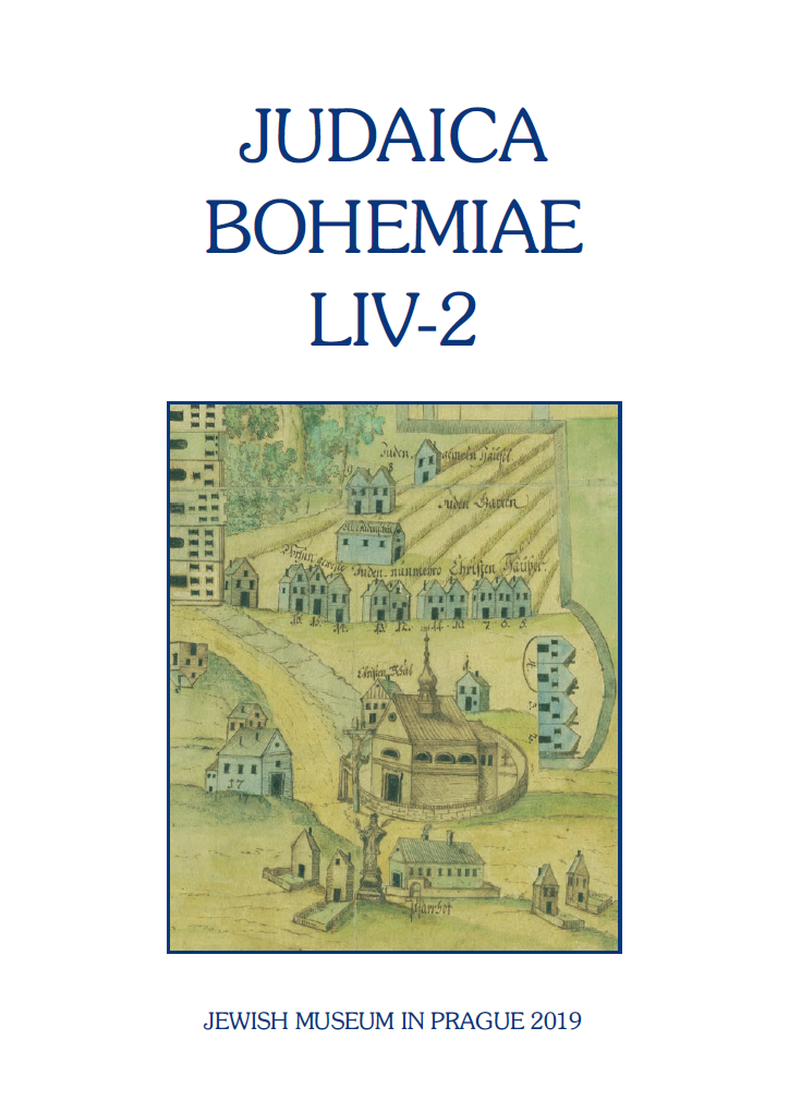
Summary/Abstract: At the end of this year, the National Archives of the Czech Republic is publishing an interdisciplinary monograph titled Krajina a urbanismus na rukopisných plánech z 18. století. Translokaèní plány židovských obydlí v zemích Koruny èeské z let 1727–1728 [Landscape and Urban Planning in 18th-Century Manuscript Maps: Resettlement Maps of Jewish Dwellings in the Lands of the Bohemian Crown, 1727–1728]. This is the outcome of a long-term study of these unique cartographic documents. Resettlement maps are of exceptional value, as they provide a reliable picture of the internal development of settlements and their topography, and they document, among other things, the economic and social condition of the Jewish population in the Bohemian lands. On the basis of a comparison with other sources and, above all, with the Indication Sketches of the so-called Stabile Cadastre, 2 it is possible, to a certain extent, to trace the development of Jewish settlement over a span of more than a hundred years (until the middle of the 19th century).
Journal: Judaica Bohemiae
- Issue Year: LIV/2019
- Issue No: 2
- Page Range: 87-104
- Page Count: 18
- Language: English