Cookies help us deliver our services. By using our services, you agree to our use of cookies. Learn more.
  • Log In
  • Register
CEEOL Logo
Advanced Search
  • Home
  • SUBJECT AREAS
  • PUBLISHERS
  • JOURNALS
  • eBooks
  • GREY LITERATURE
  • CEEOL-DIGITS
  • INDIVIDUAL ACCOUNT
  • Help
  • Contact
  • for LIBRARIANS
  • for PUBLISHERS

Content Type

Subjects

Languages

Legend

  • Journal
  • Article
  • Book
  • Chapter
  • Open Access
  • Geography, Regional studies
  • Environmental Geography

We kindly inform you that, as long as the subject affiliation of our 300.000+ articles is in progress, you might get unsufficient or no results on your third level or second level search. In this case, please broaden your search criteria.

Result 1961-1980 of 2643
  • Prev
  • 1
  • 2
  • 3
  • ...
  • 98
  • 99
  • 100
  • ...
  • 131
  • 132
  • 133
  • Next
THE MESOLITHIC CEMETERY OF GROß FREDENWALDE (NORTH-EASTERN GERMANY) AND ITS CULTURAL AFFILIATIONS

THE MESOLITHIC CEMETERY OF GROß FREDENWALDE (NORTH-EASTERN GERMANY) AND ITS CULTURAL AFFILIATIONS

Author(s): Andreas Kotula,Henny Piezonka,Thomas Terberger / Language(s): English Issue: 46/2020

The site of Groß Fredenwalde was discovered in 1962 and has been known as a Mesolithic multiple burial since 14C-dates verified an early Atlantic age in the early 1990s. New research since 2012 reconstructed the situation of the poorly documented rescue excavation in 1962 and identified six individuals from at least two separate burials. The new excavations uncovered more burials and Groß Fredenwalde stands out as the largest Mesolithic cemetery in North Central Europe and the oldest cemetery in Germany. In this paper the known burial evidence from this site is presented and the location of the cemetery, mortuary practices, and grave goods are discussed in a broader European context. Northern and Eastern connections appear especially tangible in Groß Fredenwalde and it is suggested that the community associated with the Groß Fredenwalde Mesolithic cemetery was integrated into wider cultural networks connected to the North and East.

More...
NEOLITHIC SOCIETIES AND THEIR POTTERY IN SOUTH-EASTERN LITHUANIA

NEOLITHIC SOCIETIES AND THEIR POTTERY IN SOUTH-EASTERN LITHUANIA

Author(s): EGLĖ ŠATAVIČĖ / Language(s): English Issue: 46/2020

South-Eastern Lithuanian Stone Age pottery reflects the way of life, nutrition, social status, artistic expression, and intercommunity relationships of its creators and users. Natural conditions unfavourable for the survival of organic material and the intermingling of artefacts from different periods in sandy settlements limit the ability to precisely date and reconstruct the long, distinctive process of Neolithisation that began in the late 6th millennium bc. Analysing the traces of ceramic vessel use, the structure of the pottery, the coiling and decoration technologies, their changes and reasons, it is possible to understand better the traditions of the Forest Neolithic communities and the encounters of different influences in SE Lithuania.

More...
MACRO AND MICRO SCALE NEOLITHISATION PROCESSES IN SOUTH-EASTERN POLAND AGAINST THE BACKGROUND OF CENTRAL-EASTERN EUROPE

MACRO AND MICRO SCALE NEOLITHISATION PROCESSES IN SOUTH-EASTERN POLAND AGAINST THE BACKGROUND OF CENTRAL-EASTERN EUROPE

Author(s): Sławomir Kadrow / Language(s): English Issue: 46/2020

The aim of the article is to outline the causes, mechanisms, and course of the Neolithisation process in South-Eastern Poland, as seen from a global (macro-) and local (microregional) perspective. It has been assumed that the most effective tool for analyzing this process on a macro scale is a set of concepts and rules constituting the theory of globalization (Hodos 2017). Cultural analysis (Wuthnow 1987), on the other hand, considers conflict as the main driving force of deep changes on a micro scale. Globalization is a form of connectivity that is the price humans pay to access resources that satisfy their desire for status and wellbeing. A common human pursuit is the desire to achieve a higher status and to improve one’s own wellbeing. People, realizing their intentions and aspirations, enter into conflicts which can potentially be one of the main sources of crises, and thus also of cultural change.

More...
РЕЦ. НА КН.: МАРКОВСКАЯ Е. Ф., ШМАКОВА Н. Ю. РАСТЕНИЯ И ЛИШАЙНИКИ ЗАПАДНОГО ШПИЦБЕРГЕНА: ЭКОЛОГИЯ, ФИЗИОЛОГИЯ

РЕЦ. НА КН.: МАРКОВСКАЯ Е. Ф., ШМАКОВА Н. Ю. РАСТЕНИЯ И ЛИШАЙНИКИ ЗАПАДНОГО ШПИЦБЕРГЕНА: ЭКОЛОГИЯ, ФИЗИОЛОГИЯ

Author(s): Nadezhda P. Chernobrovkina / Language(s): Russian Issue: 3 (172)/2018

Review of: Chernobrovkina N. P. - Марковская Е. Ф., Шмакова Н. Ю. Растения и лишайники Западного Шпицбергена: экология, физиология / Е. Ф. Марковская, Н. Ю. Шмакова ; М-во образования и науки Рос. Федерации, федер. гос. бюджет. учреждение науки Полярно-альпийский ботан. сад-ин-т им. Н. А. Аврорина, федер. гос. бюджет. образоват. учреждение высш. образования Петрозавод. гос. ун-т. – Петрозаводск : Изд-во ПетрГУ, 2017. – 270 с.

More...
POL TISÍCROČIA V STAVEBNEJ HISTÓRII A TOPOGRAFII ZVOLENSKÉHO PODZÁMKU

POL TISÍCROČIA V STAVEBNEJ HISTÓRII A TOPOGRAFII ZVOLENSKÉHO PODZÁMKU

Author(s): Peter PIŠÚT,Juraj Procházka / Language(s): Slovak Issue: 2/2020

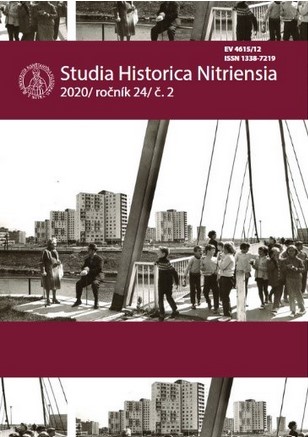
The town of Zvolen with a population of over 43 000 is an important regional center and traffic node of Central Slovakia. Although in close neighbourhood of the town, historical Podzámok or Subcastle quarter (Zólyom Várallya in Hungarian) made historically an administrative unit subordinate to Zvolen castle, not to a free royal town. The castle itself was since 13th Century also the seat of both the Zvolen County and Zvolen castle domain. In this paper we reconstruct the shape and evolution of Podzámok over time. As a service village of the castle, earliest structures by royal courtyard already existed prior to 1244 AD. They were represented by a toll-house, manor house, barns, royal garden and a fishpond, respectively. Since 1619 AD the habitation became a property of Eszterházi House. Medieval buildings were gradually supplemented by houses of clerical staff, brewery, lord´s pub, butchery, mill, saw-mill, artisan workshops and cottages. Spatial development of Podzámok was not only influenced by military function of the castle, but also by local natural conditions (= flooded area of river Slatina). The 18th Century was a period of relative economic boom, in contrast to a consecutive 19th century. Besides historical written data, our knowledge of Podzámok is mainly based on little-known plans and maps of 1708-1711, 1753 and 1860, respectively. The last standing buildings of Podzámok – besides the castle itself and the cannon bastion – are those of manorial brewery and distillery.

More...
İKLİM DEĞİŞİKLİĞİ VE ÇEVRESEL GÜVENLİK: TÜRKİYE ÖRNEĞİ

İKLİM DEĞİŞİKLİĞİ VE ÇEVRESEL GÜVENLİK: TÜRKİYE ÖRNEĞİ

Author(s): Sezen Kaya,Aslı Ilgit / Language(s): Turkish Issue: 1/2021

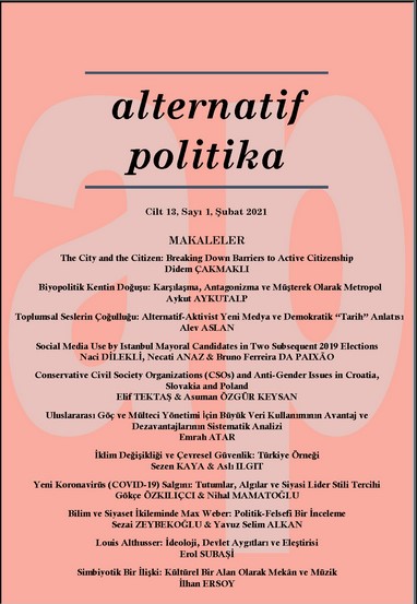
Since the 1980s, in International Relations discipline the “widening” of the concept of security led to several definitions, including environmental security, and the understanding of environmental problems such as climate change as a global security issue that requires joint efforts in the international system. Given the projections of the Mediterranean Basin to be one of the most affected regions by climate change, understanding Turkey’s perception and policies regarding environmental problems and climate change is important. This paper, thus, examines Turkey’s approach to climate change during the period from 2002 to 2019 under the Justice and Development Party rule. By drawing on the Copenhagen School’s politicization/securitization framework, this study claims that throughout the 2000s Turkish governments have made climate change visible as a problem, developed administrative, institutional and political initiatives, taken on responsibilities, albeit limited, and addressed climate change predominantly within the sustainable development framework, thereby politicized rather than securitized climate change.

More...
Ландшафтное окружение городищ и курганов скифского времени в донской лесостепи
4.50 €
Preview

Ландшафтное окружение городищ и курганов скифского времени в донской лесостепи

Author(s): Yury D. Razuvaev,Yury G. Chendev / Language(s): Russian Issue: 3/2021

The article offers a reconstruction of the landscape in the 6th—3rd centuries BC in the environs of 24 sites of Scyphoid and Gorodets archaeological cultures. Information on previous soil and palynological analyses is summarized, and the results of the latest studies of buried soils are published. A modern soil map offers an approximate view of the vegetation of the Don basin in the past. Hillforts and barrows of the Scyphoid culture are concentrated in the territories of typical forest steppe, while the fortified settlements of Gorodets are found in the more forested northern territory. This may be due to the difference in management systems, especially farming (tillage and slash-and-burn farming). Under the earthen defensive ramparts of all the studied hillforts of Early Iron Age, associated with forest valley-river landscapes, the soils with properties of forest formation have been identified, however, in many cases preserving the features of Chernozems of the drier Bronze Age. Qualities of paleosoils suggest the process of afforestation of river valleys and adjacent sections of watersheds at the beginning of Early Iron Age. Kurgans, which demonstrate the military-elitist appearance of the material culture and mobility of their creators, are situated in the interfluvial meadow-steppes and are separated from the nearest hillforts under the forests by the local relief. Localization of these and other sites confirms the existence of different economic and cultural types among the population of the Scythian era.

More...
Bütünleşik kıyı alanları planları ve mekânsal planlama ilişkisi, İzmit Körfezi ve Bursa ili örneği üzerinden bir değerlendirme

Bütünleşik kıyı alanları planları ve mekânsal planlama ilişkisi, İzmit Körfezi ve Bursa ili örneği üzerinden bir değerlendirme

Author(s): Burcu Değerli,Adem Erdem ERBAŞ / Language(s): Turkish Issue: 1/2021

Coastal areas have always been an indispensable area for humankind due to the opportunities they offer. The sustainability of the coastal areas, which have social and economic meanings for human activities, has been endangered as they are exposed to huge pressures owing to the rapid depletion of resources. It is necessary to well-organized integrated coastal zone management that adressess environmental, economic and social dimensions with a holistic approach as well as spatial planning in order to sustainability of coastal areas. In this context, integrated coastal zone plans and spatial planning relations in Turkey were evaluated through case study on Izmit Bay and Bursa Province within the frame of principles of integrated coastal zone management as a comparative table. As a result of this study, it was seen that decisions are developed only for the land sections, and there are no provisions regarding aquatic ecosystem and water resources management for marine sections in the integrated coastal area plans of Izmit Bay and Bursa Province where anthropogenic effects are intense. The awareness of the actors involved in the process should be provided first in order to constitute a management model for consistence and coordination between institutions and administration that have authority and responsibility in the coastal areas and the sectors in business on the coastal areas.

More...
Natural hazards of Izvorul Crișului

Natural hazards of Izvorul Crișului

Author(s): Gheorghe Roșian,Csaba Horváth,Liviu Muntean / Language(s): English Issue: 1/2021

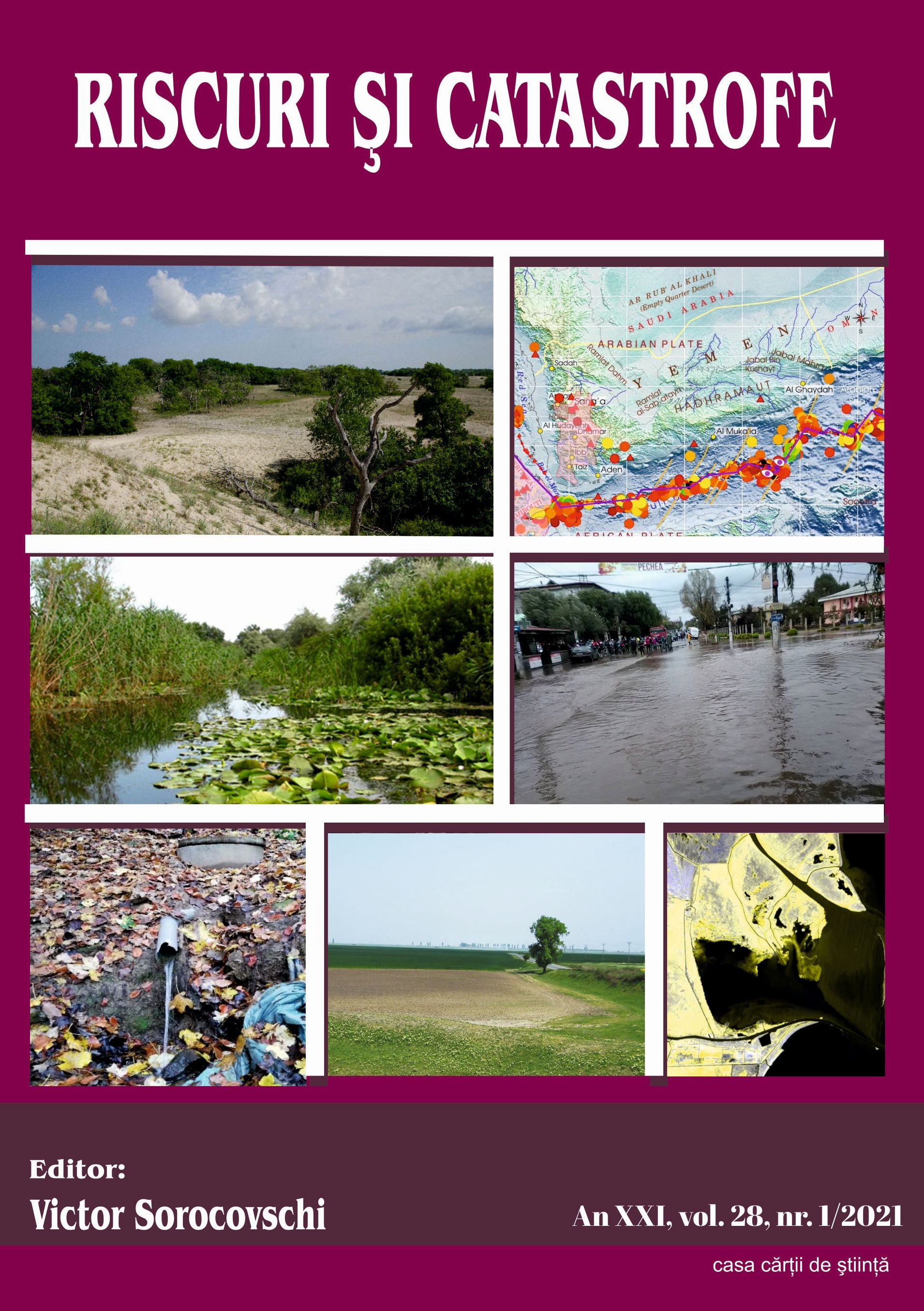
The presence of the Izvorul Crisului local territorial administrative unit (commune), in the western part of the Transylvanian Depression, not far from its border with the Apuseni Mountains, implies the existence of various natural hazardous processes. Their manifestation, in the presence of anthropic components and their activities and goods, determines their hazard attributes. Of the possible natural hazards (geological, geomorphological, atmospheric, hydrological, biological, etc.), only the geomorphological, hydrological, and meteorological ones will be addressed in this paper. The presence of these natural processes may cause material damage and victims, for this it is necessary to know their magnitude. Thus, the present study aims to identify the potential hazards which exist in the Izvorul Crisului administrative unit and to assess the susceptibility to these natural processes. To achieve this objective, specific maps will be made, which finally, beside the supporting role for the analysis of natural processes, will become tools for the management of these conditions, tools to reduce the induced risks.

More...
Land use in a Subcarpathian Depression – Sălătrucel commune, Vâlcea County

Land use in a Subcarpathian Depression – Sălătrucel commune, Vâlcea County

Author(s): Ana-Maria Roangheş-Mureanu / Language(s): English Issue: 1/2021

The use of the lands from Sălătrucel Commune located in the Jiblea – Berslăvești Depression, at the contact between the Southern Carpathians – Cozia Massif and the Vâlcea Subcarpathians, bears the characteristics of the physical-geographical particularities, especially those of the relief configuration with the specific lithological structure. The Jiblea – Berislăvești Depression was a favourable geographical area for early settlement, which also attracted important changes in the natural landscape reflected in the current structure of land use

More...
TÜRKİYE’DE GÜNCEL COĞRAFYA DERS KİTAPLARINDA İSTANBUL TEMASININ ELEŞTİREL ANALİZİ

TÜRKİYE’DE GÜNCEL COĞRAFYA DERS KİTAPLARINDA İSTANBUL TEMASININ ELEŞTİREL ANALİZİ

Author(s): Mustafa SAĞDIÇ,Ziya İNCE / Language(s): Turkish Issue: 45/2020

The aim of this study is to determine Turkey in secondary schools taught geography lesson on what books to date in Istanbul extent where it is given. For this, 9, 10, 11 and 12th grade geography textbooks approved by the Ministry of National Education Board of Education were examined through qualitative research methods and document analysis. NVivo 12 Plus program was used to analyze the text contents. In this research, answers to the following questions were sought. To what extent are discussed in current geography textbooks Istanbul in Turkey? The sections mentioned in the current geography textbooks from Istanbul in Turkey, which are grouped under sub-categories? Findings from the current geography textbooks are gathered under 6 different categories. These categories are: Population and Settlement Istanbul, Transportation Center Istanbul, Culture and Tourism Center Istanbul, Industry and Trade Center Istanbul, Istanbul in terms of Natural Features and Istanbul in terms of Environmental Problems. As a result, it is understood that Istanbul is not handled sufficiently in current Geography textbooks. When considering the importance for Turkey of Istanbul's geography lessons to be addressed in a more comprehensive book is only important in terms of education and training for students not living at all living in Istanbul, Turkey.

More...
BRAMA ZACHODNIA W LEPTIS MAGNA (PORTA OEA) JAKO ŁUK TRIUMFALNY ANTONINUSA PIUSA

BRAMA ZACHODNIA W LEPTIS MAGNA (PORTA OEA) JAKO ŁUK TRIUMFALNY ANTONINUSA PIUSA

Author(s): Jakub Mosiejczyk / Language(s): Polish Issue: 66/2020

The aim of the presented study is to consider the remains of the Western Gate in Leptis Magna as a relic of the triumphal arch in the urban and social context of the city. The monument is relatively unknown and functions among researchers mainly as the monument of late ancient fortifications. The history and current state of the research on the architecture and decoration of this object is described in the light of studies and deliberations. Presented here is an iconographic analysis of the few details discovered near the monument, including a figural representation featuring a Medusa medallion. Conclusions on the stylistics of the arch decorations point to the work of craftsmen from Asia Minor. The importance of the phenomenon, which in the middle of the 2nd century begins the process of transformation of the city with the use of a newly imported raw material – marble, was emphasized. These processes resulted in the formation of the local North African architectural style in public buildings.

More...
The effects of membership in the Polish National Cittaslow Network

The effects of membership in the Polish National Cittaslow Network

Author(s): Eliza Farelink,Agnieszka Stanowicka,Wioletta Wierzbicka / Language(s): English Issue: 1/2021

Research background: Identification of the effects achieved by cities owing to their membership in the Cittaslow network plays a role not only in the development of every city, but also in the growth of national and international Cittaslow networks. Being a member of the Cittaslow network, and thereby adopting the slow city development model, affects the process of urban management by directing it towards such activities that agree with the assumed development concept. The achieved effects, manifested in the social, economic, and spatial spheres, contribute to the improved quality of life in a slow city, which in turn influences its development. Purpose of the article: Identification of the effects of membership of Polish cities in the Polish National Cittaslow Network. Methods: The study included a diagnostic survey method. The diagnostic survey based on a standardized survey questionnaire was used to identify the effects achieved by the Polish cities in the Cittaslow network. The survey was addressed to mayors of all member cities in the Polish National Cittaslow Network. The survey was conducted in May 2020. Findings & value added: The most important effects to date of cities being members of the Polish National Cittaslow Network, and their scale, have been investigated. An attempt was made to determine in which areas of urban life the effects become observable in a relatively short time (a few years), and which effects are attainable after a longer period of time. Major barriers to obtaining the desired effects were also identified. The research fills in a gap in this scope, as it provides a complex analysis of the effects of the membership of cities in the national Cittaslow network as seen by the city authorities. The results can serve to make comparative analyses of the effects achieved on different levels of development in the national Cittaslow networks, particularly in view of the fact that the Polish National Cittaslow Network is the second largest network in the world with respect to the number of member cities.

More...
Political Responsibility for Climate Change

Political Responsibility for Climate Change

Author(s): Alice Roberts / Language(s): English Issue: 3/2020

Global structural injustices are harms caused by structural processes, involving multiple individuals, acting across more than one state. Young develops the concept of ‘political responsibility,’ to allocate responsibility for structural injustice. In this paper, I am going to argue that when considering the climate crisis Young’s model needs to be adapted— to have agency as a basis for allocating political responsibility instead of contribution. This is a more intuitive way to allocate responsibility for the climate crisis given its nature as a threshold problem, and the subtle structural positions occupied by the individuals involved.

More...
Характер использования долины р. Большой Бабки в средневековье
4.50 €
Preview

Характер использования долины р. Большой Бабки в средневековье

Author(s): Ghennadii E. Svistun,Viktor I. Kvitkovskij / Language(s): Russian Issue: 5/2021

The authors have summarized the materials from a number of archaeological sites accumulated during many years of investigations by several generations of archaeologists in the Bolshaya Babka river valley. Despite their different quality of exploration and documentation of the research, the following areas were brought to light: general trends in exploration of this territory in temporal and spatial dimensions, preferred locations for settlement in certain landscapes, its usage and perception by various ethnocultural communities. The authors managed to determine some interdependencies between the river valley landscape, shaped by fluvial processes with frequent streamflow changes, and its usage dynamics. It was also discovered that stable flood land regions played an important role; they were not exposed to constant degradations in its widest segment — in its middle and lower reaches. It explains the multilayer nature of the most sites occupied by the population with the similar pattern of economic activity over the wide time line — from the Bronze Age to the Middle Ages. Moreover, some naturally emerged within the same landscape lines of communication with neighboring settlement enclaves had to play a significant role in determination of locations for residential areas.

More...
Природные условия и адаптация к ним у средневекового населения лесостепей
4.50 €
Preview

Природные условия и адаптация к ним у средневекового населения лесостепей

Author(s): Sergey V. Vasilyev,Tatyana A. Puzanova,Svetlana B. Borutskaya,Gennadiy Yu. Starodubtsev,Fatima G. Kurbanova,Alexandr V. Zorin,Olga V. Rudenko / Language(s): Russian Issue: 5/2021

The article presents the results of research on the reconstruction of natural and climatic conditions and human adaptation to them. In order to identify the stages of the evolution of the natural environment of the forest-steppe zone (Kursk region) in the Middle Ages, buried sub-kurgan soils and bone remains in the Gochevo burial mound were analyzed. Spore-pollen, anthropological and isotope analyzes were carried out on soil and bone samples. Bioclimatic fluctuations of the natural environment were established based on the reconstruction of paleolandscapes (soils, vegetation) and associated changes in socio-cultural factors (changes in paleo-diet, anthropological characteristics).

More...
Природные катаклизмы 1120-х гг. и население запада Новгородской земли
4.50 €
Preview

Природные катаклизмы 1120-х гг. и население запада Новгородской земли

Author(s): Vladislav Yu. Sobolev / Language(s): Russian Issue: 5/2021

The change in the burial rite and introduction of new funerary practices are explained by Christianization of the populace and appearance of a Christian community. In studies of the emergence of medieval Rus’ burial rite, a feature is discriminated with regard to continuation of the tradition of raising burial mounds. The earliest phase of the formation of the medieval mortuary rites still remains poorly studied since there are practically no reliably dated sites before the mid-11th century. After this date, we find inhumations across the Novgorod Land documenting different variations in the rite but which nevertheless keep within the frame of the Christian norms. As the main rules on the rite of interment set by the Church were complied with, some details of the mortuary practice not regulated by the Orthodox canonic law continued to evolve, drawing on the pre-Christian tradition. Of these, raising of burial mounds was the most prominent. Differences in the method of construction of the burial mounds indicate a partial change in the population which took place in the western area of the Novgorod Land in the second half of the 12th century. Throughout the 13 th century, across this region, the funerary rite becomes much more uniform. Everywhere the kurgan-zhalnik and flat zhalnik cemeteries become widespread.The emergence of a new form of burials may be associated with migration of the population. The reason for the migration, in my opinion, could be the famine that happened in the Novgorod land in the late 1120s.

More...
«…Отложить поход до зимы»: влияние природных факторов на военные действия XIV—XV вв. на псковских границах
4.50 €
Preview

«…Отложить поход до зимы»: влияние природных факторов на военные действия XIV—XV вв. на псковских границах

Author(s): Sergey A. Salmin,Elena V. Salmina / Language(s): Russian Issue: 5/2021

The Pskov state, limited to its natural borders, seems to be a good object for the research of the influence of natural and geographical factors on military and political history. Thus, the military actions of 1323—1480 are explored to consider the influence that these factors had on the causes, course and results of the wars waged by Pskov.The inequality in natural resources in the border areas and the struggle for their redistribution determined the main directions of military expansion, forms of invasions and their seasonal dating. The rugged landscape characteristic for the western part of Pskov land and the dependence of the state of the Pskov-Peipus reservoir complicated the choice of the season for military operations. The incursions of small detachments, timed to the periods of economic activity (May-June, August) which were more diversionary than predatory in character, customarily prevailed. The February-March incursions into the fishing zones were usually carried out by larger forces and were aimed at capturing the product of fishery.The military clashes between Pskov and Veliky Novgorod and the Grand Duchy of Lithuania, as well as the full-scale wars with Livonia, were mainly political, which was reflected in the active actions of the parties against the fortified settlements. In these cases, the necessity of large military contingents and siege equipment moving determined the choice of a season with the most predictable weather conditions.

More...
Животный мир в искусстве и реальности: от раннего железного века до раннего средневековья (по материалам Среднего Подесенья)
4.50 €
Preview

Животный мир в искусстве и реальности: от раннего железного века до раннего средневековья (по материалам Среднего Подесенья)

Author(s): Evgenii A. Shinakov,Arthur A. Chubur / Language(s): Russian Issue: 5/2021

The authors aimed to compare the real animal world of a particular region and its reflection in the minds of people of different historical eras, represented in works of applied art and small plastic arts. The choice of the Middle Desna region was determined by its transitional character for Eastern Europe in almost all historical and archaeological periods (both in physical-geographical and ethno-cultural aspects). The authors considered materials of the Yukhnovo culture of the early Iron Age, the Great Migrations, the “antiquity of the Antae”, as well as the beginning of the authentically early Slavic period (Volyntsevo-Romny antiquities). The greatest contamination of the real animal world (first of domestic) is observed in the early Iron Age. Later, in applied art, masters gradually would withdraw from the reality into a higher degree of abstraction, into the realm of mythological and totemic-religious images, in which, however, at times, some real representatives of the fauna were fancifully reflected, both typical and exotic ones for the region. The image of horse is a continuous image in the region — from ceramic figurines and ridge attachments of the end of the 1st millennium BC to the time of the Old Rus. In addition, evolution is noted from simple images associated with a species to composite images — “chimeras”, “shapeshifters” — combining features of various animals, sometimes with the inclusion of anthropomorphic elements (binary opposition “human-animal”).

More...
Successful Completion of an International Project of the Department of Natural Sciences at New Bulgarian University

Successful Completion of an International Project of the Department of Natural Sciences at New Bulgarian University

Author(s): Daniela Pilarska,Christa Schafellner,Gernot Hoch,Margarita Georgieva,Georgi Georgiev,Plamen Mirchev / Language(s): English Issue: 1/2021

The paper presents the results of a successfully completed international project of the Department of Natural Sciences titled “Monitoring and identification of the entomopathogenic fungus Entomophaga maimaiga in Lymantria dispar populations” and funded by the National Research Fund in 2017-2019. Investigating the distribution of E. maimaiga in Austria and Bulgaria in 2018-2019 shows that the pathogen has expanded its range to the west and reached Lower Austria. E. maimaiga has been identified in Bulgaria as well and has become part of the natural enemy complex of L. dispar.

More...
Result 1961-1980 of 2643
  • Prev
  • 1
  • 2
  • 3
  • ...
  • 98
  • 99
  • 100
  • ...
  • 131
  • 132
  • 133
  • Next

About

CEEOL is a leading provider of academic eJournals, eBooks and Grey Literature documents in Humanities and Social Sciences from and about Central, East and Southeast Europe. In the rapidly changing digital sphere CEEOL is a reliable source of adjusting expertise trusted by scholars, researchers, publishers, and librarians. CEEOL offers various services to subscribing institutions and their patrons to make access to its content as easy as possible. CEEOL supports publishers to reach new audiences and disseminate the scientific achievements to a broad readership worldwide. Un-affiliated scholars have the possibility to access the repository by creating their personal user account.

Contact Us

Central and Eastern European Online Library GmbH
Basaltstrasse 9
60487 Frankfurt am Main
Germany
Amtsgericht Frankfurt am Main HRB 102056
VAT number: DE300273105
Phone: +49 (0)69-20026820
Email: info@ceeol.com

Connect with CEEOL

  • Join our Facebook page
  • Follow us on Twitter
CEEOL Logo Footer
2025 © CEEOL. ALL Rights Reserved. Privacy Policy | Terms & Conditions of use | Accessibility
ver2.0.428
Toggle Accessibility Mode

Login CEEOL

{{forgottenPasswordMessage.Message}}

Enter your Username (Email) below.

Institutional Login